|
Waddon
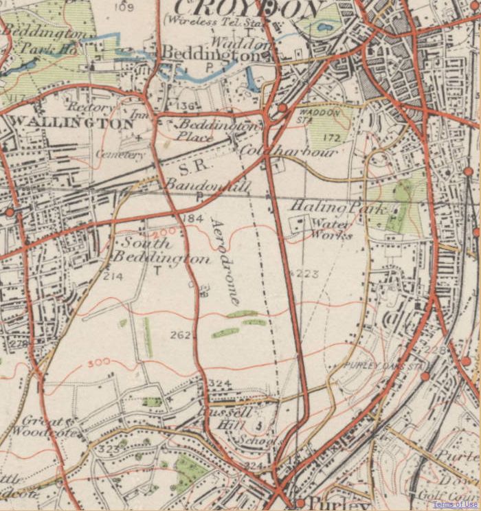
Waddon () is a neighbourhood in the London Borough of Croydon, at the western end of the town of Croydon. The area borders the London Borough of Sutton. History It is not known when the manor of Croydon was granted to the See of Canterbury, but it is thought of be before then end of the 9th century. The archbishop had lands in Croydon about 871. The Domesday Book shows it as part of the archbishop's lands held in demesne (for his own use). After a royal grant in the 13th century, Croydon became a market town. In 1276 Archbishop Robert Kilwardby obtained a grant of market in 1276. It was to be held every Friday and a nine-day fair was to be held on the vigil of St. Botolph the abbot (17 June). Waddon's name was first recorded in the twelfth century and derives from Old English meaning 'the hill where woad grows, or is grown'. Evidence of Bronze Age and Iron Age habitation have been found locally. Waddon has an older area with 19th-century properties, some even older, close to c ... [...More Info...] [...Related Items...] OR: [Wikipedia] [Google] [Baidu] |
Waddon Ponds
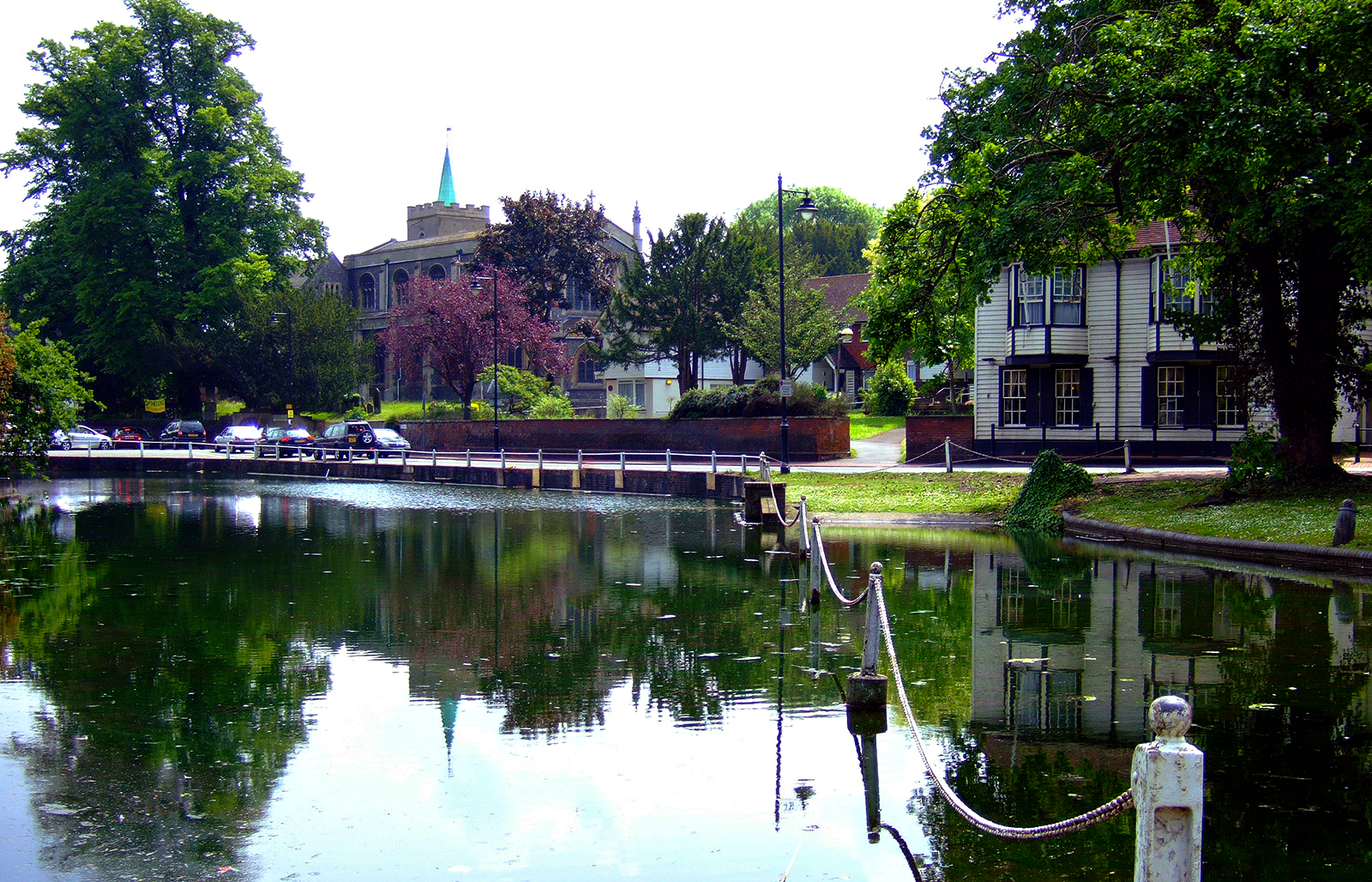
Waddon Ponds is an ornamental urban park / inland water in the western part of the London Borough of Croydon, by whom it is managed. It is bordered to the north by Mill Lane, and on the other three sides by Waddon Court Road, Court Drive and The Ridgeway. History Waddon Ponds is one of very few sites in Croydon where the River Wandle can be seen above ground. Nearby, Wandle Park contains a rivercourse, released from its culvert in 2012. The ponds formed one of the sources of the river, which initially rises at South Croydon, and originally flowed north-west through the grounds of the Archbishops of Canterbury at Croydon Palace before reaching a millpond on the northern side of Mill Lane; opposite the current (2021) site of Waddon Ponds. The ponds themselves are fed by springs occurring at the junction of sand and chalk beds with London gravel beds. The area of the ponds was formerly part of an estate of some which included Waddon Court Farm and Waddon Lodge. The Domesday ... [...More Info...] [...Related Items...] OR: [Wikipedia] [Google] [Baidu] |
Croydon Airport
Croydon Airport (former International Civil Aviation Organization airport code, ICAO code: EGCR) was the UK's only international airport during the interwar period. Located in Croydon, South London, England, it opened in 1920, built in a Neoclassical architecture, Neoclassical style, and was developed as Britain's main airport, handling more cargo, mail, and passengers than any other UK airport at the time. Innovations at the site included the world's first air traffic control and the first airport terminal. During World War II the airport was named Royal Air Force, RAF Croydon as its role changed to that of a Fighter aircraft, fighter airfield during the Battle of Britain; and in 1943 RAF Transport Command was founded at the site, which used the airport to transport thousands of troops into and out of Europe. After the Second World War, its role returned to civil aviation, but the role of London's primary international airport passed to London Heathrow Airport. Croydon Airport ... [...More Info...] [...Related Items...] OR: [Wikipedia] [Google] [Baidu] |
Waddon Railway Station
Waddon railway station is in the London Borough of Croydon in south London. The station and all trains serving it are operated by Southern. It is in Travelcard Zone 5, between and , and is down the line from measured via Forest Hill. Accidents and incidents *On 4 November 1942, two electric multiple units collided due to a signalman's error: two people were killed. Services All services at Waddon are operated by Southern using EMUs. The typical off-peak service in trains per hour is: * 2 tph to (non-stop from ) * 2 tph to via * 2 tph to * 2 tph to During the peak hours, the station is served by an additional half-hourly service between London Victoria and . The station is also served by a small number of services to and to London Bridge via in the early mornings. Connections London Buses routes 154, 157 and 289 __NOTOC__ Year 289 ( CCLXXXIX) was a common year starting on Tuesday (link will display the full calendar) of the Julian calendar. At the time ... [...More Info...] [...Related Items...] OR: [Wikipedia] [Google] [Baidu] |
River Wandle
The River Wandle is a right-bank tributary of the River Thames in south London, England. With a total length of about , the river passes through the London boroughs of London Borough of Croydon, Croydon, London Borough of Sutton, Sutton, London Borough of Merton, Merton and London Borough of Wandsworth, Wandsworth, where it reaches the Thames. A short headwater – the Caterham Bourne – is partially in Surrey, the historic county of the river's catchment. Tributaries of the Wandle include The Wrythe and Norbury Brook. The name ''Wandle'' is thought to derive from a back-formation of Wandsworth (Old English language, Old English "Wendlesworth" meaning "Wendle's Settlement”). The Wandle Trail follows the course of the river from Croydon to Wandsworth. History and boundaries In the pleistocene before the carving of the River Mole#Mole Gap, Mole Gap, water lapped the north of the area between the North Downs and Greensand Hills known as the Vale of Holmesdale taking the Cat ... [...More Info...] [...Related Items...] OR: [Wikipedia] [Google] [Baidu] |
Croydon South (UK Parliament Constituency)
Croydon South is a constituency created in 1974 and represented in the House of Commons of the UK Parliament since 2015 by Chris Philp, a Conservative. Political history In 1974, the original Croydon South constituency created in 1918 was renamed Croydon Central and the current Croydon South was created from the northwestern part of East Surrey, covering Purley and Coulsdon, which had become parts of Greater London in 1965. Since its creation, the constituency has been represented by three Conservative MPs. Sir William Clark, who had represented East Surrey since 1970, won the new seat in February 1974, and held it until his retirement in 1992. His successor, Sir Richard Ottaway, then held the seat until 2015, when he stood down and was succeeded by Chris Philp. Boundary changes have been minor and the 2015 result made the seat the 145th safest of the Conservative Party's 331 seats by percentage of majority. At the 2015 general election, it was one of the Conservative ... [...More Info...] [...Related Items...] OR: [Wikipedia] [Google] [Baidu] |
Croydon
Croydon is a large town in south London, England, south of Charing Cross. Part of the London Borough of Croydon, a local government district of Greater London. It is one of the largest commercial districts in Greater London, with an extensive shopping district and night-time economy. The entire town had a population of 192,064 as of 2011, whilst the wider borough had a population of 384,837. Historically an ancient parish in the Wallington hundred of Surrey, at the time of the Norman conquest of England Croydon had a church, a mill, and around 365 inhabitants, as recorded in the Domesday Book of 1086. Croydon expanded in the Middle Ages as a market town and a centre for charcoal production, leather tanning and brewing. The Surrey Iron Railway from Croydon to Wandsworth opened in 1803 and was an early public railway. Later 19th century railway building facilitated Croydon's growth as a commuter town for London. By the early 20th century, Croydon was an important industr ... [...More Info...] [...Related Items...] OR: [Wikipedia] [Google] [Baidu] |
London Borough Of Croydon
The London Borough of Croydon () is a London borough in south London, part of Outer London. It covers an area of . It is the southernmost borough of London. At its centre is the historic town of Croydon from which the borough takes its name; while other urban centres include Coulsdon, Purley, South Norwood, Norbury, New Addington and Thornton Heath. Croydon is mentioned in Domesday Book, and from a small market town has expanded into one of the most populous areas on the fringe of London. The borough is now one of London's leading business, financial and cultural centres, and its influence in entertainment and the arts contribute to its status as a major metropolitan centre. Its population is 386,710, making it the second largest London borough and fifteenth largest English district. The borough was formed in 1965 from the merger of the County Borough of Croydon with Coulsdon and Purley Urban District, both of which had been within Surrey. The local authority, Croydon L ... [...More Info...] [...Related Items...] OR: [Wikipedia] [Google] [Baidu] |
Purley Way
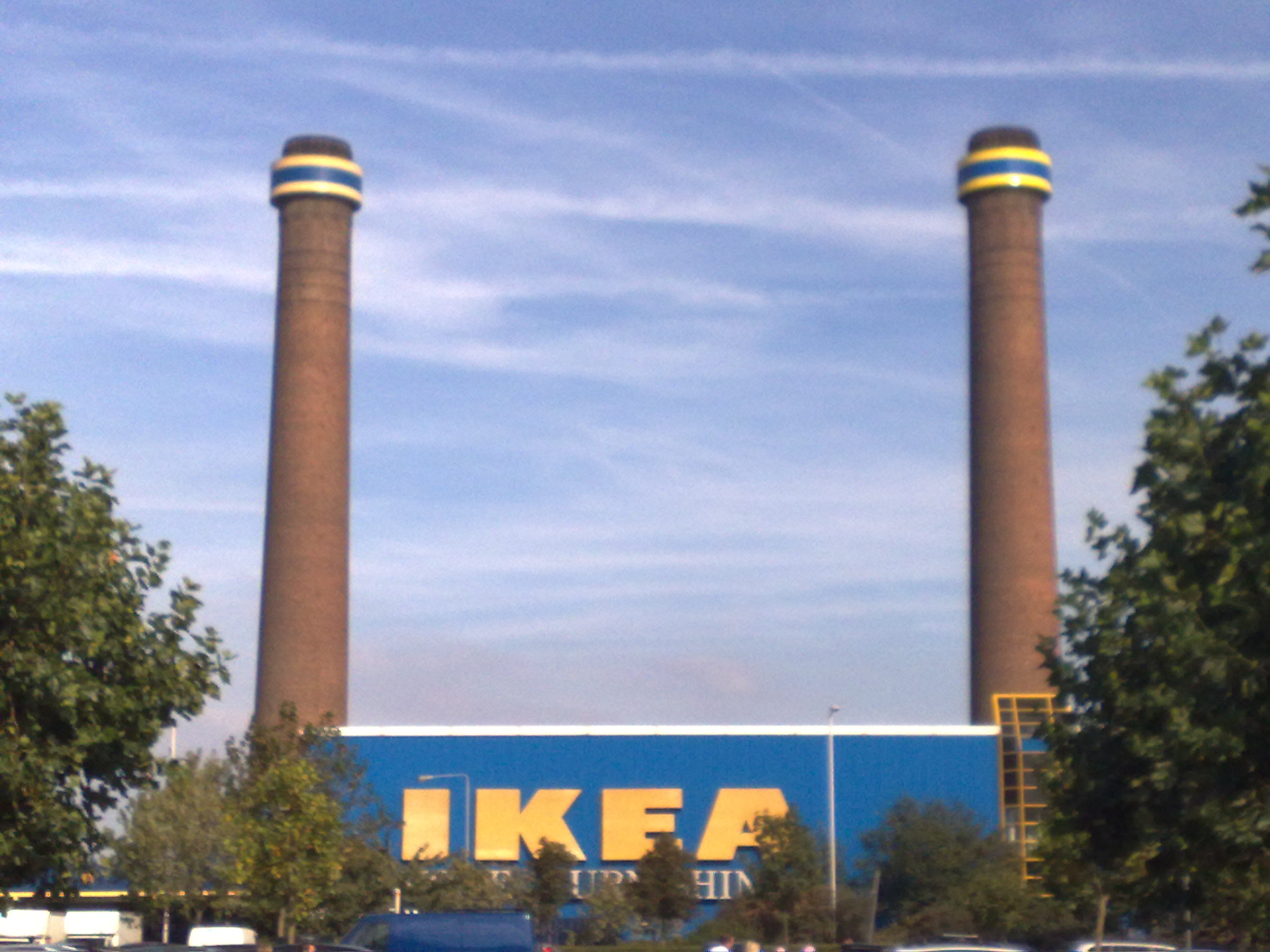
Purley Way is a section of the A23 trunk road in the London Borough of Croydon, in the areas of Purley, Waddon and Broad Green, and has given its name to the out-of-town shopping area alongside it with a catchment area covering most of South London. It was designed as a bypass for Croydon, and opened in April 1925. It was formed from improvements to pre existing local roads: from north to south, Waddon Marsh Lane, Waddon Court Road and Coldharbour Lane. (Thornton Road, the northern section of the bypass, was not renamed.) In 1932, Purley Way became the first road in the United Kingdom to be lit with sodium lights. Industrial history The opening of Purley Way attracted industry to the area and it became the main industrial area of Croydon. Industry attracted to the area included Redwing Aircraft Ltd, Trojan Ltd (car manufacturers) and Tizer Ltd. There were also several metal companies including Standard Steel Co, Croydon Foundry Ltd, Metal Propellers Ltd and Southern Fou ... [...More Info...] [...Related Items...] OR: [Wikipedia] [Google] [Baidu] |
South London Pirates
The Croydon Pirates, known between 2012 and 2019 as the South London Pirates, is a British baseball club based in South London. They have two diamonds in Roundshaw playing fields in Sutton, UK the main one being Dave Ward Field. Previously, Roundshaw and the Pirates have been hosts to the yearly London Tournament and on occasions the BBF's National Finals. From 2004 until 2017, the Pirates were made up of different teams competing at various levels including the National League, double-A, and single-A. Since 2020, the team has competed only at the double-A level. History Early history The club was formed around 1980 by Eric Petrie and Pete Paulley, who had previously played for the Croydon Blue Jays. The first team played as the Croydon Borough Pirates and placed 3rd in the 1981 Southern England Baseball Association (Group B) division with a 5-11 record. For the 1989 season, the team was renamed the Croydon Pirates, continuing to play in the 2nd Division which by this t ... [...More Info...] [...Related Items...] OR: [Wikipedia] [Google] [Baidu] |
London Borough Of Sutton
The London Borough of Sutton () is a London borough in south-west London, England and forms part of Outer London. It covers an area of and is the 80th largest local authority in England by population. It borders the London Borough of Croydon to the east, the London Borough of Merton to the north and the Royal Borough of Kingston upon Thames to the north-west; it also borders the Surrey boroughs of Epsom and Ewell and Reigate and Banstead to the west and south respectively. The local authority is Sutton London Borough Council. Its principal town is the eponymous Sutton. The Borough has some of the schools with the best results in the country. A Trust for London and New Policy Institute report noted that Sutton had the highest rate in London of pupils achieving 5 A* – C GCSEs. In December 2014 Sutton was described by a senior Government official as the most "normal place in Britain". In connection with this, the leader of Sutton Council described the borough as "quietly bri ... [...More Info...] [...Related Items...] OR: [Wikipedia] [Google] [Baidu] |
A23 Road
The A23 road is a major road in the United Kingdom between London and Brighton, East Sussex, England. It is managed by Transport for London for the section inside the Greater London boundary, Surrey County Council and West Sussex County Council for the section shadowed by the M23 motorway, National Highways (as a trunk road) between the M23 and Patcham, and by Brighton and Hove Council from the A27 to the centre of Brighton. The road has been a major route for centuries, and seen numerous upgrades, bypasses and diversions. Route The A23 begins near Lambeth North tube station. Formerly, it started as ''Westminster Bridge Road'' near Waterloo station, but this is now part of the A302. Almost immediately it turns south; the straightness of much of the heading south shows its Roman origins. The road becomes: * Kennington Road: long; near Kennington Park it joins the A3 (''Kennington Park Road''), but soon bears south again, becoming in turn over the next : * Brixton ... [...More Info...] [...Related Items...] OR: [Wikipedia] [Google] [Baidu] |
Aerodrome Hotel, Purley Way - Geograph
An aerodrome (Commonwealth English) or airdrome (American English) is a location from which aircraft flight operations take place, regardless of whether they involve air cargo, passengers, or neither, and regardless of whether it is for public or private use. Aerodromes include small general aviation airfields, large commercial airports, and military air bases. The term ''airport'' may imply a certain stature (having satisfied certain certification criteria or regulatory requirements) that not all aerodromes may have achieved. That means that all airports are aerodromes, but not all aerodromes are airports. Usage of the term "aerodrome" remains more common in Ireland and Commonwealth nations, and is conversely almost unknown in American English, where the term "airport" is applied almost exclusively. A water aerodrome is an area of open water used regularly by seaplanes, floatplanes or amphibious aircraft for landing and taking off. In formal terminology, as defined by the I ... [...More Info...] [...Related Items...] OR: [Wikipedia] [Google] [Baidu] |
.jpg)


.jpg)

