|
Woofferton
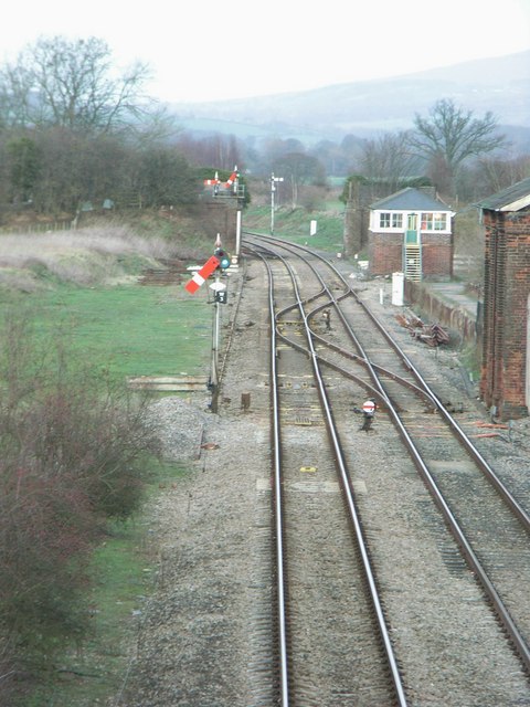
Woofferton is a village to the south of Ludlow, in Shropshire, England. It is one of Shropshire's most southerly villages and lies on the border with Herefordshire. It is part of the civil parish of Richard's Castle. The larger Herefordshire village of Brimfield is just over the border to the south. Transport Woofferton is at the crossroads of the A49 Ludlow-Leominster road (north-south), the A456 road that strikes eastwards and the B4362 (westwards). It was formerly the site of Woofferton railway station (on the Shrewsbury and Hereford Railway) and Woofferton Junction which served the (now closed) Tenbury & Bewdley Railway. The Welsh Marches Line runs through the currently closed station, with Transport for Wales running on the section without intermediate stations between Leominster and Ludlow. Places of interest It is best known for the Woofferton transmitting station (a notable feature of the area's landscape) and a Travelodge. The public house there - the "Salwey Arms ... [...More Info...] [...Related Items...] OR: [Wikipedia] [Google] [Baidu] |
Woofferton Transmitting Station
The Woofferton transmitting station is owned and operated by Encompass Digital Media, as one of the BBC's assets which were handed over as part of the privatization of World Service distribution and transmission in 1997. It is the last remaining UK shortwave broadcasting site, located at Woofferton, south of Ludlow, Shropshire, England. The large site spreads across into neighbouring Herefordshire. The station was originally built by the BBC during World War II to house additional shortwave ( HF) broadcasting transmitters. When it officially started broadcasting on 17 October 1943 it had six 50 kW RCA transmitters, obtained by lend-lease. The site has been modernised many times over the years and is now DRM (Digital Radio Mondiale) capable providing daily digital radio programmes. Woofferton is used to broadcast shortwave radio programmes on HF 4 MHz – 26 MHz to Europe, Russia, North/Central Africa, Middle East and South America for BBC World Service, Deutsche ... [...More Info...] [...Related Items...] OR: [Wikipedia] [Google] [Baidu] |
Listed Buildings In Richard's Castle (Shropshire)
Richard's Castle (Shropshire) is a civil parish in Shropshire, England. It contains 30 listed buildings that are recorded in the National Heritage List for England. Of these, one is listed at Grade I, the highest of the three grades, two are at Grade II*, the middle grade, and the others are at Grade II, the lowest grade. The parish lies to the northeast of the village of Richard's Castle. It contains the villages of Overton and Woofferton and smaller settlements, and is otherwise rural. Most of the listed buildings in the parish are houses, cottages, farmhouses and farm buildings, the earliest of which are timber framed. There are two country houses that are listed, together with associated structures. The other listed buildings include a public house, an aqueduct, a bridge, a former toll house A tollhouse or toll house is a building with accommodation for a toll collector, beside a tollgate on a toll road, canal, or toll bridge. History Many tollho ... [...More Info...] [...Related Items...] OR: [Wikipedia] [Google] [Baidu] |
Woofferton Railway Station
Woofferton is a village to the south of Ludlow, in Shropshire, England. It is one of Shropshire's most southerly villages and lies on the border with Herefordshire. It is part of the civil parish of Richard's Castle. The larger Herefordshire village of Brimfield is just over the border to the south. Transport Woofferton is at the crossroads of the A49 Ludlow-Leominster road (north-south), the A456 road that strikes eastwards and the B4362 (westwards). It was formerly the site of Woofferton railway station (on the Shrewsbury and Hereford Railway) and Woofferton Junction which served the (now closed) Tenbury & Bewdley Railway. The Welsh Marches Line runs through the currently closed station, with Transport for Wales running on the section without intermediate stations between Leominster and Ludlow. Places of interest It is best known for the Woofferton transmitting station (a notable feature of the area's landscape) and a Travelodge. The public house there - the "Salwey Ar ... [...More Info...] [...Related Items...] OR: [Wikipedia] [Google] [Baidu] |
Woofferton Junction
Woofferton is a village to the south of Ludlow, in Shropshire, England. It is one of Shropshire's most southerly villages and lies on the border with Herefordshire. It is part of the civil parish of Richard's Castle. The larger Herefordshire village of Brimfield is just over the border to the south. Transport Woofferton is at the crossroads of the A49 Ludlow-Leominster road (north-south), the A456 road that strikes eastwards and the B4362 (westwards). It was formerly the site of Woofferton railway station (on the Shrewsbury and Hereford Railway) and Woofferton Junction which served the (now closed) Tenbury & Bewdley Railway. The Welsh Marches Line runs through the currently closed station, with Transport for Wales running on the section without intermediate stations between Leominster and Ludlow. Places of interest It is best known for the Woofferton transmitting station (a notable feature of the area's landscape) and a Travelodge. The public house there - the "Salwey A ... [...More Info...] [...Related Items...] OR: [Wikipedia] [Google] [Baidu] |
Tenbury & Bewdley Railway
The Tenbury and Bewdley Railway was an English railway company that built its line from Bewdley in Worcestershire to Tenbury station, which was in Shropshire. The line connected the Severn Valley Railway at Bewdley with the Tenbury Railway at Tenbury. The Tenbury Railway connected at Woofferton with the Shrewsbury and Hereford Railway main line. Two railways were sometimes referred to as the Wyre Forest line or simply the Tenbury Line. The Tenbury and Bewdley Railway opened its line in 1864. It passed into the control of the Great Western Railway. The line closed to passenger trains in 1962 and to goods traffic in 1965; there is now no railway activity on the former line. Conception The Shrewsbury and Hereford Railway opened its line throughout on 6 December 1852. Tenbury was a little over five miles from Woofferton station on that line, and a branch line was planned: it opened on 1 August 1861.Richard K Morriss, ''Railways of Shropshire: A brief history'', Shropshire Libraries, ... [...More Info...] [...Related Items...] OR: [Wikipedia] [Google] [Baidu] |
Richard's Castle
Richard's Castle is a village, castle and two civil parishes on the border of the counties of Herefordshire and Shropshire in England. The Herefordshire section of the parish had a population of 250 at the 2011 Census. The Shropshire section of the parish had a population of 424 at the 2011 Census. The village lies on the B4361 road, south of the historic market town of Ludlow. It is to some degree a dispersed settlement, with an older core near the castle, some to the northwest of the now larger main part of the village which is situated on the B4361. There is a Village Hall and a traditional public house called The Castle Inn, both situated on the B4361. Castle Today the fortress is reduced mainly to its earthworks and foundations. A polygonal keep stood on the high motte or mound. This was reached possibly via a semi-circular barbican. The bailey wall still stands twenty feet high in places and there are remains of several towers and an early gatehouse around the perimet ... [...More Info...] [...Related Items...] OR: [Wikipedia] [Google] [Baidu] |
Richard's Castle (Shropshire)
Richard's Castle is a village, castle and two civil parishes on the border of the counties of Herefordshire and Shropshire in England. The Herefordshire section of the parish had a population of 250 at the 2011 Census. The Shropshire section of the parish had a population of 424 at the 2011 Census. The village lies on the B4361 road, south of the historic market town of Ludlow. It is to some degree a dispersed settlement, with an older core near the castle, some to the northwest of the now larger main part of the village which is situated on the B4361. There is a Village Hall and a traditional public house called The Castle Inn, both situated on the B4361. Castle Today the fortress is reduced mainly to its earthworks and foundations. A polygonal keep stood on the high motte or mound. This was reached possibly via a semi-circular barbican. The bailey wall still stands twenty feet high in places and there are remains of several towers and an early gatehouse around the perimet ... [...More Info...] [...Related Items...] OR: [Wikipedia] [Google] [Baidu] |
A456 Road
Known as the Hagley Road in Birmingham, the A456 is a main road in England running between Central Birmingham and Woofferton, Shropshire, south of Ludlow. Some sections of the route, for example Edgbaston near Bearwood, are also the route of the Elan Aqueduct which carries Birmingham's water supply from the Elan Valley. Route Birmingham - Kidderminster The A456 now starts in the underpass at the end of Broad Street ''Five Ways'' junction on the Middleway (A4540) in Birmingham. It previously started at the Paradise Circus junction with the former Inner Ring Road (A4400) but originally ran along New Street in the city centre. Heading West through the Birmingham suburbs of Edgbaston and Quinton using a mixture of dual carriageway and single carriageway roads, though maintaining at least 2 lanes in each direction. Just beyond Quinton, the A458 exits towards Halesowen, while the A456 bypasses the town to the South, meeting the M5 at Junction 3. This route was completed in the 1 ... [...More Info...] [...Related Items...] OR: [Wikipedia] [Google] [Baidu] |
A49 Road
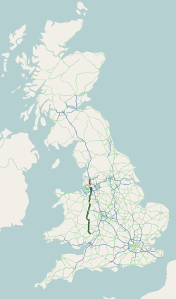
The A49 is an A road in western England, which traverses the Welsh Marches region. It runs north from Ross-on-Wye in Herefordshire via Hereford, Leominster, Ludlow, Shrewsbury and Whitchurch, then continues through central Cheshire to Warrington and Wigan before terminating at its junction with the A6 road just south of Bamber Bridge, near the junction of the M6, M65 and M61 motorways. The stretch between Ross-on-Wye and the A5 at Shrewsbury is a trunk road, maintained by National Highways. Lancashire From the A6 at Bamber Bridge, south of Preston, the road runs parallel to the M6 motorway, through Leyland towards Wigan. Through Ashton in Makerfield and Newton-le-Willows, reaching Warrington via Winwick. In June 2020, a new section of the A49 opened forming part of a link between Wigan town centre and junction 25 on the M6, the section it replaced being renumbered B5386. Cheshire From junction 9 of the M62, there is a dual-carriageway through Warrington, as far as Lo ... [...More Info...] [...Related Items...] OR: [Wikipedia] [Google] [Baidu] |
Shrewsbury And Hereford Railway
The Shrewsbury and Hereford Railway was an English railway company that built a standard gauge line between those places. It opened its main line in 1853. Its natural ally seemed to be the Great Western Railway. With other lines it formed a route between the mineral resources of South Wales and the industries of the north-west of England, and this attracted the interest of the London and North Western Railway, which sought access to South Wales. The GWR and the LNWR jointly leased the S&HR line in 1862, later jointly acquiring ownership of it, in 1871. LNWR mineral traffic developed, and after the opening of the Severn Tunnel in 1886, the line became an important main line for traffic from the south-west of England to the north-west. With the decline in local passenger and goods traffic in the 1950s many intermediate stations closed, but the main line continues in important use at the present day. Origins On 3 August 1846, 16 railway bills were passed in Parliament; one of th ... [...More Info...] [...Related Items...] OR: [Wikipedia] [Google] [Baidu] |
Ludlow
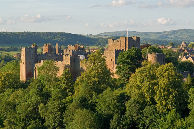
Ludlow () is a market town in Shropshire, England. The town is significant in the history of the Welsh Marches and in relation to Wales. It is located south of Shrewsbury and north of Hereford, on the A49 road which bypasses the town. The town is near the confluence of the rivers Corve and Teme. The oldest part is the medieval walled town, founded in the late 11th century after the Norman conquest of England. It is centred on a small hill which lies on the eastern bank of a bend of the River Teme. Situated on this hill are Ludlow Castle and the parish church, St Laurence's, the largest in the county. From there the streets slope downward to the rivers Corve and Teme, to the north and south respectively. The town is in a sheltered spot beneath Mortimer Forest and the Clee Hills, which are clearly visible from the town. Ludlow has nearly 500 listed buildings, including examples of medieval and Tudor-style half-timbered buildings. The town was described by Sir John Betjeman ... [...More Info...] [...Related Items...] OR: [Wikipedia] [Google] [Baidu] |
Brimfield, Herefordshire
Brimfield is a village and in north Herefordshire, England. The village lies on the A49 road at the border with Shropshire. To the south, near the hamlet of Ashton, excavations at the site of Ashton Castle have revealed traces of a large stone enclosure castle. Less than a mile to the north of this site are the earthwork remains of a medieval motte. The parish has a pub called The Roebuck Inn. Roebuck, Brimfield is west of Brimfield and is part of its civil parish. To the north, in , is |

.jpg)


