|
Woodcroft, New South Wales
Woodcroft is a suburb of Sydney, in the state of New South Wales, Australia. Woodcroft is located 37 kilometres west of the Sydney central business district, in the local government area of the City of Blacktown and is part of the Greater Western Sydney region. Woodcroft Lake is on Bricketwood Drive and the Neighbourhood Centre is beside it. It is popular among the community. The suburb contains many play areas. History From 1969 to 1988 Woodcroft was the State Brickworks in Doonside (and prior to 1969 it was the location of the State Timberworks). In 1989, the land was purchased by estate agents and developers LJ Hooker. After rezoning, residential construction commenced in 1992 and Woodcroft was formally recognized as a suburb in 1996. Commercial area There is a modest independent retail mall on Richmond Road. Services include a service station, supermarket, doctor's surgery, and a variety of independent and franchise fast food outlets. Facilities such as disabled toilets, p ... [...More Info...] [...Related Items...] OR: [Wikipedia] [Google] [Baidu] |
City Of Blacktown
Blacktown City Council is a local government area in Western Sydney, situated on the Cumberland Plain, approximately west of the Sydney central business district, in the state of New South Wales, Australia. Established in 1906 as the Blacktown Shire and becoming the Municipality of Blacktown in 1961 before gaining city status in 1979, the City occupies an area of and has a population of 366,534, making it the second most populous local government area in Sydney. The Mayor of the Blacktown City Council is Cr. Tony Bleasdale, OAM, a member of the Australian Labor Party, who was elected on 9 October 2019 following the resignation of Stephen Bali, MP. Suburbs and localities of the City of Blacktown These are the suburbs and localities in the local government area: History The first road from Prospect to Richmond became known as the "Black Town Road" and in 1860 the Railway Department gave the name of "Black Town Road Station" to the railway station at the junction of ... [...More Info...] [...Related Items...] OR: [Wikipedia] [Google] [Baidu] |
Quakers Hill Railway Station
Quakers Hill railway station is located on the Richmond line, serving the Sydney suburb of Quakers Hill. It is served by Sydney Trains T1 Western and T5 Cumberland line services. History Quakers Hill station opened in 1872 as Douglas Siding. It was renamed Quakers Hill on 30 March 1905 and relocated to its present location on 29 June 1939. Two sets of points at the southern end of the station allow trains to terminate on either platform. The station had a crossing loop until the line from Marayong was duplicated to Quakers Hill in 2002. In 2011, the second track was extended to Schofields with a new overhead concourse with lists completed at the same time. As a result, T5 Cumberland line services were extended to terminate at Schofields. Platforms & services Train Line and Services During the week, Quakers Hill has four services an hour in both directions. Two of these services come from the city while the other two run between Schofields and Leppington. In the peak, Q ... [...More Info...] [...Related Items...] OR: [Wikipedia] [Google] [Baidu] |
Suburbs Of Sydney
This is a complete listing of the suburbs and localities in the greater Sydney area in alphabetical order. Sydney has about 30 local government areas, each consisting of several suburbs. Suburbs in Australia are purely geographical, not political, divisions. See table below, : Suburbs of Sydney and : Local government areas in Sydney. Suburbs are listed here if they are inside the Sydney metro area, and are listed in the New South Wales Geographical Names Register as being suburbs. For this list, the boundaries of the Sydney metro area are defined as the Hawkesbury/Nepean River in the north/north west, and then the outer boundaries of the City of Penrith, Camden Council, the City of Campbelltown and Sutherland Shire. Some but not all Sydney localities are also listed, and localities are shown in italics to differentiate them from suburbs. Further localities may be added if they are on the Geographical Names Register, are inside the Sydney metro area, and are also listed in ... [...More Info...] [...Related Items...] OR: [Wikipedia] [Google] [Baidu] |
Penrith, New South Wales
Penrith is a city in New South Wales, Australia, located in Greater Western Sydney, 55 kilometres (31 mi) west of the Sydney central business district on the banks of the Nepean River, on the outskirts of the Cumberland Plain. Its elevation is 32 metres (105 ft). Penrith is the administrative centre of the Local government in Australia, local government area of the City of Penrith. The Geographical Names Board of New South Wales acknowledges Penrith as one of only four List of cities in Australia, cities within the Greater Sydney metropolitan area. History Indigenous settlement Prior to the arrival of the Europeans, the Penrith area was home to the Mulgoa tribe of the Darug people. They lived in makeshift huts called ''gunyahs'', hunted native animals such as kangaroos, fished in the Nepean River, and gathered local fruits and vegetables such as yams. They lived under an elaborate system of law which had its origins in the Dreamtime. Most of the Mulgoa were kil ... [...More Info...] [...Related Items...] OR: [Wikipedia] [Google] [Baidu] |
Parramatta, New South Wales
Parramatta () is a suburb and major Central business district, commercial centre in Greater Western Sydney, located in the state of New South Wales, Australia. It is located approximately west of the Sydney central business district on the banks of the Parramatta River. Parramatta is the administrative seat of the Local government areas of New South Wales, local government area of the City of Parramatta and is often regarded as the main business district of Greater Western Sydney. Parramatta also has a long history as a second administrative centre in the Sydney metropolitan region, playing host to a number of state government departments as well as state and federal courts. It is often colloquially referred to as "Parra". Parramatta, founded as a British settlement in 1788, the same year as Sydney, is the oldest inland European settlement in Australia and is the economic centre of Greater Western Sydney. Since 2000, government agencies such as the New South Wales Police Force ... [...More Info...] [...Related Items...] OR: [Wikipedia] [Google] [Baidu] |
Blacktown, New South Wales
Blacktown is a suburb in the City of Blacktown, in Greater Western Sydney, in the state of New South Wales, Australia. Blacktown is located west of the Sydney central business district. It is one of the most multicultural places within Greater Sydney. History Prior to the arrival of the First Fleet in 1788, the area of today's Blacktown was inhabited by different groups of the Darug people including the Warmuli, based around what is now Prospect, and their neighbours the Gomerigal from the South Creek area and the Wawarawarry from the Eastern Creek area. It is estimated that fifty to ninety percent of the Darug died of smallpox and other introduced diseases within a few years of the British arrival. Governor Arthur Phillip began granting land in the area to white settlers in 1791. In 1819 Governor Lachlan Macquarie granted land to two indigenous men, Colebee and Nurragingy as payment for their service to The Crown, for assisting Cox with the road over the Blue Mountains ... [...More Info...] [...Related Items...] OR: [Wikipedia] [Google] [Baidu] |
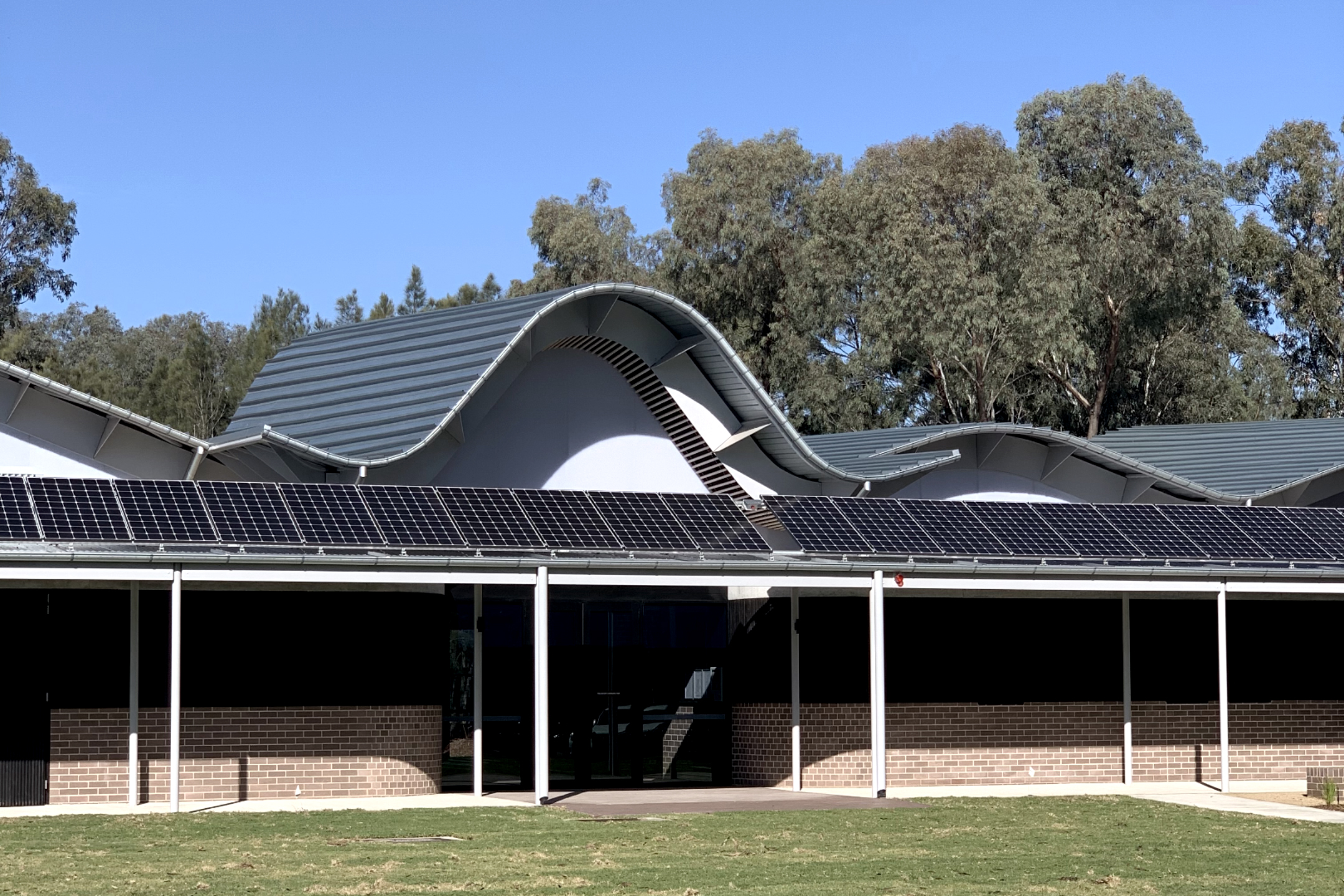
Ben Peake - Woodcroft Neighbourhood Centre - Entry Exterior
Ben is frequently used as a shortened version of the given names Benjamin, Benedict, Bennett or Benson, and is also a given name in its own right. Ben (in he, בֶּן, ''son of'') forms part of Hebrew surnames, e.g. Abraham ben Abraham ( he, אברהם בן אברהם). Bar-, "son of" in Aramaic, is also seen, e.g. Simon bar Kokhba ( he, שמעון בר כוכבא). Ben meaning "son of" is also found in Arabic as ''Ben'' (dialectal Arabic) or ''bin'' (بن), ''Ibn''/''ebn'' (ابن). People with the given name * Ben Adams (born 1981), member of the British boy band A1 * Ben Affleck (born 1972), American Academy Award-winning actor and screenwriter * Ben Ashkenazy (born 1968/69), American billionaire real estate developer * Ben Askren (born 1984), American sport wrestler and mixed martial artist * Ben Banogu (born 1996), American football player * Ben Barba (born 1989), Australian rugby player * Ben Barnes (other), multiple people * Ben Bartch (born 1998), Amer ... [...More Info...] [...Related Items...] OR: [Wikipedia] [Google] [Baidu] |
Lake Burragorang
Lake Burragorang is a man-made reservoir in the lower Blue Mountains of New South Wales, Australia, serving as a major water supply for greater metropolitan Sydney. The dam impounding the lake, the Warragamba Dam, is located approximately southwest of the Sydney central business district. Lake Burragorang is within the World Heritage Site of the Greater Blue Mountains Area. The reservoir collects water from the converged flows of the Coxs, Kowmung, Nattai, Wingecarribee, Wollondilly, and Warragamba rivers and their associated tributaries, all within the Nepean and Hawkesbury River catchment. Pre-lake history Before the construction of the dam, Burragorang Valley had been inhabited by white settlers since the 19th century, and for thousands of years before, the Burragorang valley was part of the tribal lands of the Gundungarra nation, an indigenous tribe that called the Burragorang valley, along with the Blue Mountains and Megalong Valley, their tribal land. A number of ... [...More Info...] [...Related Items...] OR: [Wikipedia] [Google] [Baidu] |
Burrinjuck Dam
Burrinjuck Dam is a heritage-listed major gated concrete-walled gravity hydro-electric dam at Burrinjuck, Yass Valley Shire, New South Wales, Australia. It has three spillways across the Murrumbidgee River located in the South West Slopes region of New South Wales, Australia. The dam's purpose includes flood mitigation, hydro-power, irrigation, water supply and conservation. The impounded reservoir is called Lake Burrinjuck. It was designed by Lawrence Augustus Burton Wade (of the New South Wales Public Works Department)Article on Leslie Wade by C.J. Lloyd in Australian Dictionary of Biography Volume 12 (1990), Melbourne University Press. and built from 1907 to 1927 by Lane & Peters, Sydney. It is also known as Barren Jack Dam and Barrenjack. The property was ... [...More Info...] [...Related Items...] OR: [Wikipedia] [Google] [Baidu] |
M4 Western Motorway
The M4 Motorway is a dual carriageway partially tolled motorway in Sydney, New South Wales, Australia that is designated as the M4 route. The M4 designation is part of the wider A4 and M4 route designation, the M4 runs parallel/below ground to the Great Western Highway and Parramatta Road (A44). The M4 route number comprises two connected parts: *The original section completed between 1971 and 1993 is titled M4 Western Motorway, formerly known as F4 Western Freeway. It spans between in the east, to in the west, where it continues as the Great Western Highway as the A32. The section between Church Street in to was widened and tolled as part of WestConnex since 2017. *An eastern tunnel extension of the M4 from to , known as the M4 East or New M4 Tunnels, was completed as part of WestConnex and opened to traffic on 13 July 2019. The M4 East will be extended even further to in 2023. This section (including the extension to Rozelle) is also tolled as part of WestConnex. ... [...More Info...] [...Related Items...] OR: [Wikipedia] [Google] [Baidu] |
M2 Hills Motorway
The Hills Motorway (also known as the Hills M2 Motorway, M2 Motorway or simply M2) is a tollway in north-western Sydney, Australia, owned by toll road operator Transurban. It forms majority of Sydney's M2 route and part of the 110 km Sydney Orbital Network, with Lane Cove Tunnel constituting the rest of the M2 route. The M2 is also part of the National Highway west of Pennant Hills Road. It was known as the North West Transport Link during planning in the early 1990s. The M2 cycleway is located on the breakdown lanes of the M2 Hills Motorway. Route The M2 Hills Motorway connects directly with the Lane Cove Tunnel at the Lane Cove River in North Ryde and heads north-west through Macquarie Park to Epping, then West through Beecroft, Carlingford then through Baulkham Hills and Winston Hills onto the Westlink M7 motorway at Seven Hills. The motorway runs underneath the suburb of North Epping via twin tunnels known as the Epping/Norfolk tunnels. Connection to NorthConne ... [...More Info...] [...Related Items...] OR: [Wikipedia] [Google] [Baidu] |
Liverpool, New South Wales
Liverpool is a suburb of Greater Western Sydney, in the state of New South Wales, Australia. It is located approximately south-west of the Sydney CBD. Liverpool is the administrative seat of the local government area of the City of Liverpool and is situated in the Cumberland Plain. History Liverpool is one of the oldest urban settlements in Australia, founded on 7 November 1810 as an agricultural centre by Governor Lachlan Macquarie. He named it after Robert Banks Jenkinson, Earl of Liverpool, who was then the Secretary of State for the Colonies and the English city of Liverpool, upon which some of the area's architecture is based. Liverpool is at the head of navigation of the Georges River and combined with the Great Southern Railway from Sydney to Melbourne reaching Liverpool in the late 1850s, Liverpool became a major agricultural and transportation centre as the land in the district was very productive. Until the 1950s, Liverpool was still a satellite town with an a ... [...More Info...] [...Related Items...] OR: [Wikipedia] [Google] [Baidu] |

Blacktown_Council_Chambers.jpg)


.jpg)


