|
Woodbridge, Ontario
Woodbridge is a very large suburban community in Vaughan, Ontario, Canada, along the city's border with Toronto. It occupies the city's entire southwest quadrant, west of Ontario Highway 400, Highway 400, east of Ontario Highway 50, Highway 50, north of Steeles Avenue, and generally south of Major Mackenzie Drive. It was once an independent town before being amalgamated with nearby communities to form the city in 1971. Its traditional downtown core is the Woodbridge Avenue stretch between Islington Avenue and Kipling Avenue north of Highway 7 (Ontario), Highway 7. History The community had its origins with the British Crown granting the west half of lots six and seven, concession 7 of Vaughan Township to Jacob Philips and Hugh Cameron in 1802. Woodbridge had its beginnings in what is today Pine Grove, Vaughan, Pine Grove. During the early half the 19th century, a school was built on Vaughan's eighth concession; and a flour mill and store flourished. A scattering of houses ar ... [...More Info...] [...Related Items...] OR: [Wikipedia] [Google] [Baidu] |
List Of L Postal Codes Of Canada
__NOTOC__ This is a list of postal codes in Canada where the first letter is L. Postal codes beginning with L are located within the Canadian province of Ontario. Only the first three characters are listed, corresponding to the Forward Sortation Area. Canada Post provides a free postal code look-up tool on its website, via its smartphone applications for iPhone and Android, and sells hard-copy directories and CD-ROMs. Many vendors also sell validation tools, which allow customers to properly match addresses and postal codes. Hard-copy directories can also be consulted in all post offices, and some libraries. Central Ontario Central Ontario is a secondary region of Southern Ontario in the Canadian province of Ontario that lies between Georgian Bay and the eastern end of Lake Ontario. The population of the region was 1,123,307 in 2016; however, this number does not in ... - 165 FSAs Urban Rural (* = retired)ftp://seismo.nrcan.gc.ca/exports/intensity/mlr.txt References ... [...More Info...] [...Related Items...] OR: [Wikipedia] [Google] [Baidu] |
Toronto
Toronto ( ; or ) is the capital city of the Canadian province of Ontario. With a recorded population of 2,794,356 in 2021, it is the most populous city in Canada and the fourth most populous city in North America. The city is the anchor of the Golden Horseshoe, an urban agglomeration of 9,765,188 people (as of 2021) surrounding the western end of Lake Ontario, while the Greater Toronto Area proper had a 2021 population of 6,712,341. Toronto is an international centre of business, finance, arts, sports and culture, and is recognized as one of the most multicultural and cosmopolitan cities in the world. Indigenous peoples have travelled through and inhabited the Toronto area, located on a broad sloping plateau interspersed with rivers, deep ravines, and urban forest, for more than 10,000 years. After the broadly disputed Toronto Purchase, when the Mississauga surrendered the area to the British Crown, the British established the town of York in 1793 and later designat ... [...More Info...] [...Related Items...] OR: [Wikipedia] [Google] [Baidu] |
Narrow Gauge Railway
A narrow-gauge railway (narrow-gauge railroad in the US) is a railway with a track gauge narrower than standard . Most narrow-gauge railways are between and . Since narrow-gauge railways are usually built with tighter curves, smaller structure gauges, and lighter rails, they can be less costly to build, equip, and operate than standard- or broad-gauge railways (particularly in mountainous or difficult terrain). Lower-cost narrow-gauge railways are often used in mountainous terrain, where engineering savings can be substantial. Lower-cost narrow-gauge railways are often built to serve industries as well as sparsely populated communities where the traffic potential would not justify the cost of a standard- or broad-gauge line. Narrow-gauge railways have specialised use in mines and other environments where a small structure gauge necessitates a small loading gauge. In some countries, narrow gauge is the standard; Japan, Indonesia, Taiwan, New Zealand, South Africa, and the Aust ... [...More Info...] [...Related Items...] OR: [Wikipedia] [Google] [Baidu] |
Weston, Toronto
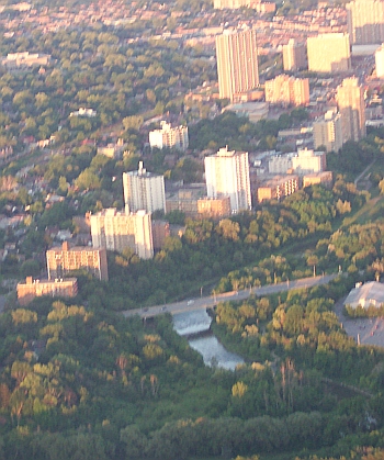
Weston is a neighbourhood and former village in Toronto, Toronto, Ontario, Canada. The neighbourhood is situated in the northwest of the city, south of Ontario Highway 401, Highway 401, east of the Humber River (Ontario), Humber River, north of Eglinton Avenue, and west of Jane Street. Weston Road just north of Lawrence Avenue is the commercial core of Weston, with many small businesses and services. Weston was incorporated as a village in the 19th century and was absorbed into the York, Toronto, Borough of York in the late 1960s. York itself was amalgamated into Toronto in 1998. Description Weston's building stock consists mostly of Victorian homes east of the railway with apartment and condominium towers on Weston Road overlooking the Humber River valley. Weston's main shopping district is located on Weston Road between Church Street in the north and Wilby Crescent (just south of Lawrence Avenue) in the south. Most buildings in this area reflect early-mid-20th century Ontario to ... [...More Info...] [...Related Items...] OR: [Wikipedia] [Google] [Baidu] |
Toronto, Grey And Bruce Railway
The Toronto, Grey and Bruce Railway (TG&B) was a railway company which operated in Ontario, Canada in the years immediately following the Canadian Confederation of 1867. It connected two rural counties, Grey County and Bruce County, with the provincial capital of Toronto to the east. The TG&B suffered from engineering and financial problems throughout its existence, and its struggle to finance a gauge conversion from narrow to standard gauge led to a takeover by bondholders and subsequent acquisition by the Canadian Pacific Railway through its proxy, the Ontario and Quebec Railway. The bulk of the former TG&B lines were managed under Canadian Pacific's Bruce Division, which had its divisional point at Orangeville, the junction of the original TG&B lines to Owen Sound and Teeswater. Background Early development of railways in the Province of Canada, which consisted of Lower Canada (Quebec) and Upper Canada (Ontario), was delayed by lack of capital and industrial infrastructure. ... [...More Info...] [...Related Items...] OR: [Wikipedia] [Google] [Baidu] |
Pine Grove, Vaughan
Pine Grove is a neighbourhood of Vaughan, Ontario, Canada, in York Region. Originally a hamlet north of Woodbridge, it is now an enclave within that larger neighbourhood. History The lands located on the east half of lots 9, 10 and 11 of concession 7 were first patented to David Thompson on May 20, 1801. By 1830, it was a well settled community. John Smith (Schmidt), a farmer from Edgeley, came to Pine Grove where he erected a grist mill and saw mill in 1828. In 1831 he built a store. In 1840 John Smith sold the mill to John W. Gamble who later became the first reeve of Vaughan Township. The mill was sold to Gooderham and Worts in 1860. By the time of Confederation, Pine Grove was home to a flour mill, churches, three hotels, a blacksmith shop, harness shops, a spool factory, one common school and a large general store with a post office. A stage coach ran daily to Weston. On October 15, 1954, Pine Grove was hit by Hurricane Hazel. The flooding of the village along Islington Ave ... [...More Info...] [...Related Items...] OR: [Wikipedia] [Google] [Baidu] |
Woodbridge Old Barn Raising
Woodbridge may refer to: Places Australia *Woodbridge, Western Australia formerly called ''West Midland'' *Woodbridge, Tasmania Canada *Woodbridge, Ontario England *Woodbridge, Suffolk, the location of **Woodbridge (UK Parliament constituency), 1885–1950 **Woodbridge School **RAF Woodbridge * Woodbridge High School, Redbridge *Woodbridge, Devon * Woodbridge, Dorset * Woodbridge, Gloucestershire, a location * Woodbridge, Northumberland, a location United States *Woodbridge, California *Woodbridge, Irvine, California *Woodbridge, Connecticut *Woodbridge Township, New Jersey *Woodbridge (CDP), New Jersey *Woodbridge, Virginia *Woodbridge, Dallas, Texas, a neighborhood *Woodbridge, Detroit Other uses *Woodbridge (plantation), formerly in Prince William County, Virginia, US *Woodbridge (surname) *The Woodbridge Company *Woodbridge's Regiment of Militia, a Massachusetts regiment in the American Revolutionary War *Woodbridge wine, made by Robert Mondavi (now part of Constellation B ... [...More Info...] [...Related Items...] OR: [Wikipedia] [Google] [Baidu] |
CPR Woodbridge Ca
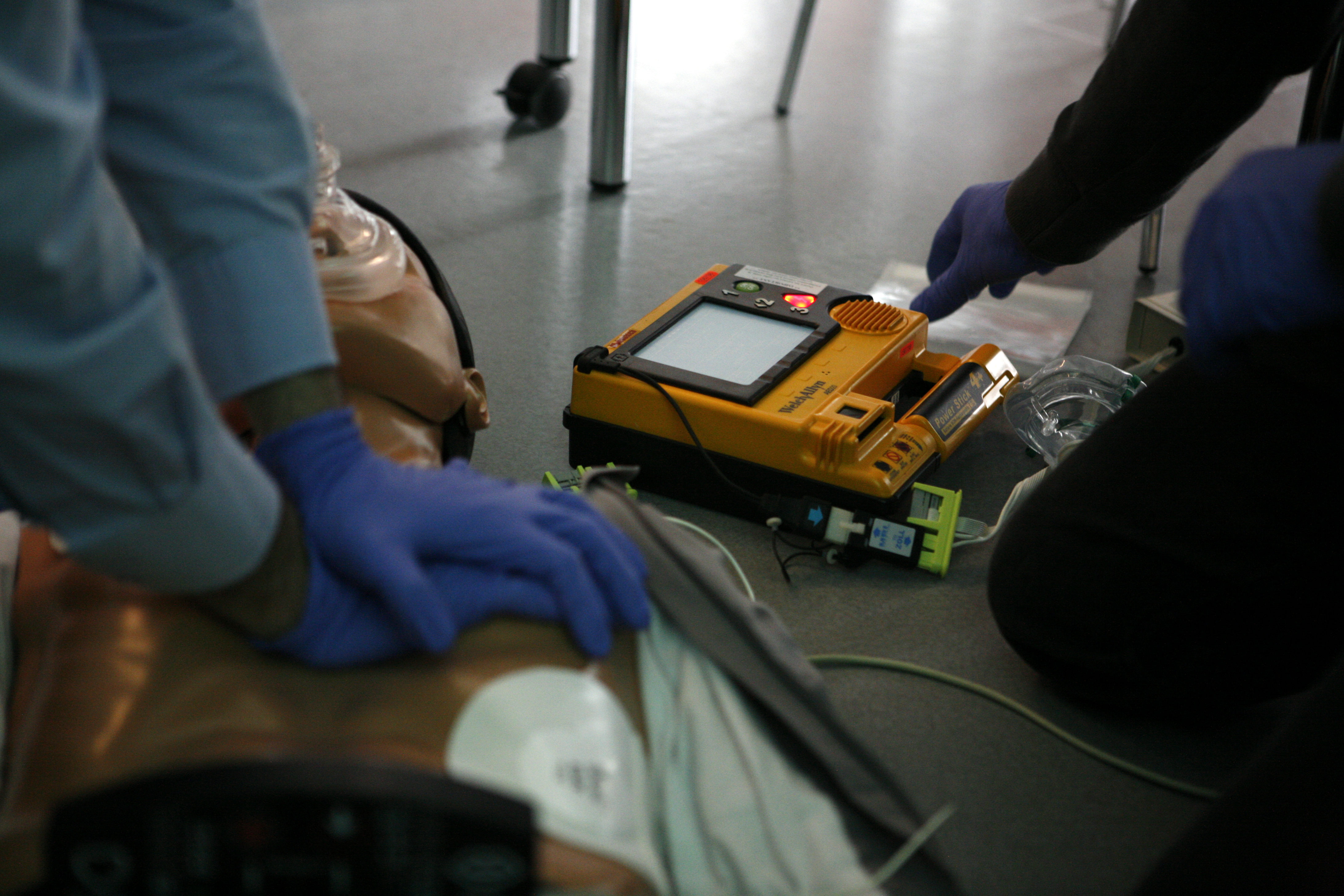
Cardiopulmonary resuscitation (CPR) is an emergency procedure consisting of chest compressions often combined with artificial ventilation in an effort to manually preserve intact brain function until further measures are taken to restore spontaneous blood circulation and breathing in a person who is in cardiac arrest. It is recommended in those who are unresponsive with no breathing or abnormal breathing, for example, agonal respirations. CPR involves chest compressions for adults between and deep and at a rate of at least 100 to 120 per minute. The rescuer may also provide artificial ventilation by either exhaling air into the subject's mouth or nose (mouth-to-mouth resuscitation) or using a device that pushes air into the subject's lungs (mechanical ventilation). Current recommendations place emphasis on early and high-quality chest compressions over artificial ventilation; a simplified CPR method involving only chest compressions is recommended for untrained rescuers. With ... [...More Info...] [...Related Items...] OR: [Wikipedia] [Google] [Baidu] |
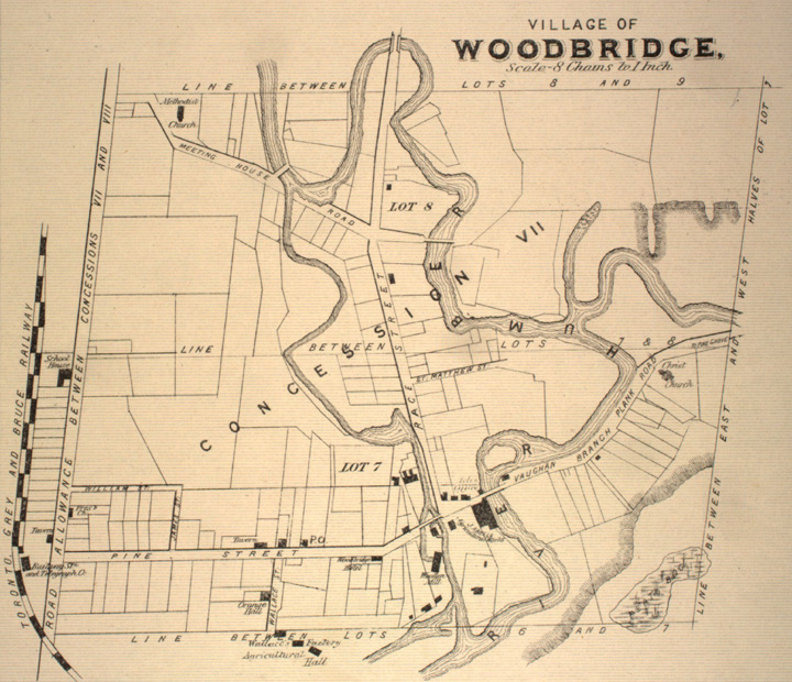
Map Of Woodbridge, Ontario, 1878
A map is a symbolic depiction emphasizing relationships between elements of some space, such as objects, regions, or themes. Many maps are static, fixed to paper or some other durable medium, while others are dynamic or interactive. Although most commonly used to depict geography, maps may represent any space, real or fictional, without regard to context or scale, such as in brain mapping, DNA mapping, or computer network topology mapping. The space being mapped may be two dimensional, such as the surface of the earth, three dimensional, such as the interior of the earth, or even more abstract spaces of any dimension, such as arise in modeling phenomena having many independent variables. Although the earliest maps known are of the heavens, geographic maps of territory have a very long tradition and exist from ancient times. The word "map" comes from the , wherein ''mappa'' meant 'napkin' or 'cloth' and ''mundi'' 'the world'. Thus, "map" became a shortened term referring to ... [...More Info...] [...Related Items...] OR: [Wikipedia] [Google] [Baidu] |
Highway 7 (Ontario)
King's Highway 7, commonly referred to as Highway 7 and historically as the Northern Highway, is a provincially maintained highway in the Canadian province of Ontario. At its peak, Highway 7 measured in length, stretching from Highway 40 east of Sarnia in Southwestern Ontario to Highway 17 west of Ottawa in Eastern Ontario. However, due in part to the construction of Highways 402 and 407, the province transferred the sections of Highway 7 west of London and through the Greater Toronto Area to county and regional jurisdiction. The highway is now long; the western segment begins at Highway 4 north of London and extends to Georgetown, while the eastern segment begins at Donald Cousens Parkway in Markham and extends to Highway 417 in Ottawa. Highway 7 was first designated in 1920 between Sarnia and Guelph and extended to Brampton the following year. Between 1927 and 1932, the highway was more than doubled in length as it was gradually ... [...More Info...] [...Related Items...] OR: [Wikipedia] [Google] [Baidu] |
Kipling Avenue
Kipling Avenue is a street in the cities of Toronto and Vaughan in Ontario, Canada. It is a concession road, 6 concessions (12 km) west from Yonge Street, and is a major north–south arterial road. It consists of three separate sections, with total combined length of 26.4 km. (16.4 mi.). The street travels through the district of Etobicoke and serves areas such as New Toronto, Etobicoke Centre, Richview, and Rexdale, passing through residential neighbourhoods and pockets of industrial and commercial areas. The Toronto Transit Commission's 45 Kipling, 44 Kipling South, 944 Kipling South Express and 945 Kipling Express bus routes operate from Kipling Station on the Bloor-Danforth line. These surface routes provide service along the length of the road. Film studio complex Kipling Studio located on 777 Kipling Avenue is part of Cinespace Film Studios. History Originally named Mimico Avenue, the street was surveyed in 1795 as a Meridian road south of the e ... [...More Info...] [...Related Items...] OR: [Wikipedia] [Google] [Baidu] |
Islington Avenue
Islington () is a district in the north of Greater London, England, and part of the London Borough of Islington. It is a mainly residential district of Inner London, extending from Islington's High Street to Highbury Fields, encompassing the area around the busy High Street, Upper Street, Essex Road (former "Lower Street"), and Southgate Road to the east. Modern definition Islington grew as a sprawling Middlesex village along the line of the Great North Road, and has provided the name of the modern borough. This gave rise to some confusion, as neighbouring districts may also be said to be in Islington. This district is bounded by Liverpool Road to the west and City Road and Southgate Road to the south-east. Its northernmost point is in the area of Canonbury. The main north–south high street, Upper Street splits at Highbury Corner to Holloway Road to the west and St. Paul's Road to the east. The Angel business improvement district (BID), an area centered around the Angel ... [...More Info...] [...Related Items...] OR: [Wikipedia] [Google] [Baidu] |


