|
Wollemi National Park
The Wollemi National Park () is a protected national park and wilderness area that is located in the northern Blue Mountains and Lower Hunter regions of New South Wales, in eastern Australia. The park, the second largest national park in New South Wales, contains the Wollemi Wildernessthe largest such wilderness area in Australiaand is situated approximately northwest of Sydney. The Wollemi National Park is one of the eight protected areas that, in 2000, was inscribed to form part of the UNESCO World Heritagelisted Greater Blue Mountains Area. The Wollemi National Park is the most northwesterly of the eight protected areas within the World Heritage Site. The national park forms part of the Great Dividing Range. The only known living wild specimens of the Wollemi Pine (''Wollemia nobilis'') were discovered in 1994. Special efforts were made to protect the trees when the 2019-20 Australian bushfires burned through the park. The national park is bounded to the north by t ... [...More Info...] [...Related Items...] OR: [Wikipedia] [Google] [Baidu] |
Capertee River
The Capertee River, a perennial stream that is part of the Hawkesbury- Nepean catchment, is located in the Central Tablelands region of New South Wales, Australia. Course The Capertee River rises on the Great Dividing Range, close to Bogee, southeast of Kandos, formed by the confluence of the Tea Tree Creek and Brymair Creek, and flows through the Capertee Valley, generally to the south, east, and southeast, joined by seven minor tributaries, to its confluence with Wolgan River to form the Colo River, northeast of Newnes. The river descends over its course. See also * List of rivers of Australia * List of rivers of New South Wales (A–K) * Rivers of New South Wales * Wollemi National Park The Wollemi National Park () is a protected national park and wilderness area that is located in the northern Blue Mountains and Lower Hunter regions of New South Wales, in eastern Australia. The park, the second largest national park in New ... References Riv ... [...More Info...] [...Related Items...] OR: [Wikipedia] [Google] [Baidu] |
Goulburn River National Park
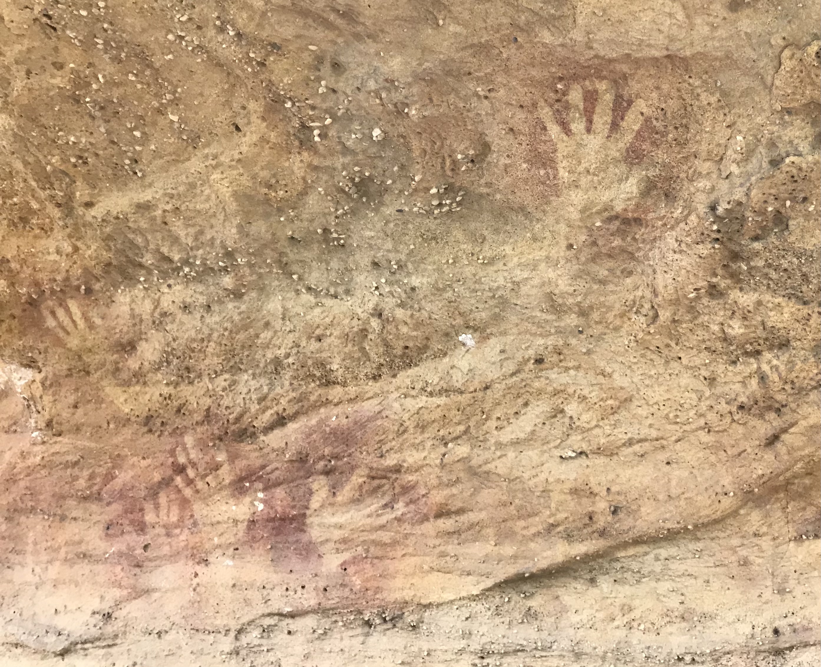
The Goulburn River National Park is a national park located in New South Wales, Australia, northwest of Sydney and it is south-west of Merriwa. The Goulburn River National Park is located in the Hunter Valley region and covers approximately of the Goulburn River. It is near the towns of Sandy Hollow, Denman, Merriwa, and Mudgee. The park with its beautiful surroundings, forest and river offers many opportunities for recreation, such as fishing, hiking, kayaking, swimming and camping. Animals The park is a sanctuary for kangaroos, wombats, emus, goannas, platypus, and a wide variety of birds. It lies within the Mudgee-Wollar Important Bird Area, so identified by BirdLife International because of its importance for the endangered regent honeyeater. Aboriginal heritage The park contains some 300 or more aboriginal site (mostly along the river). The Wiradjuri, Gamileroi and Wonnarua Clans peoples have traditionally lived in this area since ancient times. See also * Prot ... [...More Info...] [...Related Items...] OR: [Wikipedia] [Google] [Baidu] |
Narrabeen
Narrabeen is a beachside suburb in northern Sydney, in the state of New South Wales, Australia. Narrabeen is 23 kilometres north-east of the Sydney central business district, in the local government area of Northern Beaches Council and is part of the Northern Beaches region. This area was named Broken Bay by James Cook as he sailed by. History There are a number of theories on the origin of the name "Narrabeen". The most fanciful is that Narrabeen is named after "narrow beans" which the English in the first year of settlement (1788) found and ate from a vine growing over beach sand. Surgeon White indeed recorded getting ill from such beans but this was well north of Narrabeen, near Broken Bay. The name Narrobine Creek appears in 1801 in records relating to two escaped convicts, and thus the name appears to have been in use before then. Another suggestion is that it derives from an Aboriginal word meaning swan. Surveyor James Meehan placed the name Narabang Narabang ... [...More Info...] [...Related Items...] OR: [Wikipedia] [Google] [Baidu] |
Sedimentary Rock
Sedimentary rocks are types of rock that are formed by the accumulation or deposition of mineral or organic particles at Earth's surface, followed by cementation. Sedimentation is the collective name for processes that cause these particles to settle in place. The particles that form a sedimentary rock are called sediment, and may be composed of geological detritus (minerals) or biological detritus (organic matter). The geological detritus originated from weathering and erosion of existing rocks, or from the solidification of molten lava blobs erupted by volcanoes. The geological detritus is transported to the place of deposition by water, wind, ice or mass movement, which are called agents of denudation. Biological detritus was formed by bodies and parts (mainly shells) of dead aquatic organisms, as well as their fecal mass, suspended in water and slowly piling up on the floor of water bodies ( marine snow). Sedimentation may also occur as dissolved minerals precipita ... [...More Info...] [...Related Items...] OR: [Wikipedia] [Google] [Baidu] |
Stratum
In geology and related fields, a stratum ( : strata) is a layer of rock or sediment characterized by certain lithologic properties or attributes that distinguish it from adjacent layers from which it is separated by visible surfaces known as either '' bedding surfaces'' or ''bedding planes''.Salvador, A. ed., 1994. ''International stratigraphic guide: a guide to stratigraphic classification, terminology, and procedure. 2nd ed.'' Boulder, Colorado, The Geological Society of America, Inc., 215 pp. . Prior to the publication of the International Stratigraphic Guide, older publications have defined a stratum as either being either equivalent to a single bed or composed of a number of beds; as a layer greater than 1 cm in thickness and constituting a part of a bed; or a general term that includes both ''bed'' and '' lamina''.Neuendorf, K.K.E., Mehl, Jr., J.P., and Jackson, J.A. , eds., 2005. ''Glossary of Geology'' 5th ed. Alexandria, Virginia, American Geological Institute. 779 pp. ... [...More Info...] [...Related Items...] OR: [Wikipedia] [Google] [Baidu] |
Sydney Basin
The Sydney Basin is an interim Australian bioregion and is both a structural entity and a depositional area, now preserved on the east coast of New South Wales, Australia and with some of its eastern side now subsided beneath the Tasman Sea. The basin is named for the city of Sydney, on which it is centred. Around thick, the Sydney Basin consists of Permian and Triassic sedimentary rocks, which stretches from Newcastle in the north to Batemans Bay in the south, and west to the Great Dividing Range. The basin is also home to the major centres of Newcastle and Wollongong, and contains economically significant reserves of coal. Sydney's famous harbour and the sculptured cliffs of the Blue Mountains are signature formations of relatively hard upper strata of sandstone. The basin contains the UNESCO World Heritage-listed Greater Blue Mountains Area. Geography According to NSW Primary Industries, the basin extends through approximately of coastline from Newcastle in the north ... [...More Info...] [...Related Items...] OR: [Wikipedia] [Google] [Baidu] |
Colo River Valley
Colo may refer to: Places * Colo (volcano), in Indonesia * Colo, Iowa, United States *Colo, New South Wales, Australia * Colo River, in Australia *Colo., an abbreviation for the U.S. state of Colorado *A former name of Duaringa, Queensland, Australia People with the surname * Don Colo (born 1925), American football player *Papo Colo (born 1946), Puerto Rican artist *Licia Colò (born 1962), Italian television hostess and journalist * Zeno Colò (1920–1993), Italian alpine skier *Nando de Colo (born 1987), French basketball player Other * ''Colo'' (film) *Colo (gorilla), the first gorilla born into captivity *An alternate name for the Alemow (''Citrus × macrophylla'') *A colloquial term for the French ''École Nationale de la France d'Outre-Mer'' *Short for colocation centre See also * Colo-Colo * Colos (other) * Colocolo (other) Colocolo, colo-colo, Colo-Colo, or Colo Colo may refer to: * Colocolo (tribal chief), 16th century Mapuche leader and Chilean fol ... [...More Info...] [...Related Items...] OR: [Wikipedia] [Google] [Baidu] |
Capertee Valley
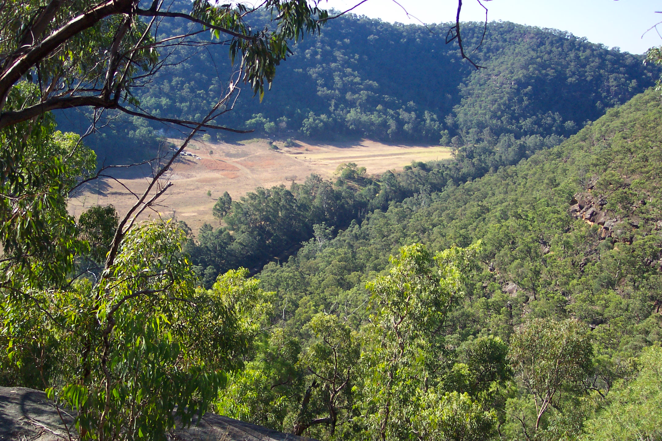
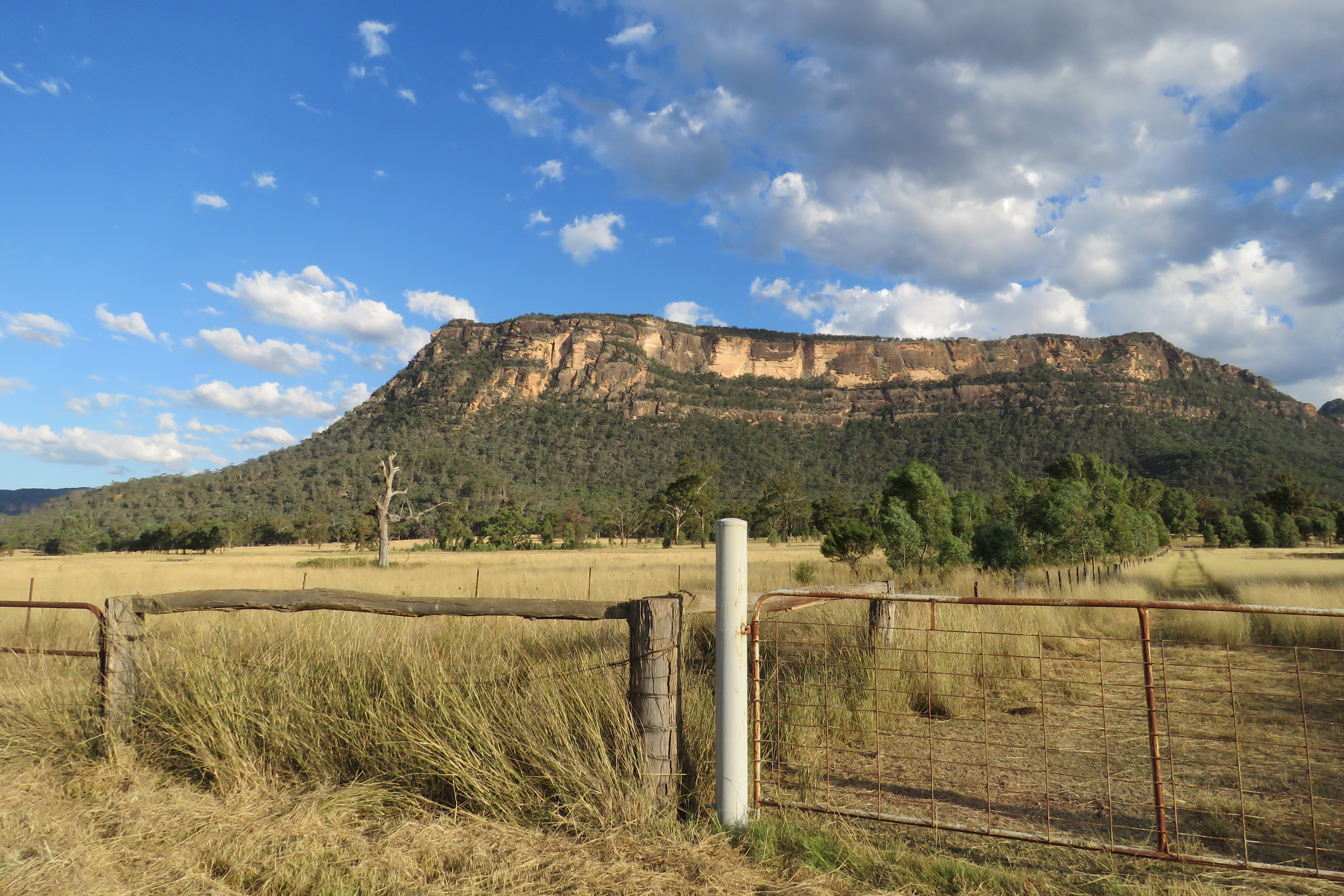
The Capertee Valley (pronounced Kay-per-tee) is a large canyon in New South Wales, Australia, north-west of Sydney that is noted to be the second widest of any canyon in the world, exceeding The Grand Canyon. It is located kilometres north-west of Sydney, between Lithgow and Mudgee, in the Central Tablelands, just above the Blue Mountains. The only population centre of any kind is the village of Glen Davis, which includes a camp-site and often serves as a starting point for bushwalks around the Capertee River and other parts of the Wollemi National Park. Geology The valley follows the Capertee River as it cuts through the Sydney Basin, a sedimentary basin consisting of Permian and Triassic sedimentary rock west of the Blue Mountains. Sandstone cliffs and limestone formations predominate the escarpment, which descend into a deep chasm sculpted into the environment over millions of years. One of the most prominent features of the valley is Pantony's Crown, a sandstone bu ... [...More Info...] [...Related Items...] OR: [Wikipedia] [Google] [Baidu] |
Gardens Of Stone National Park
The Gardens of Stone National Park is a protected national park that is located in the Central Tablelands region of New South Wales in eastern Australia. The national park is situated northwest of Sydney, and northwest of . The national park draws its name from the natural stone pagodas within its boundaries. The Gardens of Stone National Park is one of the eight protected areas that, in 2000, was inscribed to form part of the UNESCO World Heritagelisted Greater Blue Mountains Area. The national park forms part of the Great Dividing Range. Features and location The most prominent features of the park are the sandstone pagoda landscapes and cliffs and canyons. Limestone outcrops, karsts and elevated swamps are other unusual features. The park is bounded on the west by the Castlereagh Highway; to the north by the Glen Davis Road; to the east by the Wollemi National Park; and to the south by the Newnes State Forest, the Wolgan Valley, and the Wolgan State Forest. The rur ... [...More Info...] [...Related Items...] OR: [Wikipedia] [Google] [Baidu] |
Wolgan Valley
Wolgan Valley is a small valley located along the Wolgan River in the Lithgow Region of New South Wales, Australia. The valley is located approximately north of Lithgow and 150 kilometres north-west of Sydney. Accessible by thWolgan Valley Discovery Trail(Wolgan Road) from the Castlereagh Highway, the road travels through the valley leading onto the historical village of Newnes and its extensive industrial ruins. Description and history Wolgan Valley is formed by the Wolgan River in rugged mountainous country west of Sydney in Lithgow north of the city. It flows broadly east until it joins the Capertee River, after which it becomes the Colo River. The latter then continues east through the Wollemi Wilderness which is the largest wilderness area in New South Wales and the largest in eastern Australia. The Wolgan Valley includes sections of Wollemi National Park, Gardens of Stone National Park and the UNESCO declared Greater Blue Mountains World Heritage Area. The valley ... [...More Info...] [...Related Items...] OR: [Wikipedia] [Google] [Baidu] |
Bells Line Of Road
Bells Line of Road is a major road located in New South Wales, Australia, providing an alternative crossing of the Blue Mountains to the Great Western Highway. The eastern terminus of the road is in , 51 km northwest of Sydney, where the road continues eastward as Kurrajong Road, which intersects the A9. The western terminus of the road is in , in the Blue Mountains, where the road continues as the Chifley Road. The route, part of the traditional Aboriginal pathway network, was shown to Archibald Bell, Jr. by Darug men Emery and Cogy in 1823. Subsequently, he was accompanied by the Government Assistant Surveyor and the route marked was known as Bell's Line, to be later cleared to become the second road across the Blue Mountains. Due to its condition and the gradients around Mount Tomah it was rarely used before World War II. The road was improved between 1939 and 1943, as an alternative to the Great Western Highway for the war effort. At the same time that it was improved ... [...More Info...] [...Related Items...] OR: [Wikipedia] [Google] [Baidu] |
Blue Mountains National Park
The Blue Mountains National Park is a protected national park that is located in the Blue Mountains region of New South Wales, in eastern Australia. The national park is situated approximately west of Sydney, and the park boundary is quite irregular as it is broken up by roads, urban areas and inholdings. Despite the name mountains, the area is an uplifted plateau, dissected by a number of larger rivers. The highest point in the park is Mount Werong at above sea level; while the low point is on the Nepean River at above sea level as it leaves the park. The national park is one of the eight protected areas that, in 2000, was inscribed to form part of the UNESCO World Heritagelisted Greater Blue Mountains Area. The Greater Blue Mountains was one of 15 World Heritage places included in the National Heritage List on 21 May 2007. The Blue Mountains National Park is the most central of the eight protected areas within the World Heritage Site and it forms part of the Great ... [...More Info...] [...Related Items...] OR: [Wikipedia] [Google] [Baidu] |


-Location-Map.png)