|
Wisconsin Highway 66
State Trunk Highway 66 (often called Highway 66, STH-66 or WIS 66) is a state highway in the U.S. state of Wisconsin. It runs east–west in central Wisconsin from Rosholt to Stevens Point and along what used to be County Trunk Highway P (CTH-P) to Wisconsin Rapids. The entire length of this highway is designated the Polish Heritage Highway. Route description WIS 66 originally began at the corner of Reserve and Main streets in downtown Stevens Point however once US Highway 10 (US 10) finished the expansion of the bypass around Stevens Point deserting the old US 10, plans arose to expand WIS 66 to use the former highway. This is how WIS 66 got its current-day route, which begins in Wisconsin Rapids traveling east on the Old CTH-P, it then adjoins the former US 10 which routes through downtown Stevens Point, passing the University of Wisconsin–Stevens Point campus, and later joins with current US 10, US 51, and Interstate 39 (I-39) traveling ... [...More Info...] [...Related Items...] OR: [Wikipedia] [Google] [Baidu] |
Wisconsin Rapids, Wisconsin
Wisconsin Rapids is a city in and the county seat of Wood County, Wisconsin. The population was 18,877 at the 2020 census. The city also forms one of the core areas of the United States Census Bureau's Marshfield-Wisconsin Rapids Micropolitan Statistical Area, which includes all of Wood County and had a 2020 population of 74,207. History The American Indians called the area "Ahdawagam", meaning "Two-sided Rapids". Although Europeans began to settle this area in the 1830s, Wisconsin Rapids has been known by this name only since 1920. Prior to that, the community was divided by the Wisconsin River, with the west side incorporated as Centralia and the east side as Grand Rapids. The two cities merged in 1900, with the entire community taking the name Grand Rapids. The name was changed in 1920 to avoid mail and other goods from being misdirected to the much better known Grand Rapids, Michigan. Geography Wisconsin Rapids is located at (44.386805, −89.823078). According to th ... [...More Info...] [...Related Items...] OR: [Wikipedia] [Google] [Baidu] |
Stevens Point, Wisconsin
Stevens Point is the county seat of Portage County, Wisconsin, United States. The city was incorporated in 1858. Its 2020 population of 25,666 makes it the largest city in the county. Stevens Point forms the core of the United States Census Bureau's Stevens Point Micropolitan Statistical Area, which had a 2020 population of 70,377 Stevens Point is home to the University of Wisconsin–Stevens Point and a campus of Mid-State Technical College. History Historically part of the Menominee homelands, a three-mile strip along the Wisconsin River was ceded to the United States in an 1836 treaty. In 1854 the Menominee made its last treaty with the U.S., gathering on a reservation on the Wolf River. In the Menominee language it is called ''Pasīpahkīhnen'' which means "It juts out as land" or "point of land". Stevens Point was named after George Stevens, who operated a grocery and supply business on the Wisconsin River during the extensive logging of interior Wisconsin. The river wa ... [...More Info...] [...Related Items...] OR: [Wikipedia] [Google] [Baidu] |
Rosholt, Wisconsin
Rosholt is a village in Portage County, Wisconsin, United States. The population was 478 at the 2020 census. History The person recorded as first owning the land on which Rosholt sits is Gottlieb Stanbly. Stanbly received four parcels directly from the U.S. Government on May 10, 1858 because he was a veteran. Gottlieb Stanbly sold the land to Theodor Stanbly in 1861 for $430 when Gottlieb left the area to fight in the Civil War. Theodor sold the land to Jens Rasmussen in 1867 for $400. Rasmussen created a millpond by damming Flume Creek, and built a water-driven feed mill sometime between 1867 and 1881. John Gilbert (J.G.) Rosholt built the first sawmill in town on the east end of the millpond in 1884, after making a deal to share water rights with Rasmussen. J.G. Rosholt's first mill burned in 1901, but it was rebuilt later that year and into 1902. The first survey and platting of Rosholt was done on June 1, 1903 at J.G. Rosholt's request. Rosholt was incorporated in 1907 and ... [...More Info...] [...Related Items...] OR: [Wikipedia] [Google] [Baidu] |
Wood County, Wisconsin
Wood County is a county located in the U.S. state of Wisconsin. As of the 2020 census, the population was 74,207. Its county seat is Wisconsin Rapids. The county is named after Joseph Wood, a member of the Wisconsin State Assembly. Wood County comprises the Wisconsin Rapids- Marshfield, WI Micropolitan Statistical Area and is included in the Wausau-Stevens Point-Wisconsin Rapids, WI Combined Statistical Area. Geography According to the U.S. Census Bureau, the county has a total area of , of which is land and (2.0%) is water. The geographic center of Wisconsin is in Wood County, nine miles southeast of Marshfield. Wood County spans two of Wisconsin's five geographical regions. The northern part of the county is in the Northern Highlands, with mostly rich cropland with heavy clay soil, used for corn, soybeans, hay and dairy. In the northwest corner the Marshfield moraine runs from Marathon County through Marshfield, Bakerville and Nasonville into Clark County. The sout ... [...More Info...] [...Related Items...] OR: [Wikipedia] [Google] [Baidu] |
Portage County, Wisconsin
Portage County is a county in the U.S. state of Wisconsin. As of th2020 census the population was 70,377. Its county seat is Stevens Point. Portage County comprises the Stevens Point, WI Micropolitan Statistical Area and is included in the Wausau-Stevens Point-Wisconsin Rapids, WI Combined Statistical Area. History Portage County was created from the Wisconsin Territory in 1836 and organized in 1844. Like the city of Portage, Portage County is named for the portage between the Fox and Wisconsin rivers; Portage County originally included the portage and Portage but boundary changes detached the county from its namesake. Geography According to the U.S. Census Bureau, the county has a total area of , of which is land and (2.7%) is water. Major highways Railroads *Canadian National Buses * Stevens Point Transit *List of intercity bus stops in Wisconsin Airport * KSTE - Stevens Point Municipal Airport Adjacent counties * Marathon County - north * Shawano County - nort ... [...More Info...] [...Related Items...] OR: [Wikipedia] [Google] [Baidu] |
State Highway (US)
A state highway, state road, or state route (and the equivalent provincial highway, provincial road, or provincial route) is usually a road that is either ''numbered'' or ''maintained'' by a sub-national state or province. A road numbered by a state or province falls below numbered national highways (Canada being a notable exception to this rule) in the hierarchy (route numbers are used to aid navigation, and may or may not indicate ownership or maintenance). Roads maintained by a state or province include both nationally numbered highways and un-numbered state highways. Depending on the state, "state highway" may be used for one meaning and "state road" or "state route" for the other. In some countries such as New Zealand, the word "state" is used in its sense of a sovereign state or country. By this meaning a state highway is a road maintained and numbered by the national government rather than local authorities. Countries Australia Australia's State Route system covers u ... [...More Info...] [...Related Items...] OR: [Wikipedia] [Google] [Baidu] |
Wisconsin
Wisconsin () is a state in the upper Midwestern United States. Wisconsin is the 25th-largest state by total area and the 20th-most populous. It is bordered by Minnesota to the west, Iowa to the southwest, Illinois to the south, Lake Michigan to the east, Michigan to the northeast, and Lake Superior to the north. The bulk of Wisconsin's population live in areas situated along the shores of Lake Michigan. The largest city, Milwaukee, anchors its largest metropolitan area, followed by Green Bay and Kenosha, the third- and fourth-most-populated Wisconsin cities respectively. The state capital, Madison, is currently the second-most-populated and fastest-growing city in the state. Wisconsin is divided into 72 counties and as of the 2020 census had a population of nearly 5.9 million. Wisconsin's geography is diverse, having been greatly impacted by glaciers during the Ice Age with the exception of the Driftless Area. The Northern Highland and Western Upland along wi ... [...More Info...] [...Related Items...] OR: [Wikipedia] [Google] [Baidu] |
University Of Wisconsin–Stevens Point
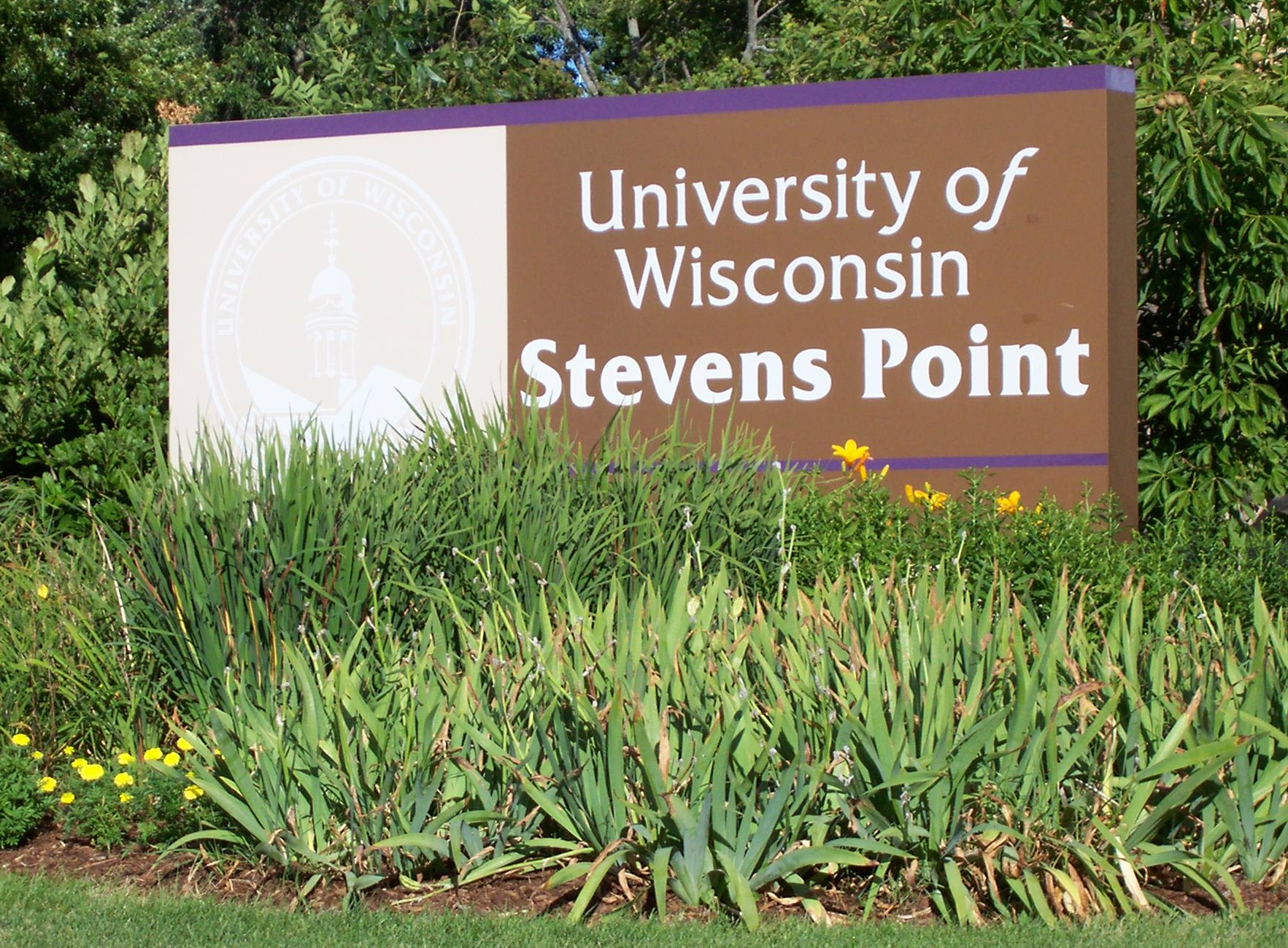
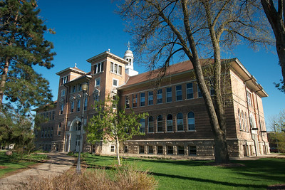
The University of Wisconsin–Stevens Point (UW–Stevens Point or UWSP) is a public university in Stevens Point, Wisconsin. It is part of the University of Wisconsin System and grants associate, baccalaureate, and master's degrees, as well as doctoral degrees in audiology and educational sustainability. As of 2018, UW-Stevens Point has merged with University of Wisconsin–Stevens Point at Wausau, UW-Stevens Point at Wausau and University of Wisconsin–Stevens Point at Marshfield, UW-Stevens Point at Marshfield. History After securing land and funding from the City of Stevens Point and Portage County, Wisconsin, Portage County and winning the right to host the new normal school, Stevens Point Normal School opened on September 17, 1894, with 201 students. In addition to teacher preparation, "domestic science" (home economics) and conservation education were offered; the latter formed the basis for the College of Natural Resources. In 1927, Stevens Point Normal School became C ... [...More Info...] [...Related Items...] OR: [Wikipedia] [Google] [Baidu] |
Interstate 39
Interstate 39 (I-39) is a highway in the Midwestern United States. I-39 runs from Normal, Illinois, at I-55 to State Trunk Highway 29 (WIS 29) in the town of Rib Mountain, Wisconsin, which is approximately south of Wausau. I-39 was designed to replace U.S. Route 51 (US 51), which, in the early 1980s, was one of the busiest two-lane highways in the United States. I-39 was built in the 1980s and 1990s. In Illinois, the route has a total length of . In Wisconsin, I-39 has a distance of . With the exception of an segment around Portage, Wisconsin, the Interstate shares a route with at least one other route number in I-39's entirety. From Rockford, Illinois, to Portage, Wisconsin, I-39 runs concurrently with I-90. In Wisconsin, I-94 joins the pair in Madison until Portage. At in length, this concurrency of three Interstates is the longest in the country. From Portage northward, US 51 is cosigned with the Interstate and has exit numbers based on its ... [...More Info...] [...Related Items...] OR: [Wikipedia] [Google] [Baidu] |
Stevens Point Municipal Airport
Stevens Point Municipal Airport is a public airport located three miles (5 km) northeast of the central business district of Stevens Point, a city in Portage County, Wisconsin, United States. It is owned and operated by the city of Stevens Point. It is included in the Federal Aviation Administration (FAA) National Plan of Integrated Airport Systems for 2021–2025, in which it is categorized as a regional general aviation facility. Airshow A biannual airshow is held at Stevens Point Municipal Airport. The event includes meals, aircraft displays and inflight demonstrations. The show features various demonstrations and historical aircraft, especially warbirds. The show often partners with local organizations to honor veterans. Facilities and Aircraft Stevens Point Municipal Airport covers an area of at an elevation of 1,110 feet (338 m) above mean sea level. The airport contains two asphalt paved runways: 3/21 measuring 6,028 x 120 ft (1,837 x 37 m) with approved ILS ... [...More Info...] [...Related Items...] OR: [Wikipedia] [Google] [Baidu] |
Jordan, Wisconsin
Jordan is a town in Green County, Wisconsin, United States. The population was 577 at the 2000 census. The unincorporated community of Jordan Center is located in the town. Geography According to the United States Census Bureau, the town has a total area of 36.0 square miles (93.3 km2), of which, 36.0 square miles (93.2 km2) of it is land and 0.03% is water. History The first settlement, within the limits now comprising the town of Jordan, was made by William Brazel. In 1836, he raised the first corn and in 1837 raised the first crop of wheat in the township. Others to follow him were: John and George Shelton from Virginia in 1836, Lars Larson Bothan from Norway in 1843, brothers Ole Iverson from Vik, Norway in 1843 and Axel Iverson from Voss, Norway in 1844, Curtis Hard and Henry Crary in 1845. At the junction of Jordan Creek and the Pecatonica River, the early settlers believed there would some day be a city. Steamboats came up the river to that point ... [...More Info...] [...Related Items...] OR: [Wikipedia] [Google] [Baidu] |
Ellis, Wisconsin
Ellis is an unincorporated community in the town of Sharon, Portage County, Wisconsin, United States. History Originally known as Poland Corners, Ellis was renamed in 1867 when the post office was established. It was named in honor of Albert G. Ellis, who was the mayor of Stevens Point, Wisconsin at the time. Geography Ellis is located in central Wisconsin approximately six miles northeast of Stevens Point, approximately four miles north of Custer George Armstrong Custer (December 5, 1839 – June 25, 1876) was a United States Army officer and cavalry commander in the American Civil War and the American Indian Wars. Custer graduated from West Point in 1861 at the bottom of his class, b ..., and approximately six miles southwest of Rosholt, where State Road 66 and Portage County Road J to the south meets with Ellis Road. Ellis is located on State Road 66 between Portage County Road K to the north and K to the south in Polonia. Notes External linksHistory of Ellisfr ... [...More Info...] [...Related Items...] OR: [Wikipedia] [Google] [Baidu] |


