|
Wisconsin Assembly, District 58
The 58th Assembly District of Wisconsin is one of 99 districts in the Wisconsin State Assembly. Located in southeastern Wisconsin, the district covers central Washington County, including the city of West Bend and the villages of Slinger and Jackson, and the northern half of the village of Richfield. It also contains the University of Wisconsin–Milwaukee at Washington County campus, the Moraine Park Technical College, and West Bend Municipal Airport, and a significant portion of the Pike Lake Unit, Kettle Moraine State Forest. The district is represented by Republican Rick Gundrum, elected to the seat in a January 2018 special election following the death of previous officeholder Bob Gannon Robert John Gannon (January 6, 1959October 3, 2017) was an American politician and businessman from West Bend, Wisconsin. Early life and education Gannon was born in Mequon, Wisconsin on January 6, 1959. He graduated from the West Bend High Sc .... The 58th Assembly distr ... [...More Info...] [...Related Items...] OR: [Wikipedia] [Google] [Baidu] |
Bob Gannon
Robert John Gannon (January 6, 1959October 3, 2017) was an American politician and businessman from West Bend, Wisconsin. Early life and education Gannon was born in Mequon, Wisconsin on January 6, 1959. He graduated from the West Bend High School in West Bend, Wisconsin and attended various colleges and vocational schools. Career He owned Richards Insurance Agency and AmericInn Hotel in West Bend. On November 4, 2014, Gannon was elected to the Wisconsin State Assembly as a Republican. While discussing a shooting that took place at the East Towne Mall during a town hall meeting in 2015, Gannon criticized gun-free zones and called on concealed carry gun owners to "help clean our society of these scumbags." Representative Chris Taylor denounced his comments as a call "for a vigilante uprising." In early January 2016, Gannon released a press release tying crime in Milwaukee to the city's economy. After receiving criticism over the press release from Peter Barca, Gannon gave B ... [...More Info...] [...Related Items...] OR: [Wikipedia] [Google] [Baidu] |
Mequon, Wisconsin
Mequon () is the largest city in Ozaukee County, in the U.S. state of Wisconsin, and the third-largest city in Wisconsin by land area. Located on Lake Michigan's western shore with significant commercial developments along Interstate 43, the community is a suburb in the Milwaukee metropolitan area. Despite being an incorporated city, approximately half of Mequon's land is undeveloped and agriculture plays a significant role in the local economy. At the time of the 2010 census the population was 23,132. When the first white settlers arrived in the 1830s, the Mequon area was inhabited by the Menominee, Potawatomi, and Sauk people. In the 1840s, German immigrants settled in the community, building farms and hydropowered mills along the Milwaukee River. Much of the community remained rural, while Thiensville developed as a market town along the local railway, providing services to the farmers. Thiensville incorporated as a village in 1910. Mequon remained rural in the early 20th cen ... [...More Info...] [...Related Items...] OR: [Wikipedia] [Google] [Baidu] |
Waupaca County, Wisconsin
Waupaca County is a county in the U.S. state of Wisconsin. As of the 2020 census, the population was 51,812. The county seat is Waupaca. The county was created in 1851 and organized in 1853. It is named after the Waupaca River, a Menominee language name meaning 'white sand bottom', 'pale water', or 'tomorrow river'. History Ancient indigenous peoples constructed earthworks that expressed their religious and political concepts. An early European explorer counted 72 such earthen mounds in what is now Waupaca County, many of them in the form of effigy mounds, shaped like "humans, turtles, catfish and others." There were 52 mounds constructed around what is now called Taylor Lake. Most mounds were lost to agricultural development. One mound, shaped like a catfish, is still visible in a private yard along County Hwy. QQ, just east of Taylor Lake. The site was marked by a local women's club with a commemorative plaque installed on a large stone. Under pressure from European-America ... [...More Info...] [...Related Items...] OR: [Wikipedia] [Google] [Baidu] |
Portage County, Wisconsin
Portage County is a county in the U.S. state of Wisconsin. As of th2020 census the population was 70,377. Its county seat is Stevens Point. Portage County comprises the Stevens Point, WI Micropolitan Statistical Area and is included in the Wausau-Stevens Point-Wisconsin Rapids, WI Combined Statistical Area. History Portage County was created from the Wisconsin Territory in 1836 and organized in 1844. Like the city of Portage, Portage County is named for the portage between the Fox and Wisconsin rivers; Portage County originally included the portage and Portage but boundary changes detached the county from its namesake. Geography According to the U.S. Census Bureau, the county has a total area of , of which is land and (2.7%) is water. Major highways Railroads *Canadian National Buses * Stevens Point Transit *List of intercity bus stops in Wisconsin Airport * KSTE - Stevens Point Municipal Airport Adjacent counties * Marathon County - north * Shawano County - nort ... [...More Info...] [...Related Items...] OR: [Wikipedia] [Google] [Baidu] |
Stevens Point, Wisconsin
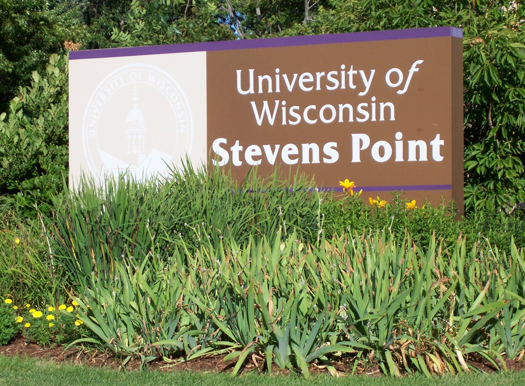
Stevens Point is the county seat of Portage County, Wisconsin, United States. The city was incorporated in 1858. Its 2020 population of 25,666 makes it the largest city in the county. Stevens Point forms the core of the United States Census Bureau's Stevens Point Micropolitan Statistical Area, which had a 2020 population of 70,377 Stevens Point is home to the University of Wisconsin–Stevens Point and a campus of Mid-State Technical College. History Historically part of the Menominee homelands, a three-mile strip along the Wisconsin River was ceded to the United States in an 1836 treaty. In 1854 the Menominee made its last treaty with the U.S., gathering on a reservation on the Wolf River. In the Menominee language it is called ''Pasīpahkīhnen'' which means "It juts out as land" or "point of land". Stevens Point was named after George Stevens, who operated a grocery and supply business on the Wisconsin River during the extensive logging of interior Wisconsin. The river wa ... [...More Info...] [...Related Items...] OR: [Wikipedia] [Google] [Baidu] |
Sheboygan County, Wisconsin
Sheboygan County is a county (United States), county in the U.S. state of Wisconsin. It is named after the Sheboygan River. As of the 2020 United States Census, 2020 census, the population was 118,034. Its county seat is Sheboygan, Wisconsin, Sheboygan. The county was created in 1836 and organized in 1846. At the time, it was located in the Wisconsin Territory. Sheboygan County comprises the Sheboygan, WI Metropolitan Statistical Area. Part of The Holyland (Wisconsin), the Holyland region is located in northwestern Sheboygan County. Geography According to the U.S. Census Bureau, the county has a total area of , of which is land and (60%) is water. Major highways * Interstate 43 * Highway 23 (Wisconsin) * Highway 28 (Wisconsin) * Highway 32 (Wisconsin) * Highway 42 (Wisconsin) * Highway 57 (Wisconsin) * Highway 67 (Wisconsin) * Highway 144 (Wisconsin) Railroads *Union Pacific *Wisconsin and Southern Railroad Buses *Shoreline Metro *List of intercity bus sto ... [...More Info...] [...Related Items...] OR: [Wikipedia] [Google] [Baidu] |
Sheboygan, Wisconsin
Sheboygan () is a city in and the county seat of Sheboygan County, Wisconsin, United States. The population was 49,929 at the 2020 census. It is the principal city of the Sheboygan, Wisconsin Metropolitan Statistical Area, which has a population of 118,034. The city is located on the western shore of Lake Michigan at the mouth of the Sheboygan River, about north of Milwaukee and south of Green Bay. History Before its settlement by European Americans, the Sheboygan area was home to Native Americans, including members of the Potawatomi, Chippewa, Ottawa, Winnebago, and Menominee tribes. In the Menominee language, the place is known as ''Sāpīwǣhekaneh,'' "at a hearing distance in the woods". The Menominee ceded this land to the United States in the 1831 Treaty of Washington. Following the treaty, the land became available for sale to American settlers. Migrants from New York, Michigan, and New England were among the first white Americans to settle this area in the 1830s ... [...More Info...] [...Related Items...] OR: [Wikipedia] [Google] [Baidu] |
Democratic Party (United States)
The Democratic Party is one of the two major contemporary political parties in the United States. Founded in 1828, it was predominantly built by Martin Van Buren, who assembled a wide cadre of politicians in every state behind war hero Andrew Jackson, making it the world's oldest active political party.M. Philip Lucas, "Martin Van Buren as Party Leader and at Andrew Jackson's Right Hand." in ''A Companion to the Antebellum Presidents 1837–1861'' (2014): 107–129."The Democratic Party, founded in 1828, is the world's oldest political party" states Its main political rival has been the Republican Party since the 1850s. The party is a big tent, and though it is often described as liberal, it is less ideologically uniform than the Republican Party (with major individuals within it frequently holding widely different political views) due to the broader list of unique voting blocs that compose it. The historical predecessor of the Democratic Party is considered to be th ... [...More Info...] [...Related Items...] OR: [Wikipedia] [Google] [Baidu] |
Wisconsin Assembly, District 60
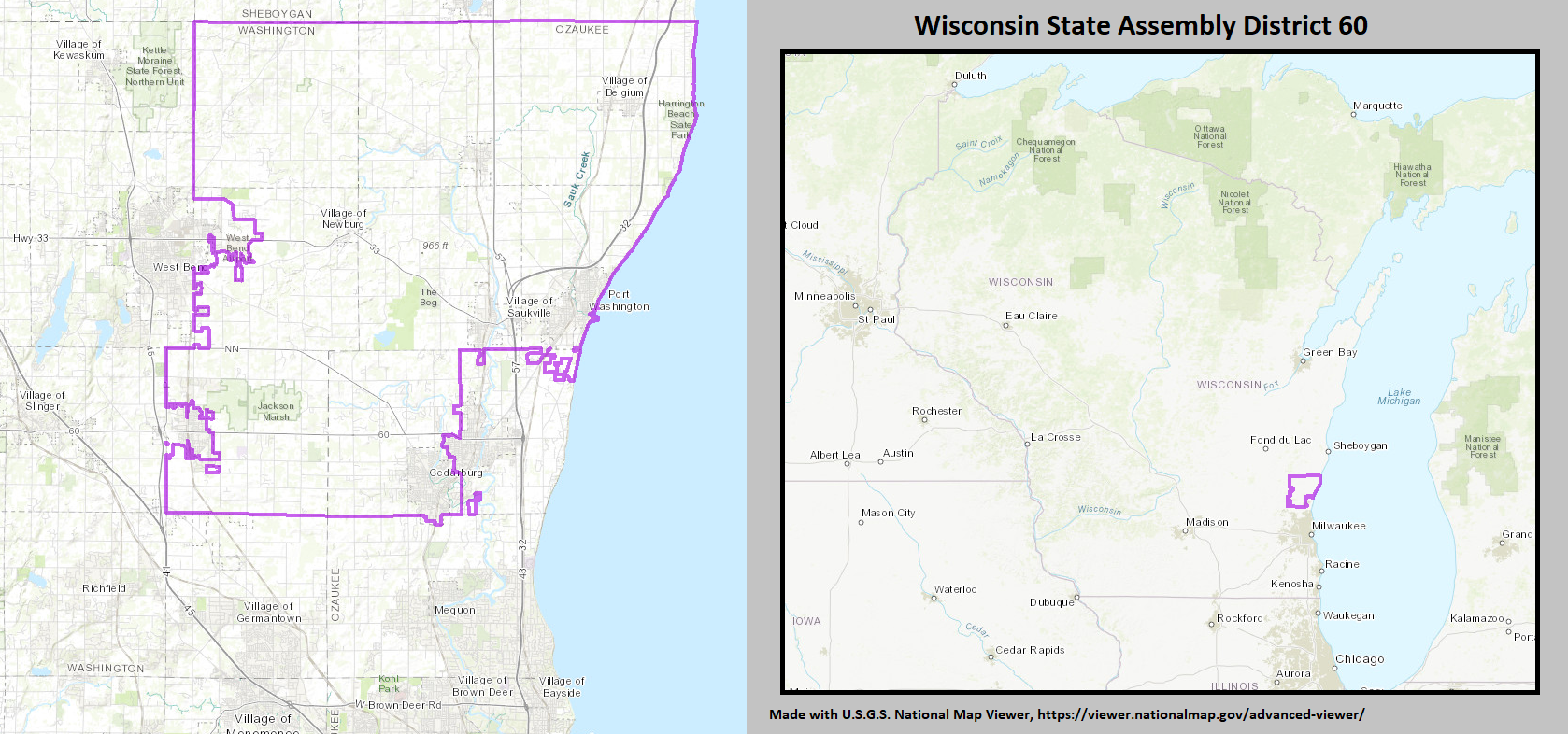
The 60th Assembly District of Wisconsin is one of 99 districts in the Wisconsin State Assembly. Located in Eastern Wisconsin, the district covers northern Ozaukee County and parts of eastern Washington County. It includes the city of Port Washington and the western half of the city of Cedarburg, as well as the villages of Belgium, Newburg, and Saukville. It also contains the Harrington Beach State Park and Cedarburg Bog. The district is represented by Republican Robert Brooks Robert Darren Brooks (born June 23, 1970) is a former American football wide receiver who attended University of South Carolina and played for the Green Bay Packers (1992–1998) and the Denver Broncos. Biography Early life Brooks sta ..., since January 2015.\ The 60th Assembly district is located within Wisconsin's 20th Senate district, along with the 58th and 59th Assembly districts. List of past representatives References {{Wisconsin state legislature districts Wisco ... [...More Info...] [...Related Items...] OR: [Wikipedia] [Google] [Baidu] |
Wisconsin Assembly, District 59
The 59th Assembly District of Wisconsin is one of 99 districts in the Wisconsin State Assembly. Located in eastern Wisconsin, the district covers parts of western Washington County, eastern Fond du Lac County, western Sheboygan County, and southern and central Calumet County. The district includes the cities of Hartford and New Holstein, as well as the villages of Campbellsport, Kewaskum, Mount Calvary, St. Cloud, and Stockbridge. It also contains the Kettle Moraine State Forest Northern Unit, Theresa Marsh Theresa Marsh is located near Theresa, Wisconsin, in northern Washington County and eastern Dodge County. The marsh is the starting point for the Rock River, a tributary of the Mississippi River, and the marsh is an important stopping point for ..., and part of the Pike Lake State Park. The district is represented by Republican Ty Bodden, since January 2023. The 59th Assembly district is located within Wisconsin's 20th Senate district, along with the ... [...More Info...] [...Related Items...] OR: [Wikipedia] [Google] [Baidu] |
Wisconsin Senate, District 20
The 20th Senate district of Wisconsin is one of 33 districts in the Wisconsin State Senate. Located in eastern Wisconsin, the district comprises northern Ozaukee County and most of Washington County, as well as parts of eastern Fond du Lac County, western Sheboygan County, and southern Calumet County. Current elected officials Duey Stroebel is the senator representing the 20th district. He was first elected to the Senate in a 2015 special election and was subsequently elected to a full four-year term in the 2016 general election. He previously served as a member of the Wisconsin State Assembly from 2011 to 2015. Each Wisconsin State Senate district is composed of three State Assembly districts. The 20th Senate district comprises the 58th, 59th, and 60th Assembly districts. The current representatives of those districts are: * Assembly District 58: Rick Gundrum (R– Slinger) * Assembly District 59: Ty Bodden (R– Stockbridge) * Assembly District 60: Robert Br ... [...More Info...] [...Related Items...] OR: [Wikipedia] [Google] [Baidu] |


