|
Wirral, New Brunswick
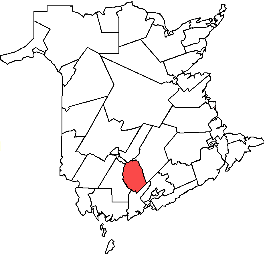
Wirral-Enniskillen is a local service district in the Canadian province of New Brunswick. It is located at the confluence of the Gaspereau and Salmon rivers. History Originally settled as Gaspereau and later Gaspereau Station, when it was a flag station on the Canadian Pacific Railway. It was renamed Wirral after the English peninsula of the same name in 1923. Amalgamated with the former community of Enniskillen, which was among the communities expropriated for CFB Gagetown. It was first settled as Adair Settlement in 1826 by Irish immigrants and renamed Enniskillen after the town in Ireland. It also included the former farming community of Blakely, which merged in 1911. Demographics Notable people See also *List of communities in New Brunswick This is a list of communities in New Brunswick, a province in Canada. For the purposes of this list, a community is defined as either an incorporated municipality, an Indian reserve, or an unincorporated community inside or out ... [...More Info...] [...Related Items...] OR: [Wikipedia] [Google] [Baidu] |
Wirral Peninsula
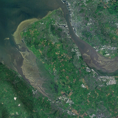
Wirral (; ), known locally as The Wirral, is a peninsula in North West England. The roughly rectangular peninsula is about long and wide and is bounded by the River Dee to the west (forming the boundary with Wales), the River Mersey to the east, and the Irish Sea to the north. Historically, the Wirral was wholly in Cheshire; in the Domesday Book, its border with the rest of the county was placed at "two arrow falls from Chester city walls". However, since the Local Government Act 1972, only the southern third has been in Cheshire, with almost all the rest lying in the Metropolitan Borough of Wirral, Merseyside. An area of saltmarsh to the south-west of the peninsula lies in the Welsh county of Flintshire. The most extensive urban development is on the eastern side of the peninsula. The Wirral contains both affluent and deprived areas, with affluent areas largely in the west, south and north of the peninsula, and deprived areas concentrated in the east, especially Bir ... [...More Info...] [...Related Items...] OR: [Wikipedia] [Google] [Baidu] |
Petersville Parish, New Brunswick
Petersville is a civil parish in Queens County, New Brunswick, Canada. For governance purposes it is divided between CFB Gagetown and the local service districts of Wirral-Enniskillen and the parish of Petersville. Wirral-Enniskillen is part of Regional Service Commission 11 (RSC11) and Petersville Parish is part of the Fundy Regional Service Commission (FRSC). Origin of name William Francis Ganong states that the parish was named in honour of Harry Peters, then Speaker of the House of Assembly. Peters' tenure as Speaker actually ended in 1827 but he continued to serve as MLA until 1843. Harry's brother Charles Jeffery Peters was Attorney General of New Brunswick when the parish was erected. History Petersville was erected in 1838 from Gagetown and Hampstead Parishes. Much of the parish was expropriated in 1953 for the creation of CFB Gagetown. Boundaries Petersville Parish is bounded: Remainder of parish on maps 147–149, 155, 156, and 163 at same site. Remainder of pa ... [...More Info...] [...Related Items...] OR: [Wikipedia] [Google] [Baidu] |
Local Service District (New Brunswick)
A local service district (LSD) is a provincial administrative unit for the provision of local services in the Canadian province of New Brunswick. LSDs relate to areas of the province's former county municipalities that were not incorporated as municipalities around centres of population. They are defined in law by the ''Local Service Districts Regulation'' of the ''Municipalities Act''. In 2017, the ''Municipalities Act'' was replaced by the ''Local Governance Act'', which continued the ''Local Service Districts Regulation''. LSDs are operated by provincial staff. Residents have the opportunity to serve in an advisory capacity to provincial staff. As management units collectively referred to as unincorporated areas, application of the LSD concept has evolved to fit changes in communities over time, and they define their communities to varying degrees. For example, sub-units of the LSD make it possible to have separate taxing units within a LSD where one area may have grown to ha ... [...More Info...] [...Related Items...] OR: [Wikipedia] [Google] [Baidu] |
Provinces And Territories Of Canada
Within the geographical areas of Canada, the ten provinces and three territories are sub-national administrative divisions under the jurisdiction of the Canadian Constitution. In the 1867 Canadian Confederation, three provinces of British North America—New Brunswick, Nova Scotia, and the Province of Canada (which upon Confederation was divided into Ontario and Quebec)—united to form a federation, becoming a fully independent country over the next century. Over its history, Canada's international borders have changed several times as it has added territories and provinces, making it the world's second-largest country by area. The major difference between a Canadian province and a territory is that provinces receive their power and authority from the ''Constitution Act, 1867'' (formerly called the ''British North America Act, 1867''), whereas territorial governments are creatures of statute with powers delegated to them by the Parliament of Canada. The powers flowing from t ... [...More Info...] [...Related Items...] OR: [Wikipedia] [Google] [Baidu] |
New Brunswick
New Brunswick (french: Nouveau-Brunswick, , locally ) is one of the thirteen provinces and territories of Canada. It is one of the three Maritime provinces and one of the four Atlantic provinces. It is the only province with both English and French as its official languages. New Brunswick is bordered by Quebec to the north, Nova Scotia to the east, the Gulf of Saint Lawrence to the northeast, the Bay of Fundy to the southeast, and the U.S. state of Maine to the west. New Brunswick is about 83% forested and its northern half is occupied by the Appalachians. The province's climate is continental with snowy winters and temperate summers. New Brunswick has a surface area of and 775,610 inhabitants (2021 census). Atypically for Canada, only about half of the population lives in urban areas. New Brunswick's largest cities are Moncton and Saint John, while its capital is Fredericton. In 1969, New Brunswick passed the Official Languages Act which began recognizing French as an ... [...More Info...] [...Related Items...] OR: [Wikipedia] [Google] [Baidu] |
Flag Station
In public transport, a request stop, flag stop, or whistle stop is a stop or station at which buses or trains, respectively, stop only on request; that is, only if there are passengers or freight to be picked up or dropped off. In this way, stops with low passenger counts can be incorporated into a route without introducing unnecessary delay. Vehicles may also save fuel by continuing through a station when there is no need to stop. There may not always be significant savings on time if there is no one to pick up because vehicles going past a request stop may need to slow down enough to be able to stop if there are passengers waiting. Request stops may also introduce extra travel time variability and increase the need for schedule padding. The appearance of request stops varies greatly. Many are clearly signed, but many others rely on local knowledge. Implementations The methods by which transit vehicles are notified that there are passengers waiting to be picked up at a reque ... [...More Info...] [...Related Items...] OR: [Wikipedia] [Google] [Baidu] |
CFB Gagetown
5th Canadian Division Support Base (5 CDSB) Gagetown, formerly known as and commonly referred to as CFB Gagetown, is a large Canadian Forces Base covering an area over , located in southwestern New Brunswick. Construction of the base At the beginning of the Cold War, Canadian defence planners recognized the need for providing the Canadian Army with a suitable training facility where brigade and division-sized armoured, infantry, and artillery units could exercise in preparation for their role in defending western Europe under Canada's obligations to the North Atlantic Treaty. The facility would need to be located relatively close to an all-season Atlantic port and have suitable railway connections. Existing training facilities dating from the First and Second World Wars in eastern Canada were relatively small ( Camp Debert, Camp Aldershot, Sussex Military Camp, Camp Valcartier, Camp Petawawa, Camp Utopia), thus a new facility was considered. At the same time, regional econo ... [...More Info...] [...Related Items...] OR: [Wikipedia] [Google] [Baidu] |
Enniskillen
Enniskillen ( , from ga, Inis Ceithleann , 'Cethlenn, Ceithlenn's island') is the largest town in County Fermanagh, Northern Ireland. It is in the middle of the county, between the Upper and Lower sections of Lough Erne. It had a population of 13,823 at the United Kingdom census, 2011, 2011 Census. Enniskillen Castle was built in the 15th century as a stronghold of the Maguires, before coming under English control in the early 17th century. The castle and town were expanded during the Plantation of Ulster. It was the seat of local government for the former Fermanagh District Council, and is the county town of Fermanagh. Toponymy The town's name comes from the ga, Inis Ceithleann. This refers to Cethlenn, a figure in Irish mythology who may have been a goddess. Local legend has it that Cethlenn was wounded in battle by an arrow and attempted to swim across the River Erne, which surrounds the island, but she never reached the other side, so the island was named in reference to h ... [...More Info...] [...Related Items...] OR: [Wikipedia] [Google] [Baidu] |
2016 Canadian Census
The 2016 Canadian census was an enumeration of Canadian residents, which counted a population of 35,151,728, a change from its 2011 population of 33,476,688. The census, conducted by Statistics Canada, was Canada's seventh quinquennial census. The official census day was May 10, 2016. Census web access codes began arriving in the mail on May 2, 2016. The 2016 census marked the reinstatement of the mandatory long-form census, which had been dropped in favour of the voluntary National Household Survey for the 2011 census. With a response rate of 98.4%, this census is said to be the best one ever recorded since the 1666 census of New France. This census was succeeded by Canada's 2021 census. Planning Consultation with census data users, clients, stakeholders and other interested parties closed in November 2012. Qualitative content testing, which involved soliciting feedback regarding the questionnaire and tests responses to its questions, was scheduled for the fall of 2013, w ... [...More Info...] [...Related Items...] OR: [Wikipedia] [Google] [Baidu] |


.jpg)