|
Winesburg, Ohio (town)
Winesburg is an unincorporated area, unincorporated community and census-designated place (CDP) in Paint Township, Holmes County, Ohio, Paint Township, Holmes County, Ohio, Holmes County, Ohio, in the United States. The population was 340 at the 2020 United States Census, 2020 census. The community sits on the crest of a hill in the Amish country of Ohio. It lies along U.S. Route 62. It is not the setting of the novel ''Winesburg, Ohio'' by Sherwood Anderson, a collection of inter-related fictional short stories about citizens of a small town set in the early 20th century. History The community was founded in 1829 and originally named Weinsberg, after Weinsberg in Germany. The spelling was changed to "Winesburg" by postal authorities in 1833 when a post office was opened there. Geography Winesburg is in the southeastern part of Paint Township, in northeastern Holmes County. The community sits on a ridge, with the north side draining toward the Middle Fork of Sugar Creek and the ... [...More Info...] [...Related Items...] OR: [Wikipedia] [Google] [Baidu] |
Census-designated Place
A census-designated place (CDP) is a concentration of population defined by the United States Census Bureau for statistical purposes only. CDPs have been used in each decennial census since 1980 as the counterparts of incorporated places, such as self-governing cities, towns, and villages, for the purposes of gathering and correlating statistical data. CDPs are populated areas that generally include one officially designated but currently unincorporated community, for which the CDP is named, plus surrounding inhabited countryside of varying dimensions and, occasionally, other, smaller unincorporated communities as well. CDPs include small rural communities, edge cities, colonias located along the Mexico–United States border, and unincorporated resort and retirement communities and their environs. The boundaries of any CDP may change from decade to decade, and the Census Bureau may de-establish a CDP after a period of study, then re-establish it some decades later. Most unin ... [...More Info...] [...Related Items...] OR: [Wikipedia] [Google] [Baidu] |
Winesburg, Ohio
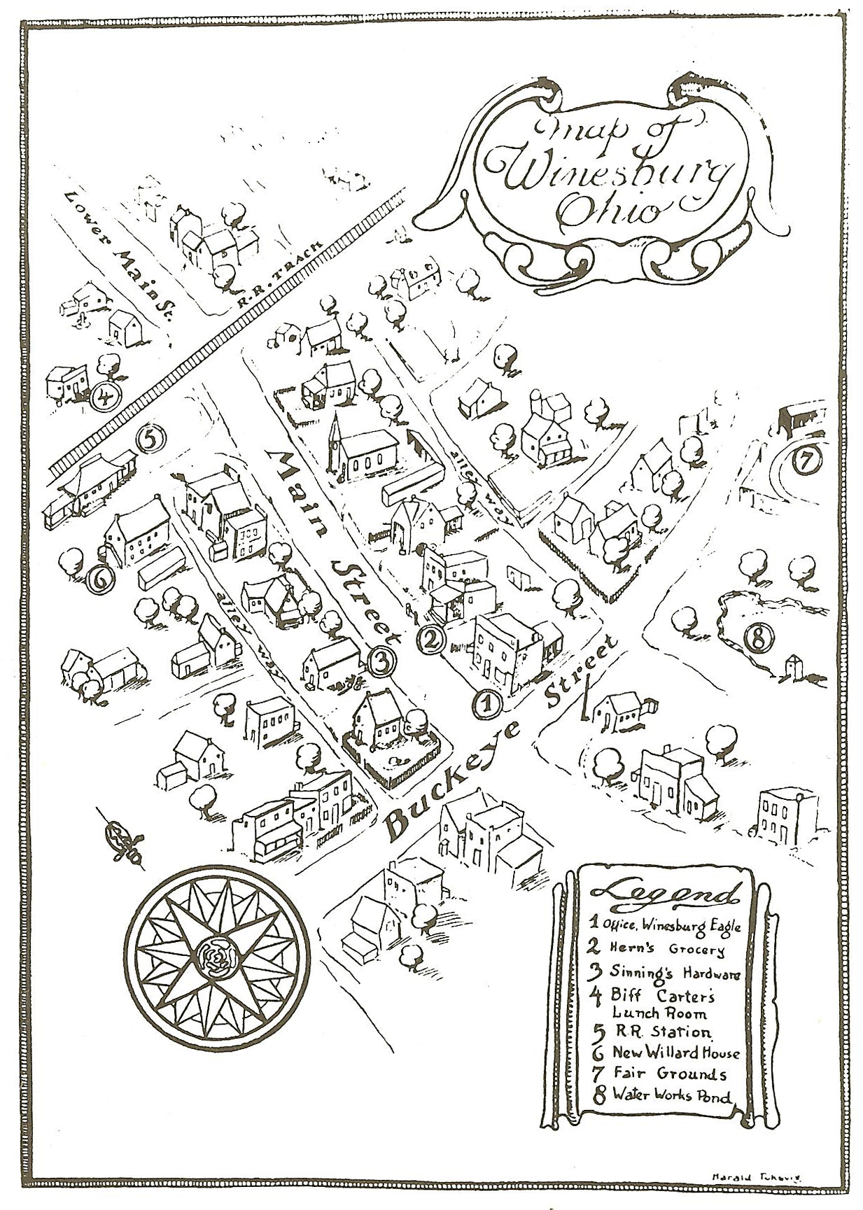
''Winesburg, Ohio'' (full title: ''Winesburg, Ohio: A Group of Tales of Ohio Small-Town Life'') is a 1919 short story cycle by the American author Sherwood Anderson. The work is structured around the life of protagonist George Willard, from the time he was a child to his growing independence and ultimate abandonment of Winesburg as a young man. It is set in the fictional town of Winesburg, Ohio (not to be confused with the Winesburg, Holmes County, Ohio, actual Winesburg, Ohio), which is based loosely on the author's childhood memories of Clyde, Ohio. Mostly written from late 1915 to early 1916, with a few stories completed closer to publication, they were "...conceived as complementary parts of a whole, centered in the background of a single community."Phillips (1951), 17-18 The book consists of twenty-two stories, with the first story, "The Book of the Grotesque", serving as an introduction. Each of the stories shares a specific character's past and present struggle to overcom ... [...More Info...] [...Related Items...] OR: [Wikipedia] [Google] [Baidu] |
Amish In Ohio
The Ohio Amish Country, also known simply as the Amish Country, is the second-largest community of Amish (a Plain Dutch group) in the world, with in 2021 an estimated 80,240 members according to the Young Center for Anabaptist and Pietist Studies at Elizabethtown College. Ohio's largest Amish settlement is centered around Holmes County and in 2021 included an estimated 37,770 children and adults, the second largest in the world and the highest concentration of Amish in any US county; the Amish make up half the population of Holmes County. The second largest community in Ohio is centered around Geauga County. Ohio's Amish Country in and around Holmes County is one of the state's primary tourist attractions and a major driver of the area's economy. History The Holmes County community was founded in 1808 and the Geauga County community in 1886. At the time of the Holmes County settlement's founding there was at least one sizable village of Native Americans on the northern edg ... [...More Info...] [...Related Items...] OR: [Wikipedia] [Google] [Baidu] |
German-American Culture In Ohio
German Americans (german: Deutschamerikaner, ) are Americans who have full or partial German ancestry. With an estimated size of approximately 43 million in 2019, German Americans are the largest of the self-reported ancestry groups by the United States Census Bureau in its American Community Survey. German Americans account for about one third of the total population of people of German ancestry in the world. Very few of the German states had colonies in the new world. In the 1670s, the first significant groups of German immigrants arrived in the British colonies, settling primarily in Pennsylvania, New York and Virginia. The Mississippi Company of France moved thousands of Germans from Europe to Louisiana and to the German Coast, Orleans Territory between 1718 and 1750. Immigration ramped up sharply during the 19th century. There is a "German belt" that extends all the way across the United States, from eastern Pennsylvania to the Oregon coast. Pennsylvania, with 3.5 mill ... [...More Info...] [...Related Items...] OR: [Wikipedia] [Google] [Baidu] |
County Seat
A county seat is an administrative center, seat of government, or capital city of a county or civil parish. The term is in use in Canada, China, Hungary, Romania, Taiwan, and the United States. The equivalent term shire town is used in the US state of Vermont and in some other English-speaking jurisdictions. County towns have a similar function in the Republic of Ireland and the United Kingdom, as well as historically in Jamaica. Function In most of the United States, counties are the political subdivisions of a state. The city, town, or populated place that houses county government is known as the seat of its respective county. Generally, the county legislature, county courthouse, sheriff's department headquarters, hall of records, jail and correctional facility are located in the county seat, though some functions (such as highway maintenance, which usually requires a large garage for vehicles, along with asphalt and salt storage facilities) may also be located or conducted ... [...More Info...] [...Related Items...] OR: [Wikipedia] [Google] [Baidu] |
Millersburg, Ohio
Millersburg is a village and the county seat of Holmes County, Ohio, United States located south of Cleveland. The population was 3,025 at the 2010 census. Holmes County Airport, located two miles southwest of Millersburg, serves the county. History The Old Town of Millersburg was laid out by Adam Johnson and Charles Miller of Coshocton County in November 1815. It was located at the north side of the northwest quarter of Section 12, township 9, range 7 adjoining the School Lands, and very near the northwest corner of said quarter section. The Northwest corner, lot 1, was a little over the hill towards the present mill dam and the northeast corner, lot 9, was about 100 steps west of the present Wooster Road. The center of the town was very nearly the center of Walkups Addition. The principal streets were Bridge, High and Market, each four rods wide. The direction of the former was east and west, and ll rods south of the school land; and was located on the State Road east and we ... [...More Info...] [...Related Items...] OR: [Wikipedia] [Google] [Baidu] |
Canton, Ohio
Canton () is a city in and the county seat of Stark County, Ohio. It is located approximately south of Cleveland and south of Akron in Northeast Ohio. The city lies on the edge of Ohio's extensive Amish country, particularly in Holmes and Wayne counties to the city's west and southwest. As of the 2020 Census, the population of Canton was 70,872, making Canton eighth among Ohio cities in population. It is the largest municipality in the Canton–Massillon metropolitan area, which includes all of Stark and Carroll counties, and was home to 401,574 residents in 2020. Founded in 1805 alongside the Middle and West Branches of Nimishillen Creek, Canton became a heavy manufacturing center because of its numerous railroad lines. However, its status in that regard began to decline during the late 20th century, as shifts in the manufacturing industry led to the relocation or downsizing of many factories and workers. After this decline, the city's industry diversified into the ... [...More Info...] [...Related Items...] OR: [Wikipedia] [Google] [Baidu] |
Ohio River
The Ohio River is a long river in the United States. It is located at the boundary of the Midwestern and Southern United States, flowing southwesterly from western Pennsylvania to its mouth on the Mississippi River at the southern tip of Illinois. It is the third largest river by discharge volume in the United States and the largest tributary by volume of the north-south flowing Mississippi River that divides the eastern from western United States. It is also the 6th oldest river on the North American continent. The river flows through or along the border of six states, and its drainage basin includes parts of 14 states. Through its largest tributary, the Tennessee River, the basin includes several states of the southeastern U.S. It is the source of drinking water for five million people. The lower Ohio River just below Louisville is obstructed by rapids known as the Falls of the Ohio where the elevation falls in restricting larger commercial navigation, although in the 18th ... [...More Info...] [...Related Items...] OR: [Wikipedia] [Google] [Baidu] |
Tuscarawas River
The Tuscarawas River is a principal tributary of the Muskingum River, 129.9 miles (209 km) long, in northeastern Ohio in the United States. Via the Muskingum and Ohio rivers, it is part of the watershed of the Mississippi River, draining an area of on glaciated and unglaciated portions of the Allegheny Plateau. Route The river rises southwest of Hartville in northern Stark County, and initially flows westward, through Uniontown into southern Summit County, where it passes through the Portage Lakes area south of Akron, and Barberton. From Barberton the Tuscarawas flows generally south through Stark and Tuscarawas counties; the communities of Clinton, Canal Fulton, Massillon, Navarre, Bolivar, Zoar, Dover, and New Philadelphia were developed along its banks. South of New Philadelphia, the river turns southwest and west, flowing past Tuscarawas, Gnadenhutten, Port Washington, and Newcomerstown, sites of former Lenape people villages at the time of the Ameri ... [...More Info...] [...Related Items...] OR: [Wikipedia] [Google] [Baidu] |
Sugar Creek (Tuscarawas River Tributary)
Sugar Creek is a tributary of the Tuscarawas River in northeastern Ohio in the United States. It is 45 miles (72 km) long. Via the Tuscarawas, Muskingum, and Ohio Rivers, it is part of the watershed of the Mississippi River, draining an area of 356 square miles (922 km²) on glaciated and unglaciated portions of the Allegheny Plateau. It is the namesake of Sugarcreek, Ohio and of townships in Stark, Tuscarawas and Wayne counties Ohio. Path of the river It rises in north-central Wayne County, approximately five miles (8 km) northwest of Smithville, and flows southeastwardly through southwestern Stark County and northwestern Tuscarawas County, past the communities of Smithville, Brewster, Beach City and Strasburg to Dover, where it joins the Tuscarawas River from the west.DeLorme (1991). ''Ohio Atlas & Gazetteer''. Yarmouth, Maine: DeLorme. pp. 50-51, 61. . Along its course Sugar Creek collects several tributaries that have been given deriva ... [...More Info...] [...Related Items...] OR: [Wikipedia] [Google] [Baidu] |


