|
William Hazledine
William Hazledine (1763 – 26 October 1840) was an English ironmaster. Establishing large foundries, he was a pioneer in casting structural ironwork, most notably for canal aqueducts and early suspension bridges. Many of these projects were collaborations with Thomas Telford, including the Pontcysyllte Aqueduct and the Menai Suspension Bridge. Telford called him "the Arch conjuror himself, Merlin Hazledine"."Hazledine, William". A. W. Skempton. ''A Biographical Dictionary of Civil Engineers in Great Britain and Ireland: 1500–1830''. Thomas Telford, 2002. Early life and career Hazledine was born in Shawbury in 1763, one of several children of William Hazledine, a millwright; when he was young the family moved to Sowbatch, near Moreton Corbet. He and his brother John were trained as millwrights by their uncle. (Later, John and younger brothers Robert and Thomas set up an ironworks in Bridgnorth, Shropshire). About 1780 William supervised the erection of machinery at Upton F ... [...More Info...] [...Related Items...] OR: [Wikipedia] [Google] [Baidu] |
Hazledine And Company
Hazledine and Company (or Hazeldine and Company) was an ironworks in Bridgnorth, Shropshire, England. It was set up about 1792 by three brothers: John Hazledine (1760–1810), Robert Hazledine (1768–1837) and Thomas Hazledine (1771–1842). Sources differ about the partnership - ''Discover Shropshire'' claims that the partners were John Hazledine, William Hallen and John Wheeler. The company The company built up a good reputation for the quality of its castings but, in 1797, John Hazledine was declared bankrupt. It seems that some accommodation was made with his creditors because the company remained in business. From 1802, Richard Trevithick placed several orders with the company for the construction of steam engines, including the locomotive ''Catch Me Who Can'', built in 1808. In 1807, John Hazledine entered into partnership with John Urpeth Rastrick, to form the company Hazeldine and Rastrick but the partnership was a troubled one. John Hazledine died in 1810 and Rastrick lef ... [...More Info...] [...Related Items...] OR: [Wikipedia] [Google] [Baidu] |
Coleham
Coleham is a district of the town of Shrewsbury in Shropshire, England. It is located just south, over the River Severn, from Shrewsbury town centre. History Coleham grew up as a village outside medieval Shrewsbury, with the nearest crossing over the Severn to the town being the Stone Bridge (now the English Bridge). Shrewsbury Abbey and its associated lands and buildings were nearby. The Rea Brook separates Coleham from the other old suburb on this end of town – Abbey Foregate. Coleham is centered on the Shrewsbury to Longden road, which as it passes through Coleham itself is called "Longden Coleham". The Victorian suburb of Belle Vue grew up south of Coleham and the wealthy suburb of Kingsland (which centres on Shrewsbury School) grew up west of Coleham. The first large scale industrial building in Shrewsbury arose in Coleham when in 1790 the firm of Powis & Hodge built three factory buildings on land bought from John Carline at the junction of Longden Coleham and Coleham ... [...More Info...] [...Related Items...] OR: [Wikipedia] [Google] [Baidu] |
St Chad's Church, Shrewsbury
St Chad's Church occupies a prominent position in Shrewsbury, the county town of Shropshire. The current church building was built in 1792, and with its distinctive round shape and high tower it is a well-known landmark in the town. It faces The Quarry area of parkland, which slopes down to the River Severn. The church is a Grade I listed building. The motto of the church is "open doors, open hearts, and open minds". This indicates the aspiration of the church to be a welcoming church, involved in the community, and on a collective journey seeking after God. Charles Darwin was baptised in St Chad's church in 1809, and as a young boy attended the church with his mother Susannah. In 2010, the church became a member of the Greater Churches Group. History The present building replaced an earlier church, dedicated to St Chad, situated near College Hill; this was a 13th-century building which was largely destroyed when the central tower collapsed in 1788. All that remains of the ... [...More Info...] [...Related Items...] OR: [Wikipedia] [Google] [Baidu] |
Shawbury
Shawbury is a village and civil parish in the English county of Shropshire. The village is northeast of the town of Shrewsbury, northwest of Telford and northwest of London. The village straddles the A53 between Shrewsbury and Market Drayton. The nearest railway station is at Yorton on the Welsh Marches Line for Shrewsbury/Crewe. The 2011 census recorded a population of 2,872 for the entire civil parish of Shawbury. History Shawbury has an entry in the Domesday Book of 1085. In the great book Shawbury is recorded by the name ''Sawesberie''. The main landholders was Gerard from Earl Roger of Shrewsbury. The survey also mentions that there is a church and a mill. Geography The River Roden flows through the village. The village of Moreton Corbet, with its castle, is just to the north. The main weather station for Shropshire is located in the village, at the RAF base. On 13 December 1981 a temperature of -25.2 °C was recorded, one of the coldest on record for Engl ... [...More Info...] [...Related Items...] OR: [Wikipedia] [Google] [Baidu] |
Welsh Bridge
The Welsh Bridge is a masonry arch viaduct in the town of Shrewsbury, England, which crosses the River Severn. It connects Frankwell with the town centre. It is a Grade II* listed building. The bridge was designed and built from 1793 to 1795 by John Tilley and John Carline (whose namesake father was a mason on the English Bridge), who had built Montford Bridge for Thomas Telford. It replaced the medieval St George's Bridge. Four of the arches span 43 feet 4 inches, while the fifth and central arch is 46 feet 2 inches. The bridge is 30 feet wide, and built from Grinshill sandstone. In total it is 266 feet long. It was completed in 1795 at a cost of £8,000. On the south end of the bridge, on the junction with Victoria Avenue, one of the parapets of the bridge has the words "Commit No Nuisance" chiselled into the stone. This is an archaic injunction not to urinate in public. Gallery File:WelshBridgeCB2.jpg, The Welsh Bridge, with the river at flood level. Fil ... [...More Info...] [...Related Items...] OR: [Wikipedia] [Google] [Baidu] |
Caledonian Canal
The Caledonian Canal connects the Scottish east coast at Inverness with the west coast at Corpach near Fort William in Scotland. The canal was constructed in the early nineteenth century by Scottish engineer Thomas Telford. Route The canal runs some from northeast to southwest and reaches above sea level. Only one third of the entire length is man-made, the rest being formed by Loch Dochfour, Loch Ness, Loch Oich, and Loch Lochy. These lochs are located in the Great Glen, on a geological fault in the Earth's crust. There are 29 locks (including eight at Neptune's Staircase, Banavie), four aqueducts and 10 bridges in the course of the canal. Northern section The canal starts at its north-eastern end at Clachnaharry Sea Lock, built at the end of a man-made peninsula to ensure that boats could always reach the deep water of the Beauly Firth. Because the peninsula is built with mud foundations, it has required regular maintenance ever since. Next to the lock is the ... [...More Info...] [...Related Items...] OR: [Wikipedia] [Google] [Baidu] |
Tewkesbury
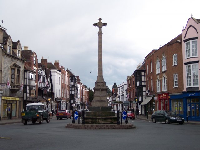
Tewkesbury ( ) is a medieval market town and civil parish in the north of Gloucestershire, England. The town has significant history in the Wars of the Roses and grew since the building of Tewkesbury Abbey. It stands at the confluence of the River Severn and the River Avon, and thus became an important trading point, which continued as railways and later M5 and M50 motorway connections were established. The town gives its name to the Borough of Tewkesbury, due to the earlier governance by the Abbey, yet the town is the second largest settlement in the Borough. The town lies on border with Worcestershire, identified largely by the Carrant Brook (a tributary of the River Avon). The name Tewkesbury is thought to come from Theoc, the name of a Saxon who founded a hermitage there in the 7th century, and in the Old English language was called '. Toulmin Smith L., ed. 1909, ''The Itinerary of John Leland'', London, IV, 150 An erroneous derivation from Theotokos (the Greek title of Ma ... [...More Info...] [...Related Items...] OR: [Wikipedia] [Google] [Baidu] |
Mythe Bridge
Mythe Bridge carries the A438 road across the River Severn at Tewkesbury. It is a cast-iron arch bridge spanning and 24 feet (7.3m) wide, designed by Thomas Telford and completed in April 1826. It is a Grade II* listed structure. Telford was appointed to design the bridge in 1823, following a dispute between the bridge trustees and their existing architect, who had proposed a bridge with three shorter iron arches. Telford changed the scheme to a single span so as to reduce interference with navigation of the river, and also to eliminate the expense of constructing foundations in the river gravels. Like Telford's Craigellachie Bridge, Mythe Bridge was cast by William Hazledine, and is similar in form to Telford's Galton Bridge, which spans the Birmingham Canal at Smethwick. It has six cast iron ribs, each cast in 23-foot (7m) lengths, with spandrels filled with X-shaped bracing. Telford described the iron as ''"best Shropshire iron, commonly called No. 2". The arch rises 17 ... [...More Info...] [...Related Items...] OR: [Wikipedia] [Google] [Baidu] |
Cefn Mawr
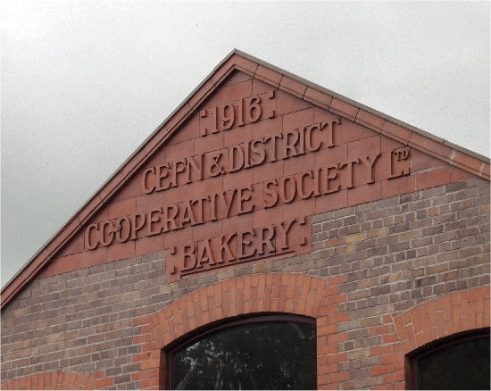
Cefn Mawr () is a village in the community of Cefn within Wrexham County Borough, Wales. Its name translates as "big ridge".Mills, D. ''A Dictionary of British Place Names'', OUP, p.104 The population in 2001 was 6,669, increasing to 7,051 in 2011. The community of Cefn comprises the villages of Cefn Mawr, Cefn-bychan ("little ridge"), Acrefair, Penybryn, Newbridge, Plas Madoc and Rhosymedre and is situated on the northern slopes of the Dee Valley. History Cefn Mawr was part of the ancient parish of Ruabon and the area was known as ''Cristionydd Cynrig'' (or ''Cristioneth Kenrick'' in English). In 1844, most of Cristionydd Cynrig, together with the neighbouring township of ''Coed Cristionydd'' became part of the new parish of Rhosymedre.Rhosymedre, St John |
View Along Pontcysyllte Aqueduct - Geograph
A view is a sight or prospect or the ability to see or be seen from a particular place. View, views or Views may also refer to: Common meanings * View (Buddhism), a charged interpretation of experience which intensely shapes and affects thought, sensation, and action * Graphical projection in a technical drawing or schematic ** Multiview orthographic projection, standardizing 2D images to represent a 3D object * Opinion, a belief about subjective matters * Page view, a visit to a World Wide Web page * Panorama, a wide-angle view * Scenic viewpoint, an elevated location where people can view scenery * World view, the fundamental cognitive orientation of an individual or society encompassing the entirety of the individual or society's knowledge and point-of-view Places * View, Kentucky, an unincorporated community in Crittenden County * View, Texas, an unincorporated community in Taylor County Arts, entertainment, and media Music * ''View'' (album), the 2003 debut album by ... [...More Info...] [...Related Items...] OR: [Wikipedia] [Google] [Baidu] |
Charles Bage
Charles Woolley Bage (1751–1822) was an English architect, born in a Quaker family "Bage Way", part of Shrewsbury's 20th century inner ring road which links Old Potts Way to Crowmere Road, was named for him. References 1751 births 1822 deaths 18th-century English architects Architects from Derby Mayors of places in Shropshire People from Elford {{UK-architect-stub ... [...More Info...] [...Related Items...] OR: [Wikipedia] [Google] [Baidu] |


