|
William H. Buracker
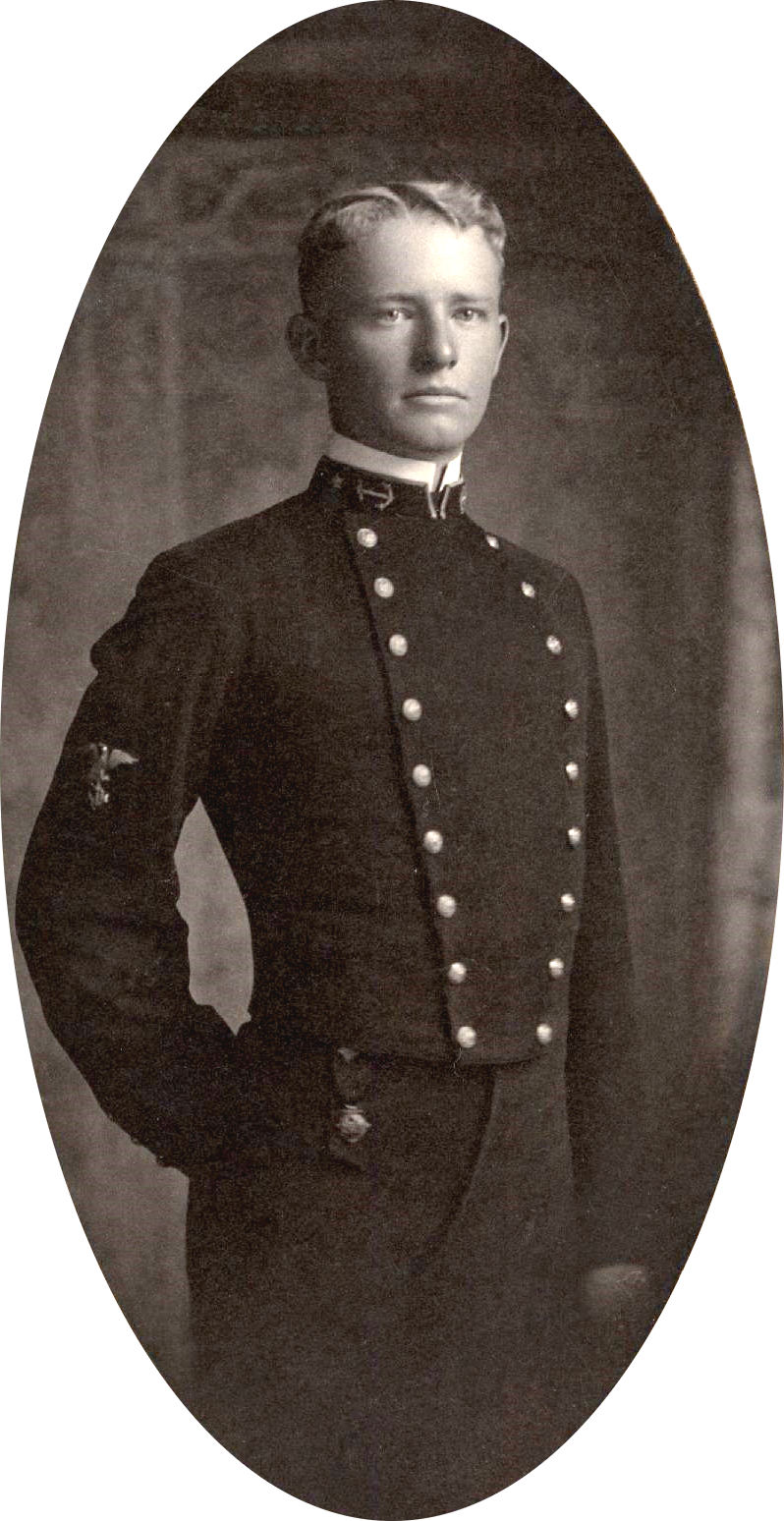
William Houck Buracker (July 25, 1897 – March 7, 1977) was a Rear Admiral in the United States Navy who served as commanding officer of the USS Princeton (CVL-23), USS ''Princeton'' during the Battle of Leyte Gulf, was a member of the task force that carried out the Gilbert and Marshall Islands campaign, and was the operations officer for the carrier task force that transported planes for the Doolittle Raid. After leaving the Navy, Buracker worked as an engineer and was Massachusetts Commissioner of Public Works from 1947 to 1949. Early life Buracker was born in Luray, Virginia, on July 25, 1897. He graduated from the United States Naval Academy in 1920. He became a Navy pilot and was a member of the squadron which made the first non-stop flight from California to Central America. From 1928 to 1930 he studied aeronautic engineering at the Massachusetts Institute of Technology. While there he met Dorothy Martin of Winchester, Massachusetts. The two later married. World War II At ... [...More Info...] [...Related Items...] OR: [Wikipedia] [Google] [Baidu] |
Luray, Virginia
Luray is the county seat of Page County, Virginia, Page County, Virginia, United States, in the Shenandoah Valley in the northern part of the Commonwealth. The population was 4,895 at the 2010 United States Census, 2010 census. The town was started by William Staige Marye in 1812, a descendant of a family native to Luray, Eure-et-Loir, Luray, France. The mayor of the town is Jerry Dofflemyer. Geography Luray is located at (38.664097, −78.454531). According to the United States Census Bureau, the town has a total area of 4.8 square miles (12.3 km2), of which, 4.7 square miles (12.3 km2) of it is land and 0.21% is water. Demographics As of the census of 2000, there were 4,871 people, 2,037 households, and 1,332 families residing in the town. The population density was 1,026.8 people per square mile (396.8/km2). There were 2,191 housing units at an average density of 461.9 per square mile (178.5/km2). The racial makeup of the town was 92.45% White (U.S. ... [...More Info...] [...Related Items...] OR: [Wikipedia] [Google] [Baidu] |
USS Princeton (CVL-23)
The fourth USS ''Princeton'' (CVL-23) was a United States Navy light aircraft carrier active in the Pacific Ocean during World War II. She was launched in 1942 and lost at the Battle of Leyte Gulf in 1944. Construction and deployment The ship was laid down as the ''Tallahassee'' (CL-61) by the New York Shipbuilding Corporation, Camden, New Jersey, 2 June 1941. She was reclassified as the Independence-class light aircraft carrier CV-23 on 16 February 1942, renamed ''Princeton'' 31 March 1942, launched 18 October 1942, sponsored by Margaret Dodds (wife of Princeton University president Harold Dodds), and commissioned at Philadelphia 25 February 1943, Capt. George R. Henderson in command. Following shakedown in the Caribbean, and reclassification to CVL-23 on 15 July 1943, ''Princeton'', with Air Group 23 embarked, got underway for the Pacific. Arriving at Pearl Harbor 9 August, she sortied with TF 11 on 25 August and headed for Baker Island. There she served as ... [...More Info...] [...Related Items...] OR: [Wikipedia] [Google] [Baidu] |
Jayapura
Jayapura (formerly Dutch: ''Hollandia'') is the capital and largest city of the Indonesian province of Papua. It is situated on the northern coast of New Guinea island and covers an area of . The city borders the Pacific Ocean and Yos Sudarso Bay to the north, the sovereign state of Papua New Guinea to the east, Keerom Regency to the south, and Jayapura Regency to the west. With a population of 398,478 according to the 2020 census, Jayapura is the most populous city in the entire island of New Guinea, surpassing Port Moresby, the national capital of Papua New Guinea. It is also the fastest-growing city in Indonesia, with the population increasing by 55.23% since the previous census in 2010. The official estimate as at mid 2021 was 404,004. Jayapura is the fourth largest city by economy in Eastern Indonesia—after Makassar, Denpasar, and Manado—with an estimated 2016 GDP at Rp19.48 trillion. As of 2017, it is also the second-most expensive Indonesian city to live in, aft ... [...More Info...] [...Related Items...] OR: [Wikipedia] [Google] [Baidu] |
Chester Nimitz
Chester William Nimitz (; February 24, 1885 – February 20, 1966) was a fleet admiral in the United States Navy. He played a major role in the naval history of World War II as Commander in Chief, US Pacific Fleet, and Commander in Chief, Pacific Ocean Areas, commanding Allied air, land, and sea forces during World War II. Nimitz was the leading US Navy authority on submarines. Qualified in submarines during his early years, he later oversaw the conversion of these vessels' propulsion from gasoline to diesel, and then later was key in acquiring approval to build the world's first nuclear-powered submarine, , whose propulsion system later completely superseded diesel-powered submarines in the US. He also, beginning in 1917, was the Navy's leading developer of underway replenishment techniques, the tool which during the Pacific war would allow the US fleet to operate away from port almost indefinitely. The chief of the Navy's Bureau of Navigation in 1939, Nimitz ... [...More Info...] [...Related Items...] OR: [Wikipedia] [Google] [Baidu] |
James Forrestal
James Vincent Forrestal (February 15, 1892 – May 22, 1949) was the last Cabinet-level United States Secretary of the Navy and the first United States Secretary of Defense. Forrestal came from a very strict middle-class Irish Catholic family. He was a successful financier on Wall Street before becoming Undersecretary of the Navy in 1940, shortly before the United States entered the Second World War. He became Secretary of the Navy in May 1944 upon the death of his superior, Frank Knox. President Franklin D. Roosevelt requested that Forrestal take the lead in building up the Navy. In 1947, after the end of the war, President Harry S. Truman appointed him the first secretary of the newly created Department of Defense. Forrestal was intensely hostile to the Soviet Union, fearing Communist expansion in Europe and the Middle East. Along with Secretary of State George C. Marshall, he strongly opposed the United States' support for the establishment of the State of Israel, fearing ... [...More Info...] [...Related Items...] OR: [Wikipedia] [Google] [Baidu] |
United States Secretary Of The Navy
The secretary of the Navy (or SECNAV) is a statutory officer () and the head (chief executive officer) of the United States Department of the Navy, Department of the Navy, a military department (component organization) within the United States Department of Defense. By law, the secretary of the Navy must civilian control of the military, be a civilian at least five years removed from active military service. The secretary is appointed by the President of the United States, president and requires confirmation by the United States Senate, Senate. The secretary of the Navy was, from its creation in 1798, a member of the president's United States Cabinet, Cabinet until 1949, when the secretary of the Navy (and the secretaries of the United States Secretary of the Army, Army and United States Secretary of the Air Force, Air Force) were by amendments to the National Security Act of 1947 made subordinate to the United States Secretary of Defense, secretary of defense. On August 7, 202 ... [...More Info...] [...Related Items...] OR: [Wikipedia] [Google] [Baidu] |
Pensacola, Florida
Pensacola () is the westernmost city in the Florida Panhandle, and the county seat and only incorporated city of Escambia County, Florida, United States. As of the 2020 United States census, the population was 54,312. Pensacola is the principal city of the Pensacola Metropolitan Area, which had an estimated 502,629 residents . Pensacola is the site of the first Spanish settlement within the borders of the continental United States in 1559, predating the establishment of St. Augustine by 6 years, although the settlement was abandoned due to a hurricane and not re-established until 1698. Pensacola is a seaport on Pensacola Bay, which is protected by the barrier island of Santa Rosa and connects to the Gulf of Mexico. A large United States Naval Air Station, the first in the United States, is located southwest of Pensacola near Warrington; it is the base of the Blue Angels flight demonstration team and the National Naval Aviation Museum. The main campus of the University of West F ... [...More Info...] [...Related Items...] OR: [Wikipedia] [Google] [Baidu] |
Naval Air Station Pensacola
Naval Air Station Pensacola or NAS Pensacola (formerly NAS/KNAS until changed circa 1970 to allow Nassau International Airport, now Lynden Pindling International Airport, to have IATA code NAS), "The Cradle of Naval Aviation", is a United States Navy base located next to Warrington, Florida, a community southwest of the Pensacola city limits. It is best known as the initial primary training base for all U.S. Navy, Marine Corps and Coast Guard officers pursuing designation as naval aviators and naval flight officers, the advanced training base for most naval flight officers, and as the home base for the United States Navy Flight Demonstration Squadron, the precision-flying team known as the Blue Angels. Because of contamination by heavy metals and other hazardous materials during its history, it is designated as a Superfund site needing environmental cleanup. The air station also hosts the Naval Education and Training Command (NETC) and the Naval Aerospace Medical Institute (NAM ... [...More Info...] [...Related Items...] OR: [Wikipedia] [Google] [Baidu] |
Minami-Tori-shima
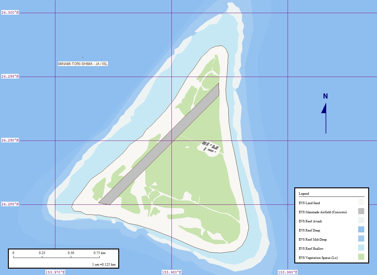
, also known as Marcus Island, is an isolated Japanese coral atoll in the northwestern Pacific Ocean, located some southeast of Tokyo and east of the closest Japanese island, South Iwo Jima of the Ogasawara Islands, and nearly on a straight line between mainland Tokyo and Wake Island, further to the east-southeast. The closest island to Minamitorishima is East Island in the Mariana Islands, which is to the west-southwest. It is the easternmost territory belonging to Japan, and the only Japanese territory on the Pacific Plate, past the Japan Trench. Although small () it is of strategic importance, as it enables Japan to claim a exclusive economic zone in the surrounding waters. It is also the easternmost territory of Tokyo, being administratively part of Ogasawara village. There is no civilian population, except personnel of the Japan Meteorological Agency, JSDF, and Japan Coast Guard serving temporary tours of duty on the island. Access The island is off-limits to civilia ... [...More Info...] [...Related Items...] OR: [Wikipedia] [Google] [Baidu] |
Wake Island
Wake Island ( mh, Ānen Kio, translation=island of the kio flower; also known as Wake Atoll) is a coral atoll in the western Pacific Ocean in the northeastern area of the Micronesia subregion, east of Guam, west of Honolulu, southeast of Tokyo and north of Majuro. The island is an unorganized, unincorporated territory belonging to (but not a part of) the United States that is also claimed by the Republic of the Marshall Islands. Wake Island is one of the most isolated islands in the world. The nearest inhabited island is Utirik Atoll in the Marshall Islands, to the southeast. The United States took possession of Wake Island in 1899. One of 14 U.S. insular areas, Wake Island is administered by the United States Air Force under an agreement with the U.S. Department of the Interior. The center of activity on the atoll is at Wake Island Airfield, which is primarily used as a mid-Pacific refueling stop for military aircraft and as an emergency landing area. The runway is the ... [...More Info...] [...Related Items...] OR: [Wikipedia] [Google] [Baidu] |
Marshall Islands
The Marshall Islands ( mh, Ṃajeḷ), officially the Republic of the Marshall Islands ( mh, Aolepān Aorōkin Ṃajeḷ),'' () is an independent island country and microstate near the Equator in the Pacific Ocean, slightly west of the International Date Line. Geographically, the country is part of the larger island group of Micronesia. The country's population of 58,413 people (at the 2018 World Bank Census) is spread out over five islands and 29 coral atolls, comprising 1,156 individual islands and islets. The capital and largest city is Majuro. It has the largest portion of its territory composed of water of any sovereign state, at 97.87%. The islands share maritime boundaries with Wake Island to the north, Kiribati to the southeast, Nauru to the south, and Federated States of Micronesia to the west. About 52.3% of Marshall Islanders (27,797 at the 2011 Census) live on Majuro. In 2016, 73.3% of the population were defined as being "urban". The UN also indicates a population d ... [...More Info...] [...Related Items...] OR: [Wikipedia] [Google] [Baidu] |
Gilbert Islands
The Gilbert Islands ( gil, Tungaru;Reilly Ridgell. ''Pacific Nations and Territories: The Islands of Micronesia, Melanesia, and Polynesia.'' 3rd. Ed. Honolulu: Bess Press, 1995. p. 95. formerly Kingsmill or King's-Mill IslandsVery often, this name applied only to the southern islands of the archipelago, the northern half being designated as the Scarborough Islands. ''Merriam-Webster's Geographical Dictionary''. Springfield, Massachusetts: Merriam Webster, 1997. p. 594) are a chain of sixteen atolls and coral islands in the Pacific Ocean, about halfway between Papua New Guinea and Hawaii. They constitute the main part of the nation of Kiribati (the name of which is a rendering of “Gilberts” in the phonology of the indigenous Gilbertese). Geography The atolls and islands of the Gilbert Islands are arranged in an approximate north-to-south line. The northernmost island in the group, Makin, it is approximately from southernmost, Arorae, as the crow flies. Geographically, the ... [...More Info...] [...Related Items...] OR: [Wikipedia] [Google] [Baidu] |


.jpg)


