|
Wilderness Canoe Base
Wilderness Canoe Base is a Christian youth camp that borders the Boundary Waters Canoe Area Wilderness on Seagull Lake near the end of the Gunflint Trail, about 50 miles from Grand Marais, Minnesota, USA. The camp hosts canoe camping trips and work-service trips for youth during the summer as well as retreats for all ages year round. Part of the camp is on the northern half of Fishhook Island and another tract resides on nearby Dominion Island. It has been under the management of Lake Wapogasset Lutheran Bible Camp, Inc. since 2002. Ham Lake fire Almost one third of the 138 structures destroyed by the Ham Lake fire in May 2007 were part of Wilderness Canoe Base. Of the camp's 60 structures, 40 were consumed by flames, including outhouses and staff cabins. A year later Wilderness raised nearly $200,000 to rebuild the camp. Another $100,000 came in the form of matching funds from Thrivent Financial for Lutherans. Reconstruction and fund-raising are ongoing as many of the structure ... [...More Info...] [...Related Items...] OR: [Wikipedia] [Google] [Baidu] |
Boundary Waters Canoe Area Wilderness
The Boundary Waters Canoe Area Wilderness (BWCAW or BWCA) is a wilderness area within the Superior National Forest in the northeastern part of the US state of Minnesota Minnesota () is a state in the upper midwestern region of the United States. It is the 12th largest U.S. state in area and the 22nd most populous, with over 5.75 million residents. Minnesota is home to western prairies, now given over to ... under the administration of the United States Forest Service, U.S. Forest Service. A mixture of forests, glacial lakes, and streams, the BWCAW's preservation as a primitive wilderness began in the 1900s and culminated in the Boundary Waters Canoe Area Wilderness Act of 1978. It is a popular destination for canoeing, hiking, and fishing, and is one of the most visited wildernesses in the United States. Geography The BWCAW extends along of the U.S.–Canada border in the Arrowhead Region of Minnesota. The combined region of the BWCAW, Superior National Forest, ... [...More Info...] [...Related Items...] OR: [Wikipedia] [Google] [Baidu] |
Gunflint Trail
County State-Aid Highway 12 (CSAH 12), also known as the Gunflint Trail, or County Road 12 (CR 12), is a paved roadway and National Scenic Byway in Cook County, Minnesota, that begins in Grand Marais and ends at Saganaga Lake in the Boundary Waters Canoe Area Wilderness (BWCAW), near the U.S. border with Ontario. It provides access to many of the entry points in the BWCAW. Route description Originally a footpath for travelers from inland lakes to Lake Superior, the trail was eventually widened into a roadway, and designated as County Road 12 (CR 12). It now serves as a route to lodges, outfitters, hiking trails and the lakes and rivers of the BWCA. A small number of people, numbering in the hundreds, have full-time residences or businesses along the road, though thousands have cabins or other part-time residential properties. The route begins at Highway 61 in Grand Marais. It travels generally northward until Northern Light Lake, where it turns northwestw ... [...More Info...] [...Related Items...] OR: [Wikipedia] [Google] [Baidu] |
Grand Marais, Minnesota
Grand Marais () is a city and the county seat of Cook County, Minnesota, United States, of which it is the only municipality. It is on Lake Superior's North Shore. Grand Marais had a population of 1,337 at the 2020 census. Before it was settled by French Canadians and before Minnesota's statehood, it was inhabited by the Ojibwe. The National Scenic Byway begins in Grand Marais and ends near the border with Ontario. History The Ojibwe name for the area is ''Gichi-biitoobiig'', which means "great duplicate water," "parallel body of water" or "double body of water" (like a bayou), a reference to the two bays that form this large harbor of Lake Superior. The area was a bustling fur trading station in the 1700s, and the French Canadian Voyageurs termed the settled village "Grand Marais" ("Great Marsh"), referring to a marsh that, in early fur-trading times, was 20 acres (8.1 ha) or less in area, nearly at the level of Lake Superior, and at the head of the little bay and harbor that ... [...More Info...] [...Related Items...] OR: [Wikipedia] [Google] [Baidu] |
Thrivent Financial For Lutherans
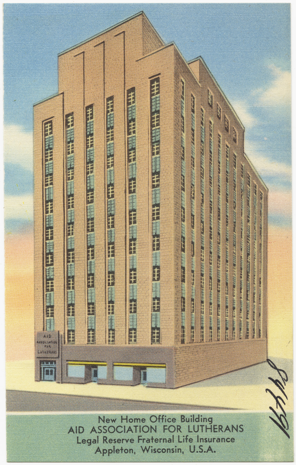
Thrivent ( ) is a US Fortune 500 not-for-profit financial services organization headquartered in Minneapolis, Minnesota, and Appleton, Wisconsin, and founded by Lutherans. As a member-owned fraternal benefit society, it operates under a chapter system, serving nearly 2.3 million members. Operating through its local chapters nationwide, Thrivent and its subsidiaries offer financial products and services including life insurance, annuities, mutual funds, disability income insurance, credit union products, money management, brokerage services, and retirement planning. The organization and its members provide volunteer services to charitable organizations and schools. For example, Thrivent members reportedly volunteered more than 8.6 million hours in 2013 and contributed $182.7 million in that year to organizations and activities that aim to strengthen families and communities. In June 2013, members voted to allow non-Lutheran Christians to join, and in March 2014 the marketi ... [...More Info...] [...Related Items...] OR: [Wikipedia] [Google] [Baidu] |
Amery, Wisconsin
Amery is a city in Polk County, Wisconsin, United States, along the Apple River. It is a part of Wisconsin's 7th congressional district. The population was 2,902 at the 2010 census. The city was named in honor of William Amery, a carpenter who held several local offices in the 1870s. Geography Amery is located at (45.309747, -92.362782). According to the United States Census Bureau, the city has a total area of , of which, is land and is water. Wisconsin Highway 46 and Polk County Road F are main routes in the community. Demographics 2010 census As of the census of 2010, there were 2,902 people, 1,286 households, and 705 families living in the city. The population density was . There were 1,445 housing units at an average density of . The racial makeup of the city was 97.3% White, 0.1% African American, 0.8% Native American, 0.3% Asian, 0.1% Pacific Islander, 0.4% from other races, and 0.9% from two or more races. Hispanic or Latino of any race were 2.2% of the populatio ... [...More Info...] [...Related Items...] OR: [Wikipedia] [Google] [Baidu] |
Geography Of Minnesota
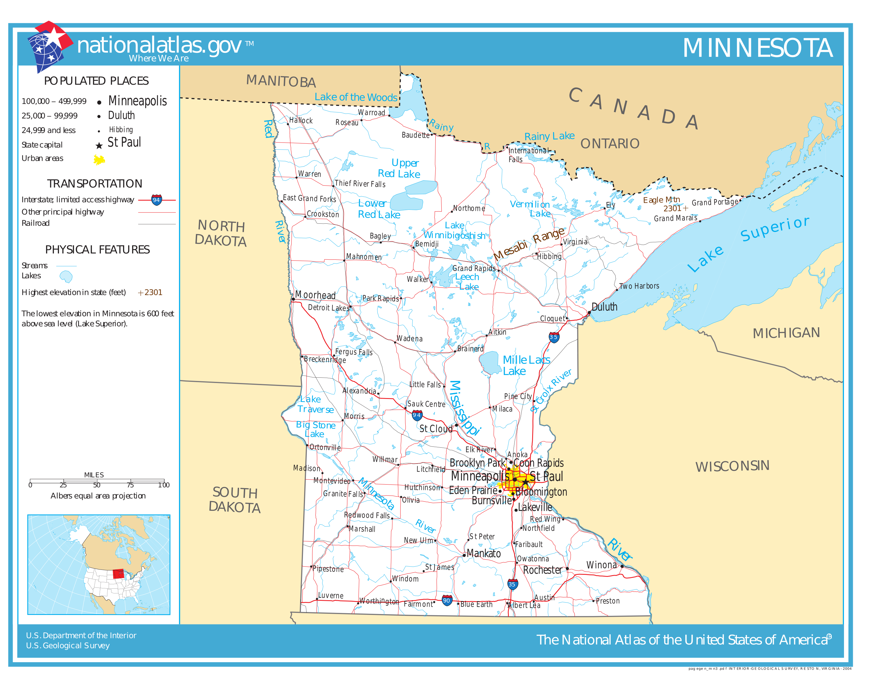
The U.S. State of Minnesota is the northernmost state outside Alaska; its isolated Northwest Angle in Lake of the Woods is the only part of the 48 contiguous states lying north of the 49th parallel north. Minnesota is in the U.S. region known as the Upper Midwest in interior North America. The state shares a Lake Superior water border with Michigan and Wisconsin on the northeast; the remainder of the eastern border is with Wisconsin. Iowa is to the south, North Dakota and South Dakota are to the west, and the Canadian provinces of Ontario and Manitoba are to the north. With , or approximately 2.26% of the United States, Minnesota is the 12th largest state. Geology and terrain Minnesota contains some of the oldest rocks found on earth, gneisses some 3.6 billion years old, or 80% as old as the planet. About 2.7 billion years ago, basaltic lava poured out of cracks in the floor of the primordial ocean; the remains of this volcanic created the Canadian Shield in northe ... [...More Info...] [...Related Items...] OR: [Wikipedia] [Google] [Baidu] |


