|
Wiehl (Agger)
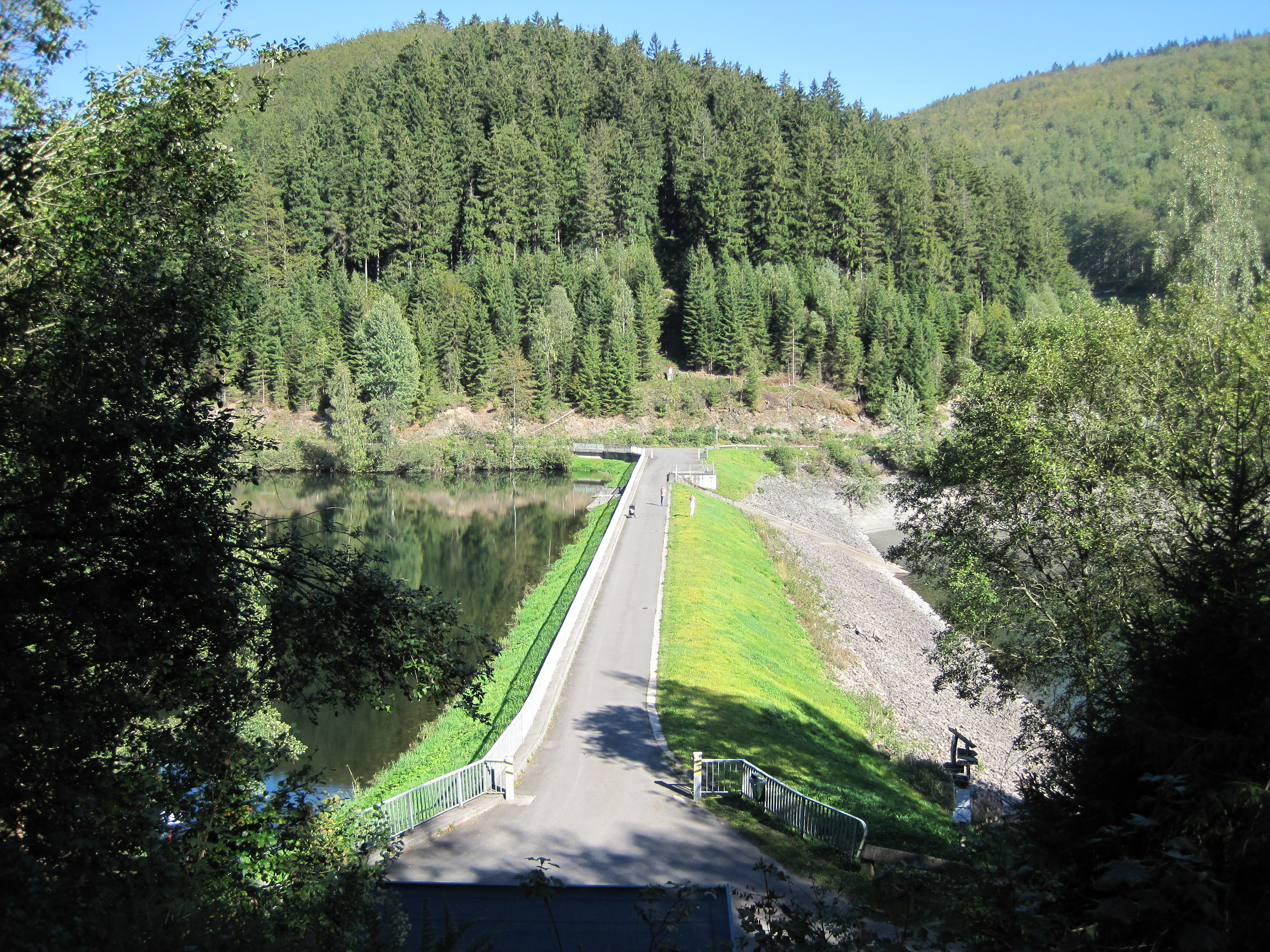
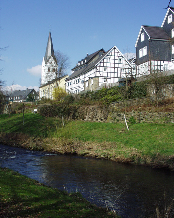
The Wiehl () is a 33.6-kilometre-long, orographically left tributary of the River Agger in the German state of North Rhine-Westphalia. It is the longest river situated entirely within the county of Oberbergischer Kreis and the third longest tributary of the Agger. Geography The river rises in the region of Bergisches Land in the municipality of Reichshof. Its source is located about 700 metres north of the village of Hahn on the southern slopes of the Silberkuhle (514.6 m) at a height of . The Wiehl initially flows in a southerly direction and passes through the parish of Wiehl. Near Wildbergerhütte it turns towards the west. Between Nespen and Brüchermühle it is impounded by the Wiehl Dam. After passing Brüchermühle it is impounded again, this time by the Stauweiher Bieberstein. From here it flows mainly in a northwesterly direction. After passing through the parishes of Oberwiehl, Wiehl, Bielstein and Weiershagen, it empties into the Agger near Wiehlmü ... [...More Info...] [...Related Items...] OR: [Wikipedia] [Google] [Baidu] |
Wiehl
Wiehl () is a municipality in the Oberbergischer Kreis, in North Rhine-Westphalia, Germany. It is located approximately 41 km east of Cologne. The neighbouring municipalities Reichshof, Waldbröl, Nümbrecht, Much, Engelskirchen and Gummersbach border on the town. Geography Between the highway and Wiehl lies the biggest Wiehl industrial area, covering about 81 ha: Wiehl-Bomig. The river of the same name, Wiehl, flows by the town in an east–west direction. History Wiehl is first recorded in 1131 under the name of ''Wila''. On the 1575 Mercator map it is shown as ''Wiell''. Wiehl was eventually allocated in the 1604 Treaty of Siegburg to the Barony of Homburg and was subordinated with it to the House of Sayn-Wittgenstein. In 1815, the Congress of Vienna assigned the little Homburg territory, which practically only consisted of the municipalities of Wiehl and Nümbrecht, to Prussia. At that time, Wiehl was still an agriculturally oriented settlement with a village charact ... [...More Info...] [...Related Items...] OR: [Wikipedia] [Google] [Baidu] |
List Of Rivers Of North Rhine-Westphalia
A list of rivers of North Rhine-Westphalia, Germany: A * Aa, left tributary of the Möhne * Aa, left tributary of the Nethe * Aa, left tributary of the Werre * Aabach, tributary of the Afte * Aabach, small river in the Ems river system * Abbabach * Abrocksbach *Afte * Agger *Ahler Bruchgraben *Ahr * Ahre * Ahse * Alaunbach * Albaumer Bach * Alche * Alme *Alte Emscher *Alte Hessel * Alte Issel * Altenau *Angel *Angerbach *Ankerbach * Arbach *Armuthsbach * Arpe, left tributary of the Wenne joining it at Berge (a district of Meschede) * Arpe, left tributary of the Wenne joining it at Niederberndorf (a district of Schmallenberg) *Arzdorfer Bach, alternative name for Godesberger Bach *Asbeke *Asdorf *Aue * Auelsbach * Auer Bach * Aupke * Axtbach B * Baagebach *Baarbach * Babenhausener Bach * Bachseifen * Bachumer Bach *Banfe * Bärenbach *Bastau * Beberbach * Beckendorfer Mühlenbach * Bega * Beilbach * Beke *Bekelbach *Belgenbach * Bendahler Bach * Benfe * Bennier Graben * Bentgraben ... [...More Info...] [...Related Items...] OR: [Wikipedia] [Google] [Baidu] |
Hundred-year Flood
A 100-year flood is a flood event that has a 1 in 100 chance (1% probability) of being equaled or exceeded in any given year. The 100-year flood is also referred to as the 1% flood, since its annual exceedance probability is 1%.Holmes, R.R., Jr., and Dinicola, K. (2010) ''100-Year flood–it's all about chance 'U.S. Geological Survey General Information Product 106/ref> For coastal or lake flooding, the 100-year flood is generally expressed as a flood elevation or depth, and may include wave effects. For river systems, the 100-year flood is generally expressed as a flowrate. Based on the expected 100-year flood flow rate, the flood water level can be mapped as an area of inundation. The resulting floodplain map is referred to as the 100-year floodplain. Estimates of the 100-year flood flowrate and other streamflow statistics for any stream in the United States are available.Ries, K.G., and others (2008) ''StreamStats: A water resources web application 'U.S. Geological Survey, Fac ... [...More Info...] [...Related Items...] OR: [Wikipedia] [Google] [Baidu] |
Forebay (reservoir)
A forebay is an artificial pool of water in front of a larger body of water. The larger body of water may be natural or man-made. at www.wisegeek.com. Retrieved on 13 Jun 2013 Forebays have a number of functions. They are used in to act as a buffer during or s, impounding water and releasing in a controlled way into the larger waterbody. They may be used upstream of |
Orographic
Orography is the study of the topographic relief of mountains, and can more broadly include hills, and any part of a region's elevated terrain. Orography (also known as ''oreography'', ''orology'' or ''oreology'') falls within the broader discipline of geomorphology. The term orography comes from the Greek: , hill, , to write. Uses Mountain ranges and elevated land masses have a major impact on global climate. For instance, the elevated areas of East Africa substantially determine the strength of the Indian monsoon.Srinivasan, J., Nanjundiah, Ravi S. and Chakraborty, Arindam (2005Impact of Orography on the Simulation of Monsoon Climate in a General Circulation Model''Indian Institute of Science'' In scientific models, such as general circulation models, orography defines the lower boundary of the model over land. When a river's tributaries or settlements by the river are listed in 'orographic sequence', they are in order from the highest (nearest the source of the river) to the l ... [...More Info...] [...Related Items...] OR: [Wikipedia] [Google] [Baidu] |
Wiehl Dam
Wiehl () is a municipality in the Oberbergischer Kreis, in North Rhine-Westphalia, Germany. It is located approximately 41 km east of Cologne. The neighbouring municipalities Reichshof, Waldbröl, Nümbrecht, Much, Engelskirchen and Gummersbach border on the town. Geography Between the highway and Wiehl lies the biggest Wiehl industrial area, covering about 81 ha: Wiehl-Bomig. The river of the same name, Wiehl, flows by the town in an east–west direction. History Wiehl is first recorded in 1131 under the name of ''Wila''. On the 1575 Mercator map it is shown as ''Wiell''. Wiehl was eventually allocated in the 1604 Treaty of Siegburg to the Barony of Homburg and was subordinated with it to the House of Sayn-Wittgenstein. In 1815, the Congress of Vienna assigned the little Homburg territory, which practically only consisted of the municipalities of Wiehl and Nümbrecht, to Prussia. At that time, Wiehl was still an agriculturally oriented settlement with a village charac ... [...More Info...] [...Related Items...] OR: [Wikipedia] [Google] [Baidu] |


