|
Whitikahu
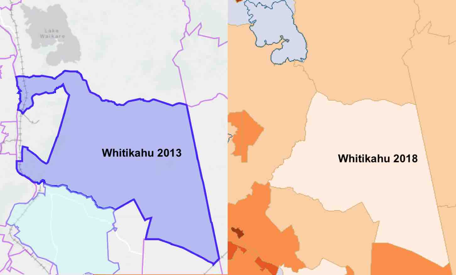
Whitikahu is a settlement scattered along Whitikahu Rd in the Waikato District and Waikato region of New Zealand's North Island. It has a blueberry farm, a winery, the Senton Sawmill, a fire station, a petrol station and a hall. It is in the Hukanui Waerenga Ward of Waikato District Council. Geology Pukemokemoke hill is formed of greywacke of the Jurassic Manaia Hill Group (shown as Jm on map). The rest of the Whitikahu area is largely on a drained peat bog, which lies on ash from Lake Taupō. Taupiri Fault is an inferred fault separating the peat from the Taupiri Range. Seismic testing in 2017 added evidence of the fault's position. Whitikahu is at the north end of an alluvial fan of the ash, which drops about 60 m (200 ft) from Karapiro. After the Oruanui eruption, some 26,500 years ago, Lake Taupō was about 145 m (476 ft) above the present lake. Around 22,500 years ago the ash dam eroded rapidly and the lake fell about 75 m (246 ft) i ... [...More Info...] [...Related Items...] OR: [Wikipedia] [Google] [Baidu] |
Waikato District
Waikato District is a territorial authority of New Zealand, in the northern part of Waikato region, North Island. Waikato District is administered by the Waikato District Council, with headquarters in Ngāruawāhia. The district is centred to the north and west of the city of Hamilton, and takes in much of the northern Waikato Plains and also the Hakarimata Range. The north of the district contains swampy floodplain of the Waikato River and several small lakes, of which the largest is Lake Waikare. Other than Ngāruawāhia, the main population centres are Huntly, Raglan, and Te Kauwhata. The main industries in the district are dairy farming, forestry, and coal mining. There is a major coal-fired power station at Huntly. Te Kauwhata is at the centre of a major wine region. Demographics At the 2006 census the district had a population of 43,959. Of these, 6834 lived in Huntly, 5106 in Ngāruawāhia, 2637 in Raglan, and 1294 in Te Kauwhata. In 2010, the district acquired part o ... [...More Info...] [...Related Items...] OR: [Wikipedia] [Google] [Baidu] |
Waerenga
Waerenga is the name of a hamlet, east of Te Kauwhata, which is part of a statistical area unit in the Waikato District. Waerenga-a-Hika, near Gisborne has a similar name. The area is in the Hukanui Waerenga ward of Waikato District Council. Settlements in the area The area unit stretches between Lake Waikare and the summits of the Hapuakohe Range, at the boundary of Hauraki District. The area includes Taniwha, and the upper part of Whangamarino River. Centres not covered in other articles are - Taniwha Taniwha is about south east of Waerenga. It is in meshblock 0937700, which had 63 people in 2018. About 1900 the Taniwha estate was divided into smaller farms, with a creamery opened in 1902 and Taniwha School in 1905. The school closed in 1962, but the listed building remains. Waerenga The hamlet has a garage, a few kilometres to the south on Taniwha Rd is a school and, further along, a 1928 war memorial church and 1962 hall. Meshblocks 0937800, 0936900, 0937200 ... [...More Info...] [...Related Items...] OR: [Wikipedia] [Google] [Baidu] |
Waikato District Council
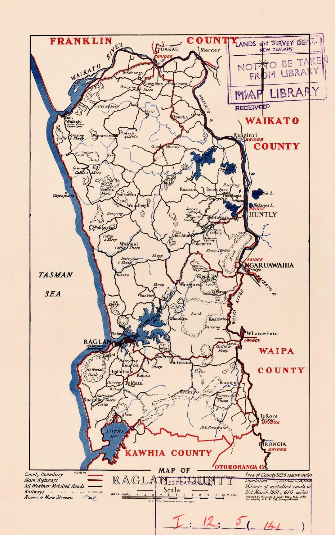
Waikato District Council ( mi, Te Kaunihera ā-Rohe o Waikato) is the territorial authority for the Waikato District of New Zealand. The council is led by the mayor of Waikato The Mayor of Waikato officiates over the Waikato District of New Zealand's North Island. Jacqui Church is the current mayor. The previous mayor was Allan Sanson, a third generation farmer who had served on the council since 2001 and had been may ..., who is currently . There are also ward councillors. Composition Mayor Councillors * History The council was established in 1989, replacing Raglan County Council (established in 1876), Waikato County Council (established in 1876), Ngāruawāhia Borough Council (established in 1920), and Huntly Borough Council (established in 1931). References External links Official website {{coord, -37.6680745, 175.1487314, display=title Waikato District Politics of Waikato Territorial authorities of New Zealand ... [...More Info...] [...Related Items...] OR: [Wikipedia] [Google] [Baidu] |
Lake Karapiro
Lake Karapiro () is an artificial reservoir lake on the Waikato River at Karapiro, south-east of Cambridge in New Zealand's North Island. The lake was formed in 1947 by the damming of the Waikato River to store water for the 96-megawatt Karapiro power station. The lake is also one of two premier rowing venues in New Zealand (alongside Lake Ruataniwha in Canterbury) and is the base for the country's high-performance rowing programme. History and etymology In about 1600, Te Ihingarangi built a pā (fortified village) called Te Tiki o Ihingarangi near where Lake Karapiro is today. In 1830 Ngāti Hauā defeated Ngāti Maru in a battle at Taumatawīwī, two kilometres south of Karapiro Domain. On the orders of the Ngāti Hauā chief Te Waharoa, his dead warriors were cremated, this taking place on rocks beside the Waikato River, the location then becoming known as ''Karāpiro'', from the Māori language words , meaning "basaltic stone", and , meaning "foul smelling". The site ... [...More Info...] [...Related Items...] OR: [Wikipedia] [Google] [Baidu] |
Oruanui Eruption
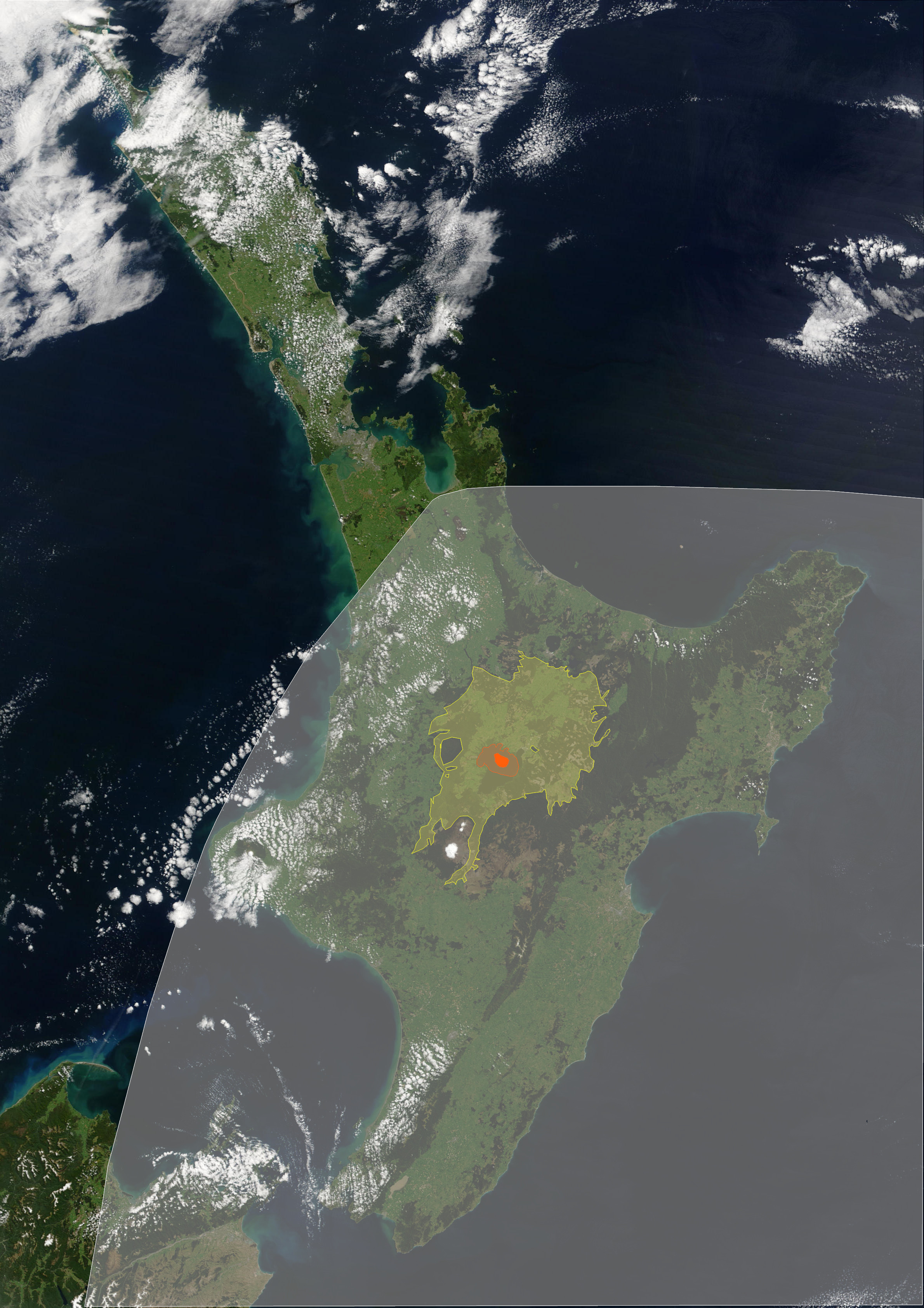
The Oruanui eruption of New Zealand's Taupō Volcano (also known as the Kawakawa eruption or Kawakawa/Oruanui event) was the world's most recent Supervolcano#Known supereruptions, supereruption.} Eruption With a Volcanic Explosivity Index of 8, it is one of the largest eruptions ever to occur in New Zealand. It occurred about 26,500 years ago in the Late Pleistocene and generated approximately of pyroclastic fall deposits, of pyroclastic density current (PDC) deposits (mostly ignimbrite) and of primary intracaldera material, equivalent to of magma, totaling of total deposits. The eruption is divided into 10 different phases on the basis of nine geological map, mappable fall strata, units and a tenth, poorly preserved but volumetrically dominant fall unit. Modern-day Lake Taupō, in area and deep, partly fills the caldera generated during this eruption. A structural collapse is concealed beneath Lake Taupō, while the lake outline at least partly reflects volcano-tectonic ... [...More Info...] [...Related Items...] OR: [Wikipedia] [Google] [Baidu] |
Aggradation
Aggradation (or alluviation) is the term used in geology for the increase in land elevation, typically in a river system, due to the deposition of sediment. Aggradation occurs in areas in which the supply of sediment is greater than the amount of material that the system is able to transport. The mass balance between sediment being transported and sediment in the bed is described by the Exner equation. Typical aggradational environments include lowland alluvial rivers, river deltas, and alluvial fans. Aggradational environments are often undergoing slow subsidence which balances the increase in land surface elevation due to aggradation. After millions of years, an aggradational environment will become a sedimentary basin, which contains the deposited sediment, including paleochannels and ancient floodplains. Aggradation can be caused by changes in climate, land use, and geologic activity, such as volcanic eruption, earthquakes, and faulting. For example, volcanic eruptions may l ... [...More Info...] [...Related Items...] OR: [Wikipedia] [Google] [Baidu] |
Pyroclastic Rock
Pyroclastic rocks (derived from the el, πῦρ, links=no, meaning fire; and , meaning broken) are clastic rocks composed of rock fragments produced and ejected by explosive volcanic eruptions. The individual rock fragments are known as pyroclasts. Pyroclastic rocks are a type of volcaniclastic deposit, which are deposits made predominantly of volcanic particles. 'Phreatic' pyroclastic deposits are a variety of pyroclastic rock that forms from volcanic steam explosions and they are entirely made of accidental clasts. 'Phreatomagmatic' pyroclastic deposits are formed from explosive interaction of magma with groundwater. Unconsolidated accumulations of pyroclasts are described as tephra. Tephra may become lithified to a pyroclastic rock by cementation or chemical reactions as the result of the passage of hot gases (fumarolic alteration) or groundwater (e.g. hydrothermal alteration and diagenesis) and burial, or, if it is emplaced at temperatures so hot that the soft glassy pyrocl ... [...More Info...] [...Related Items...] OR: [Wikipedia] [Google] [Baidu] |
Pumice
Pumice (), called pumicite in its powdered or dust form, is a volcanic rock that consists of highly vesicular rough-textured volcanic glass, which may or may not contain crystals. It is typically light-colored. Scoria is another vesicular volcanic rock that differs from pumice in having larger vesicles, thicker vesicle walls, and being dark colored and denser.Jackson, J.A., J. Mehl, and K. Neuendorf (2005) ''Glossary of Geology'' American Geological Institute, Alexandria, Virginia. 800 pp. McPhie, J., M. Doyle, and R. Allen (1993) ''Volcanic Textures A guide to the interpretation of textures in volcanic rocks'' Centre for Ore Deposit and Exploration Studies, University of Tasmania, Hobart, Tasmania..198 pp. Pumice is created when super-heated, highly pressurized rock is violently ejected from a volcano. The unusual foamy configuration of pumice happens because of simultaneous rapid cooling and rapid depressurization. The depressurization creates bubbles by lowering the solubi ... [...More Info...] [...Related Items...] OR: [Wikipedia] [Google] [Baidu] |
Waikato
Waikato () is a Regions of New Zealand, local government region of the upper North Island of New Zealand. It covers the Waikato District, Waipa District, Matamata-Piako District, South Waikato District and Hamilton, New Zealand, Hamilton City, as well as Hauraki Plains, Hauraki, Coromandel Peninsula, the northern King Country, much of the Taupō District, and parts of Rotorua, Rotorua District. It is governed by the Waikato Regional Council. The region stretches from Coromandel Peninsula in the north, to the north-eastern slopes of Mount Ruapehu in the south, and spans the North Island from the west coast, through the Waikato and Hauraki to Coromandel Peninsula on the east coast. Broadly, the extent of the region is the Waikato River catchment. Other major catchments are those of the Waihou River, Waihou, Piako River, Piako, Awakino River (Waikato), Awakino and Mokau River, Mokau rivers. The region is bounded by Auckland Region, Auckland on the north, Bay of Plenty on the east ... [...More Info...] [...Related Items...] OR: [Wikipedia] [Google] [Baidu] |
Wind Gap
A wind gap (or air gap) is a gap through which a waterway once flowed that is now dry as a result of stream capture. A water gap is a similar feature, but one in which a waterway still flows. Water gaps and wind gaps often provide routes which, due to their gently inclined profile, are suitable for trails, roads, and railroads through mountainous terrain. Examples of wind gaps in the Blue Ridge Mountains of Virginia include Swift Run Gap, Rockfish Gap, and Buford's Gap. The last was the original crossing of the Blue Ridge Mountains near Bedford for the Virginia and Tennessee Railroad, later the Norfolk and Western Railway, a precursor of today's Norfolk Southern Railway system. Another wind gap with substantial importance in U.S. history is the Cumberland Gap near the junction of Kentucky, Virginia, and Tennessee. Gallery Rockfish Gap November 2009.jpg, Wind gap Rockfish Gap, Blue Ridge Mountains, Virginia Desfiladero C Encantada.jpg, Wind gap opened by an ancient stream on ... [...More Info...] [...Related Items...] OR: [Wikipedia] [Google] [Baidu] |
Alluvial Fan
An alluvial fan is an accumulation of sediments that fans outwards from a concentrated source of sediments, such as a narrow canyon emerging from an escarpment. They are characteristic of mountainous terrain in arid to semiarid climates, but are also found in more humid environments subject to intense rainfall and in areas of modern glaciation. They range in area from less than to almost . Alluvial fans typically form where flow emerges from a confined channel and is free to spread out and infiltrate the surface. This reduces the carrying capacity of the flow and results in deposition of sediments. The flow can take the form of infrequent debris flows or one or more ephemeral or perennial streams. Alluvial fans are common in the geologic record, such as in the Triassic basins of eastern North America and the New Red Sandstone of south Devon. Such fan deposits likely contain the largest accumulations of gravel in the geologic record. Alluvial fans have also been found on Mars ... [...More Info...] [...Related Items...] OR: [Wikipedia] [Google] [Baidu] |
Ngati Koura
''Ngati'' is a 1987 New Zealand feature film directed by Barry Barclay, written by Tama Poata and produced by John O'Shea (director), John O'Shea. Production ''Ngati'' is of historical and cultural significance in New Zealand as it is the first feature film written and directed by Māori people, Māori. Producer John O'Shea, an icon in New Zealand's film industry, was the founder of independent film company Pacific Films. The film is set in 1948 in a small town on the east coast of New Zealand during the impending closure of a freezing works and the threat of unemployment for the local community. ''Ngati'' was screened as part of Cannes' Critics Week. Synopsis Set in and around the fictional town of Kapua in 1948, Ngati is the story of a Māori community. The film comprises three narrative threads: a boy, Ropata, is dying of leukaemia; the return of a young Australian doctor, Greg, and his discovery that he has Māori heritage; and the fight to keep the local freezing works ope ... [...More Info...] [...Related Items...] OR: [Wikipedia] [Google] [Baidu] |


