|
White River Glacier (Oregon)
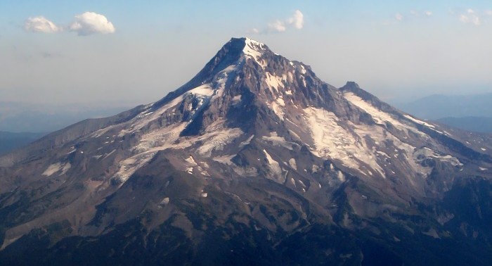
White River Glacier is an alpine glacier located on the south slopes of Mount Hood in the U.S. state of Oregon. It ranges in elevation from about . It is among the best known of the twelve glaciers on the mountain, and the lower reaches are a popular destination for Nordic skiing enthusiasts. The glacier is the source of the White River, a tributary of the Deschutes River, and has a long history of washing out the bridge where Oregon Route 35 crosses at . The glacier is a remnant of the massive glaciers that formed during the last ice age and have created White River Canyon. The canyon divides the two largest ski areas on Mount Hood, and is easily seen from many areas of Timberline Lodge ski area, and from the upper southern runs of Mount Hood Meadows. The glacier is bounded on the east by a ridge shared with Newton Clark Glacier and on the west by a ridge shared with Palmer Glacier. The upper glacier forms at the base of ''Steel Cliff'' to the east of an area known as '' ... [...More Info...] [...Related Items...] OR: [Wikipedia] [Google] [Baidu] |
Hood River County, Oregon
Hood River County is one of the 36 counties in the U.S. state of Oregon. As of the 2020 census, the population was 23,977. The county seat is Hood River. The county was established in 1908 and is named for the Hood River, a tributary of the Columbia River. Hood River County comprises the Hood River, OR Micropolitan Statistical Area. The Hood River Valley produces apples, pears, and cherries. Situated between Mount Hood and the Columbia River in the middle of the Columbia River Gorge, Hood River County is a popular destination for outdoor enthusiasts, such as windsurfers, mountain-bikers, skiers, hikers, kayakers, and many more. History The first permanent settlers in present-day Hood River County filed a donation land claim in 1854. The first school was built in 1863 and a road from The Dalles was completed in 1867. By 1880 there were 17 families living in the valley. By the latter part of the nineteenth century farmers of Japanese, Finnish, German, and French ethnicity ha ... [...More Info...] [...Related Items...] OR: [Wikipedia] [Google] [Baidu] |
Palmer Glacier
Palmer Glacier is a glacier on the south slopes of Mount Hood in the U.S. state of Oregon. The glacier is situated at an elevation range of , and was named for Joel Palmer, an Oregon pioneer. Palmer Glacier is the most well-known of the twelve glaciers on the mountain, and is a popular destination for snow sport enthusiasts. Some of the lower part is within the Timberline ski area, and can be accessed by Sno-Cat or chairlift, conditions permitting. The glacier is a remnant of the massive glaciers that formed during the last ice age, and is the only location in North America that provides skiing and snowboarding all twelve months of the year. The glacier was considered a snow field until a Mazama committeeThe Mazamas committee consisted of Rodney L. Glisan, L. A. Nelson, Earl A. Marshall, Raymond Smith, Fred McNeil, Everett Philpoe, T. Raymond Conway, and Fred W. Stadter. investigated on October 19, 1924 and determined it was, in fact, a glacier and should be named on maps. F ... [...More Info...] [...Related Items...] OR: [Wikipedia] [Google] [Baidu] |
Glaciers Of Hood River County, Oregon
A glacier (; ) is a persistent body of dense ice that is constantly moving under its own weight. A glacier forms where the accumulation of snow exceeds its ablation over many years, often centuries. It acquires distinguishing features, such as crevasses and seracs, as it slowly flows and deforms under stresses induced by its weight. As it moves, it abrades rock and debris from its substrate to create landforms such as cirques, moraines, or fjords. Although a glacier may flow into a body of water, it forms only on land and is distinct from the much thinner sea ice and lake ice that form on the surface of bodies of water. On Earth, 99% of glacial ice is contained within vast ice sheets (also known as "continental glaciers") in the polar regions, but glaciers may be found in mountain ranges on every continent other than the Australian mainland, including Oceania's high-latitude oceanic island countries such as New Zealand. Between latitudes 35°N and 35°S, glaciers occur only in ... [...More Info...] [...Related Items...] OR: [Wikipedia] [Google] [Baidu] |
Glaciers Of Mount Hood
A glacier (; ) is a persistent body of dense ice that is constantly moving under its own weight. A glacier forms where the accumulation of snow exceeds its ablation over many years, often centuries. It acquires distinguishing features, such as crevasses and seracs, as it slowly flows and deforms under stresses induced by its weight. As it moves, it abrades rock and debris from its substrate to create landforms such as cirques, moraines, or fjords. Although a glacier may flow into a body of water, it forms only on land and is distinct from the much thinner sea ice and lake ice that form on the surface of bodies of water. On Earth, 99% of glacial ice is contained within vast ice sheets (also known as "continental glaciers") in the polar regions, but glaciers may be found in mountain ranges on every continent other than the Australian mainland, including Oceania's high-latitude oceanic island countries such as New Zealand. Between latitudes 35°N and 35°S, glaciers occur only in ... [...More Info...] [...Related Items...] OR: [Wikipedia] [Google] [Baidu] |
List Of Glaciers In The United States
This is a list of glaciers existing in the United States, currently or in recent centuries. These glaciers are located in nine states, all in the Rocky Mountains or farther west. The southernmost named glacier among them is the Lilliput Glacier in Tulare County, east of the Central Valley of California. Glaciers of Alaska There are approximately 664 named glaciers in Alaska according to the Geographic Names Information System (GNIS). * Agassiz Glacier - Saint Elias Mountains * Aialik Glacier - Kenai Peninsula * Alsek Glacier - Glacier Bay * Aurora Glacier - Glacier Bay * Bacon Glacier *Barnard Glacier * Bear Glacier - Aialik Peninsula, Resurrection Bay *Bering Glacier * Black Rapids *Brady Glacier *Brooks Glacier - Alaska Range *Buckskin Glacier - Alaska Range * Burns Glacier (Alaska) - Kenai Mountains *Byron Glacier - Kenai Mountains * Caldwell Glacier - Alaska Range *Cantwell Glacier - Alaska Range *Carroll Glacier - Glacier Bay *Casement Glacier - Glacier Bay *Cast ... [...More Info...] [...Related Items...] OR: [Wikipedia] [Google] [Baidu] |
Glacier Terminus
A glacier terminus, toe, or snout, is the end of a glacier at any given point in time. Although glaciers seem motionless to the observer, in reality glaciers are in endless motion and the glacier terminus is always either advancing or retreating. The location of the terminus is often directly related to glacier mass balance, which is based on the amount of snowfall which occurs in the accumulation zone of a glacier, as compared to the amount that is melted in the ablation zone. The position of a glacier terminus is also impacted by localized or regional temperature change over time. Tracking Tracking the change in location of a glacier terminus is a method of monitoring a glacier's movement. The end of the glacier terminus is measured from a fixed position in neighboring bedrock periodically over time. The difference in location of a glacier terminus as measured from this fixed position at different time intervals provides a record of the glacier's change. A similar way of trac ... [...More Info...] [...Related Items...] OR: [Wikipedia] [Google] [Baidu] |
USGS
The United States Geological Survey (USGS), formerly simply known as the Geological Survey, is a scientific agency of the United States government. The scientists of the USGS study the landscape of the United States, its natural resources, and the natural hazards that threaten it. The organization's work spans the disciplines of biology, geography, geology, and hydrology. The USGS is a fact-finding research organization with no regulatory responsibility. The agency was founded on March 3, 1879. The USGS is a bureau of the United States Department of the Interior; it is that department's sole scientific agency. The USGS employs approximately 8,670 people and is headquartered in Reston, Virginia. The USGS also has major offices near Lakewood, Colorado, at the Denver Federal Center, and Menlo Park, California. The current motto of the USGS, in use since August 1997, is "science for a changing world". The agency's previous slogan, adopted on the occasion of its hundredth anniv ... [...More Info...] [...Related Items...] OR: [Wikipedia] [Google] [Baidu] |
Jökulhlaup
A jökulhlaup ( ) (literally "glacial run") is a type of glacial outburst flood. It is an Icelandic term that has been adopted in glaciological terminology in many languages. It originally referred to the well-known subglacial outburst floods from Vatnajökull, Iceland, which are triggered by geothermal heating and occasionally by a volcanic subglacial eruption, but it is now used to describe any large and abrupt release of water from a subglacial or proglacial lake/reservoir. Since jökulhlaups emerge from hydrostatically sealed lakes with floating levels far above the threshold, their peak discharge can be much larger than that of a marginal or extra-marginal lake burst. The hydrograph of a jökulhlaup from Vatnajökull typically either climbs over a period of weeks with the largest flow near the end, or it climbs much faster during the course of some hours. These patterns are suggested to reflect channel melting, and sheet flow under the front, respectively. Similar pr ... [...More Info...] [...Related Items...] OR: [Wikipedia] [Google] [Baidu] |
Mount Hood Climbing Accidents
Mount Hood climbing accidents are incidents related to mountain climbing or hiking on Oregon's Mount Hood. As of 2007, about 10,000 people attempt to climb the mountain each year. As of May 2002, more than 130 people are known to have died climbing Mount Hood since records have been kept. One of the worst climbing accidents occurred in 1986, when seven teenagers and two school teachers froze to death while attempting to retreat from a storm. Despite a quadrupling of forest visitors since 1990, the number of people requiring rescue remains steady at around 25 to 50 per year, largely because of the increased use of cell phones and GPS devices. In 2006, 3.4 percent of search and rescue missions were for mountain climbers. In comparison, 20% were for vehicles (including ATVs and snowmobiles), 3% were for mushroom collectors, the remaining 73.6 percent were for skiers, boaters, and participants in other mountain activities. Regardless of route, Mount Hood is a technical climb. It requi ... [...More Info...] [...Related Items...] OR: [Wikipedia] [Google] [Baidu] |
Zigzag Canyon
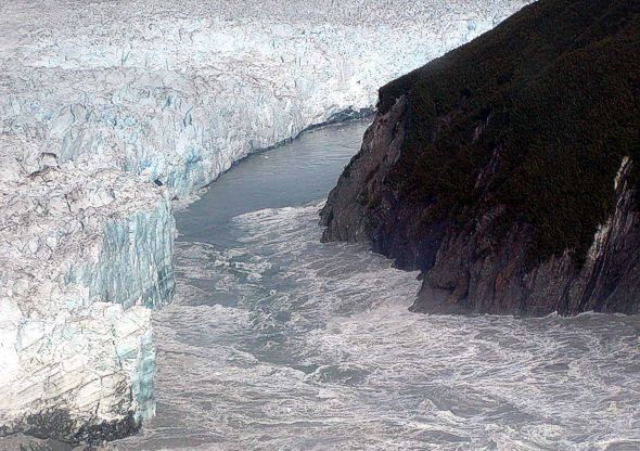
Zigzag Glacier is an alpine glacier located on the upper southwest slopes of Mount Hood in the U.S. state of Oregon. It ranges in elevation from with fingers in canyons extending to about , and lies almost entirely within Mount Hood Wilderness. The upper extent is divided from Reid Glacier by Illumination Rock. The top of the glacier is at the foot of Crater Rock. The glacier is bounded on the east by a slight rise shared with the Palmer Glacier (a popular skiing area north of Timberline Lodge since the 1930s) and on the northwest by Reid Glacier. It is the source of the Zigzag River which has erosion, eroded a large, steep canyon named Zigzag Canyon. Below the glacier, its snowfield varies significantly seasonally, varying in length by almost two miles (3.2 km). In 1922, a jökulhlaup originating from Zigzag Glacier as a flow of dark debris came out of a crevasse high on the glacier. It flowed on the surface more than 650 m (2100 ft) before entering another c ... [...More Info...] [...Related Items...] OR: [Wikipedia] [Google] [Baidu] |
Mount Hood Wilderness
The Mount Hood Wilderness is a protected wilderness area inside the Mount Hood National Forest, in the U.S. state of Oregon. The area, covering , includes the peak of Mount Hood and its upper slopes, and ranges from temperate rain forests at the lower elevations, to glaciers and rocky ridges at higher elevations. The wilderness wraps around the mountain from west to northeast, and borders Timberline Lodge and Mount Hood Meadows ski lifts on some of the south and east slopes of the mountain. Trails Journeys to the summit are popular. There are opportunities for experienced and novice mountaineers to traverse glaciers, snowfields and steep volcanic soil, and to deal with rapidly changing and difficult to predict weather. More than 10,000 climbers annually make the attempt, making Mount Hood's summit the most visited snowclad peak in America. Numerous trails circle the mountain, from Lolo Pass on the northwest (which the Pacific Crest Trail crosses) to Cloud Cap on the northeast ... [...More Info...] [...Related Items...] OR: [Wikipedia] [Google] [Baidu] |
Newton Clark Glacier
Newton Clark Glacier is an alpine glacier on the southeast slope of Mount Hood in the U.S. state of Oregon. The glacier extends from . The glacier lies entirely within Mount Hood Wilderness. Between 1907 and 2004, Newton Clark Glacier lost 32% of its surface area and the glacier terminus retreated over the same time period. See also *List of glaciers in the United States References Glaciers of Mount Hood Glaciers of Hood River County, Oregon Mount Hood National Forest Glaciers of Oregon {{HoodRiverCountyOR-geo-stub ... [...More Info...] [...Related Items...] OR: [Wikipedia] [Google] [Baidu] |


