|
Westwood, Los Angeles
Westwood is a commercial and residential neighborhood in the northern central portion of the Westside (Los Angeles County), Westside region of the city of Los Angeles, California. It is the home of the University of California, Los Angeles (UCLA). Bordering the campus on the south is Westwood Village, a major regional district for shopping, dining, movie theaters, and other entertainment. Wilshire Boulevard through Westwood is a major corridor of condominium towers, on the eastern end and of Class A office towers, on the western end. Westwood also has residential areas of multifamily and single family housing, including exclusive Holmby Hills, Los Angeles, Holmby Hills. The neighborhood was developed starting in 1919, and UCLA opened in 1929, while Westwood Village was built up starting in 1929 through the 1930s. Geography According to the Westwood Neighborhood Council, the Westwood Homeowners Association, and the ''Los Angeles Times'' Mapping L.A. project, Westwood is bo ... [...More Info...] [...Related Items...] OR: [Wikipedia] [Google] [Baidu] |
Neighborhoods In Los Angeles
This is a list of notable districts and neighborhoods within the city of Los Angeles in the U.S. state of California, present and past. It includes residential and commercial industrial areas, historic preservation zones, and business-improvement districts, but does not include sales subdivisions, tract names, homeowners associations, and informal names for areas. Regions Current districts and neighborhoods AE * Angelino Heights, Los Angeles, Angelino Heights''The Thomas Guide: Los Angeles County'', Rand McNally (2004), pages N and O * Angeles Mesa, Los Angeles, Angeles Mesa * Angelus Vista, Los Angeles, Angelus Vista * Annandale, California, Annandale (partially in Pasadena) * Arleta, Los Angeles, ArletaNeighborhoods , Mapping L.A., ''Los Angeles Times'' * Arlington Heights, Los Angeles, Arlington Heights [...More Info...] [...Related Items...] OR: [Wikipedia] [Google] [Baidu] |
Wilshire Boulevard
Wilshire Boulevard (['wɪɫ.ʃɚ]) is a prominent boulevard in the Los Angeles area of Southern California, extending from Ocean Avenue (Santa Monica), Ocean Avenue in the city of Santa Monica, California, Santa Monica east to Grand Avenue (Los Angeles), Grand Avenue in the Financial District, Los Angeles, Financial District of downtown Los Angeles. One of the principal east–west arterial roads of Los Angeles, it is also one of the major city streets through the city of Beverly Hills, California, Beverly Hills. Wilshire Boulevard runs roughly parallel to Santa Monica Boulevard from Santa Monica to the west boundary of Beverly Hills. From the east boundary, it runs a block south of Sixth Street to its terminus. Wilshire Boulevard is densely developed throughout most of its span, connecting five of Los Angeles's major business districts and Beverly Hills. Many of the post-1956 skyscrapers in Los Angeles are located along Wilshire; for example, the Wilshire Grand C ... [...More Info...] [...Related Items...] OR: [Wikipedia] [Google] [Baidu] |
Sawtelle Veterans Home
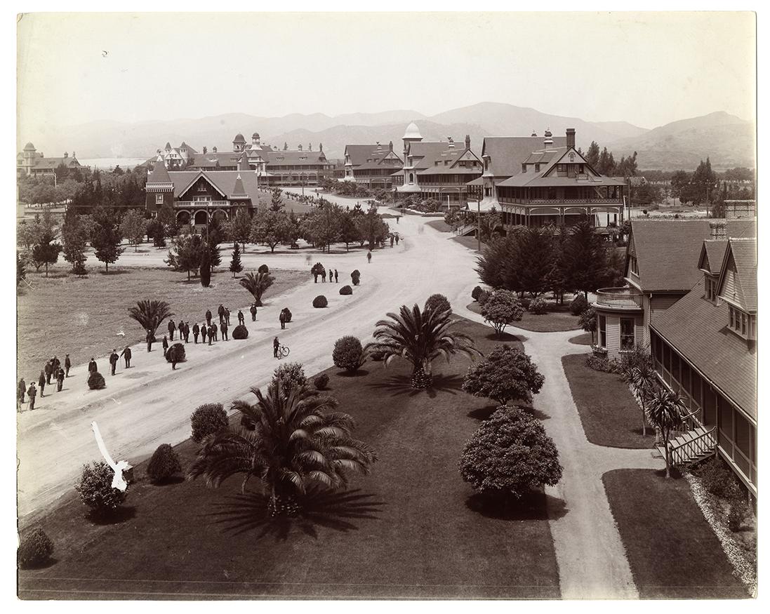
The Sawtelle Veterans Home was a long-term care, care home for disabled American veterans in Sawtelle, Los Angeles, California, United States. The Home, formally the Pacific Branch of the National Home for Disabled Volunteer Soldiers, was established in 1887 on of Rancho San Vicente y Santa Monica lands donated by Senator John Percival Jones, John P. Jones and Arcadia Bandini de Stearns Baker, Arcadia B. de Baker. The following year, the site grew by an additional ; in 1890, more were appended for use as Los Angeles National Cemetery, a veterans' cemetery. With more than 1,000 veterans in residence, a new hospital was erected in 1900. This hospital was replaced in 1927 by the #James W. Wadsworth Hospital, James W. Wadsworth Hospital, now known as the West Los Angeles VA Medical Center. National Asylum for Disabled Volunteer Soldiers In 1865, Congress passed legislation to incorporate the National Asylum for Disabled Volunteer Soldiers and Sailors of the Civil War. Volunteers wer ... [...More Info...] [...Related Items...] OR: [Wikipedia] [Google] [Baidu] |
Interstate 405 In California
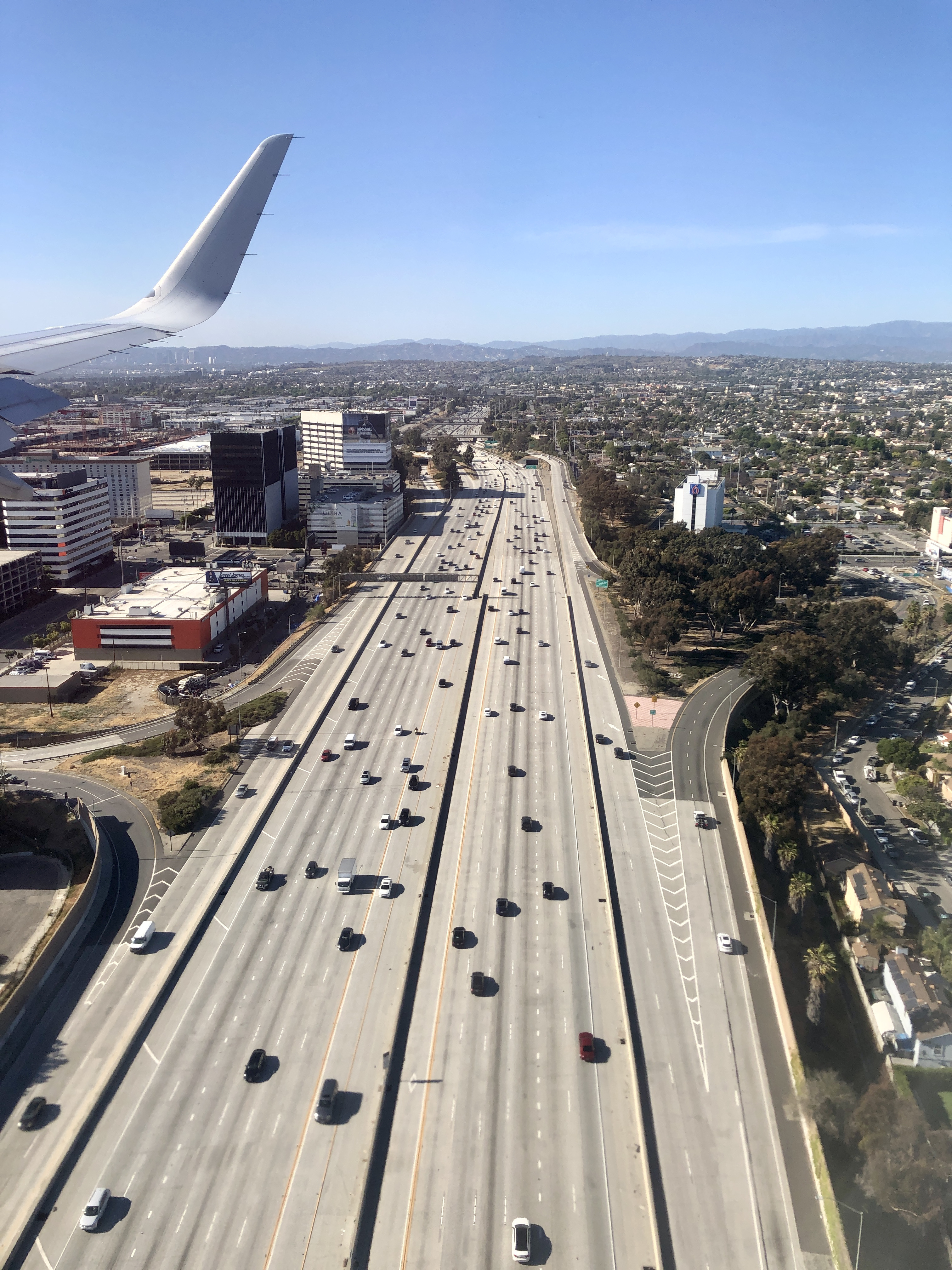
Interstate 405 (I-405, locally referred to as the 405) is a major north–south auxiliary Interstate Highway in Southern California. The entire route is known as the northern segment of the San Diego Freeway. I-405 is a bypass auxiliary route of I-5, running along the southern and western parts of the Greater Los Angeles urban area from Irvine in the south to Sylmar in the north. I-405, heavily traveled by both commuters and freight haulers along its entire length, is the busiest and most congested freeway in the United States. The freeway's annual average daily traffic between exits 21 and 22 in Seal Beach reached 374,000 in 2008, making it the highest count in the nation. It has played a crucial role in the development of dozens of cities and suburbs along its route through Los Angeles and Orange counties. It also serves Los Angeles International Airport, Long Beach Airport, and Orange County's John Wayne Airport. Route description The entirety of I-405 is d ... [...More Info...] [...Related Items...] OR: [Wikipedia] [Google] [Baidu] |
Sepulveda Boulevard
Sepulveda Boulevard is a major street and transportation corridor in the City of Los Angeles and several other cities in western Los Angeles County, California. The street parallels Interstate 405 for much of its route. Portions of Sepulveda Boulevard between Manhattan Beach and Los Angeles International Airport (LAX) are designated as part of State Route 1 (SR 1). Since 2018, there have been four distinct segments in Los Angeles County signed as Sepulveda Boulevard. The southernmost of the four segments is an east-west route located in the South Bay, and continues west as Camino Real in Torrance and east as Willow Street in Long Beach. The second segment runs from Manhattan Beach north to the southern border of El Segundo. The third segment runs from LAX, through the Westside regions, and over the Santa Monica Mountains at the Sepulveda Pass into the San Fernando Valley. The northernmost section of Sepulveda Boulevard is in Sylmar, running from Roxford Street north t ... [...More Info...] [...Related Items...] OR: [Wikipedia] [Google] [Baidu] |
Century City, Los Angeles
Century City is a 176-acre (71.2 ha) neighborhood and business district in Los Angeles, California, United States. Located on the Westside to the south of Santa Monica Boulevard around 10 miles (16 km) west of downtown Los Angeles, Century City is one of the most prominent employment centers in the Los Angeles metropolitan area, and its skyscrapers form a distinctive skyline on the city's westside. The district was developed on the former backlot of 20th Century Studios—the film studio from which the district partially derived its name—and its first building was opened in 1963. Important to the economy are the Westfield Century City shopping center, business towers, and the Fox Studio Lot. History The land of Century City belonged to cowboy actor Tom Mix (1880-1940), who used it as a ranch.Gary BaumWhy Century City Ranks Among the Worst Real Estate Deals in Hollywood History ''The Hollywood Reporter'', September 26, 2013 It later became a backlot of the former 20th ... [...More Info...] [...Related Items...] OR: [Wikipedia] [Google] [Baidu] |
West Los Angeles
West Los Angeles is an area within the city of Los Angeles, California, United States. The residential and commercial neighborhood is divided by the Interstate 405 freeway, and each side is sometimes treated as a distinct neighborhood, mapped differently by different sources. Each lies within the larger Westside region of Los Angeles County. Geography West Los Angeles Community Plan The West Los Angeles Community Plan area recognized by the city of Los Angeles is generally bounded by Centinela Avenue on the west; Wilshire Boulevard and Santa Monica Boulevard on the north; National Boulevard, Pico Boulevard, and Exposition Boulevard on the south; and Durango Avenue, Robertson Boulevard, and Canfield Avenue on the east. Among the neighborhoods included within it are Sawtelle, Rancho Park, Beverlywood, Cheviot Hills, Castle Heights, and Century City. The Community Plan area itself is part of the larger West Los Angeles Area Plan Commission area (i.e., the Westside regio ... [...More Info...] [...Related Items...] OR: [Wikipedia] [Google] [Baidu] |
Santa Monica Boulevard
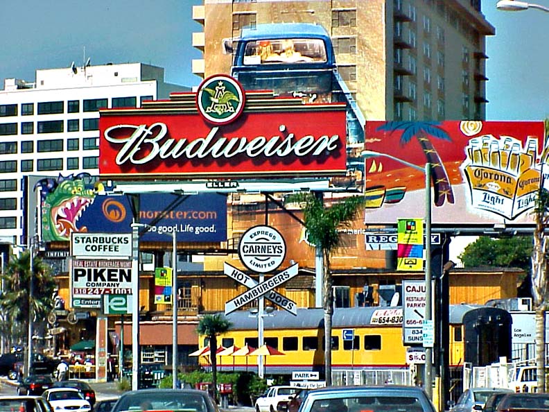
Santa Monica Boulevard is a major west–east thoroughfare in Los Angeles County, California, United States. It runs from Ocean Avenue in Santa Monica near the Pacific Ocean to Sunset Boulevard at Sunset Junction in Los Angeles. It passes through Beverly Hills and West Hollywood. A portion of it is designated as California State Route 2, while the full avenue was Historic Route 66. Route description The western terminus of Santa Monica Boulevard is at Ocean Avenue near the Pacific Ocean. From there until the San Diego Freeway ( Interstate 405), Santa Monica Boulevard is a densely urban commercial street. It assumes the designation California State Route 2 between Centinela Avenue at the Santa Monica–Los Angeles border, and the Hollywood Freeway ( U.S. Route 101). The portion between Centinela Avenue and Lincoln Boulevard in Santa Monica was also originally part of California State Route 2. From Centinela Avenue, Santa Monica Boulevard heads northeast through the ... [...More Info...] [...Related Items...] OR: [Wikipedia] [Google] [Baidu] |
Los Angeles Country Club
The Los Angeles Country Club is a golf and country club in Los Angeles, California, United States. The club is noted for being very exclusive. It hosted the 2023 U.S. Open on its North Course. History In the fall of 1897, a group of Los Angeles residents organized the Los Angeles Golf Club, and a lot was leased at the corner of Pico and Alvarado streets (now part of the Alvarado Terrace Historic District) for a nine-hole golf course. Called "The Windmill Links," the course was named for a makeshift clubhouse crafted from the bottom of an abandoned windmill. Through the middle of 1898, this site served as the club's home until the course became too crowded. The club was removed to Pico Heights, at Hobart and 16th streets, and was named "The Convent Links" for its location behind a convent near Rosedale Cemetery. Again, nine holes were laid out for play, but by the spring of 1899, this course and clubhouse had also become too restricted for play. The search committee for ... [...More Info...] [...Related Items...] OR: [Wikipedia] [Google] [Baidu] |
Beverly Hills
Beverly Hills is a city located in Los Angeles County, California, United States. A notable and historic suburb of Los Angeles, it is located just southwest of the Hollywood Hills, approximately northwest of downtown Los Angeles. Beverly Hills' land area totals and (together with the neighboring smaller city of West Hollywood to the east) is entirely surrounded by the city of Los Angeles. According to the 2020 census, the city has a population of 32,701, marking a decrease of 1,408 from the 2010 census count of 34,109. In American popular culture, Beverly Hills has been known as an affluent location within Greater Los Angeles, which corresponds to higher property values and taxes in the area. The city is well known for its Rodeo Drive shopping district that includes many designer brands. Throughout its history, the city has been home to many celebrities. It is noted for numerous hotels and resorts, including the Beverly Hilton and the Beverly Hills Hotel. The city h ... [...More Info...] [...Related Items...] OR: [Wikipedia] [Google] [Baidu] |
Bel Air, Los Angeles
Bel Air (or Bel-Air) is a residential neighborhood on the Los Angeles Westside, in the foothills of the Santa Monica Mountains in the U.S. state of California. Together with Beverly Hills, California, Beverly Hills and Holmby Hills, Bel Air forms the Platinum Triangle, Los Angeles, Platinum Triangle of Los Angeles neighborhoods. Along with Beverly Hills and the Los Angeles community of Brentwood, Los Angeles, Brentwood, Bel Air is also part of a high-priced area on the Westside known as the "three Bs." History The community was founded in 1923 by Alphonzo Bell. Bell owned farm property in Santa Fe Springs, California, where oil was discovered. He bought a large ranch with a home on what is now Bel Air Road. He subdivided and developed the property with large residential lots, with work on the master plan led by the landscape architect Mark Daniels. He also built the Bel-Air Bay Club in Pacific Palisades, Los Angeles, Pacific Palisades and the Bel-Air Country Club. His wife ch ... [...More Info...] [...Related Items...] OR: [Wikipedia] [Google] [Baidu] |
Sunset Boulevard
Sunset Boulevard is a boulevard in the central and western part of Los Angeles, California, United States, that stretches from the Pacific Coast Highway (California), Pacific Coast Highway in Pacific Palisades, Los Angeles, Pacific Palisades east to Figueroa Street in downtown Los Angeles. It is a major thoroughfare in the cities of Beverly Hills, California, Beverly Hills and West Hollywood, California, West Hollywood (including a portion known as the Sunset Strip), as well as several districts in Los Angeles. Geography Approximately in length, the boulevard roughly traces the arc of mountains that form part of the northern boundary of the Los Angeles Basin, following the path of a 1780s cattle trail from the Pueblo de Los Angeles to the ocean. From Downtown Los Angeles, the boulevard heads northwest, to Hollywood, Los Angeles, Hollywood, through which it travels due west for several miles before it bends southwest towards the ocean. It passes through or near Echo Park ... [...More Info...] [...Related Items...] OR: [Wikipedia] [Google] [Baidu] |


