|
Westrich Plateau
The Westrich Plateau (german: Westricher Hochfläche),Helmut Beeger et al.: "Die Landschaften von Rheinhessen-Pfalz − Benennung und räumliche Abgrenzung". In: ''Berichte zur deutschen Landeskunde'', Vol. 63, Part 2, Trier, 1989, pp. 327–359 also Zweibrücken Westrich (''Zweibrücker Westrich'')For example in the Handbuch der naturräumlichen Gliederung Deutschlands. or Southwest Palatine Plateau (''Südwestpfälzische Hochfläche''), is a landscape in the German state of Rhineland-Palatinate, with small areas also in the Saarland (Saarpfalz-Kreis). Its heart is in the southwest of the Palatinate region and it is part of the historic region of Westrich. Geography Structure and boundaries The Westrich Plateau consists mainly of the Sickingen Heights in the north and the Zweibrücken Hills in the south which, morphologically, belong more to northeastern Lorraine in France). The main plateau falls away in a marked scarp slope, the Sickingen Escarpment, to the northwe ... [...More Info...] [...Related Items...] OR: [Wikipedia] [Google] [Baidu] |
Blieskastel
Blieskastel () is a city in the Saarpfalz (Saar-Palatinate) district, in Saarland, Germany which is divided into villages. It is situated on the river Blies, approximately southwest of Homburg (Saar), west of Zweibrücken, and east of Saarbrücken. Geography Blieskastel is the capital of the Bliesgau and is located in the center of the Bliesgau Biosphere Reserve. The city borders on the cities of Homburg, St. Ingbert, Zweibrücken and Hornbach, and the municipalities of Gersheim, Kirkel and Mandelbachtal. The Blies flows by Blieskastel. The districts of Niederwürzbach, Lautzkirchen and Alschbach are located in the Sankt Ingbert-Kirkeler forest area. Climate The annual rainfall is and is in the upper third. 70% indicate low values. The driest month is April. It rains most in December. Organization The city of Blieskastel consists of Blieskastel-Mitte and 14 districts. Alphabetically these are Altheim, Aßweiler, Ballweiler, Bierbach an der Blies, Biesingen, Blickweiler, Böc ... [...More Info...] [...Related Items...] OR: [Wikipedia] [Google] [Baidu] |
Blies
The Blies () is a right tributary of the Saar in southwestern Germany (Saarland) and northeastern France (Moselle). The Blies flows from three springs in the Hunsrück near Selbach, Germany. It is roughly 100 km long, ending in the French city of Sarreguemines. It flows through Sankt Wendel, Ottweiler, Neunkirchen, Bexbach, Homburg and Blieskastel (Blieskastel being named after the river). Its lower extent demarcates part of the Franco–German border. The section within France and on the French-German border is long. Tributaries Tributaries of the Blies are, from source to mouth: * Todbach (left) *Oster (left) * Mutterbach (right) * Erbach (left) *Lambsbach (left) * Schwarzbach (left) *Würzbach (right) * Hetschenbach (left) * Gailbach (left) * Mandelbach (right) World War II Fighting took place on the Blies during the Lorraine Campaign, fought from September to December 1944 by the Third United States Army, famously led by George S. Patton. The 35th Infantry Divisi ... [...More Info...] [...Related Items...] OR: [Wikipedia] [Google] [Baidu] |
Bliesgau
The Bliesgau is a region in the state of Saarland in the south-west of Germany and borders with France. It is named after the River Blies, which is a tributary to the Saar. Blieskastel is the principal town of the district. Other towns in the area include Gersheim, Mandelbachtal and Wolfersheim. The region forms part of the larger Muschelkalk geological zone. Historically the district is first recorded in the seventh century when it formed part of the lands of the Bishopric of Metz, along with neighbouring Sankt Ingbert. It was ruled by Counts of Bliesgau. Bliesgau Biosphere Reserve The district Einöd is part of thbiosphere reserve Bliesgauwith the Pfänderbachtal in Einöd forming a core zone of 45 hectares. The region is a sanctuary for many rare animal and plant species such as the little owl, beaver, red kite, lizard orchid, and the yellow rattle. Almost half of all types of orchids that occur in Germany can be found here, on the vast, semi-dry grasslands that cover formatio ... [...More Info...] [...Related Items...] OR: [Wikipedia] [Google] [Baidu] |
Saint Ingbert-Kirkeler Woods
In religious belief, a saint is a person who is recognized as having an exceptional degree of holiness, likeness, or closeness to God. However, the use of the term ''saint'' depends on the context and denomination. In Catholic, Eastern Orthodox, Anglican, Oriental Orthodox, and Lutheran doctrine, all of their faithful deceased in Heaven are considered to be saints, but some are considered worthy of greater honor or emulation. Official ecclesiastical recognition, and consequently a public cult of veneration, is conferred on some denominational saints through the process of canonization in the Catholic Church or glorification in the Eastern Orthodox Church after their approval. While the English word ''saint'' originated in Christianity, historians of religion tend to use the appellation "in a more general way to refer to the state of special holiness that many religions attribute to certain people", referring to the Jewish tzadik, the Islamic walī, the Hindu rishi or Sikh ... [...More Info...] [...Related Items...] OR: [Wikipedia] [Google] [Baidu] |
Alsace Bossue
The Alsace bossue (Alsatian dialect, Alemannic and Lorraine Franconian, Frankish: ''S'Gromme/S'Krumme Elsass'', German: ''das krumme Elsass/ Krummes Elsass''), is a territory of Bas-Rhin in Alsace, which includes the three former cantons of Sarre-Union, Drulingen and La Petite-Pierre (today all part of the canton of Ingwiller). Just like nearby parts of Lorraine, the Alsace bossue is linguistically predominantly located into the Rhine Franconian area. History The current borders of this territory date back from 1793, when the County of Saarwerden was annexed by the young French First Republic. Initially, the county of Saarwerden was meant to be fragmented and distributed between the departments of Moselle (department), Moselle, Meurthe Department, Meurthe and/or Bas-Rhin, but its inhabitants were against the fragmentation, and as such the project was afterwards cancelled. The county was then temporarily absorbed by the nearby districts of Moselle and Meurthe until a final decisi ... [...More Info...] [...Related Items...] OR: [Wikipedia] [Google] [Baidu] |
Pays De Bitche
The Pays de Bitche (, literally ''Land of Bitche'', german: Bitscherland or ) is a natural region located in the Moselle department of the Grand Est region of France. It corresponds to the present French part of the former principality of Zweibrücken-Bitsch and to the part of the Northern Vosges that lies within Lorraine. The Pays de Bitche has a total of 47 municipalities. 46 of them are gathered into the Bitche canton and the remaining one, Kalhausen, is a part of the Sarreguemines canton. Geography The Pays de Bitche has a total of 47 municipalities and covers the part of the Northern Vosges Regional Nature Park that lies within Lorraine. In the west and southwest it forms part of the agriculturally dominated Westrich Plateau. To the south it borders the so-called ''Alsace bossue'' (German: ''Krumme Elsass''), which belongs to the arrondissement of Saverne. To the east is the canton of Wissembourg. To the north it is adjoined by the German states of Rhineland-Palatinate a ... [...More Info...] [...Related Items...] OR: [Wikipedia] [Google] [Baidu] |
Moosalb (Schwarzbach)
The Moosalb (also Moosalbe) is a stream in West Palatinate in the German state of Rhineland-Palatinate. The upper Moosalb valley is also called the ''Hammertal'' ("hammer mill valley") on account of the many witnesses, in the form of ruined buildings and structures, to the iron smelting and working industries of the 18th and 19th centuries. Course and tributaries The Moosalb rises in the heart of the Palatine Forest west of the Palatine Watershed at a height of about 450 metres. East of its source lies the village of Johanniskreuz which belongs to Trippstadt. Initially the Moosalb flows roughly westwards before heading south. After just under 26 km it empties into the Schwarzbach, also known here as the ''Burgalbe'', at Waldfischbach-Burgalben. The biggest tributary of the Moosalb is the 15.8 km long Aschbach, which – like the Moosalb comes from the Palatine Forest. It joins from the right at Karlstal station and delivers more than half as much water again as ... [...More Info...] [...Related Items...] OR: [Wikipedia] [Google] [Baidu] |
Queidersbach
Queidersbach is a municipality in the district of Kaiserslautern, in Rhineland-Palatinate, western Germany. Geography The municipality is located 10 km southwest of Kaiserslautern in a natural meadow valley on the western edge of the Palatinate Forest, which merges in this area into the Sickingen Heights. Almost two-thirds of the 1500 hectare district is covered with forest. Queidersbach includes the areas Forsthaus Stempelberg, Schweinstal and Zuckerhof. Through Queidersbach flows the eponymous creek, which is popularly referred to as Steinalb. The neighbouring communities are Bann, Kaiserslautern, Krickenbach, Linden, Weselberg and Obernheim-Kirchenarnbach. History The community was first documented in 976 when Emperor Otto II gave his vassal Biso, the Bishop of Paderborn, land on the Queidersbach. The village Queidersbach, until the end of the 18th century, belonged to the Grand Court of the Rule Landstuhl, which was ruled by the barons of Sickingen-Hohen ... [...More Info...] [...Related Items...] OR: [Wikipedia] [Google] [Baidu] |
Pirmasens
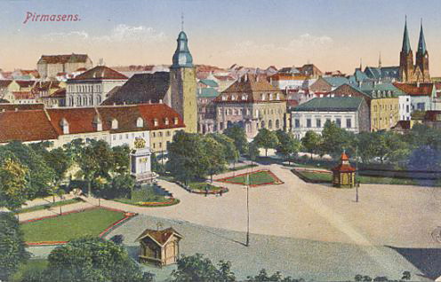
Pirmasens (; pfl, Bärmesens (also ''Bermesens'' or ''Bärmasens'')) is an independent town in Rhineland-Palatinate, Germany, near the border with France. It was famous for the manufacture of shoes. The surrounding rural district was called ''Landkreis Pirmasens'' from 1818 until 1997, when it was renamed to ''Südwestpfalz''. Pirmasens can be easily mistaken with ''Primasens'', of which means a first sense in Latin-derived languages (the first sense in Latin would be "primus sensus"). History Early years The first mention of "Pirminiseusna", a colony of Hornbach Abbey, dates from 860. The name derives from St. Pirminius, the founder of the monastery. During the period it was under rule of the Bishopric of Metz. It was passed to Diocese of Speyer in last the quarter of the 11th century, then was captured by County of Saarbrücken in 1100. In 1182, the County of Saarbrücken was divided by Simon II and Henry I, who were sons of Simon I. Pirmasens was given to the latter and He ... [...More Info...] [...Related Items...] OR: [Wikipedia] [Google] [Baidu] |


