|
Western Kangaroo Island Marine Park (state Waters)
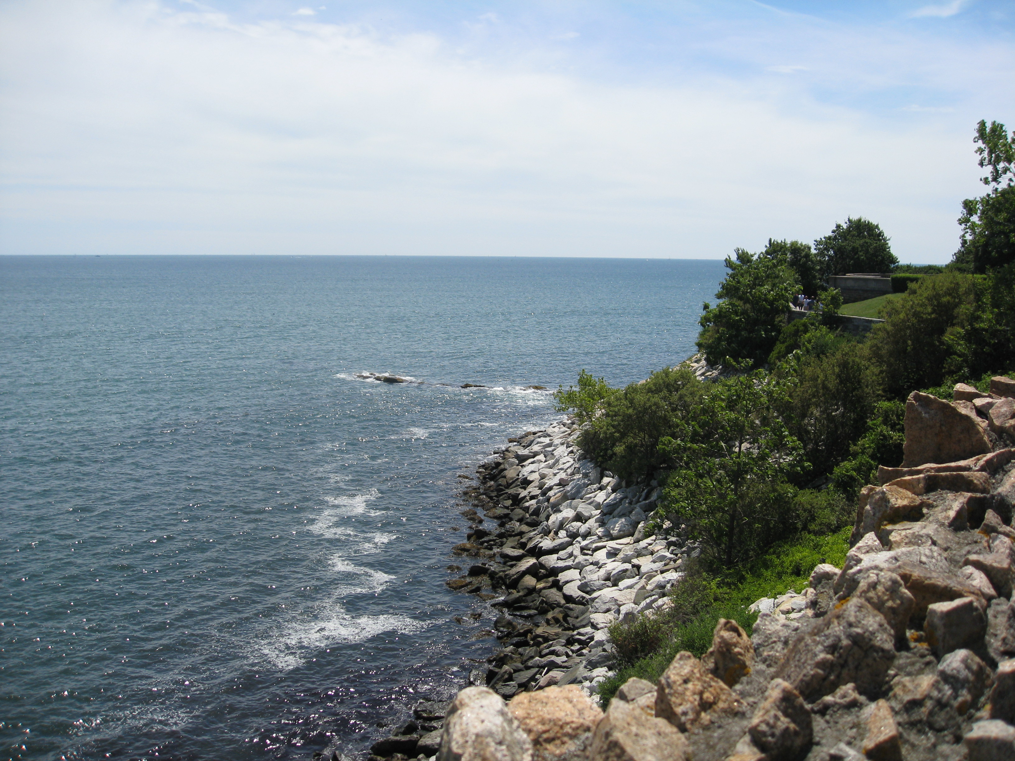
__NOTOC__ Western Kangaroo Island Marine Park is a marine protected area in the Australian state of South Australia located in the state’s coastal waters adjoining both the west coast of Kangaroo Island and Lipson Reef, an islet located to the south of Kangaroo Island. The marine park was established on 29 January 2009 under the ''Marine Parks Act 2007''. The marine park consists of two areas of water. The first is the portion of coastal waters adjoining the coastline to the western end of Kangaroo Island extending from the middle of Sanderson Bay on the south coast to Cape Forbin on the north coast. The seaward boundary is the limit of coastal waters which moves away from within of the island in a northern-westerly direction towards the Eyre Peninsula while the northern boundary is a line with an east-west alignment and located about north of Cape Forbin. The second is the coastal waters within of Lipson Reef which is located about south-east of Cape du Couedic. Th ... [...More Info...] [...Related Items...] OR: [Wikipedia] [Google] [Baidu] |
Cape Du Couedic
Cape du Couedic is a headland in the Australian state of South Australia located on the southwest tip of Kangaroo Island in the locality of Flinders Chase, South Australia, Flinders Chase. It was named after a French naval officer, , by the Baudin expedition to Australia during January 1803. It is the site for the Cape du Couedic Lighthouse. It is currently located within the Flinders Chase National Park. Description Cape du Couedic is located southwest of the municipal seat of Kingscote, South Australia, Kingscote at the most southwesterly point of the Kangaroo Island coast. It is the termination for a pair of coastlines - the western coastline extending from Cape Borda in the north and the southern coastline extending from Cape Willoughby in the east. It is described as "a narrow promontory about 1 mile long" (i.e. ) and that "its SW face slopes to the sea whereas its N and S sides are steep." Formation, geology & oceanography Cape du Couedic was formed when the sea reached ... [...More Info...] [...Related Items...] OR: [Wikipedia] [Google] [Baidu] |
Remarkable Rocks
Flinders Chase National Park (formerly Flinders Chase) is a protected area in the Australian state of South Australia located at the west end of Kangaroo Island about west-south west of the state capital of Adelaide and west of the municipal seat of Kingscote. It is a sanctuary for endangered species and home to a few geological phenomena. It was the second national park to be declared in South Australia. Flinders Chase National Park consists of three sections - an area of coastal landscapes around Cape du Couedic in the south west corner of the island, the Gosse Lands in the centre of the west end of the island and the former Cape Borda Lightstation reserve in the north west corner of the island. Description Location Flinders Chase National Park is located at the north-western end of Kangaroo Island in South Australia approximately west of Kingscote. It is located within the gazetted localities of Flinders Chase, Gosse and Karatta. Extent As of 1993, the national pa ... [...More Info...] [...Related Items...] OR: [Wikipedia] [Google] [Baidu] |
IUCN Category IV
IUCN protected area categories, or IUCN protected area management categories, are categories used to classify protected areas in a system developed by the International Union for Conservation of Nature (IUCN). The enlisting of such areas is part of a strategy being used toward the conservation of the world's natural environment and biodiversity. The IUCN has developed the protected area management categories system to define, record and classify the wide variety of specific aims and concerns when categorising protected areas and their objectives. This categorisation method is recognised on a global scale by national governments and international bodies such as the United Nations and the Convention on Biological Diversity. Categories Category Ia – strict nature reserve A strict nature reserve (IUCN Category Ia) is an area which is protected from all but light human use in order to protect its biodiversity and also possibly its geological/geomorphical features. These areas ... [...More Info...] [...Related Items...] OR: [Wikipedia] [Google] [Baidu] |
IUCN Category II
IUCN protected area categories, or IUCN protected area management categories, are categories used to classify protected areas in a system developed by the International Union for Conservation of Nature (IUCN). The enlisting of such areas is part of a strategy being used toward the conservation of the world's natural environment and biodiversity. The IUCN has developed the protected area management categories system to define, record and classify the wide variety of specific aims and concerns when categorising protected areas and their objectives. This categorisation method is recognised on a global scale by national governments and international bodies such as the United Nations and the Convention on Biological Diversity. Categories Category Ia – strict nature reserve A strict nature reserve (IUCN Category Ia) is an area which is protected from all but light human use in order to protect its biodiversity and also possibly its geological/geomorphical features. These areas ... [...More Info...] [...Related Items...] OR: [Wikipedia] [Google] [Baidu] |
Marine Parks Of South Australia
Marine is an adjective meaning of or pertaining to the sea or ocean. Marine or marines may refer to: Ocean * Maritime (other) * Marine art * Marine biology * Marine debris * Marine habitats * Marine life * Marine pollution Military * Marines, a naval-based infantry force ** United States Marine Corps ** Royal Marines of the UK ** Brazilian Marine Corps ** Spanish Marine Infantry ** Fusiliers marins (France) ** Indonesian Marine Corps ** Republic of China Marine Corps ** Republic of Korea Marine Corps ** Royal Thai Marine Corps *"Marine" also means "navy" in several languages: ** Austro-Hungarian Navy () ** Belgian Navy (, , ) ** Royal Canadian Navy () *** Provincial Marine (1796–1910), a predecessor to the Royal Canadian Navy ** Navy of the Democratic Republic of the Congo () ** Royal Danish Navy () ** Finnish Navy (, ) ** French Navy () ** Gabonese Navy () ** German Navy () ** Royal Moroccan Navy () ** Royal Netherlands Navy () ** Swedish Navy () Places * Marines ... [...More Info...] [...Related Items...] OR: [Wikipedia] [Google] [Baidu] |
IUCN Protected Area Categories
IUCN protected area categories, or IUCN protected area management categories, are categories used to classify protected areas in a system developed by the International Union for Conservation of Nature (IUCN). The enlisting of such areas is part of a strategy being used toward the conservation of the world's natural environment and biodiversity. The IUCN has developed the protected area management categories system to define, record and classify the wide variety of specific aims and concerns when categorising protected areas and their objectives. This categorisation method is recognised on a global scale by national governments and international bodies such as the United Nations and the Convention on Biological Diversity. Categories Category Ia – strict nature reserve A strict nature reserve (IUCN Category Ia) is an area which is protected from all but light human use in order to protect its biodiversity and also possibly its geological/geomorphical features. These areas ... [...More Info...] [...Related Items...] OR: [Wikipedia] [Google] [Baidu] |
Director Of National Parks
Director of National Parks is a government-owned corporation of the Government of Australia, Australian government responsible for the management of a portfolio of protected area, terrestrial and marine protected areas proclaimed under the ''Environment Protection and Biodiversity Conservation Act 1999'' (''EPBC Act''). The agency is a corporation sole. Parks Australia (formerly the Australian Nature Conservation Agency and the Australian National Parks and Wildlife Service) is a division of the Department of Agriculture, Water and the Environment which supports the Director of National Parks in the management of six Commonwealth national parks, the Australian National Botanic Gardens, and Australian marine parks. Legal status and history The Director of National Parks was established under the EPBC Act as a corporation sole, i.e. the corporation is constituted by the person appointed to the office named the Director of National Parks. It was established on 17 July 2000 upon ... [...More Info...] [...Related Items...] OR: [Wikipedia] [Google] [Baidu] |
Western Kangaroo Island Marine Park
__NOTOC__ Western Kangaroo Island Marine Park (formerly Western Kangaroo Island Commonwealth Marine Reserve) is a marine protected area located south of South Australia in waters within the Australian Exclusive economic zone to the south-west of Kangaroo Island and ranging in depth from to . It was gazetted in November 2012. It was renamed on 11 October 2017. It is part of a group of Australian marine parks managed by the Department of the Environment and Energy known as the South-west Marine Parks Network. It adjoins the Western Kangaroo Island Marine Park managed by the Government of South Australia which it both bounds on its north-west side and fully encloses the portion of the state marine park surrounding Lipson Reef near its eastern extent. The marine park includes ecosystems representative of the bioregion known as the "Spencer Gulf Shelf Province", two "key ecological features" consisting of firstly of a feature known as the "Kangaroo Island Pool" and the asso ... [...More Info...] [...Related Items...] OR: [Wikipedia] [Google] [Baidu] |
Cape Borda
Cape Borda is a headland in the Australian state of South Australia located in the gazetted locality of Cape Borda on the north west tip of Kangaroo Island about west of the municipal seat of Kingscote. It was named after Jean-Charles de Borda (1733–1799), the French mathematician, physicist, naturalist and sailor, by the Baudin expedition to Australia during January 1803. It has been the site of an operating lighthouse since 1858 and is currently located within the Flinders Chase National Park. Description Cape Borda is located in the gazetted locality of Cape Borda about west of Kingscote. It is the most north westerly point of the Kangaroo Island coast. It is the termination for a pair of coastlines – the western coastline extending from Cape du Couedic in the south and the northern coastline extending from Point Marsden in the east. It is described as ‘a bold cliffy headland, high’ with ‘the upper half of the cliff is formed of white limestone, and the ... [...More Info...] [...Related Items...] OR: [Wikipedia] [Google] [Baidu] |
Intertidal Zone
The intertidal zone, also known as the foreshore, is the area above water level at low tide and underwater at high tide (in other words, the area within the tidal range). This area can include several types of habitats with various species of life, such as seastars, sea urchins, and many species of coral with regional differences in biodiversity. Sometimes it is referred to as the ''littoral zone'' or '' seashore'', although those can be defined as a wider region. The well-known area also includes steep rocky cliffs, sandy beaches, bogs or wetlands (e.g., vast mudflats). The area can be a narrow strip, as in Pacific islands that have only a narrow tidal range, or can include many meters of shoreline where shallow beach slopes interact with high tidal excursion. The peritidal zone is similar but somewhat wider, extending from above the highest tide level to below the lowest. Organisms in the intertidal zone are adapted to an environment of harsh extremes, living in water pr ... [...More Info...] [...Related Items...] OR: [Wikipedia] [Google] [Baidu] |
Casuarina Islets
The Casuarina Islets ( French: Ilots du Cassuarina), also known as The Brothers, is a pair of islands located in the Great Australian Bight immediately off the south-west coast of Kangaroo Island in South Australia approximately south-west of Kingscote. The pair is currently part of the Flinders Chase National Park. Location and features Casuarina Islets are located approximately south-west of Kingscote. The North Islet and the South Islet lay respectively and south of Cape du Couedic. The North Islet covers an area of about and reaches an elevation of . The South Islet covers an area of about and reaches an elevation of . The Casuarina Islets were formed between 7500 and 8900 years ago after sea levels rose at the start of the Holocene. Both islets are humps of Kanmantoo group metasandstone that have been rounded by wave action. A remnant cap of calcarenite still exists over the eastern half of the North Islet while the South Islet has lost its calcarenite cap due to wa ... [...More Info...] [...Related Items...] OR: [Wikipedia] [Google] [Baidu] |
Paisley Islet
Paisley Islet (also known as West Bay Islet) is an islet located in the Great Australian Bight immediately off the west coast of Kangaroo Island in South Australia approximately west south-west of Kingscote. It is currently part of the Flinders Chase National Park. Description Paisley Islet is approximately west south-west of Kingscote. It is an extension of the southern headland of West Bay and is only separated from the mainland by tide or wind driven waves. It can be reached by walking along the rock isthmus at low tide. Formation, geology and oceanography Paisley Islet was formed about 7500 years ago after sea levels rose at the start of the Holocene. The islet consists of basement rock of Kanmantoo group metasandstone which extends to the mainland. The central portion of the islet is topped with a layer of Bridgewater Formation calcarenite which is in turn capped with a layer of calcrete. Layers of soil lie in depressions within the calcrete layer. The islet is l ... [...More Info...] [...Related Items...] OR: [Wikipedia] [Google] [Baidu] |


