|
Wentlooge
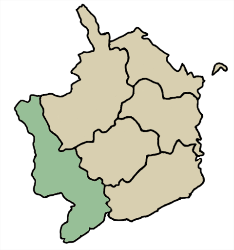
Wentlooge ( cy, Gwynllŵg), sometimes known as Wentloog, is a community in the southwest of the city of Newport, South Wales, in the Marshfield ward. The community includes Peterstone Wentloodge and St. Brides Wentloodge and in 2011 had a population of 737. Description The name Wentlooge is a corruption of the earlier name Gwynllŵg, said to have been named after Gwynllyw, its 5th - 6th century ruler. The community is bounded by Percoed reen to the northwest, the Ebbw River to the northeast, the Bristol Channel to the southeast and the South Wales Main Line to the southwest. It contains the hamlets of St Brides Wentloog and Peterstone Wentloog.Wentlooge Community Council Wentlooge Community Council homepage. Retrieved 18 March 2016. The |
Peterstone
Peterstone or Peterstone Wentlooge ( cy, Llanbedr Gwynllŵg) is a small hamlet to the south west of the city of Newport, South Wales. Location Peterstone Wentlooge lies six miles to the west of Newport city centre and 7½ miles east of Cardiff city centre. It lies in the community parish of Wentloog and electoral ward of Marshfield. History and amenities Like most of the settlements on the Wentlooge Level it lies on land reclaimed from the Bristol Channelbr> Peterstone itself lies right against the sea wallbr> an The former parish church, St Peter's Church, Wentlooge, St Peter's is now a private hous [...More Info...] [...Related Items...] OR: [Wikipedia] [Google] [Baidu] |
Peterstone Wentloog
Peterstone or Peterstone Wentlooge ( cy, Llanbedr Gwynllŵg) is a small hamlet to the south west of the city of Newport, South Wales. Location Peterstone Wentlooge lies six miles to the west of Newport city centre and 7½ miles east of Cardiff city centre. It lies in the community parish of Wentloog and electoral ward of Marshfield. History and amenities Like most of the settlements on the Wentlooge Level it lies on land reclaimed from the Bristol Channelbr> Peterstone itself lies right against the sea wallbr> an The former parish church, St Peter's Church, Wentlooge, St Peter's is now a private hous [...More Info...] [...Related Items...] OR: [Wikipedia] [Google] [Baidu] |
Wentloog (hundred)
Wentloog (also known as Wentlloog and Wentllooge) was an ancient hundred of Monmouthshire. It was also known as Newport hundred. It was situated in the western part of the county, bounded to the north by Brecknockshire; on the east by the hundreds of Abergavenny, Usk and Caldicot; on the south by the Bristol Channel, and on the west by Glamorganshire. ''Wentloog'' is an anglicisation of the Welsh ''Gwynllŵg'', the name of the early kingdom and medieval ''cantref''. It contained the following ancient parishes: *Aberystruth *Bassaleg: consisting of Duffryn township, Graig hamlet and Rogerstone township *Bedwas *Bedwellty * Bettws *Coedkernew * Henllys * Llanfihangel Llantarnam * Llanhilleth *Machen * Malpas * Marshfield *Michaelston y vedw *Mynyddislwyn * Newport *Peterstone Wentlooge *Risca * Rumney *St. Brides Wentlooge * St. Mellons * St. Woolos The area is now administered by several local authorities, in particular Newport, Torfaen, Blaenau Gwent and Caerphi ... [...More Info...] [...Related Items...] OR: [Wikipedia] [Google] [Baidu] |
St Brides, Newport
St. Bride's or St. Bride's Wentloog ( cy, Llansanffraid Gwynllŵg) is a small hamlet to the south west of the city of Newport in South Wales. Location It lies in the parish of Wentlooge and electoral district (ward) of Marshfield. Like most of the settlements on the Wentloog Level it lies on land behind the sea wall, reclaimed from the Bristol Channel, and criss-crossed by large and small drainage ditches, known locally as reens. History The village and church of St. Bride's, Wentloog is dedicated to St. Bridget. St Brides church is an ancient building of stone in the Decorated and Perpendicular styles, and consists of chancel, nave, south porch and an unusually fine perpendicular embattled western tower containing 6 bells, four of which are dated 1734 and bear inscriptions. A plaque inside the porch marks the high-tide level of the Bristol Channel floods of 1607. It was the birthplace of Lyn Harding David Llewellyn Harding (12 October 1867 – 26 December 1952) ... [...More Info...] [...Related Items...] OR: [Wikipedia] [Google] [Baidu] |
St Brides Wentloog
St. Bride's or St. Bride's Wentloog ( cy, Llansanffraid Gwynllŵg) is a small hamlet to the south west of the city of Newport in South Wales. Location It lies in the parish of Wentlooge and electoral district (ward) of Marshfield. Like most of the settlements on the Wentloog Level it lies on land behind the sea wall, reclaimed from the Bristol Channel, and criss-crossed by large and small drainage ditches, known locally as reens. History The village and church of St. Bride's, Wentloog is dedicated to St. Bridget. St Brides church is an ancient building of stone in the Decorated and Perpendicular styles, and consists of chancel, nave, south porch and an unusually fine perpendicular embattled western tower containing 6 bells, four of which are dated 1734 and bear inscriptions. A plaque inside the porch marks the high-tide level of the Bristol Channel floods of 1607. It was the birthplace of Lyn Harding David Llewellyn Harding (12 October 1867 – 26 December 1 ... [...More Info...] [...Related Items...] OR: [Wikipedia] [Google] [Baidu] |
Marshfield, Newport
Marshfield ( cy, Maerun) is a village and community of Newport, Wales. It sits approximately 5 miles (8 km) southwest of Newport, and 7 miles (11 km) northeast of Cardiff. The area is governed by Newport City Council. The community includes Castleton. Its population in 2011 was 3,054. Description The ward is bounded by Cardiff to the southwest, Caerphilly to the northwest, the Bristol Channel to the south, the mouth of the River Usk to the east, Graig ward to the north, and Tredegar Park and Gaer wards to the northeast. It is mostly rural and has a farming economy. The community is bound by the city boundary to the west, the A48(M) to the north and Great Western Main Line to the south. The eastern boundary with Coedkernew is formed by the ''Nant y Selsig'' ("sausage brook"). The area forms a green belt between the cities of Cardiff and Newport. There are bus services to both cities. Marshfield has a village hall, post office, chemist and shop. There are two churches: t ... [...More Info...] [...Related Items...] OR: [Wikipedia] [Google] [Baidu] |
Freightliner Group
Freightliner Group is a rail freight and logistics company headquartered in the United Kingdom. It is presently a wholly owned subsidiary of the American holding company Genesee & Wyoming. It was originally created after the Transport Act 1968 as ''Freightliner Ltd'', a British government-owned company . From its onset, Freightliner was focused on the haulage of international traffic, thus came to centre its activities around Britain's sea ports, often building new multimodal freight depots adjacent to such locations to better capture this business. During the late 1970s, it was reorganised under British Rail, and became a part of its Railfreight Distribution subsidiary during the late 1980s. Work to expand the loading gauge on routes such as the East Coast Main Line were undertaken, allowing trains hauling larger containers to be routes, were conducted around this time. Numerous domestic depots previously operated by Freightliner were closed during the 1990s in preparation for t ... [...More Info...] [...Related Items...] OR: [Wikipedia] [Google] [Baidu] |
Newport City Council
Newport City Council () is the governing body for Newport, one of the Principal Areas of Wales. It consists of 51 councillors, who represent the city's 20 wards. The council is currently, and has historically been, held by the Labour Party. However from 2008 to 2012 the council was controlled jointly by the Conservatives and Liberal Democrats due to there being no party with an overall majority. Between 1996 and 2002 the authority was known as Newport County Borough Council. History Newport is an ancient mesne borough, occupying an important position on the Welsh Marches. The town grew up round the castle built early in the 12th century. Giraldus Cambrensis, writing in 1187, calls it ''Novus Burgus'', probably to distinguish it from Caerleon, whose prosperity declined as that of Newport increased. The first lord was Robert Fitzhamon, who died in 1107, and from him the lordship passed to the Earls of Gloucester and Stafford and the Dukes of Buckingham. Hugh le Despenser, w ... [...More Info...] [...Related Items...] OR: [Wikipedia] [Google] [Baidu] |
Newport, Wales
Newport ( cy, Casnewydd; ) is a city and Local government in Wales#Principal areas, county borough in Wales, situated on the River Usk close to its confluence with the Severn Estuary, northeast of Cardiff. With a population of 145,700 at the 2011 census, Newport is the third-largest authority with City status in the United Kingdom, city status in Wales, and seventh List of Welsh principal areas, most populous overall. Newport became a unitary authority in 1996 and forms part of the Cardiff-Newport metropolitan area. Newport was the site of the last large-scale armed insurrection in Great Britain, the Newport Rising of 1839. Newport has been a port since medieval times when the first Newport Castle was built by the Normans. The town outgrew the earlier Roman Britain, Roman town of Caerleon, immediately upstream and now part of the borough. Newport gained its first Municipal charter, charter in 1314. It grew significantly in the 19th century when its port became the focus of Coa ... [...More Info...] [...Related Items...] OR: [Wikipedia] [Google] [Baidu] |
Container Terminal
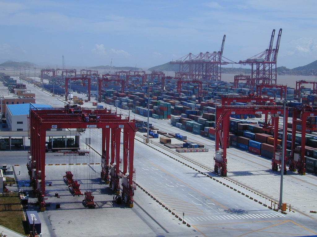
A container port or container terminal is a facility where cargo containers are transshipped between different transport vehicles, for onward transportation. The transshipment may be between container ships and land vehicles, for example trains or trucks, in which case the terminal is described as a ''maritime container port''. Alternatively, the transshipment may be between land vehicles, typically between train and truck, in which case the terminal is described as an ''inland container port''. In November 1932, the first inland container port in the world was opened by the Pennsylvania Railroad company in Enola, Pennsylvania. Port Newark-Elizabeth on the Newark Bay in the Port of New York and New Jersey is considered the world's first maritime container port. On April 26, 1956, the Ideal X was rigged for an experiment to use standardized cargo containers that were stacked and then unloaded to a compatible truck chassis at Port Newark. The concept had been developed by the M ... [...More Info...] [...Related Items...] OR: [Wikipedia] [Google] [Baidu] |
Rail Freight
Rail freight transport is the use of railroads and trains to transport cargo as opposed to human passengers. A freight train, cargo train, or goods train is a group of freight cars (US) or goods wagons (International Union of Railways) hauled by one or more locomotives on a railway, transporting cargo all or some of the way between the shipper and the intended destination as part of the logistics chain. Trains may haul bulk material, intermodal containers, general freight or specialized freight in purpose-designed cars. Rail freight practices and economics vary by country and region. When considered in terms of ton-miles or tonne-kilometers hauled per unit of energy consumed, rail transport can be more efficient than other means of transportation. Maximum economies are typically realized with bulk commodities (e.g., coal), especially when hauled over long distances. However, shipment by rail is not as flexible as by the highway, which has resulted in much freight being haul ... [...More Info...] [...Related Items...] OR: [Wikipedia] [Google] [Baidu] |
Green Belt
A green belt is a policy and land-use zone designation used in land-use planning to retain areas of largely undeveloped, wild, or agricultural land surrounding or neighboring urban areas. Similar concepts are greenways or green wedges, which have a linear character and may run through an urban area instead of around it. In essence, a green belt is an invisible line designating a border around a certain area, preventing development of the area and allowing wildlife to return and be established. Purposes In those countries which have them, the stated objectives of green belt policy are to: * Protect natural or semi-natural environments; * Improve air quality within urban areas; * Ensure that urban dwellers have access to countryside, with consequent educational and recreational opportunities; * Protect the unique character of rural communities that might otherwise be absorbed by expanding suburbs. The green belt has many benefits for people: * Walking, camping, and biking areas c ... [...More Info...] [...Related Items...] OR: [Wikipedia] [Google] [Baidu] |


