|
Watts' West Indies And Virginia Expedition
Watts' West Indies and Virginia expedition also known as the Action of Cape Tiburon was an English expedition to the Spanish Main during the Anglo–Spanish War.Appleby p 189 The expedition began on 10 May and ended by 18 July 1590 and was commanded by Abraham Cocke and Christopher Newport. This was financed by the highly renowned London merchant John Watts.Andrews p 164-65 The English ships intercepted and dispersed Spanish convoys capturing, sinking, and grounding many ships off the Spanish colonies of Hispaniola, Cuba, and Jamaica. Despite losing an arm, Newport was victorious and captured a good haul of booty.Bicheno p 316 A breakaway expedition from this discovered that the Roanoke Colony was completely deserted and which gave the name ''The Lost Colony''.Milton pp 261-65 Background By the end of 1589 the immediate threat of a Spanish invasion of England had been abated. Attempts were now made by privateering expeditions or joint-stock companies to raid the Spanish Main. In ... [...More Info...] [...Related Items...] OR: [Wikipedia] [Google] [Baidu] |
Anglo–Spanish War (1585)
Anglo-Spanish War may refer to: * Anglo-Spanish War (1585–1604), including the Spanish Armada and the English Armada * Anglo-Spanish War (1625–1630), part of the Thirty Years' War * Anglo-Spanish War (1654–1660), part of the Franco-Spanish War * Portuguese Restoration War (1662–1668), English support for Portugal * War of the Spanish Succession (1701–1713), British support to Archduke Charles * War of the Quadruple Alliance (1718–1720) * Anglo-Spanish War (1727–1729) (1727–1729) * War of Jenkins' Ear (1739-1748), later merged into the War of the Austrian Succession * Anglo-Spanish War (1762–1763), part of the Seven Years' War * Anglo-Spanish War (1779–1783), linked to the American Revolutionary War * Anglo-Spanish War (1796–1808), part of the French Revolutionary and Napoleonic Wars * The Spanish American wars of independence (1815–1832), British supporting role to the Decolonization of the Americas * First Carlist War (1833–1840), British support to Quee ... [...More Info...] [...Related Items...] OR: [Wikipedia] [Google] [Baidu] |
Dominica
Dominica ( or ; Kalinago: ; french: Dominique; Dominican Creole French: ), officially the Commonwealth of Dominica, is an island country in the Caribbean. The capital, Roseau, is located on the western side of the island. It is geographically situated as part of the Windward Islands chain in the Lesser Antilles archipelago in the Caribbean Sea. Dominica's closest neighbours are two constituent territories of the European Union, the overseas departments of France, Guadeloupe to the northwest and Martinique to the south-southeast. Dominica comprises a land area of , and the highest point is Morne Diablotins, at in elevation. The population was 71,293 at the 2011 census. The island was settled by the Arawak arriving from South America in the fifth century. The Kalinago displaced the Arawak by the 15th century. Columbus is said to have passed the island on Sunday, 3 November 1493. It was later colonised by Europeans, predominantly by the French from the 1690s to 1763. The Frenc ... [...More Info...] [...Related Items...] OR: [Wikipedia] [Google] [Baidu] |
Cabo Corrientes, Cuba
Cabo Corrientes is a cape on the Guanahacabibes Peninsula in Pinar del Río Province, in the west of Cuba. It is covered by a protected nature reserve. The cape has been the scene of various pirate encounters and shipwrecks. During World War II (1939–45) several ships were sunk near the cape. There is a hotel for researchers and ecotourists or scuba divers. Location The cape extends from the south of the Guanahacabibes Peninsula, to the east of the Bahia de Corrientes. It is covered in dense forest and jagged rocks. A road runs along the bay to the village of Maria la Gorda. Since 1963 the cape has been strictly protected by the Cabo Corrientes Nature Reserve, which since 2001 has been part of the Guanahacabibes National Park, in turn part of the Peninsula de Guanahacabibes Biosphere Reserve. The cape is brushed or hit by a tropical storm on average every 2.27 years, and hit by hurricane-force winds every 5.58 years. History The peninsula was one of the last places of refuge ... [...More Info...] [...Related Items...] OR: [Wikipedia] [Google] [Baidu] |
Kingston, Jamaica
Kingston is the capital and largest city of Jamaica, located on the southeastern coast of the island. It faces a natural harbour protected by the Palisadoes, a long sand spit which connects the town of Port Royal and the Norman Manley International Airport to the rest of the island. In the Americas, Kingston is the largest predominantly English-speaking city in the Caribbean. The local government bodies of the parishes of Kingston and Saint Andrew were amalgamated by the Kingston and St. Andrew Corporation Act of 1923, to form the Kingston and St. Andrew Corporation (KSAC). Greater Kingston, or the "Corporate Area" refers to those areas under the KSAC; however, it does not solely refer to Kingston Parish, which only consists of the old downtown and Port Royal. Kingston Parish had a population of 89,057, and St. Andrew Parish had a population of 573,369 in 2011 Kingston is only bordered by Saint Andrew to the east, west and north. The geographical border for the parish of K ... [...More Info...] [...Related Items...] OR: [Wikipedia] [Google] [Baidu] |
Cagway Bay
Cagway Bay as the English called it following their arrival in Jamaica during the invasion of 1655 had been known to the earlier Taino and Spanish occupiers as ''Caguay'' or ''Caguaya'' bay. The bay in turn got its name from the Taino name for the sand spit now known as the Palisadoes which protects the bay or, as it is now known as, Kingston Harbour. Edward Long argued in his 1744 ''History of Jamaica'' argues that the names were "a corruption of ''caragua'', the Indian name for coratoe, or great aloe, which overspreads the adjacent Saltpan Hill". See also *Port Royal Port Royal is a village located at the end of the Palisadoes, at the mouth of Kingston Harbour, in southeastern Jamaica. Founded in 1494 by the Spanish, it was once the largest city in the Caribbean, functioning as the centre of shipping and co ... References {{Geography of Jamaica Ports and harbours of Jamaica Bays and coves of Jamaica Kingston, Jamaica ... [...More Info...] [...Related Items...] OR: [Wikipedia] [Google] [Baidu] |
Broadside (naval)
A broadside is the side of a ship, or more specifically the battery of cannon on one side of a warship or their coordinated fire in naval warfare, or a measurement of a warship's maximum simultaneous firepower which can be delivered upon a single target (because this concentration is usually obtained by firing a broadside). From the 16th century until the early decades of the steamship, vessels had rows of guns set in each side of the hull. Firing all guns on one side of the ship became known as a "broadside". The cannon of 18th-century men of war were accurate only at short range, and their penetrating power mediocre, which meant that the thick hulls of wooden ships could only be pierced at short ranges. These wooden ships sailed closer and closer towards each other until cannon fire would be effective. Each tried to be the first to fire a broadside, often giving one party a decisive headstart in the battle when it crippled the other ship.Platt (1993) p. 18 History Since anci ... [...More Info...] [...Related Items...] OR: [Wikipedia] [Google] [Baidu] |
Hand To Hand Combat
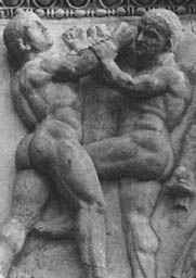
Hand-to-hand combat (sometimes abbreviated as HTH or H2H) is a physical confrontation between two or more persons at short range (grappling distance or within the physical reach of a handheld weapon) that does not involve the use of weapons.Hunsicker, A., ''Advanced Skills in Executive Protection'', Boca Raton FL: Universal Publishers, , , p. 51 The phrase "hand-to-hand" sometimes include use of melee weapons such as knives, swords, clubs, spears, axes, or improvised weapons such as entrenching tools. While the term "hand-to-hand combat" originally referred principally to engagements by combatants on the battlefield, it can also refer to any personal physical engagement by two or more people, including law enforcement officers, civilians, and criminals. Combat within close quarters, to a range just beyond grappling distance, is commonly termed close combat or close-quarters combat. It may include lethal and non-lethal weapons and methods depending upon the restrictions impos ... [...More Info...] [...Related Items...] OR: [Wikipedia] [Google] [Baidu] |
Havana
Havana (; Spanish: ''La Habana'' ) is the capital and largest city of Cuba. The heart of the La Habana Province, Havana is the country's main port and commercial center.Cuba ''''. . The city has a population of 2.3million inhabitants, and it spans a total of – making it the largest city by area, the most populous city, and the [...More Info...] [...Related Items...] OR: [Wikipedia] [Google] [Baidu] |
Spanish Treasure Fleet
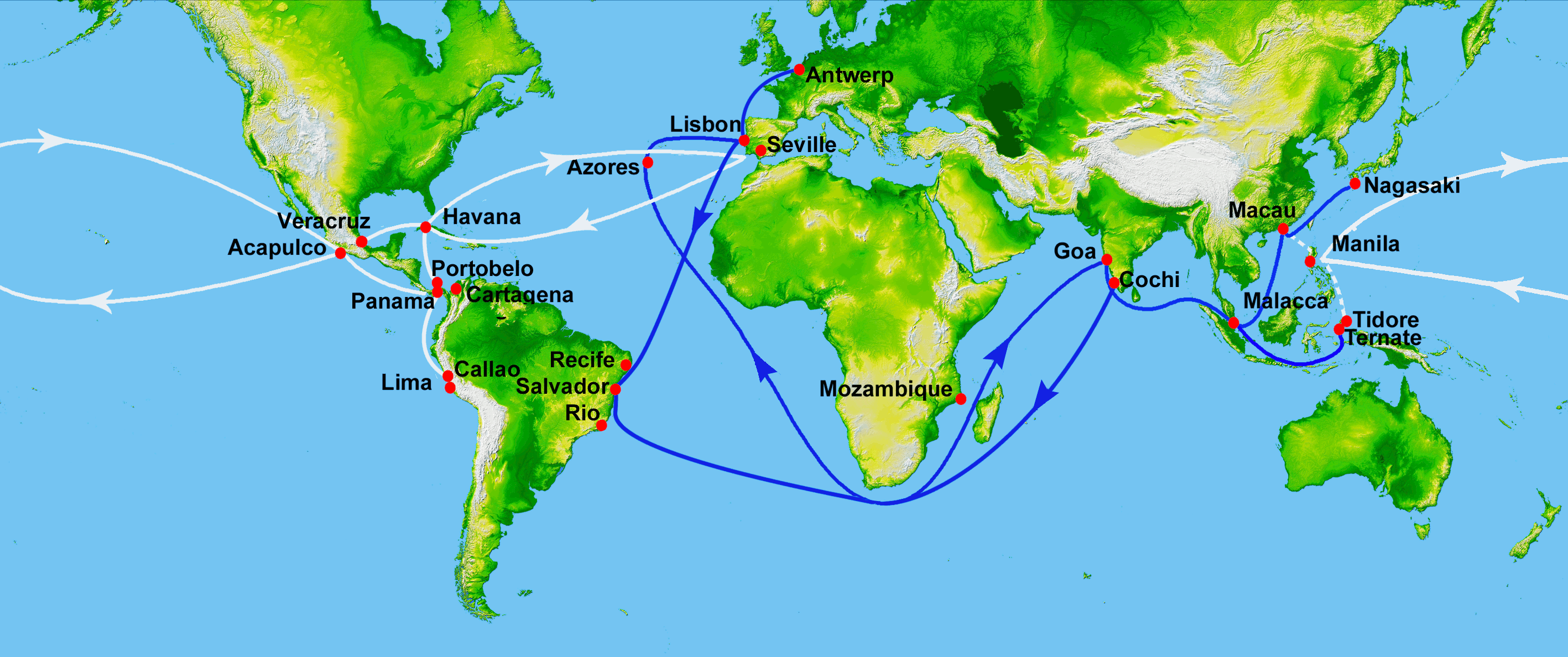
The Spanish treasure fleet, or West Indies Fleet ( es, Flota de Indias, also called silver fleet or plate fleet; from the es, label=Spanish, plata meaning "silver"), was a convoy system of sea routes organized by the Spanish Empire from 1566 to 1790, which linked Spain with its territories in the Americas across the Atlantic. The convoys were general purpose cargo fleets used for transporting a wide variety of items, including agricultural goods, lumber, various metal resources such as silver and gold, gems, pearls, spices, sugar, tobacco, silk, and other exotic goods from the overseas territories of the Spanish Empire to the Spanish mainland. Spanish goods such as oil, wine, textiles, books and tools were transported in the opposite direction. The West Indies fleet was the first permanent transatlantic trade route in history. Similarly, the related Manila galleon trade was the first permanent trade route across the Pacific. The Spanish West and East Indies fleets are considered ... [...More Info...] [...Related Items...] OR: [Wikipedia] [Google] [Baidu] |
Santo Domingo
, total_type = Total , population_density_km2 = auto , timezone = AST (UTC −4) , area_code_type = Area codes , area_code = 809, 829, 849 , postal_code_type = Postal codes , postal_code = 10100–10699 (Distrito Nacional) , website Ayuntamiento del Distrito Nacional Santo Domingo ( meaning "Saint Dominic"), once known as Santo Domingo de Guzmán and Ciudad Trujillo, is the capital and largest city of the Dominican Republic and the largest metropolitan area in the Caribbean by population. As of 2022, the city and immediate surrounding area (the Distrito Nacional) had a population of 1,484,789, while the total population is 2,995,211 when including Greater Santo Domingo (the "metropolitan area"). The city is coterminous with the boundaries of the Distrito Nacional ("D.N.", "National District"), itself bordered on three sides by Santo Domingo Province. Founded by the Spanish in 1496, on the east bank of the Ozama River and then moved by Nicolás de Ovando in 1502 ... [...More Info...] [...Related Items...] OR: [Wikipedia] [Google] [Baidu] |
Tiburon Peninsula
The Tiburon Peninsula (french: Péninsule de Tiburon), or The Xaragua Peninsula, simply "the Tiburon" (''le Tiburon''), is a region of Haiti encompassing most of Haiti's southern coast. It starts roughly at the southernmost point of the Haiti-Dominican Republic border and extends westward near Cuba, forming a large headland. Three of Haiti's ten departments are located entirely within the region. They are the departments of Grand'Anse, Nippes and Sud. Etymology The wordTiburonand Xaragua are linked to the Taino natives who were the region's first inhabitants. The region is often referred to as the Great South, le Grand-Sud (french), or Nansid (Haitian). Administrative Division The Tiburon is 1 of the 4 regions of Haiti, administrated through 4 departments and 1 arrondissement. Half of Sud-Est is also located within the Tiburon Peninsula. A large part of Ouest department is also located in the region, with the capital, Port-au-Prince serving as the line of demarcation betw ... [...More Info...] [...Related Items...] OR: [Wikipedia] [Google] [Baidu] |


