|
Washington County, Oregon
Washington County is one of 36 counties in the U.S. state of Oregon and part of the Portland metropolitan area. The 2020 census recorded the population as 600,372, making it the second most populous county in the state and most populous "Washington County" in the United States. Hillsboro is the county seat and largest city, while other major cities include Beaverton, Tigard, Cornelius, Banks, Gaston, Sherwood, North Plains, and Forest Grove, the county's oldest city. Originally named Twality when created in 1843, the Oregon Territorial Legislature renamed it for the nation's first president in 1849 and included the entire northwest corner of Oregon before new counties were created in 1854. The Tualatin River and its drainage basin lie almost entirely within the county, which shares its boundaries with the Tualatin Valley. It is bordered on the west and north by the Northern Oregon Coast Range, on the south by the Chehalem Mountains, and on the north and east by the Tuala ... [...More Info...] [...Related Items...] OR: [Wikipedia] [Google] [Baidu] |
George Washington
George Washington (February 22, 1732, 1799) was an American military officer, statesman, and Founding Father who served as the first president of the United States from 1789 to 1797. Appointed by the Continental Congress as commander of the Continental Army, Washington led the Patriot forces to victory in the American Revolutionary War and served as the president of the Constitutional Convention of 1787, which created the Constitution of the United States and the American federal government. Washington has been called the " Father of his Country" for his manifold leadership in the formative days of the country. Washington's first public office was serving as the official surveyor of Culpeper County, Virginia, from 1749 to 1750. Subsequently, he received his first military training (as well as a command with the Virginia Regiment) during the French and Indian War. He was later elected to the Virginia House of Burgesses and was named a delegate to the Continental Congress ... [...More Info...] [...Related Items...] OR: [Wikipedia] [Google] [Baidu] |
Tualatin River
The Tualatin River is a tributary of the Willamette River in Oregon in the United States. The river is about long, and it drains a fertile farming region called the Tualatin Valley southwest and west of Portland, Oregon, Portland at the northwest corner of the Willamette Valley. There are approximately 500,000 people residing on 15 percent of the land in the river's watershed. Course The Tualatin River arises near Windy Point on the eastern side of the Northern Oregon Coast Range. It begins in the Tillamook State Forest in Washington County and flows about to the Willamette River near West Linn in Clackamas County. The maps, which include river mile (RM) markers from the mouth to RM 76.7 or river kilometer (RK) 123.4, cover the following quadrants from mouth to source: Canby, Lake Oswego, Beaverton, Scholls, Hillsboro, Laurelwood, Forest Grove, Gaston, Turner Creek, and Gobblers Knob. Along the way, it falls from about above sea level to about , most of that ... [...More Info...] [...Related Items...] OR: [Wikipedia] [Google] [Baidu] |
Westside Express Service
The Westside Express Service (WES) is a commuter rail line serving part of the Portland metropolitan area's Washington County and a small portion of Clackamas County in the U.S. state of Oregon. Owned by TriMet and operated by Portland & Western Railroad (P&W), the line is long and travels north–south from Beaverton to Wilsonville via Tigard and Tualatin, along a route just west of Oregon Highway 217 (OR 217) and Interstate 5 (I-5). It consists of five stations and connects with MAX Light Rail at Beaverton Transit Center. Service operates on a 30-minute headway on weekdays during the morning and evening rush hours. In Spring 2022, the service saw daily ridership of 420 passengers, about 109,000 rides annually. Local officials in Washington County began studying the feasibility of an intercity commuter rail line in 1996, and the Washington County (Wilsonville to Beaverton) Commuter Rail Project acquired approval from affected jurisdictions in 2002. Construction commenced ... [...More Info...] [...Related Items...] OR: [Wikipedia] [Google] [Baidu] |
TriMet
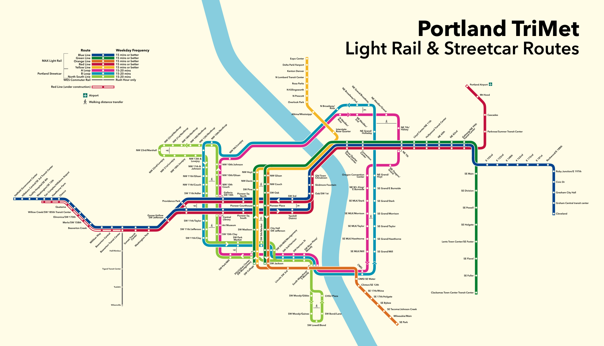
TriMet, formally known as the Tri-County Metropolitan Transportation District of Oregon, is a public agency that operates mass transit in a region that spans most of the Portland metropolitan area in the U.S. state of Oregon. Created in 1969 by the Oregon legislature, the district replaced five private bus companies that operated in the three counties: Multnomah, Washington, and Clackamas. TriMet started operating a light rail system, MAX, in 1986, which has since been expanded to five lines that now cover , as well as the WES Commuter Rail line in 2009. It also provides the operators and maintenance personnel for the city of Portland-owned Portland Streetcar system. In , the system had a ridership of , or about per weekday as of . In addition to rail lines, TriMet provides the region's bus system, as well as LIFT paratransit service. There are 688 buses in TriMet's fleet that operate on 85 lines. In 2018, the entire system averaged 310,000 rides per weekday and operat ... [...More Info...] [...Related Items...] OR: [Wikipedia] [Google] [Baidu] |
Oregon Route 8
Oregon Route 8, also known as Oregon Highway 8, is an Oregon state highway which serves the western suburbs of Portland. The road is locally known as Canyon Road and Tualatin Valley Highway, and travels through the center of the Tualatin Valley. Oregon 8 is located entirely within Washington County. The portion of the route from US 26 to Oregon Route 47 is part of the National Highway System, listed as a principal arterial. Route description The eastern terminus of OR 8 is an interchange with U.S. Route 26 (which is, at that point, the Sunset Highway) just west of the Portland city limits and the Washington- Multnomah county line. Initially, it is also known as Canyon Road, since it comes out of the gulch in which the Sunset Highway runs. The official designation, beginning from the eastern terminus, is the Tualatin Valley Highway No. 29 (see Oregon highways and routes). Continuing west, OR 8 enters the suburb of Beaverton, and after its interchange with Oregon Route 21 ... [...More Info...] [...Related Items...] OR: [Wikipedia] [Google] [Baidu] |
Oregon Route 10
Oregon Route 10 is an Oregon state highway which serves Portland and some of its western suburbs. Route description OR 10 begins as Naito Parkway in Downtown Portland starting where Naito Parkway interchanges with U.S. Route 26. It heads south out of downtown, multiplexed with Oregon Route 99W. After passing under the Portland Aerial Tram, Naito Parkway ends at an interchange with Barbur Boulevard; the two routes continue south out of Portland on Barbur. OR 10 separates from OR 99W a few miles south of downtown, and proceeds along Capitol Highway through the Portland neighborhood of Hillsdale. Along here, it is a surface street, which cuts through the southern part of Portland's West Hills. It separates from Capitol Highway in Hillsdale, which continues unnumbered, and becomes the Beaverton-Hillsdale Highway, highway number 40, a surface street with frequent traffic signals. The highway continues west into Washington County. In the community of Raleigh Hills, OR 10 inter ... [...More Info...] [...Related Items...] OR: [Wikipedia] [Google] [Baidu] |
Oregon Route 47
Oregon Route 47 is an Oregon state highway that runs between the Willamette Valley, near McMinnville, and the city of Clatskanie, along the Columbia River in the northwest part of the state. OR 47 traverses several highways of the Oregon state highway system: part of the Tualatin Valley Highway No. 29, part of the Nehalem Highway No. 102, part of the Sunset Highway No. 47, and the Mist–Clatskanie Highway No. 110. Route description Oregon Route 47 begins (at its southern terminus) at a junction with Oregon Route 99W between the cities of McMinnville and Lafayette.http://egov.oregon.gov/ODOT/TD/TDATA/rics/docs/NumRouteMap_enl.pdf , Portland Area Enlargement of map of State of Oregon Highway system-2006 This stretch is known as the Tualatin Valley Highway. It continues north along the western edge of the Willamette Valley, hugging the Coast Range. It passes through parts of Oregon's wine country (and some prime agricultural land), and through small tow ... [...More Info...] [...Related Items...] OR: [Wikipedia] [Google] [Baidu] |
Oregon Route 217
Oregon Route 217 is an Oregon state highway which serves the western suburbs of Portland. OR 217 is a controlled-access highway which connects U.S. Route 26 with Interstate 5. OR 217 consists of the Beaverton-Tigard Highway 144 (see Oregon highways and routes). Route description For most of its length, OR 217 is a freeway with two travel lanes in each direction, with a third weave lane for exiting and merging, with the exception of its two termini. The southern terminus of OR 217 is an interchange with I-5. From there, OR 217 proceeds north, through suburbs of Tigard and Beaverton. The northern terminus of OR 217 is an interchange with US 26, at that point a freeway known as the Sunset Highway. Commuters heading towards either terminus will find themselves on surface streets if they fail to exit. Indeed, southbound travelers wishing to get onto northbound I-5 have to turn left at a traffic signal; southbound travelers of I-5 wishing to become northbound travelers of O ... [...More Info...] [...Related Items...] OR: [Wikipedia] [Google] [Baidu] |
Sunset Highway (Oregon)
Sunset Highway may refer to: *Sunset Highway (Oregon) Sunset Highway may refer to: * Sunset Highway (Oregon), the westernmost portion of U.S. Highway 26 in Oregon *Sunset Highway (Washington) Primary State Highways were major state highways in the U.S. state of Washington used in the early 20th cen ..., the westernmost portion of U.S. Highway 26 in Oregon * Sunset Highway (Washington), a.k.a. Primary State Highway 2 {{Road disambiguation ... [...More Info...] [...Related Items...] OR: [Wikipedia] [Google] [Baidu] |
Interstate 205 (Oregon-Washington)
Interstate 205 may refer to either of two unconnected Interstate Highways in the United States, both of which are related to Interstate 5 * Interstate 205 (California), a connector in the San Francisco Bay Area * Interstate 205 (Oregon–Washington) Interstate 205 (I-205) is an auxiliary Interstate Highway in the Portland metropolitan area of Oregon and Washington, United States. The north–south freeway serves as a bypass route of I-5 along the east side of Portland, Oregon, and Va ..., a bypass of Portland, Oregon {{road disambiguation 05-2 2 ... [...More Info...] [...Related Items...] OR: [Wikipedia] [Google] [Baidu] |
Interstate 5 In Oregon
Interstate 5 (I-5) in the U.S. state of Oregon is a major Interstate Highway that traverses the state from north to south. It travels to the west of the Cascade Mountains, connecting Portland to Salem, Eugene, Medford, and other major cities in the Willamette Valley and across the northern Siskiyou Mountains. The highway runs from the California state line near Ashland to the Washington state line in northern Portland, forming the central part of Interstate 5's route between Mexico and Canada. I-5 was designated in 1957 and replaced U.S. Route 99 (US 99) for most of its length, itself preceded by the Pacific Highway and various wagon roads. The freeway incorporated early bypasses and expressways built for US 99 in the 1950s, including a new freeway route from Portland to Salem, and additional bypasses were built using federal funds. The last segment of I-5, on the Marquam Bridge in Portland, was opened in October 1966 and the whole highway was dedicated later t ... [...More Info...] [...Related Items...] OR: [Wikipedia] [Google] [Baidu] |
Tualatin Mountains
The Tualatin Mountains (also known as the West Hills or Southwest Hills of Portland) are a range on the western border of Multnomah County, Oregon, United States. A spur of the Northern Oregon Coast Range, they separate the Tualatin Basin of Washington County, Oregon, from the Portland Basin of western Multnomah County and Clark County, Washington. The highest peak in the range is Dixie Mountain at . Other notable peaks include Cornell Mountain at 1,270 feet (390m), Council Crest at , and Pittock Hill, location of the Pittock Mansion. Despite steep slopes, periodic landslides, and multiple earthquake faults, many residences have been built in the Tualatin Mountains, though much of the northern portion is undeveloped land within the Forest Park. The landscape, inside and outside the park, is predominantly forested. History The hills date from the late Cenozoic era, and range up to over . Composed mainly of basalt, the mountains were formed by several flows of the Grande Ronde ... [...More Info...] [...Related Items...] OR: [Wikipedia] [Google] [Baidu] |


