|
Wari River
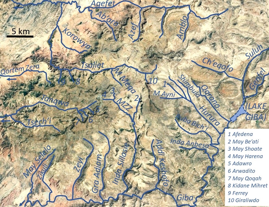
Wari River is a river of northern Ethiopia and a tributary of the Tekezé River. It rises in the Gar'alta and flows to the southwest into the Tekezé at . Tributaries of the Wari include the Assam, Chemit, Meseuma, Tsedia, Agefet and Tsaliet rivers. The general drainage is westward, to the Tekezze River. Main tributaries in Dogu’a Tembien district are, from upstream to downstream * Agefet River ** Amblo River, in ''tabia'' Addi Walka ** Azef River, at the border of ''tabias'' Addi Walka and Haddinnet ** Ab'aro River, in ''tabia'' Haddinnet and ''woreda'' Kola Tembien * May Leiba, in ''tabia'' Ayninbirkekin, which becomes Tinsehe R. in Selam and Mahbere Sillasie, and Tsaliet River, downstream from the Dabba Selama monastery ** Khunale River, in ''tabia'' Selam ** Harehuwa River, in ''tabia'' Mahbere Sillasie ** Kidan Mihret River, in ''tabia'' Mahbere Sillasie ** Ferrey River, at the border of ''tabias'' Mahbere Sillasie and Degol Woyane See also * List of rivers of Ethiopi ... [...More Info...] [...Related Items...] OR: [Wikipedia] [Google] [Baidu] |
Kola Tembien
Kola Tembien (, "Lower Tembien") is a woreda in Tigray Region, Ethiopia. It is named in part after the former province of Tembien. Part of the Mehakelegnaw Zone, Kola Tembien is bordered on the south by Abergele, on the west by the Tekezé River which separates it from the Semien Mi'irabawi (North Western) Zone, on the north by the Wari River which separates it from Naeder Adet and Werie Lehe, on the east by Misraqawi (Eastern) Zone, and on the southeast by Degua Tembien. Towns in Kola Tembien include Guya and Werkamba. The town of Abiy Addi is surrounded by Kola Tembien. Demographics Based on the 2007 national census conducted by the Central Statistical Agency of Ethiopia (CSA), this woreda has a total population of 134,336, an increase of 28.13% over the 1994 census, of whom 66,925 are men and 67,411 women; 0 or 0.00% are urban inhabitants. With an area of 2,538.39 square kilometers, Kola Tembien has a population density of 52.92, which is 56.29 than the Zone average ... [...More Info...] [...Related Items...] OR: [Wikipedia] [Google] [Baidu] |
List Of Rivers Of Ethiopia
This is a list of streams and rivers in Ethiopia, arranged geographically by drainage basin. There is an alphabetic list at the end of this article. Flowing into the Mediterranean *''Nile (Egypt, Sudan)'' Atbarah River *Mareb River (or Gash River) (only reaches the Atbarah in times of flood) **Obel River *Tekezé River (or Takkaze or Setit) ** Zarima River **Ataba River **Wari River *** Qortem Zer'a *** Tsaliet **** Agefet ***** Ab'aro ***** Azef River ***** Amblo **** Korowya **** Ferrey River **** Kidane Mihret River **** May Meqa **** Graliwdo ** Giba River *** Tanqwa **** Tsech'i River **** May Qoqah **** Arwadito **** Adawro River *** May Selelo *** Zikuli River *** Gra Adiam River, also called Bitchoqo River *** Zeyi River *** Inda Sillasie River **** May Zegzeg ***** May Harena ***** May Sho'ate **** May Be'ati River *** Addi Keshofo River *** May Gabat *** Inda Anbesa *** Ruba Bich'i River *** Hurura **** Afedena River ***** May Ayni **** Shimbula *** Ila ... [...More Info...] [...Related Items...] OR: [Wikipedia] [Google] [Baidu] |
Degol Woyane
Degol Woyane is a ''tabia'' or municipality in the Dogu'a Tembien district of the Tigray Region of Ethiopia. It includes Dabba Selama, the oldest monastery of Ethiopia, and the most inaccessible in the world. The ''tabia'' centre is in Zala village, located approximately 10 km to the west of the ''woreda'' town Hagere Selam. Geography The ''tabia'' stretches down west of Melfa, along the westernmost ridge of Dogu'a Tembien. The highest peak is T'afa (2580 m a.s.l.) and the lowest place Addi Welo (1990 m a.s.l.). Geology From the higher to the lower locations, the following geological formations are present: * Lower basalt * Amba Aradam Formation * Adigrat Sandstone Springs As there are no permanent rivers, the presence of springs is of utmost importance for the local people. The following are the springs in the tabia: * May Dara in Zala * Addi Welo Livelihood The population lives essentially from crop farming, supplemented with off-season work in nearby towns. T ... [...More Info...] [...Related Items...] OR: [Wikipedia] [Google] [Baidu] |
Ferrey River
Ferrey is a river of the Nile basin. Rising in the mountains of Dogu’a Tembien in northern Ethiopia, it flows northward to empty finally in Weri’i and Tekezé River. Characteristics It is a confined bedrock river, with an average slope gradient of 141 metres per kilometre. Flash floods and flood buffering Runoff mostly happens in the form of high runoff discharge events that occur in a very short period (called flash floods). These are related to the steep topography, often little vegetation cover and intense convective rainfall. The peaks of such flash floods have often a 50 to 100 times larger discharge than the preceding baseflow. The magnitude of floods in this river has however been decreased due to interventions in the catchment: exclosures have been established; the dense vegetation largely contributes to enhanced infiltration, less flooding and better baseflow. Physical conservation structures such as stone bunds and check dams also intercept runoff. Irrigate ... [...More Info...] [...Related Items...] OR: [Wikipedia] [Google] [Baidu] |
Dabba Selama
Dabba may refer to: * Dabba or tiffin carrier, a lunch box used in South Asia * ''The Lunchbox'', working title ''Dabba'', a 2013 Indian film * Dabba (company), a South African telco company * ∂, a mathematical symbol * Beast of the Earth, or ''Dabbat al-Ardḍ'', an apocalyptic creature in Islam See also * Dhaba A dhaba is a roadside restaurant in the Indian subcontinent, primarily across Pakistan and India. They are on highways, generally serve local cuisine, and also serve as truck stops. They are most commonly found next to petrol stations, and mos ..., the name for a roadside restaurant in South Asia * Daba (other) * Dabbas (other) * Yabba Dabba Doo (other) {{Disambiguation ... [...More Info...] [...Related Items...] OR: [Wikipedia] [Google] [Baidu] |
Tsaliet
Tsaliet is a river in northern Ethiopia, belonging to the Nile basin. Rising in the mountains of Dogu’a Tembien, where it is first called May Leiba River and then Tinsehe River, it flows westward through a deep gorge, to become Tsaliet in its lower course, where it empties in Weri’i River, just upstream of the main Weri’i bridge along the road to Adwa. Characteristics It is mostly a confined river, locally meandering in its narrow alluvial plain, with an average slope gradient of 25 metres per kilometre. With its tributaries, the river has cut deep gorges. Along the middle of its course, it occupies sandy pediments in Addeha. Flash floods and flood buffering Runoff mostly happens in the form of high runoff discharge events that occur in a very short period (called flash floods). These are related to the steep topography, often little vegetation cover and intense convective rainfall. The peaks of such flash floods have often a 50 to 100 times larger discharge than the ... [...More Info...] [...Related Items...] OR: [Wikipedia] [Google] [Baidu] |
Mahbere Sillasie
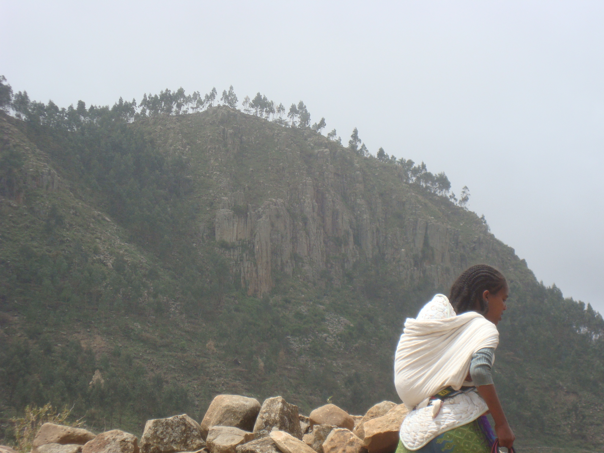
Mahbere Sillasie is a ''tabia'' or municipality in the Dogu'a Tembien district of the Tigray Region of Ethiopia. The ''tabia'' centre is in Guderbo village, located approximately 2.5 km to the west-northwest of the ''woreda'' town Hagere Selam. Geography The ''tabia'' stretches down from the ridge west of Hagere Selam, northbound towards Tsaliet river. The highest peak is just south of Guderbo (2730 m a.s.l.) and the lowest place deep in the Tsaliet gorge (1780 m a.s.l.). Geology From the higher to the lower locations, the following geological formations are present: * Phonolite plugs * Upper basalt * Interbedded lacustrine deposits * Lower basalt * Amba Aradam Formation * Antalo Limestone * Adigrat Sandstone Climate The rainfall pattern shows a very high seasonality with 70 to 80% of the annual rain falling in July and August. Mean temperature in Guderbo is 17.4 °C, oscillating between average daily minimum of 9.6 °C and maximum of 24.8 ... [...More Info...] [...Related Items...] OR: [Wikipedia] [Google] [Baidu] |
Selam (Dogu'a Tembien)
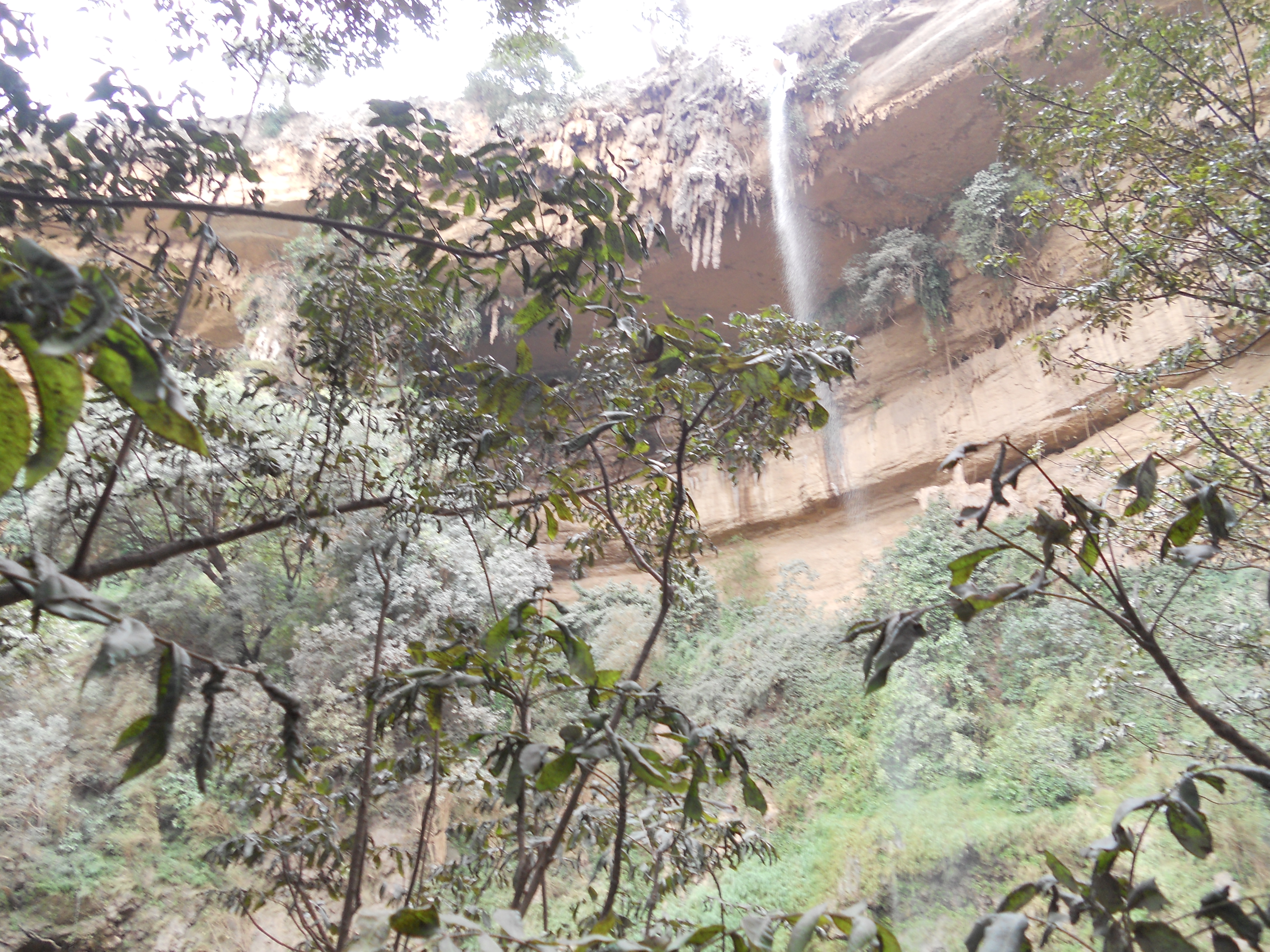
Selam is a ''tabia'' or municipality in the Dogu'a Tembien district of the Tigray Region of Ethiopia. The ''tabia'' centre is in Addi Werho village, located approximately 3 km to the northeast of the ''woreda'' town Hagere Selam. Geography The ''tabia'' stretches down north of the ridge occupied by the main road towards the Tinsehe gorge. The highest peak is Imba Khoboro (2730 m a.s.l.) and the lowest place at the foot of the waterfall in Tinsehe (2000 m a.s.l.). Geology From the higher to the lower locations, the following geological formations are present: * Phonolite plugs * Upper basalt * Interbedded lacustrine deposits * Lower basalt * Amba Aradam Formation * Antalo Limestone * Quaternary alluvium and freshwater tufa Geomorphology and soils The main geomorphic units, with corresponding soil types are: Hagere Selam Highlands, along the upper basalt and sandstone ridge * Associated soil types ** shallow soils with high stone contents (Ske ... [...More Info...] [...Related Items...] OR: [Wikipedia] [Google] [Baidu] |
Ayninbirkekin
Ayninbirkekin is a ''tabia'' or municipality in the Degua Tembien, Dogu'a Tembien district of the Tigray Region of Ethiopia. Literal meaning of Ayninbirkekin in Tigrinya is "We will not bend". The ''tabia'' centre is in Halah village, located approximately 8 km to the east of the ''woreda'' town Hagere Selam (Degua Tembien), Hagere Selam. Main town is Ala'isa, situated on the ridge overseeing the Giba valley. Geography The ''tabia'' is located astride a main water divide (that is followed by the main road) and stretches down towards May Zegzeg river at the south and upper Tsaliet River at the north. Three highest places (at around 2600 m a.s.l.) are Meri’a Ziban in the west, Imba Ra’isot in the centre and the escarpment to Arebay at the north. The lowest places are the confluence of May Zegzeg and May Be’ati Rivers (1970 m a.s.l.) in the south and in the north May Leiba River near Iyesus church (2240 m a.s.l.). Geology From the higher to the lower ... [...More Info...] [...Related Items...] OR: [Wikipedia] [Google] [Baidu] |
Ab'aro
Ab’aro is a river of the Nile basin. Rising in the mountains of Dogu’a Tembien in northern Ethiopia, it flows northwestward to empty finally in Weri’i and Tekezé River. Characteristics Ab’aro is a confined ephemeral river in its upper part, whereas it widely meanders in the lower plains, with an average slope gradient of 60 metres per kilometre. Towards the footslope the river has cut a deep gorge (a cluse). Flash floods Runoff mostly occurs in the form of high runoff discharge events that occur in a very short period (called flash floods). These are related to the steep topography, often little vegetation cover and intense convective rainfall. The peaks of such flash floods have often a 50 to 100 times larger discharge than the preceding baseflow. In contrast to neighbouring rivers such as May Meqa, May Shoate or Giraliwdo, the magnitude of floods in Ab’aro has not been decreased due to interventions in the catchment. Physical conservation structures such as ... [...More Info...] [...Related Items...] OR: [Wikipedia] [Google] [Baidu] |
Atbara OSM
Atbara (sometimes Atbarah) ( ar, عطبرة ʿAṭbarah) is a city located in River Nile State in northeastern Sudan. Because of its links to the railway industry, Atbara is also known as the "Railway City'. As of 2007, its population is 111,399. History The confluence of the Nile and its most northern tributary, the Atbarah River (Bahr-el-Aswad, or Black River) was a strategic location for military operations. in the year 1619 Atbara was conquered and sacked by forces of the Ethiopian Empire. In the Battle of Atbara, fought on 8 April 1898 near Nakheila, on the north bank of the river, Lord Kitchener's Anglo-Egyptian army defeated the Mahdist forces, commanded by Amir Mahmud Ahmad. Kitchener's strengthened position led to a decisive victory at the Battle of Omdurman on 2 September 1898, giving the British control over the Sudan. The town was the centre of the Sudanese railway industry. Few trains are made here now and rail traffic is much reduced. The original sta ... [...More Info...] [...Related Items...] OR: [Wikipedia] [Google] [Baidu] |


.jpg)

