|
Walnut–Locust Station
Walnut–Locust/Avenue of the Arts (also Walnut–Locust) is a subway station on SEPTA's Broad Street Line in Philadelphia, Pennsylvania. The station is located between Walnut Street and Locust Street at 200 South Broad Street in the Avenue of the Arts district of Center City, Philadelphia. Walnut–Locust is served by local trains, special express trains for sporting events, and is the southern terminus for express trains, which reverse direction on tracks immediately south of the station. On the special service, the station is the last stop before its terminus at the NRG station. It is the southernmost station in the Center City Concourse, the 500,000+ sq ft underground pedestrian concourse in Center City, which extends to Spruce Street. The concourse connects to City Hall Station, the Market–Frankford Line, Subway–Surface Trolley Lines, Regional Rail and PATCO Speedline's 12–13th & Locust Station and 15–16th & Locust Station. However, no free interchange is a ... [...More Info...] [...Related Items...] OR: [Wikipedia] [Google] [Baidu] |
Broad Street (Philadelphia)
upright=1.2, The Northern terminus of Broad Street on the border of Philadelphia and Cheltenham Township Broad Street is a major arterial street in Philadelphia, Pennsylvania. The street runs for approximately , beginning at the intersection of Cheltenham Avenue on the border of Cheltenham Township and the West/ East Oak Lane neighborhoods of North Philadelphia to the Philadelphia Navy Yard in South Philadelphia. It is Pennsylvania Route 611 along its entire length with the exception of its northernmost part between Old York Road and Pennsylvania Route 309 (Cheltenham Avenue) and the southernmost part south of Interstate 95. Broad Street runs along a north–south axis between 13th Street and 15th Street, containing what would otherwise be known as 14th Street in the Philadelphia grid plan. It is interrupted by Philadelphia City Hall, which stands where Broad and Market Street would intersect in the center of the city. The streets of Penn Square, Juniper Street, Joh ... [...More Info...] [...Related Items...] OR: [Wikipedia] [Google] [Baidu] |
SEPTA Subway–Surface Trolley Lines
The Southeastern Pennsylvania Transportation Authority (SEPTA) is a regional public transportation authority that operates transit bus, bus, rapid transit, commuter rail, light rail, and electric trolleybus services for nearly 4 million people in five counties in and around Philadelphia, Pennsylvania. It also manages projects that maintain, replace and expand its infrastructure, facilities and vehicles. SEPTA is the major transit provider for Philadelphia and the counties of Delaware County, Pennsylvania, Delaware, Montgomery County, Pennsylvania, Montgomery, Bucks County, Pennsylvania, Bucks, and Chester County, Pennsylvania, Chester. It is a state-created authority, with the majority of its board appointed by the five Pennsylvania counties it serves. While several SEPTA commuter rail lines terminate in the nearby states of Delaware and New Jersey, additional service to Philadelphia from those states is provided by other agencies: the PATCO Speedline from Camden County, New Jer ... [...More Info...] [...Related Items...] OR: [Wikipedia] [Google] [Baidu] |
Railway Stations In Philadelphia
Rail transport (also known as train transport) is a means of transport that transfers passengers and goods on wheeled vehicles running on rails, which are incorporated in tracks. In contrast to road transport, where the vehicles run on a prepared flat surface, rail vehicles (rolling stock) are directionally guided by the tracks on which they run. Tracks usually consist of steel rails, installed on sleepers (ties) set in ballast, on which the rolling stock, usually fitted with metal wheels, moves. Other variations are also possible, such as "slab track", in which the rails are fastened to a concrete foundation resting on a prepared subsurface. Rolling stock in a rail transport system generally encounters lower frictional resistance than rubber-tyred road vehicles, so passenger and freight cars (carriages and wagons) can be coupled into longer trains. The operation is carried out by a railway company, providing transport between train stations or freight customer facilit ... [...More Info...] [...Related Items...] OR: [Wikipedia] [Google] [Baidu] |
SEPTA Broad Street Line Stations
The Southeastern Pennsylvania Transportation Authority (SEPTA) is a regional public transportation authority that operates bus, rapid transit, commuter rail, light rail, and electric trolleybus services for nearly 4 million people in five counties in and around Philadelphia, Pennsylvania. It also manages projects that maintain, replace and expand its infrastructure, facilities and vehicles. SEPTA is the major transit provider for Philadelphia and the counties of Delaware, Montgomery, Bucks, and Chester. It is a state-created authority, with the majority of its board appointed by the five Pennsylvania counties it serves. While several SEPTA commuter rail lines terminate in the nearby states of Delaware and New Jersey, additional service to Philadelphia from those states is provided by other agencies: the PATCO Speedline from Camden County, New Jersey is run by the Delaware River Port Authority, a bi-state agency; NJ Transit operates many bus lines and a commuter rail line to ... [...More Info...] [...Related Items...] OR: [Wikipedia] [Google] [Baidu] |
Island Platform
An island platform (also center platform, centre platform) is a station layout arrangement where a single platform is positioned between two tracks within a railway station, tram stop or transitway interchange. Island platforms are popular on twin-track routes due to pragmatic and cost reasons. They are also useful within larger stations where local and express services for the same direction of travel can be provided from opposite sides of the same platform thereby simplifying transfers between the two tracks. An alternative arrangement is to position side platforms on either side of the tracks. The historical use of island platforms depends greatly upon the location. In the United Kingdom the use of island platforms is relatively common when the railway line is in a cutting or raised on an embankment, as this makes it easier to provide access to the platform without walking across the tracks. Advantages and tradeoffs Island platforms are necessary for any station with many th ... [...More Info...] [...Related Items...] OR: [Wikipedia] [Google] [Baidu] |
Rittenhouse Square
Rittenhouse Square is a neighborhood, including a public park, in Center City Philadelphia. The park is one of the five original open-space parks planned by William Penn and his surveyor Thomas Holme during the late 17th century. The neighborhood is among the highest-income urban neighborhoods in the country. Together with Fitler Square, the Rittenhouse neighborhood and the square comprise the Rittenhouse–Fitler Historic District. Rittenhouse Square Park is maintained by the non-profit group The Friends of Rittenhouse Square. The square cuts off 19th Street at Walnut Street and also at a half-block above Manning Street. Its boundaries are 18th Street to the east, Walnut St. to the north, Rittenhouse Square West (a north–south boundary street), and Rittenhouse Square South (an east–west boundary street), making the park approximately two short blocks on each side. History Originally called Southwest Square, Rittenhouse Square was renamed in 1825 after David Rittenhouse ... [...More Info...] [...Related Items...] OR: [Wikipedia] [Google] [Baidu] |
Washington Square (Philadelphia)
Washington Square (originally designated in 1682 as Southeast Square) is a open-space park in Center City, Philadelphia, The southeast quadrant and one of the five original planned squares laid out on the city grid by William Penn's surveyor, Thomas Holme. It is part of both the Washington Square West and Society Hill neighborhoods. In 2005, the National Park Service took over ownership and management of Washington Square, through an easement from the City of Philadelphia. It is now part of Independence National Historical Park. History By the early 18th century the square started being used as a burial ground. Originally divided into triangles by two creeks, the northwestern portion was the potter's field, and the southeastern section was for the burial of Catholics. The joining of the creeks created a fishing pond, and the grounds were commonly used for grazing by neighbors' cows. In 1776 it became the final resting place for Washington's fallen soldiers. Long mass grave ... [...More Info...] [...Related Items...] OR: [Wikipedia] [Google] [Baidu] |
Academy Of Music (Philadelphia)
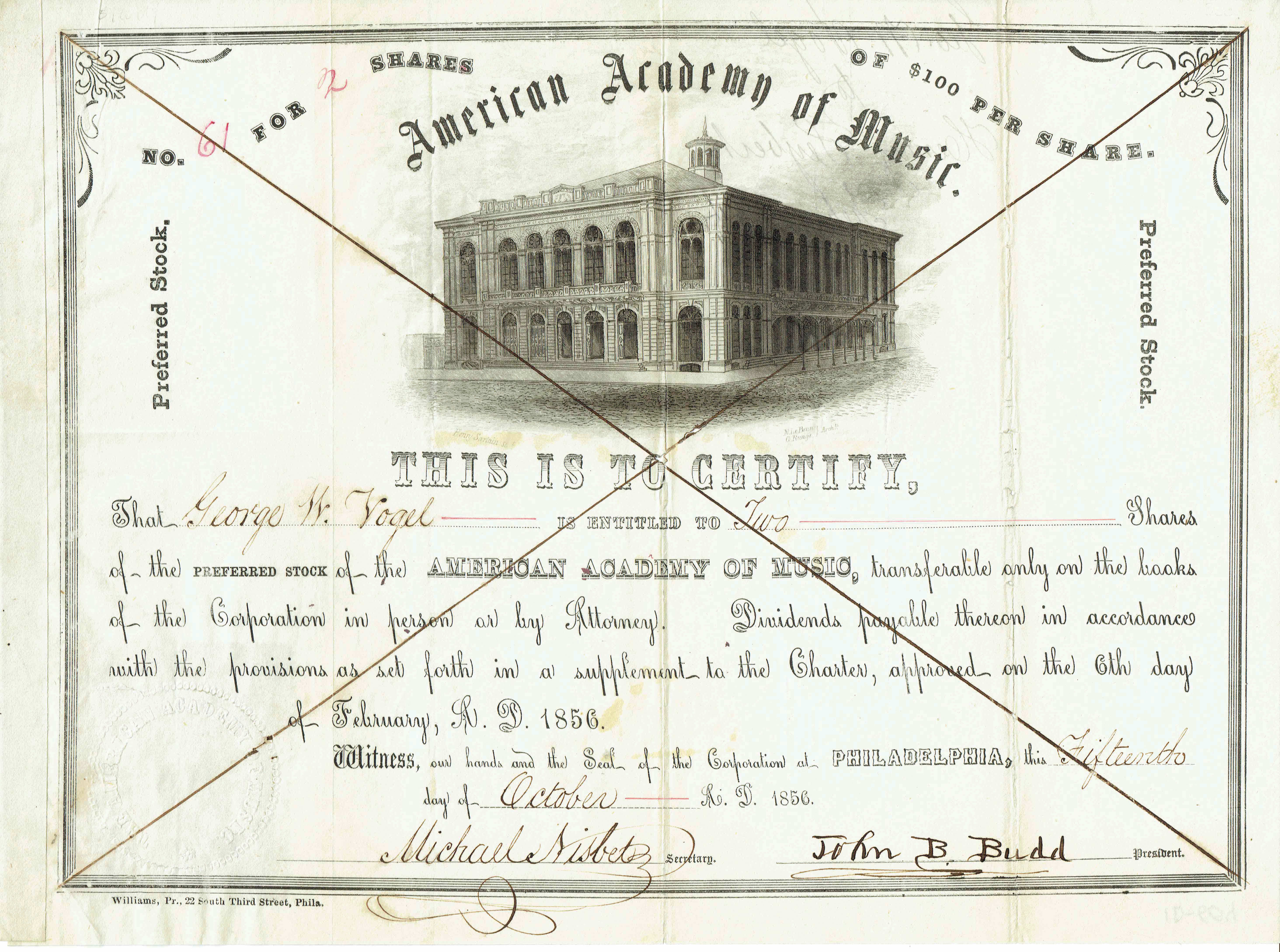
The Academy of Music, also known as American Academy of Music, is a concert hall and opera house located at 240 S. Broad Street in Philadelphia, Pennsylvania. Its location is between Locust and Manning Streets in the Avenue of the Arts area of Center City. The hall was built in 1855–57 and is the oldest opera house in the United States that is still used for its original purpose. Known as the "Grand Old Lady of Locust Street," the venue is the home of the Philadelphia Ballet and Opera Philadelphia. It was also home to the Philadelphia Orchestra from its inception in 1900 until 2001, when the orchestra moved to the new Kimmel Center for the Performing Arts. The Philadelphia Orchestra still retains ownership of the Academy. The hall was designated a National Historic Landmark in 1962.Charles E. Shedd Jr., et al. (December 1979) , National Park Service and History The Academy of Music held an inaugural ball on January 26, 1857. At the time ''The New York Times'' described ... [...More Info...] [...Related Items...] OR: [Wikipedia] [Google] [Baidu] |
Kimmel Center For The Performing Arts
The Kimmel Center for the Performing Arts is a large performing arts venue at 300 South Broad Street and the corner of Spruce Street, along the stretch known as the Avenue of the Arts in Center City Philadelphia, Pennsylvania. It is owned and operated by Kimmel Cultural Center, which also manages the Academy of Music in Philadelphia, and, as of November 2016, the Miller Theater. The center is named after philanthropist Sidney Kimmel. The center is the home of the Philadelphia Orchestra, one of America's "Big Five" symphony orchestras. It is also the home venue of the Philadelphia Youth Orchestra, Chamber Orchestra of Philadelphia, Philadanco, the Philadelphia Chamber Music Society, and the ''Kimmel Center Presents'' performance series, which features a variety of jazz, classical, and world pop performers. History In 1986, the Philadelphia Orchestra approved a plan to construct a new concert hall to replace the aging Academy of Music. It hoped to complete the new facili ... [...More Info...] [...Related Items...] OR: [Wikipedia] [Google] [Baidu] |
15–16th & Locust Station
15–16th & Locust station is the western terminus of the PATCO Speedline in the Rittenhouse Square neighborhood of Center City Philadelphia. The station has a single island platform with a fare mezzanine above. The mezzanine level connects to the Downtown Link concourse, which connects to , , , and stations in the Center City area. Notable places nearby The station is within walking distance of the following notable places: * Academy of Music * Avenue of the Arts * Kimmel Center for the Performing Arts * Miller Theatre * Rittenhouse Square Rittenhouse Square is a neighborhood, including a public park, in Center City Philadelphia. The park is one of the five original open-space parks planned by William Penn and his surveyor Thomas Holme during the late 17th century. The neighborho ... * University of the Arts * Wilma Theater References External links 15th–16th & Locust (PATCO) {{DEFAULTSORT:15-16th and Locust station PATCO Speedline stations in Philadelph ... [...More Info...] [...Related Items...] OR: [Wikipedia] [Google] [Baidu] |
12–13th & Locust (PATCO Station)
1 (one, unit, unity) is a number representing a single or the only entity. 1 is also a numerical digit and represents a single unit of counting or measurement. For example, a line segment of ''unit length'' is a line segment of length 1. In conventions of sign where zero is considered neither positive nor negative, 1 is the first and smallest positive integer. It is also sometimes considered the first of the infinite sequence of natural numbers, followed by 2, although by other definitions 1 is the second natural number, following 0. The fundamental mathematical property of 1 is to be a multiplicative identity, meaning that any number multiplied by 1 equals the same number. Most if not all properties of 1 can be deduced from this. In advanced mathematics, a multiplicative identity is often denoted 1, even if it is not a number. 1 is by convention not considered a prime number; this was not universally accepted until the mid-20th century. Additionally, 1 is the s ... [...More Info...] [...Related Items...] OR: [Wikipedia] [Google] [Baidu] |
PATCO Speedline
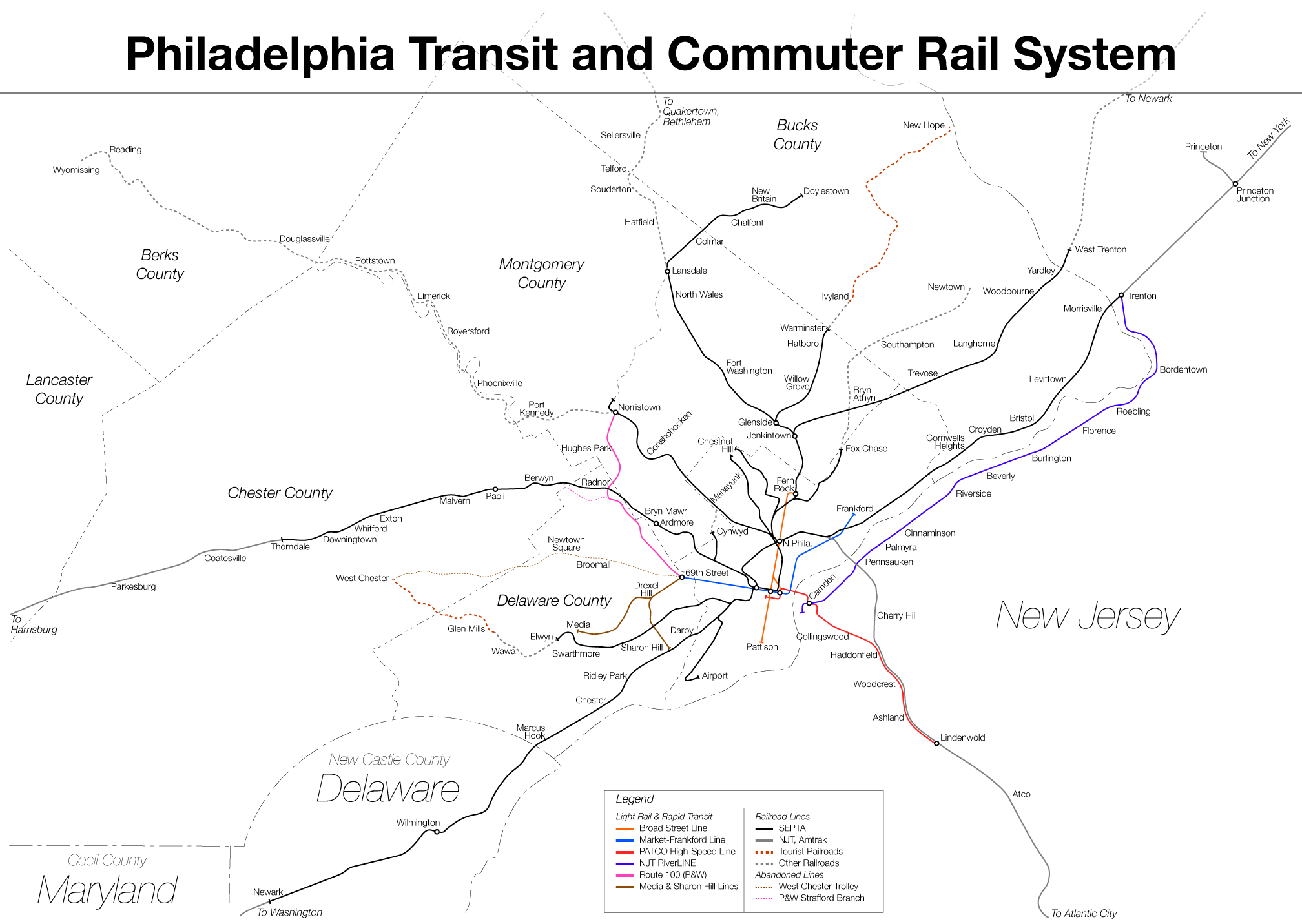
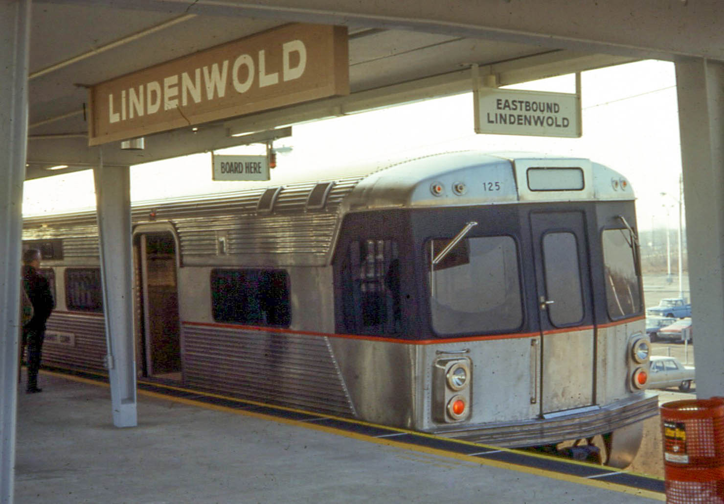
The PATCO Speedline (signed in Philadelphia as the Lindenwold Line and also known colloquially as the PATCO High Speed Line) is a rapid transit route operated by the Port Authority Transit Corporation (PATCO), which runs between Philadelphia, Pennsylvania and Camden County, New Jersey. The line runs underground in Philadelphia, crosses the Delaware River on the Benjamin Franklin Bridge, runs underground in Camden, then runs above ground to the east end of the line in Lindenwold, New Jersey. The Port Authority Transit Corporation and the Speedline are owned and operated by the Delaware River Port Authority. The line opened between Lindenwold and Camden on January 4, 1969 with the full line to Philadelphia opening a few weeks later on February 15, 1969. The PATCO Speedline operates 24 hours a day, one of only a few U.S. mass transit systems to do so. In , the line saw rides, or about per weekday in . History Philadelphia to Camden The modern-day PATCO Speedline follow ... [...More Info...] [...Related Items...] OR: [Wikipedia] [Google] [Baidu] |


