|
Waimarino County
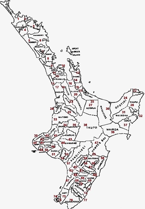
Waimarino County is a former county of New Zealand. It was defined in 1910 by the Kaitieke County Act 1910 as follows: Waimarino County was amalgamated with Raetihi Borough and Ohakune Borough to form Waimarino District in 1988. See also * List of former territorial authorities in New Zealand § Counties References Counties of New Zealand {{ManawatuWanganui-geo-stub ... [...More Info...] [...Related Items...] OR: [Wikipedia] [Google] [Baidu] |
Counties Of New Zealand
A system of counties of New Zealand was instituted after the country dissolved its provinces in 1876, and these counties were similar to other countries' systems, lasting with little change (except mergers and other localised boundary adjustments) until 1989, when they were reorganised into district and city councils within a system of larger regions. History The Counties Bill of 1876 was initiated to merge 314 road boards into 39 counties. However, as a result of lobbying the number of counties had grown to 63 by the time the bill was enacted. They had chairmen, not mayors as boroughs and cities had; many legislative provisions (such as burial and land subdivision control) were different for the counties. By 1966, there were 112 counties. During the second half of the 20th century, many counties received overflow population from nearby cities. The result was often a merger of the two into a "district" (e.g., Rotorua) or a change of name to "district" (e.g., Waimairi) or "c ... [...More Info...] [...Related Items...] OR: [Wikipedia] [Google] [Baidu] |
Kaitieke County Act
Kaitieke or Kaitīeke is a rural community, located south of Taumarunui and west of Raurimu, in the Ruapehu District and Manawatū-Whanganui region of New Zealand's North Island. The area's name translates as ''to eat'' (''kai'') ''the saddleback bird'' (''tieke''). History The area's steep rugged hills and valleys were once covered in thick native forest. However, with the arrival of European settlers in the early 1900s, most local forests were felled for farming between 1908 and 1915. Kaitīeke School opened in 1910, and some small sawmills operated in the area during the 1920s. The Spanish flu had a devastating impact on the community in November 1918, killing about 23% of the local Māori population. Painter Edward (Ted) Lattey farmed south of the settlement in the 1920s, before leaving the King Country to become a professional painter. He became known for his paintings of native forests, including King Country scenes. During World War I and again during the Great Depr ... [...More Info...] [...Related Items...] OR: [Wikipedia] [Google] [Baidu] |
Wellington
Wellington ( mi, Te Whanganui-a-Tara or ) is the capital city of New Zealand. It is located at the south-western tip of the North Island, between Cook Strait and the Remutaka Range. Wellington is the second-largest city in New Zealand by metro area, and is the administrative centre of the Wellington Region. It is the world's southernmost capital of a sovereign state. Wellington features a temperate maritime climate, and is the world's windiest city by average wind speed. Legends recount that Kupe discovered and explored the region in about the 10th century, with initial settlement by Māori iwi such as Rangitāne and Muaūpoko. The disruptions of the Musket Wars led to them being overwhelmed by northern iwi such as Te Āti Awa by the early 19th century. Wellington's current form was originally designed by Captain William Mein Smith, the first Surveyor General for Edward Wakefield's New Zealand Company, in 1840. The Wellington urban area, which only includes urbanised ar ... [...More Info...] [...Related Items...] OR: [Wikipedia] [Google] [Baidu] |
Kaitieke County
The Retaruke River is a river in the North Island of New Zealand. It joins with the Whanganui River at Whakahoro just above Wade's Landing and downstream from Taumarunui. The river flows through the farming communities of Upper and then Lower Retaruke Valley. Downstream from this junction is the Mangapurua Landing with its Bridge to Nowhere, servicing the ill-fated Mangapurua Valley farming community. Sources The river source is located south west of National Park in the Erua Forest. The river initially flows south west through the forest before bending to flow north west. Geology Most of the valley is made up of Early Miocene Mahoenui Group rocks. About 65,000 years ago movement of the Waimarino Fault probably allowed capture of the Waimarino Stream and/or Makatote River by the Manganuiateao River, which would have reduced erosion by ending the incidence of lahars and reducing flows in the Retaruke River. Coal was discovered in 1909 in the Late Miocene Whang ... [...More Info...] [...Related Items...] OR: [Wikipedia] [Google] [Baidu] |
Rangitikei, New Zealand
The Rangitikei District is a territorial authority district located primarily in the Manawatū-Whanganui region in the North Island of New Zealand, although a small part, the town of Ngamatea (13.63% by land area), lies in the Hawke's Bay Region. It is located in the southwest of the island, and follows the catchment area of the Rangitīkei River. The Rangitikei District Council is the local government authority for this district. It is composed of a mayor, currently Andy Watson, and 11 councillors, one of whom is the deputy mayor. History The Rangitikei District was established in 1989 as part of the 1989 local government reforms. Government and politics Local government The current Mayor of Rangitikei is Andy Watson, elected in 2013 and re-elected in 2016 and 2019. Watson was first elected in 2013 by obtaining 1,983 votes (41.5%) of the vote and a majority of 486 (10.2%) beating incumbent mayor Chalky Leary. Rangitikei District Council is served by eleven councill ... [...More Info...] [...Related Items...] OR: [Wikipedia] [Google] [Baidu] |
Whanganui
Whanganui (; ), also spelled Wanganui, is a city in the Manawatū-Whanganui region of New Zealand. The city is located on the west coast of the North Island at the mouth of the Whanganui River, New Zealand's longest navigable waterway. Whanganui is the 19th most-populous urban area in New Zealand and the second-most-populous in Manawatū-Whanganui, with a population of as of . Whanganui is the ancestral home of Te Āti Haunui-a-Pāpārangi and other Whanganui Māori tribes. The New Zealand Company began to settle the area in 1840, establishing its second settlement after Wellington. In the early years most European settlers came via Wellington. Whanganui greatly expanded in the 1870s, and freezing works, woollen mills, phosphate works and wool stores were established in the town. Today, much of Whanganui's economy relates directly to the fertile and prosperous farming hinterland. Like several New Zealand urban areas, it was officially designated a city until an administrativ ... [...More Info...] [...Related Items...] OR: [Wikipedia] [Google] [Baidu] |
Ohakune
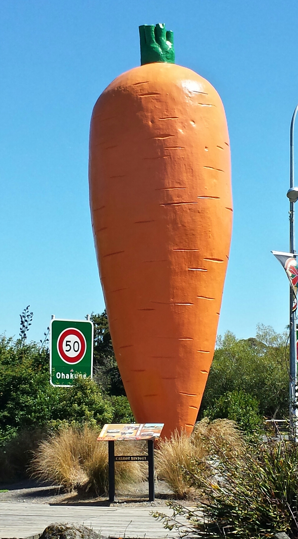
Ohakune is a small town at the southern end of Tongariro National Park, close to the southwestern slopes of the active volcano Mount Ruapehu, in the North Island of New Zealand. A rural service town known as New Zealand's Carrot Capital, Ohakune is a popular base in winter for skiers using the ski fields (particularly Turoa) of Mount Ruapehu and in summer for trampers hiking the Tongariro Alpine Crossing. Toponymy The Ngāti Rangi iwi say the Māori language name ''Ohakune'' comes from the phrase "''he Ohakune ki te ao''", which broadly means "an opening to a new world" and refers to the descent from Mount Ruapehu into the valley and swamps of the area. In 2019 the New Zealand Geographic Board changed the official name to ''Ōhakune'', indicating that the first letter was a long vowel, but swiftly reverted to ''Ohakune'' without a macron when Ngāti Rangi objected. History and culture Pre-European history The lands to the south and west of Mount Ruapehu were historically i ... [...More Info...] [...Related Items...] OR: [Wikipedia] [Google] [Baidu] |
Raetihi
Raetihi, a small town in the center of New Zealand's North Island, is located at the junction of State Highways 4 and 49 in the Manawatū-Whanganui region. It lies in a valley between Tongariro and Whanganui National Parks, 11 kilometres west of Ohakune's ski fields. Early history and economy Evidence of Māori people living here in the fourteenth century has been found. Ngāti Uenuku dwelled at Raetihi and Waimarino (known now as National Park, located approximately 35 kilometers/22 miles north on Highway 4). There is little evidence of large permanent settlements but hunting parties were common during warmer months. In 1887 the Government purchased the Waimarino block from local Māori, and the first European settlement, at Karioi, involved setting sheep to graze on open tussock land. Between 1908 and 1947 the area provided 700 million superficial feet of building timber. The remnants of 150 sawmills have been discovered, and the milling of rimu, tōtara, kahikatea, māt ... [...More Info...] [...Related Items...] OR: [Wikipedia] [Google] [Baidu] |
Waimarino District
Waimarino is the original name of the town National Park, New Zealand. It was renamed to avoid confusion, as increasingly the wider area was referred to by the same name. Waimarino may refer to the following: * Waimarino district, an area at the foot of Mount Ruapehu * Waimarino (New Zealand electorate), an electorate centred on Waimarino * Waimarino County, a former territorial local authority * Waimarino Museum Raetihi, a small town in the center of New Zealand's North Island, is located at the junction of State Highways 4 and 49 in the Manawatū-Whanganui region. It lies in a valley between Tongariro and Whanganui National Parks, 11 kilometres west ..., a museum in Raetihi * Waimarino River, a river in the region {{disambiguation, geo ... [...More Info...] [...Related Items...] OR: [Wikipedia] [Google] [Baidu] |


.jpg)
