|
Waiapu County
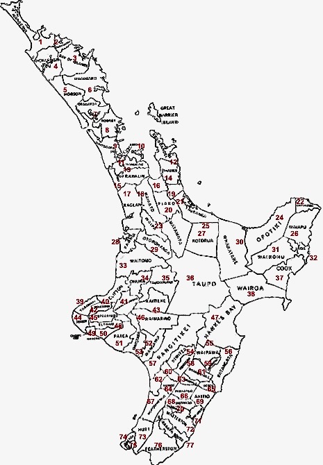
Waiapu County was one of the counties of New Zealand on the North Island. Development under difficulties NB: This section is derived from text in availablhereat the New Zealand Electronic Text Centre. The Waiapu County, which then included the area which became Matakaoa County, was formed in 1890. Its first council comprised: E. H. Henderson, W. Milner, A. H. Wallis, Travers, Connolly and White. At a meeting at Port Awanui on 27 December 1890, Mr. Henderson was elected chairman. In March 1874, there were only 32 European residents on the East Coast above Uawa—9 males and 3 females in the Te Araroa district, and 13 males and 7 females in Waiapu. By 1878 the number of pākehā had risen to 109. The 1906 census showed 858 Europeans and 2,611 Maoris. Previously, the native census had been taken on a tribal basis. In 1926 (exclusive of Matakaoa) the figures were: Europeans, 1,809; Maoris, 3,292; and, in 1945: Europeans, 1,641; Maoris, 4,341, plus 3 per cent, representing resi ... [...More Info...] [...Related Items...] OR: [Wikipedia] [Google] [Baidu] |
County (New Zealand)
A system of counties of New Zealand was instituted after the country dissolved its provinces in 1876, and these counties were similar to other countries' systems, lasting with little change (except mergers and other localised boundary adjustments) until 1989, when they were reorganised into district and city councils within a system of larger regions. History The Counties Bill of 1876 was initiated to merge 314 road boards into 39 counties. However, as a result of lobbying the number of counties had grown to 63 by the time the bill was enacted. They had chairmen, not mayors as boroughs and cities had; many legislative provisions (such as burial and land subdivision control) were different for the counties. By 1966, there were 112 counties. During the second half of the 20th century, many counties received overflow population from nearby cities. The result was often a merger of the two into a "district" (e.g., Rotorua) or a change of name to "district" (e.g., Waimairi) or "c ... [...More Info...] [...Related Items...] OR: [Wikipedia] [Google] [Baidu] |
Waiomatatini
Ruatoria ( mi, Ruatōria) is a town in the Waiapu Valley of the Gisborne Region in the northeastern corner of New Zealand's North Island. The town was originally known as Cross Roads then Manutahi and was later named Ruatorea in 1913, after the Māori language, Māori Master female grower ''Tōrea'' who had some of the finest storage pits in her Iwi at the time (Te-Rua-a-Tōrea ). In 1925 the name was altered to "Ruatoria", although some texts retain the original spelling. Ruatoria's Whakarua Park is the home of the East Coast Rugby Football Union. Demographics The population of Ruatoria was 759 in the 2018 census, an increase of 39 from 2013. There were 396 males and 360 females. 20.2% of people identified as European/Pākehā and 95.3% as Māori. 32.0% were under 15 years old, 21.3% were 15–29, 37.6% were 30–64, and 9.1% were 65 or older. The statistical area of Ruatoria-Raukumara, which at 693 square kilometres is much larger than this town, had a population of 1,233 at ... [...More Info...] [...Related Items...] OR: [Wikipedia] [Google] [Baidu] |
Tikitiki
Tikitiki is a small town in Waiapu Valley on the north bank of the Waiapu River in the Gisborne Region of the North Island of New Zealand. The area in which the town resides was formerly known as ''Kahukura''. By road, Tikitiki is north-northeast of Gisborne, northeast by north of Ruatoria, and south by east of Te Araroa. The name of the town comes from the full name of Māui, Māui-tikitiki-a-Taranga (Māui wrapped in the topknot of Taranga). State Highway 35 passes through the town at the easternmost point of the New Zealand state highway network. The town is from the smaller town of Rangitukia, near the mouth of the Waiapu River. These towns historically had a racecourse, four rugby teams, and several shops fuelled by a thriving dairy industry. In the 1950s and 1960s the towns had a combined population of 6,000, but economic downturn in the area in the mid to late 1960s led to urban drift, and 2011 figures put the population of both towns at 528. 95% of the towns' inhabita ... [...More Info...] [...Related Items...] OR: [Wikipedia] [Google] [Baidu] |
Flood
A flood is an overflow of water ( or rarely other fluids) that submerges land that is usually dry. In the sense of "flowing water", the word may also be applied to the inflow of the tide. Floods are an area of study of the discipline hydrology and are of significant concern in agriculture, civil engineering and public health. Human changes to the environment often increase the intensity and frequency of flooding, for example land use changes such as deforestation and removal of wetlands, changes in waterway course or flood controls such as with levees, and larger environmental issues such as climate change and sea level rise. In particular climate change's increased rainfall and extreme weather events increases the severity of other causes for flooding, resulting in more intense floods and increased flood risk. Flooding may occur as an overflow of water from water bodies, such as a river, lake, or ocean, in which the water overtops or breaks levees, resulting ... [...More Info...] [...Related Items...] OR: [Wikipedia] [Google] [Baidu] |
Wagon
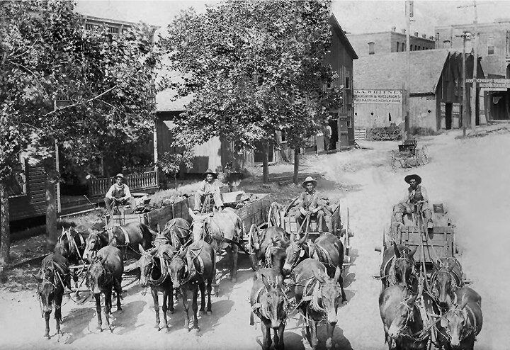
A wagon or waggon is a heavy four-wheeled vehicle pulled by draught animals or on occasion by humans, used for transporting goods, commodities, agricultural materials, supplies and sometimes people. Wagons are immediately distinguished from carts (which have two wheels) and from lighter four-wheeled vehicles primarily for carrying people, such as carriages. Animals such as horses, mules, or oxen usually pull wagons. One animal or several, often in pairs or teams may pull wagons. However, there are examples of human-propelled wagons, such as mining corfs. A wagon was formerly called a wain and one who builds or repairs wagons is a wainwright. More specifically, a wain is a type of horse- or oxen-drawn, load-carrying vehicle, used for agricultural purposes rather than transporting people. A wagon or cart, usually four-wheeled; for example, a haywain, normally has four wheels, but the term has now acquired slightly poetical connotations, so is not always used with technical ... [...More Info...] [...Related Items...] OR: [Wikipedia] [Google] [Baidu] |
New Zealand Pound
The pound (symbol £, £NZ. for distinction) was the currency of New Zealand from 1840 until 1967, when it was replaced by the New Zealand dollar. Like the pound sterling, it was subdivided into 20 shillings (abbreviation s or /) each of 12 penny, pence (symbol d). History Up until the outbreak of the World War I, First World War, the New Zealand pound was at parity with one pound sterling. As a result of the great depression of the early 1930s, the New Zealand agricultural export market to the UK was badly affected. Australian banks, which controlled the New Zealand exchanges with London, devalued the New Zealand pound to match the value of the Australian pound in 1933, from parity or £NZ 1 = £1 sterling to £NZ 1 = 16s sterling (£0.8). In 1948 it returned to parity with sterling or £NZ.1 = £1 sterling. In 1967, New Zealand decimalised its currency, replacing the pound with the New Zealand dollar, dollar at a rate of $NZ 2 = £NZ 1 (o ... [...More Info...] [...Related Items...] OR: [Wikipedia] [Google] [Baidu] |
Tokomaru Bay
Tokomaru Bay is a small beachside community located on the isolated East Coast of New Zealand's North Island. It is 91 km north of Gisborne, on State Highway 35, and close to Mount Hikurangi. The district was originally known as Toka-a-Namu, which refers to the abundance of sandflies. Over the years the name was altered to Tokomaru Bay. The two hapu or sub-tribes that reside in Tokomaru Bay are Te Whanau a Ruataupare and Te Whānau a Te Aotawarirangi. The ancestral mountain of Tokomaru Bay is Marotiri. The ancestral river is Mangahauini. History and culture The seven-kilometre wide bay is small but sheltered, and was a calling place for passenger ships until the early 20th century. Captain Cook spent time here on his 1769 journey of discovery, and later European settlement included a whaling station. A visit by missionaries William Williams, William Colenso, Richard Matthews and James Stack heralded the coming of Christianity to the district in 1838 and their crusa ... [...More Info...] [...Related Items...] OR: [Wikipedia] [Google] [Baidu] |
Fascine
A fascine is a rough bundle of brushwood or other material used for strengthening an earthen structure, or making a path across uneven or wet terrain. Typical uses are protecting the banks of streams from erosion, covering marshy ground and so on. In war they have often been used to help armiesin modern times, especially tanks and other vehiclescross trenches, valleys, marshes, muddy or uneven terrain, etc. Early military use Fascine bundles were used defensively for revetting (shoring up) trenches or ramparts, especially around artillery batteries, or offensively to fill in ditches and cross obstacles on a battlefield. Fascine bridges are a regularly attested feature of Roman military engineering and would have been widespread in the ancient world due to their usefulness and ease of construction. During the Siege of Alesia, the Gauls repeatedly attempted to repel the invading Romans by filling their trenches in with fascines and covering their traps, to support their counter ... [...More Info...] [...Related Items...] OR: [Wikipedia] [Google] [Baidu] |
Leptospermum Scoparium
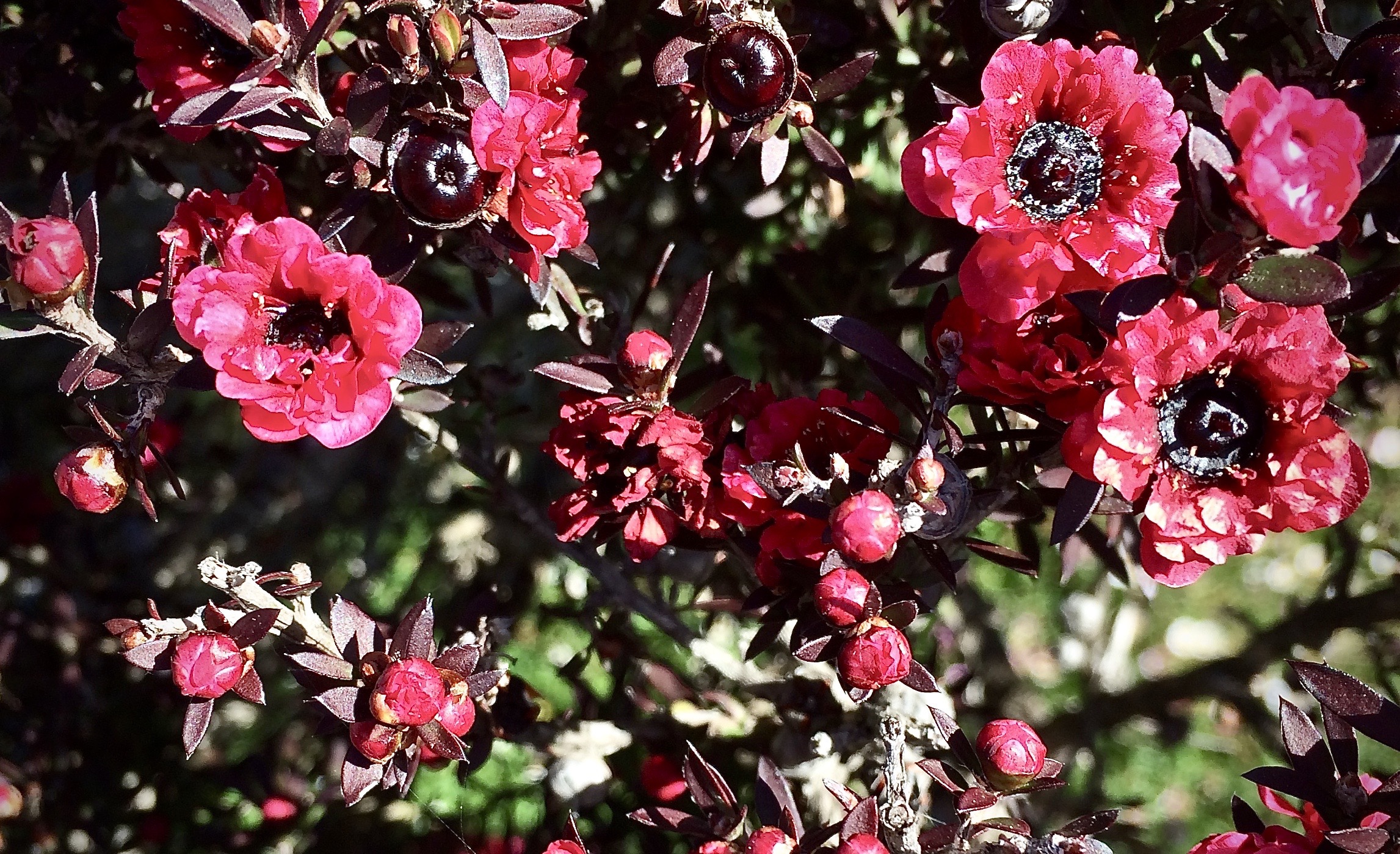
''Leptospermum scoparium'', commonly called mānuka, () mānuka myrtle, New Zealand teatree, broom tea-tree, or just tea tree, is a species of flowering plant in the myrtle family Myrtaceae, native to New Zealand (including the Chatham Islands) and south-east Australia. Its nectar produces Mānuka honey. Description Mānuka is a prolific shrub-type tree and is often one of the first species to regenerate on cleared land. It is typically a shrub growing to tall, but can grow into a moderately sized tree, up to or so in height. It is evergreen, with dense branching and small leaves long and broad, with a short spine tip. The flowers are white, occasionally pink, – rarely up to – in diameter, with five petals. The wood is tough and hard. Mānuka is often confused with the related species kānuka (''Kunzea ericoides'') – the easiest way to tell the difference between the two species in the field is to feel their foliage – mānuka leaves are prickly, while kānuka lea ... [...More Info...] [...Related Items...] OR: [Wikipedia] [Google] [Baidu] |
Hikuwai River
The Hikuwai River is the name for the middle section of the Ūawa River in the Gisborne Region of New Zealand. The river flows south through a valley between two hill ridges to the north of Tolaga Bay, and for most of its length runs parallel with the Pacific coast, which lies to the east. The Hikuwai river section ends at the confluence with the Mangatokerau River before the Ūawa River into the sea at Tolaga Bay. In March 2022, heavy rainfall in the region caused the river to rise by over 9.6 metres, causing the nearby town of Mangatuna to be evacuated. See also *List of rivers of New Zealand This is a list of all waterways named as rivers in New Zealand. A * Aan River * Acheron River (Canterbury) * Acheron River (Marlborough) * Ada River * Adams River * Ahaura River * Ahuriri River * Ahuroa River * Akatarawa River * Ākiti ... References Rivers of the Gisborne District Rivers of New Zealand {{Gisborne-river-stub ... [...More Info...] [...Related Items...] OR: [Wikipedia] [Google] [Baidu] |
Tolaga Bay
Tolaga Bay ( mi, Uawa) is both a bay and small town on the East Coast of New Zealand's North Island located 45 kilometres northeast of Gisborne and 30 kilometres south of Tokomaru Bay. The region around the bay is rugged and remote, and for many years the only access to the town was by boat. Because the bay is shallow, a long wharf – the second longest in New Zealand (600m) after the Tiwai Point wharf at Bluff (1,500m) – was built in the 1920s to accommodate visiting vessels. The last cargo ship to use the wharf loaded a cargo of maize in 1967. The town is a popular holiday spot. Its population is predominantly Māori, a centre of the Te Aitanga-a-Hauiti hapū and home of Ariki – Te Kani a Takirau and Tohunga – Rangiuia. Geography The Uawa River reaches the Pacific Ocean in the middle of Tolaga Bay. There is a bar at the river mouth with around 2 metres of water at high tide. The Uawa River is called the Hikuwai further up. Tributaries include the Waiau and the Mangah ... [...More Info...] [...Related Items...] OR: [Wikipedia] [Google] [Baidu] |


