|
Wadi Tayyibah
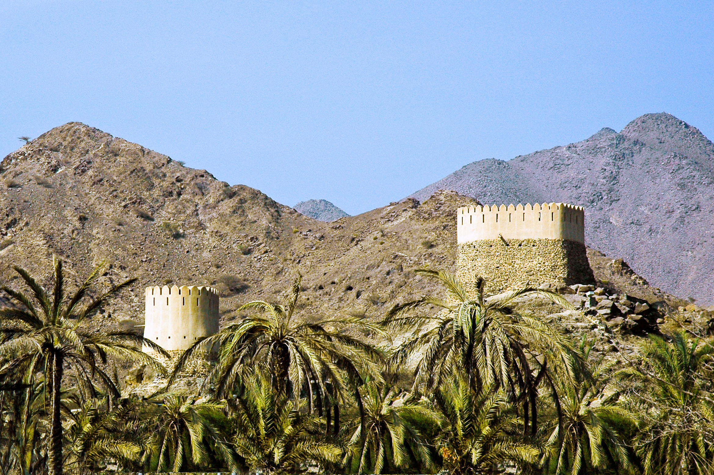
Wadi Tayyibah is a seasonal watercourse, or wadi, in the Hajar Mountains of Fujairah, United Arab Emirates. It runs from the village of Tayyibah to join the ''Seih'' Dibba or Dibba Plain, where it fans out into the plain. Prior to 1960, Wadi Tayyibah provided the main route from Masafi to Dibba and sections of tarmac are still visible, particularly on the lower reaches of the wadi as it approaches the village of Al Hala. The wadi was superseded as the main road to Dibba when the Trucial Oman Scouts built a new road in 1960, dynamiting passes through the mountains., p.174. The road was controversial in the area as it deprived the people of the village of Tayyibah of revenue from passing traffic and fighting broke out between the Sharqiyin residents of Tayyibah and members of the Mazari tribe from the nearby community of Wadi Asimah, with men from Tayyibah attacking workers on the new road project. The Wadi was traditionally an area of intensive agricultural development, providing s ... [...More Info...] [...Related Items...] OR: [Wikipedia] [Google] [Baidu] |
Wadi
Wadi ( ar, وَادِي, wādī), alternatively ''wād'' ( ar, وَاد), North African Arabic Oued, is the Arabic term traditionally referring to a valley. In some instances, it may refer to a wet (ephemeral) riverbed that contains water only when heavy rain occurs. Etymology The term ' is very widely found in Arabic toponyms. Some Spanish toponyms are derived from Andalusian Arabic where ' was used to mean a permanent river, for example: Guadalcanal from ''wādī al-qanāl'' ( ar, وَادِي الْقَنَال, "river of refreshment stalls"), Guadalajara from ''wādī al-ḥijārah'' ( ar, وَادِي الْحِجَارَة, "river of stones"), or Guadalquivir, from ''al-wādī al-kabīr'' ( ar, اَلْوَادِي الْكَبِير, "the great river"). General morphology and processes Wadis are located on gently sloping, nearly flat parts of deserts; commonly they begin on the distal portions of alluvial fans and extend to inland sabkhas or dry lakes. In basin and r ... [...More Info...] [...Related Items...] OR: [Wikipedia] [Google] [Baidu] |
Al Hajar Mountains
The Hajar Mountains ( ar, جِبَال ٱلْحَجَر, Jibāl al-Ḥajar, ''The Rocky Mountains'' or ''The Stone Mountains'') in northeastern Oman and also the eastern United Arab Emirates are the highest mountain range in the eastern Arabian peninsula. Also known as "Oman Mountains", they separate the low coastal plain of Oman from the high desert plateau, and lie inland from the Gulf of Oman. ''Al'' () means "the", and ''Ḥajar'' () means "stone" or "rock". So ''al-Ḥajar'' () is named as "the stone" or "the rock". Geology Orography and tectonic setting The Hajar Mountains extend for through the UAE and Oman. They are located on the north-east corner of the Arabian Plate, reaching from the Musandam Peninsula through to the east coast of Oman. The range is about wide, with Jabal Shams being the highest peak at 3,009 m (9,872 ft) in the central region of the mountains. Currently, the Arabian Plate is moving north relative to the Eurasian Plate at per ye ... [...More Info...] [...Related Items...] OR: [Wikipedia] [Google] [Baidu] |
Emirate Of Fujairah
The Emirate of Fujairah ( ar, إِمَـارَة ٱلْفُجَيْرَة ' ) is one of the seven emirates that make up the United Arab Emirates. The only of the seven with a coastline solely on the Gulf of Oman and none on the Persian Gulf, its capital is Fujairah. History The Emirate of Fujairah, dominated by the ''Sharqiyin'' tribe, sits at the mouth of the important trade route, the ''Wadi Ham'' (which is guarded by the Sharqiyin Al Bithnah Fort), through the mountains to the interior and the Persian Gulf Coast. Known as the ''Shamaliyah'', the east coast of what is now the UAE was subject to Muscat until 1850, when it was annexed by ''Al Qasimi'' of Sharjah, in an agreement made between Sheikh Sultan bin Saqr Al Qasimi and the Sultan of Muscat. The Shamaliyah was governed by Al-Qasimi Wali at Kalba although frequently seceded and in 1901 Sheikh Hamad bin Abdullah Al Sharqi, chief of the Sharqiyin, declared independence from Sharjah. This was recognized by a number of t ... [...More Info...] [...Related Items...] OR: [Wikipedia] [Google] [Baidu] |
United Arab Emirates
The United Arab Emirates (UAE; ar, اَلْإِمَارَات الْعَرَبِيَة الْمُتَحِدَة ), or simply the Emirates ( ar, الِْإمَارَات ), is a country in Western Asia (The Middle East). It is located at the eastern end of the Arabian Peninsula and shares borders with Oman and Saudi Arabia, while having maritime borders in the Persian Gulf with Qatar and Iran. Abu Dhabi is the nation's capital, while Dubai, the most populous city, is an international hub. The United Arab Emirates is an elective monarchy formed from a federation of seven emirates, consisting of Abu Dhabi (the capital), Ajman, Dubai, Fujairah, Ras Al Khaimah, Sharjah and Umm Al Quwain. Each emirate is governed by an emir and together the emirs form the Federal Supreme Council. The members of the Federal Supreme Council elect a president and vice president from among their members. In practice, the emir of Abu Dhabi serves as president while the ruler of Dubai is vice pre ... [...More Info...] [...Related Items...] OR: [Wikipedia] [Google] [Baidu] |
Tayyibah
Tayyibah is a large village in the Hajar Mountains of Fujairah, United Arab Emirates. It is notable for its hiking trails, its Heritage Museum and the Al Qalaa Lodge, an Emirati heritage themed guest house. History The village is situated at the head of the Wadi Tayyibah, which provided the principal link between the interior and Dibba on the East Coast before the metalled road between Masafi and Dibba was constructed by the Trucial Oman Scouts in 1960, using dynamite., p.174. A number of petroglyphs have been found in the area of the wadi. Fighting broke out between the Sharqiyin residents of Tayyibah and members of the Mazari tribe from the nearby community of Asimah in May 1959, a conflict that resulted in the Ruler of Fujairah at the time, Mohammed bin Hamad Al Sharqi, having to pay compensation, or ''muatasham,'' of 400 Rupees to the Ruler of Ras Al Khaimah, Saqr bin Mohammed Al Qasimi, as he was in breach of the ''wayi'' (protection or safeguard) agreed between them – ... [...More Info...] [...Related Items...] OR: [Wikipedia] [Google] [Baidu] |
Dibba Al-Hisn
Dibba Al-Hisn ( ar, دبا الحصن, ''white Dibba'') is a pene-exclave of the emirate of Al-Sharjah, one of the seven United Arab Emirates. It is bordered by the Gulf of Oman from the East, Dibba Al-Baya (a province of Oman in Musandam) from the North, and Dibba Al-Fujairah from the South. It is also geographically part of the Dibba region. It is the smallest in size among the Dibbas. It is mostly known for its fish market and the ancient fortress from which it got its name. Also, it is known for its high density of population relative to the other Dibbas. History Pre-Islamic period Dibba Al-Hisn has been an important site of maritime trade and settlement since the pre-Islamic era. Although there is slight information, mainly from tombs, of settlement during the later second millennium and early first millennium BCE, contemporary with such sites as Shimal, Tell Abraq and Rumeilah, and of scattered occupation during the period of al-Dur and Mileiha, most mention of Dib ... [...More Info...] [...Related Items...] OR: [Wikipedia] [Google] [Baidu] |
Masafi
Masafi ( ar, مسافي) is a village located on the edge of the Hajar Mountains in the United Arab Emirates. It sits at the inland entrance of the Wadi Ham, which runs down to Fujairah City. The border between the emirates of Fujairah and Ras Al Khaimah runs through the town, which houses a barracks used by the United Arab Emirates Armed Forces. Overview Until relatively recently, with the construction of the Sharjah to Kalba road and the 'truck road' between Dibba and the 311 highway at Ras al-Khaimah, the road through Masafi was the only route from the interior to the East Coast of the UAE. The road from the inland town of Dhaid splits at Masafi, leading to Dibba to the north and Fujairah City to the south. A number of excavations point to Bronze Age habitation in Masafi, which has a recently restored (2012) stone and adobe fort, smaller but architecturally similar to the nearby Al Bithnah Fort, also restored as part of the same project. The fort encloses an exceptional exam ... [...More Info...] [...Related Items...] OR: [Wikipedia] [Google] [Baidu] |
Trucial Oman Scouts
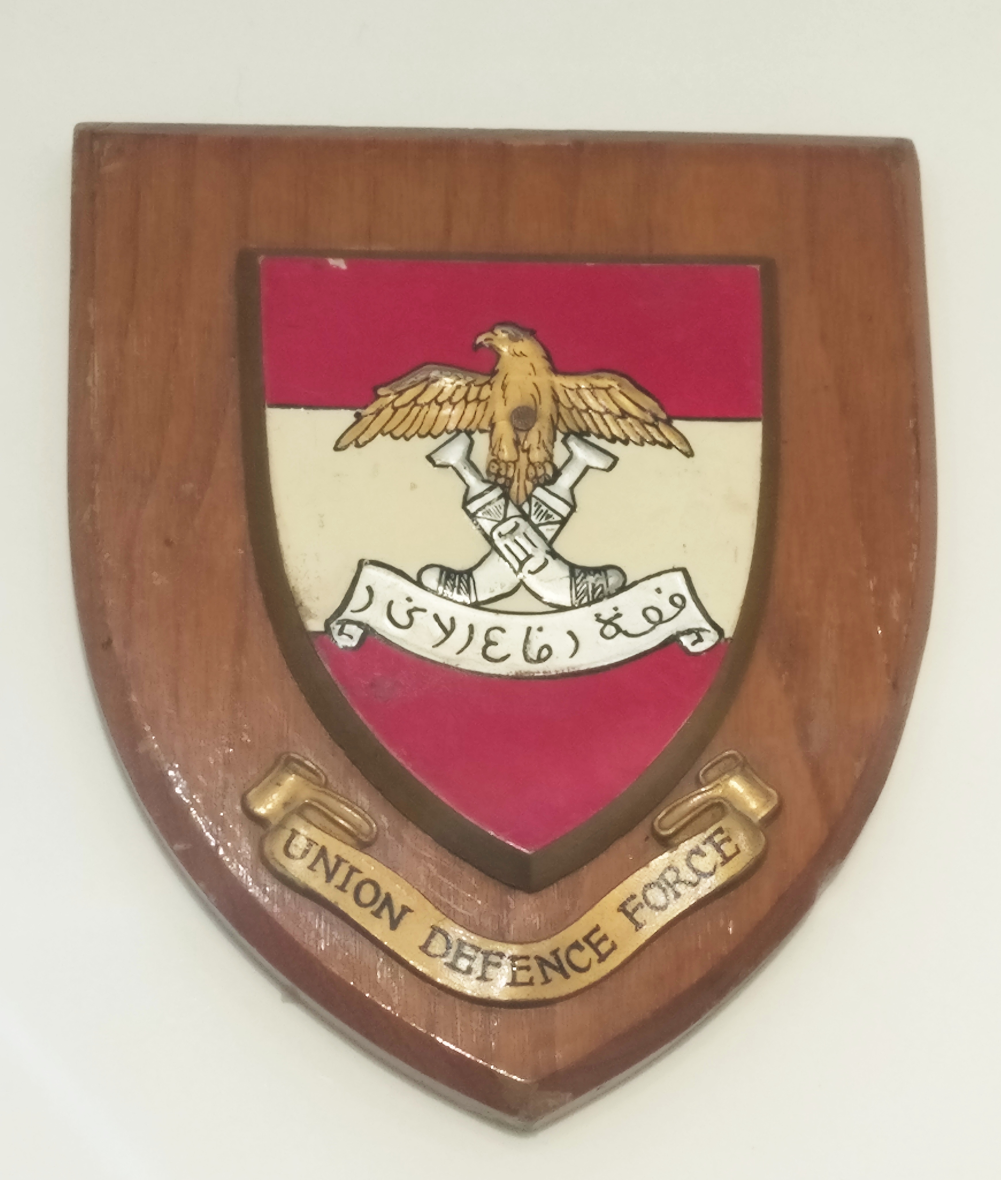
The Trucial Oman Scouts was a paramilitary force that the British raised in 1951 as the Trucial Oman Levies, to serve in the Trucial States. In 1956, the Levies were renamed the Trucial Oman Scouts. In 1971, upon the formation of the United Arab Emirates (UAE), the scouts were handed to the United Arab Emirate's government and formed its Federal Union Defence Force (UDF) which is today renamed as the United Arab Emirates Armed Forces. The Trucial Oman Scouts were a highly respected and impartial gendarmerie and were regarded as well trained, well paid, and efficient. Trucial Oman Levies The Trucial Oman Scouts were established at Sharjah, in a location adjacent to the RAF base, originally as the Trucial Oman Levies (TOL) in 1951, but renamed in 1956 by Chief of the Imperial General Staff (CIGS), Field Marshal Templar. Substituting the word 'scout' for 'levies' was done to eliminate the impression that the force was conscripted, as well as to make the force sound more exotic and a ... [...More Info...] [...Related Items...] OR: [Wikipedia] [Google] [Baidu] |
Sharqiyin
The Sharqiyin ( ar, الشرقيون, singular Al Sharqi ar, الشرقي) is a tribe of the United Arab Emirates (UAE). The Sharqiyin were long the dominant tribe along the East coast of the Trucial States (and the second most numerous in the area around the start of the 19th century), an area known as Shamailiyah. A 1968 census showed 90% of the tribal population of Fujairah was Sharqiyin. They were traditionally dependents of Sharjah and, over the centuries, made several attempts to secede and declare independence, finally practically managing this from 1901 onwards and finally gaining British recognition as a Trucial State, Fujairah, in 1952. They settled all along the East Coast of the Trucial States, from Kalba to Dibba, as well as in the Wadi Ham and Jiri plain and by the turn of the 20th century they were some 7,000 strong. Three sections of the tribe are notable, the Hafaitat (from which the ruling family of Fujairah derives), the Yammahi and the Hamudiyin. After th ... [...More Info...] [...Related Items...] OR: [Wikipedia] [Google] [Baidu] |
Mazari (Emirati)
The Mazari (singular Mazrouei or Mazrui) is a tribe of the United Arab Emirates (UAE). The Mazari settled throughout the Trucial States but principally in Abu Dhabi. They are considered a subsection of the Bani Yas and formed the majority of the Bedouin component of that federation of tribes. Liwa The Liwa Oasis was the homeplace of many of the Mazari, where they were the principal property owners of the six Bani Yas tribes in the area, consisting of some 315 houses at the turn of the 20th century. They were closely associated with the AlMarar tribe at Liwa. At that time there were also some 300 Mazari at Al Khan in Sharjah and 500 in the areas of Adhen and Asimah. Those of the Mazari who settled in Dubai came to consider themselves as apart from the Bani Yas. The area around Wadi Helou in the Hajar Mountains of Sharjah is also an area of Mazari settlement. They were herdsmen and records show they settled into an agrarian existence in the oasis following the decline in t ... [...More Info...] [...Related Items...] OR: [Wikipedia] [Google] [Baidu] |
Wadi Asimah
Wadi Asimah is a seasonal watercourse in the Hajar Mountains of Ras Al Khaimah in the United Arab Emirates. It runs broadly westward from the village of Asimah to join the Wadi Fara, its confluence forming the locus between Wadi Fara and Wadi Sidr. A popular location for day trippers and offroading, Wadi Asimah is notable for its lush greenery and agriculture. It is the site of the 'Sultan's Gardens', an area of abundant oleander, grasses, palm groves and pools that often (and unusually) harbours water year-round, as well as providing a nesting ground for heron. In winter, the mountainous wadi will receive heavy rainfall, leading to flash floods, and has even seen hail on occasion. The villages of Asimah and Mawrid and the course of the Wadi Asimah were traditionally settled by members of the Mazari tribe. Geology and archaeology Wadi Asimah is both a geologically and archaeologically rich area, with thick fluvial deposits and archaeological sites. Wadi Asimah has lent its na ... [...More Info...] [...Related Items...] OR: [Wikipedia] [Google] [Baidu] |
Date Palm
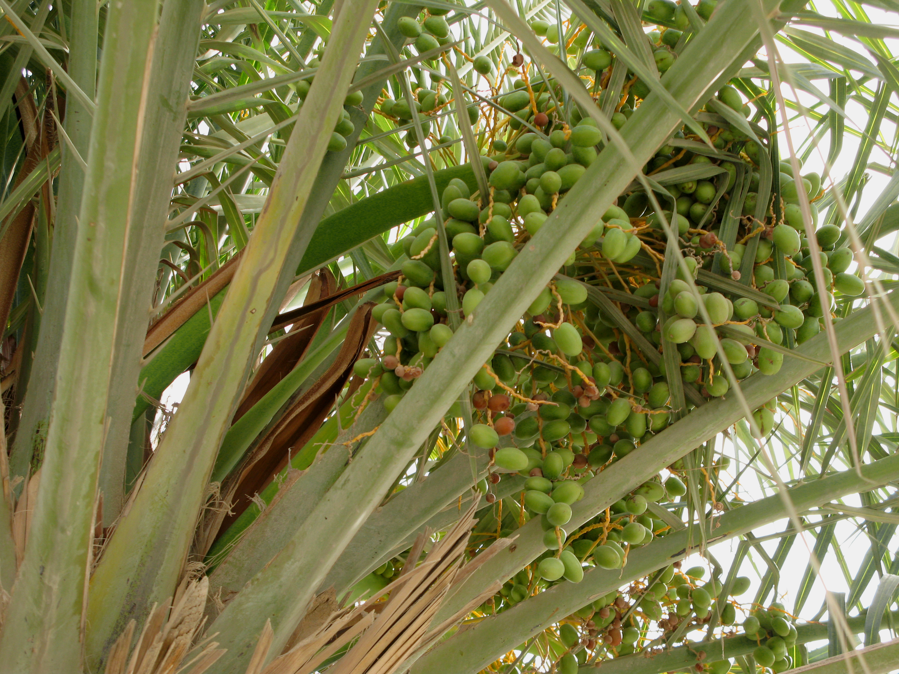
''Phoenix dactylifera'', commonly known as date or date palm, is a flowering plant species in the palm family, Arecaceae, cultivated for its edible sweet fruit called dates. The species is widely cultivated across northern Africa, the Middle East, and South Asia, and is naturalized in many tropical and subtropical regions worldwide. ''P. dactylifera'' is the type species of genus ''Phoenix'', which contains 12–19 species of wild date palms. Date trees reach up to in height, growing singly or forming a clump with several stems from a single root system. Slow-growing, they can reach over 100 years of age when maintained properly. Date fruits (dates) are oval-cylindrical, long, and about in diameter, with colour ranging from dark brown to bright red or yellow, depending on variety. Containing 61–68 percent sugar by mass when dried, dates are very sweet and are enjoyed as desserts on their own or within confections. Dates have been cultivated in the Middle East and the ... [...More Info...] [...Related Items...] OR: [Wikipedia] [Google] [Baidu] |


.jpg)


.jpg)
