|
WV 31
West Virginia Route 31 is a north–south state highway in the northwestern portion of the U.S. state of West Virginia. The northern terminus of the route is at the Ohio state line on the Williamstown Bridge over the Ohio River. The southern terminus is at West Virginia Route 16 in Harrisville, West Virginia. The northernmost extent of the route from West Virginia Route 14 near Interstate 77 Exit 185 southeast of Williamstown to the Ohio state line is not signed.Google Street View Google Street View is a technology featured in Google Maps and Google Earth that provides interactive panoramas from positions along many streets in the world. It was launched in 2007 in several cities in the United States, and has since expan ..., September 2007 Major intersections References 031 Transportation in Ritchie County, West Virginia Transportation in Wood County, West Virginia {{WestVirginia-road-stub ... [...More Info...] [...Related Items...] OR: [Wikipedia] [Google] [Baidu] |
Harrisville, West Virginia
Harrisville is a town in Ritchie County, West Virginia, Ritchie County, West Virginia, United States. It is the county seat of Ritchie County, West Virginia, Ritchie County. Harrisville is located at the junction of State Routes 31 and 16, five miles south of U.S. Route 50 in West Virginia, U.S. 50. Within the community are an elementary school, the county board of education, many businesses, three banks, a library, offices of the ''Ritchie Gazette'' and ''The Pennsboro News'', a municipal park, and North Bend Golf Course. North Bend Lake and North Bend State Park are located just outside town limits. Municipal elections are held every two years. History The town was laid out in 1822 by Thomas Harris, who had moved his family there in 1807. The town was chartered in 1832, and the first post office opened in 1833, under the name Solus. The name was later changed to Ritchie Court House, and then changed again to Harrisville in 1895, when the town was named for Gen. Thomas Harris, ne ... [...More Info...] [...Related Items...] OR: [Wikipedia] [Google] [Baidu] |
Ohio River
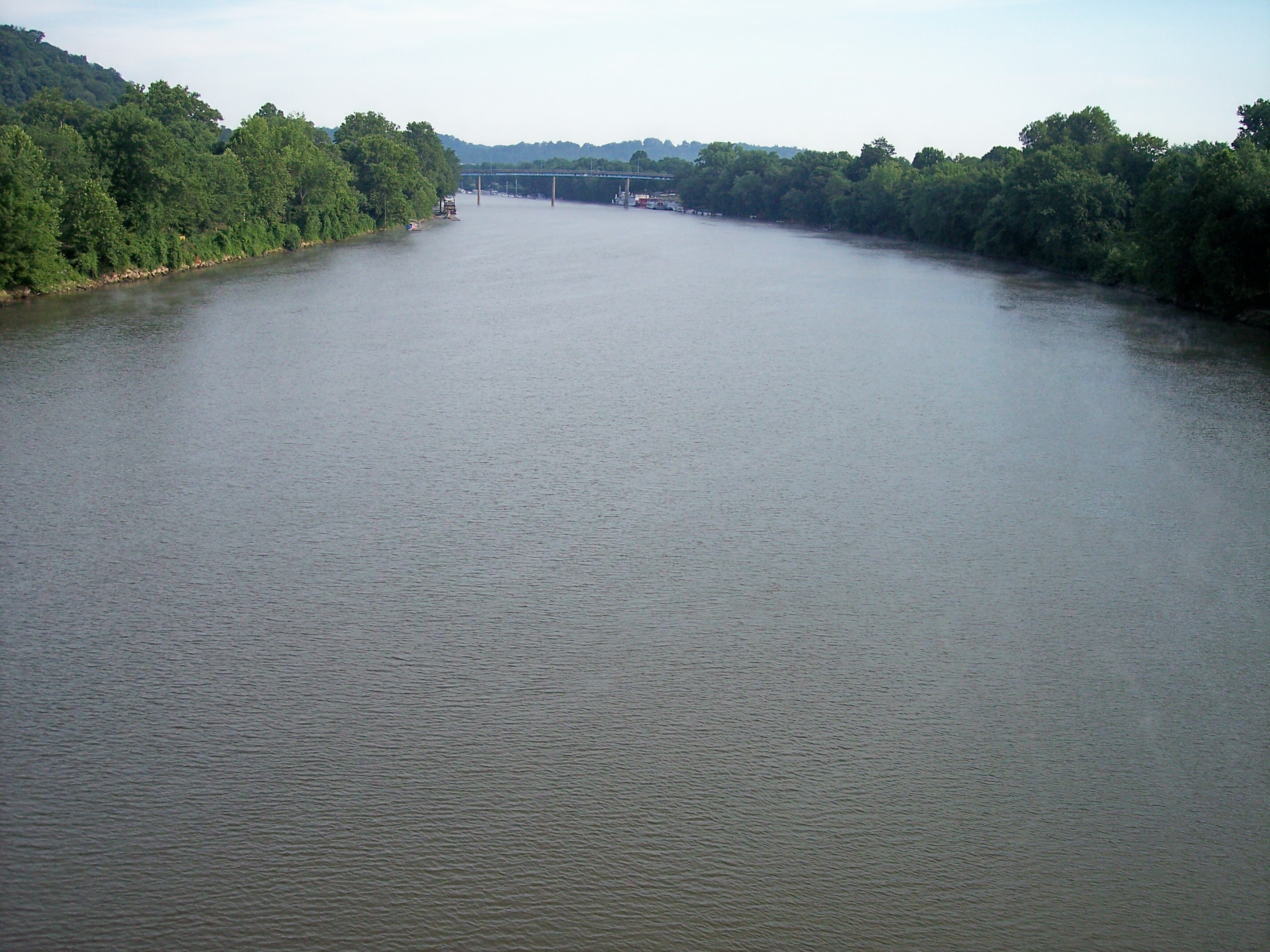
The Ohio River is a long river in the United States. It is located at the boundary of the Midwestern and Southern United States, flowing southwesterly from western Pennsylvania to its mouth on the Mississippi River at the southern tip of Illinois. It is the third largest river by discharge volume in the United States and the largest tributary by volume of the north-south flowing Mississippi River that divides the eastern from western United States. It is also the 6th oldest river on the North American continent. The river flows through or along the border of six states, and its drainage basin includes parts of 14 states. Through its largest tributary, the Tennessee River, the basin includes several states of the southeastern U.S. It is the source of drinking water for five million people. The lower Ohio River just below Louisville is obstructed by rapids known as the Falls of the Ohio where the elevation falls in restricting larger commercial navigation, although in the 18th ... [...More Info...] [...Related Items...] OR: [Wikipedia] [Google] [Baidu] |
State Highways In West Virginia
State may refer to: Arts, entertainment, and media Literature * ''State Magazine'', a monthly magazine published by the U.S. Department of State * ''The State'' (newspaper), a daily newspaper in Columbia, South Carolina, United States * ''Our State'', a monthly magazine published in North Carolina and formerly called ''The State'' * The State (Larry Niven), a fictional future government in three novels by Larry Niven Music Groups and labels * States Records, an American record label * The State (band), Australian band previously known as the Cutters Albums * ''State'' (album), a 2013 album by Todd Rundgren * ''States'' (album), a 2013 album by the Paper Kites * ''States'', a 1991 album by Klinik * ''The State'' (album), a 1999 album by Nickelback Television * ''The State'' (American TV series), 1993 * ''The State'' (British TV series), 2017 Other * The State (comedy troupe), an American comedy troupe Law and politics * State (polity), a centralized political organizatio ... [...More Info...] [...Related Items...] OR: [Wikipedia] [Google] [Baidu] |
SR 60 (OH)
State Route 60 (SR 60) is a north–south state highway that runs the entire length of the U.S. state of Ohio, from the Williamstown Bridge over the Ohio River in Marietta to U.S. Route 6 (US 6) near Lake Erie in Vermilion. It is the seventh longest state route in Ohio. Heading south from Vermilion, SR 60 traverses rural North Central Ohio while connecting Vermilion, New London, Ashland, and Loudonville. South of Loudonville, SR 60 enters more hilly country, before entering the Muskingum River Valley at Dresden. It closely parallels the Muskingum River for the remainder of its journey to Marietta except for an stretch in Morgan County where it moves inland to avoid bends in the river. Markers for SR 60 are not posted south of the Greene Street/3rd Street intersection in Marietta, the location of SR 26's southern terminus. SR 60 is unsigned along SR 7 / SR 26 / Greene Street and the Williamstown Bridge approach. Google S ... [...More Info...] [...Related Items...] OR: [Wikipedia] [Google] [Baidu] |
Marietta, OH
Marietta is a city in, and the county seat of, Washington County, Ohio, United States. It is located in southeastern Ohio at the confluence of the Muskingum and Ohio Rivers, northeast of Parkersburg, West Virginia. As of the 2020 census, Marietta has a population of 13,385 people and is the principal city of the Marietta Micropolitan Statistical Area, which includes all of Washington County, and is the second-largest city in the Parkersburg–Marietta–Vienna, WV–OH Combined Statistical Area. Founded in 1788 by pioneers to the Ohio Country, Marietta was the first permanent U.S. settlement in the newly established Northwest Territory, created in 1787, and what would later become the state of Ohio. It is named for Marie Antoinette, then Queen of France, in honor of French aid in the American Revolution. Prior to American settlement, the area was inhabited by various native tribes of the Hopewell tradition, who built the Marietta Earthworks, a complex more than 1,500 years ... [...More Info...] [...Related Items...] OR: [Wikipedia] [Google] [Baidu] |
Google Street View
Google Street View is a technology featured in Google Maps and Google Earth that provides interactive panoramas from positions along many streets in the world. It was launched in 2007 in several cities in the United States, and has since expanded to include cities and rural areas worldwide. Streets with Street View imagery available are shown as blue lines on Google Maps. Google Street View displays interactively panoramas of stitched VR photographs. Most photography is done by car, but some is done by tricycle, camel, boat, snowmobile, underwater apparatus, and on foot. History and features Street View had its inception in 2001 with the Stanford CityBlock Project, a Google-sponsored Stanford University research project. The project ended in June 2006, and its technology was folded into StreetView. * 2007: Launched on May 25 in the United States using Immersive Media Company technology. * 2008: In May Google announces that it was testing face-blurring technology on it ... [...More Info...] [...Related Items...] OR: [Wikipedia] [Google] [Baidu] |
Williamstown, West Virginia
Williamstown is a city in Wood County, West Virginia, United States, along the Ohio River. It is part of the Parkersburg-Marietta-Vienna metropolitan area. The population was 2,997 at the 2020 census. The now closed Fenton Art Glass Company was located in the city. History Williamstown was named for Isaac Williams (1737–1820), who settled here in 1787. Williams had served under General Braddock (1755) as a ranger and spy and under Governor Dunmore (1774) fighting against the Shawnee. His home was on 400 acres on the Ohio River opposite the mouth of the Muskingum River, site of Marietta, Ohio, which was founded about a year after he arrived. Other local namesakes include Williams Creek and Williams District. The settlement was known as "Williamsport" to Ohio River travelers until 1822 when the present name was formalized. Located in Williamstown is the Tomlinson Mansion, listed on the National Register of Historic Places in 1974. Located near Williamstown is the Henderson H ... [...More Info...] [...Related Items...] OR: [Wikipedia] [Google] [Baidu] |
Interstate 77 (West Virginia)
Interstate 77 (I-77) in the US state of West Virginia is a major north–south Interstate Highway. It extends for between Bluefield at the Virginia state line and Williamstown at the Ohio state line. The highway serves Charleston, the capital and largest city in West Virginia; it also serves the cities of Princeton, Beckley, and Parkersburg. I-77 follows the entire length of the West Virginia Turnpike, a toll road that runs between Princeton and Charleston, and it runs concurrently with I-64 between Beckley and Charleston. Historically, the West Virginia Turnpike was a two-lane road with treacherous curves and a tunnel (which has since been decommissioned). Construction began in 1952, several years before the Interstate Highway System was funded. It was only in 1987 that the entire length of the turnpike was upgraded to Interstate standards. Due to the difficulty and lives lost in construction, it has been called "88 miles of miracle". Route description Virginia to ... [...More Info...] [...Related Items...] OR: [Wikipedia] [Google] [Baidu] |
West Virginia Route 14
West Virginia Route 14 is a north–south state highway in the western portion of the U.S. state of West Virginia. The southern terminus of the route is at U.S. Route 33 in Spencer, Roane County. The northern terminus is at Interstate 77 exit 185 and West Virginia Route 31 on the southern outskirts of Williamstown, Wood County. The portion of the road from Williamstown to Mineral Wells in Wood County was part of U.S. Route 21 U.S. Route 21 or U.S. Highway 21 (US 21) is a major north–south United States Numbered Highway in the Southeastern United States that travels . The southern terminus is in Hunting Island State Park, South Carolina, south of the ... until US 21 was decommissioned statewide in 1974. Major intersections References 014 West Virginia Route 014 West Virginia Route 014 West Virginia Route 014 {{WestVirginia-road-stub ... [...More Info...] [...Related Items...] OR: [Wikipedia] [Google] [Baidu] |
West Virginia Route 16
West Virginia Route 16 (WV 16) is a north–south route located in the U.S. State of West Virginia. The southern terminus of the route is at the Virginia state line in Bishop, McDowell County, where the route continues south as Virginia State Route 16. The northern terminus is at West Virginia Route 2 in St. Marys, Pleasants County, on the south bank of the Ohio River. WV 16 continues as a same-numbered route into Virginia and North Carolina, ultimately ending in Waxhaw, south of Charlotte and just north of the South Carolina )''Animis opibusque parati'' ( for, , Latin, Prepared in mind and resources, links=no) , anthem = " Carolina";" South Carolina On My Mind" , Former = Province of South Carolina , seat = Columbia , LargestCity = Charleston , LargestMetro = ... border. The total length of highway is just under 475 miles (764 km) long. Major intersections References 016 West Virginia Route 016 West Vir ... [...More Info...] [...Related Items...] OR: [Wikipedia] [Google] [Baidu] |
Williamstown Bridge
The Williamstown Bridge is a bridge over the Ohio River between Williamstown, West Virginia, and Marietta, Ohio. The bridge carries West Virginia Route 31 and Ohio State Route 60. U.S. Route 21 was also formerly routed along this bridge. Original bridge The original bridge at this site was constructed in 1903. It was the first inland cantilever highway bridge in the United States and also site of the first strike, in 1902, by the United Steel Workers union. Current bridge The current Williamstown Bridge was completed in 1992. It reuses some of the piers from the prior bridge, although the Marietta approaches were relocated to a new connection with Ohio State Route 7. This bridge is a continuous truss, the 28th-longest in North America. See also *List of bridges documented by the Historic American Engineering Record in Ohio *List of bridges documented by the Historic American Engineering Record in West Virginia *List of crossings of the Ohio River This is a complete list o ... [...More Info...] [...Related Items...] OR: [Wikipedia] [Google] [Baidu] |
Cairo, West Virginia
Cairo ( ) is a town in Ritchie County, West Virginia, United States, along West Virginia Route 31, the North Fork of the Hughes River, and the North Bend Rail Trail. The population was 174 at the 2020 census. History The town was named by its earliest settlers, who were Scots Presbyterians, for the city of Cairo, Egypt, owing to the presence of water and fertile land at the site. Cairo was incorporated in 1895. The North Bend Rail Trail passes through the town. The former Bank of Cairo building, now Cairo Town Hall, was listed on the National Register of Historic Places in 1996. Geography Cairo is located at (39.208264, -81.156600). According to the United States Census Bureau, the town has a total area of , of which is land and is water. Demographics 2010 census At the 2010 census, there were 281 people, 118 households, and 71 families living in the town. The population density was . There were 151 housing units at an average density of . The racial makeup of the ... [...More Info...] [...Related Items...] OR: [Wikipedia] [Google] [Baidu] |


