|
Vézère
The Vézère (; oc, Vesera) is a 211-km-long river in southwestern France. It is an important tributary to the Dordogne. Its source is in the northwestern part of the elevated plateau known as the Massif Central. It flows into the Dordogne near Le Bugue. A tributary of the Vézère is the Corrèze. The Vézère Valley is famed for its prehistoric cave systems, containing numerous cave paintings and hominid remains. UNESCO collectively designated these a World Heritage Site in 1979. Among the sites with remarkable caves is Lascaux. Geography The Vézère takes its source in the bog of Longéroux, on the plateau of Millevaches, in the Massif Central in Corrèze, at 887 meters above sea level, in the commune of Meymac, west of the ''Puy Pendu'' (973 m) in the forest of Longéroux, at the place called ''sources de la Vézère''. It flows into the Dordogne on the right bank at Limeuil, at an altitude of 50 metres. Its main tributary is the Corrèze, their confluence is located in th ... [...More Info...] [...Related Items...] OR: [Wikipedia] [Google] [Baidu] |
Uzerche
Uzerche (; oc, Usercha) is a commune in the Corrèze department in the Nouvelle-Aquitaine region of central France. In 1787, the English writer Arthur Young described the town as "the pearl of the Limousin" because of its picturesque setting. Built on a defensible rocky outcrop in an oxbow of the river Vézère, and located at a medieval crossroads, Uzerche has a long cultural heritage. Under Pepin the Short, the city was the seat of an influential abbey and a seneschal. Uzerche still has many castles, hotels, and other buildings displaying turrets built by the Uzechoise nobility, thus adding weight to the saying "He who owns a house in Uzerche has a castle in the Limousin." In 1996 Uzerche was awarded "village étape" status and, since 2010, has been listed among the towns of France to be worthy of a "plus beaux détour". Name The name ''Uzerche'' may date as far back as Roman times. Taken by the Romans in 51 BC, it was the last place where the Gauls fought against Julius Ca ... [...More Info...] [...Related Items...] OR: [Wikipedia] [Google] [Baidu] |
Laugerie Basse
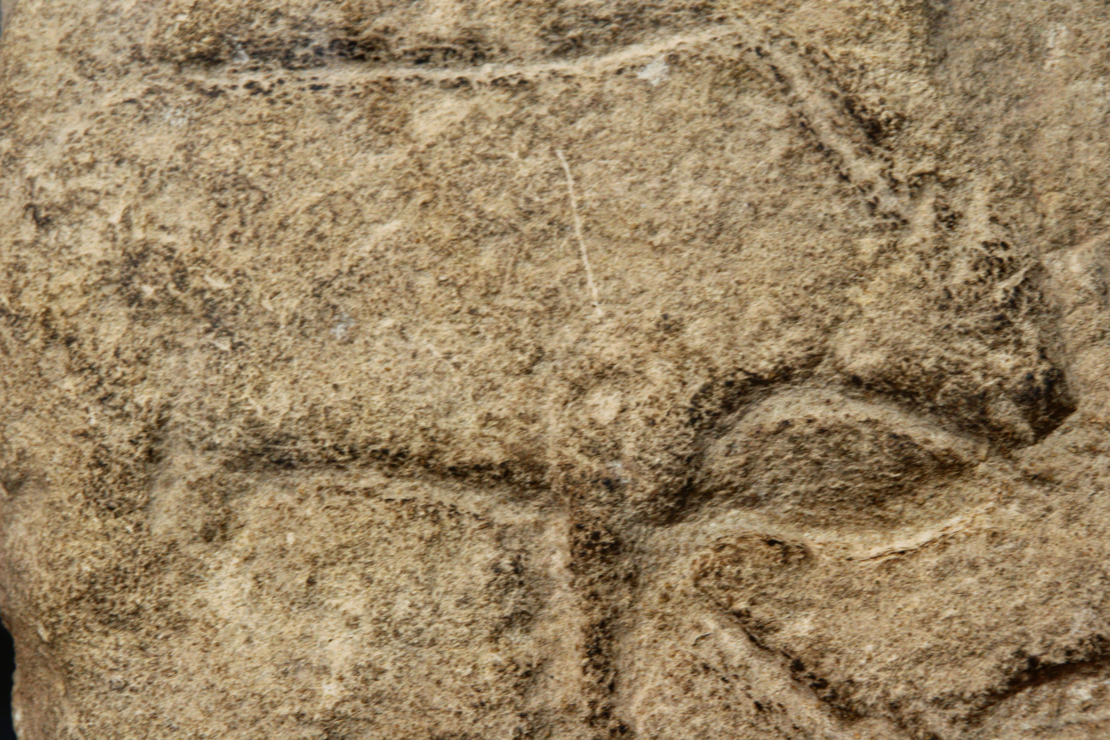
Laugerie-Basse is an important Upper Paleolithic archaeological site within the territory of the French commune Les Eyzies-de-Tayac-Sireuil in Dordogne. It is known for several works of art from the Magdalenian. In 1979, Laugerie-Basse, along with other nearby paleolithic sites, was inscribed on the UNESCO World Heritage List as ''Prehistoric Sites and Decorated Caves of the Vézère Valley''. Geography, geology and location The impressive Abri of Laugerie-Basse, named after the village, is located on the right side of the Vézère valley, about 2 kilometers upstream from Les Eyzies. It was formed at the bottom of a 45 meters high and 500 meters long scarp slope of flat-lying limestones from the Coniacian. The 15-meter-deep Abri is located 15 meters above river level. Taking advantage of the natural conditions, the houses of Laugerie-Basse were built directly into the rocks so that building a back wall and the back half of the roof was dispensable. The prehistoric site consist ... [...More Info...] [...Related Items...] OR: [Wikipedia] [Google] [Baidu] |
Lascaux
Lascaux ( , ; french: Grotte de Lascaux , "Lascaux Cave") is a network of caves near the village of Montignac, in the department of Dordogne in southwestern France. Over 600 parietal wall paintings cover the interior walls and ceilings of the cave. The paintings represent primarily large animals, typical local contemporary fauna that correspond with the fossil record of the Upper Paleolithic in the area. They are the combined effort of many generations and, with continued debate, the age of the paintings is now usually estimated at around 17,000 years (early Magdalenian). Because of the outstanding prehistoric art in the cave, Lascaux was inducted into the UNESCO World Heritage List in 1979, as an element of the ''Prehistoric Sites and Decorated Caves of the Vézère Valley''. The original caves have been closed to the public since 1963, as their condition was deteriorating, but there are now a number of replicas. History since rediscovery On 12 September 1940, the entra ... [...More Info...] [...Related Items...] OR: [Wikipedia] [Google] [Baidu] |
Cro De Granville
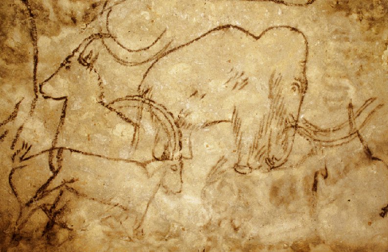
The Rouffignac cave, in the French commune of Rouffignac-Saint-Cernin-de-Reilhac in the Dordogne département, contains over 250 engravings and cave paintings dating back to the Upper Paleolithic. In conjunction with other caves and abris of the Vézère valley, the Rouffignac cave was classified a Monument historique in 1957 and a world heritage site in 1979 by UNESCO as part of the ''Prehistoric Sites and Decorated Caves of the Vézère Valley''. Geography and description of the cave The ''Cave of the hundred mammoths'', also known as ''Miremont cave'', ''Cro des Cluzeau'' or ''Cro de Granville'', is about south of Rouffignac on a hill slope along the right-hand side of the La Binche river, a left tributary of the Manaurie. Perched only about one kilometer farther east on the opposite side of the valley is the little village of Fleurac. The rocks of the cave are flat-lying limestones belonging to the uppermost Coniacian; they are very rich in flint nodules. These rocks toge ... [...More Info...] [...Related Items...] OR: [Wikipedia] [Google] [Baidu] |
Pérols-sur-Vézère
Pérols-sur-Vézère (, literally ''Pérols on Vézère''; oc, Peròls de Vesera) is a commune in the Corrèze department in central France. Population See also *Communes of the Corrèze department The following is a list of the 279 communes of the Corrèze department of France. The communes cooperate in the following intercommunalities (as of 2020):Communes of Corrèze {{Corrèze-geo-stub ... [...More Info...] [...Related Items...] OR: [Wikipedia] [Google] [Baidu] |
Le Cap Blanc
The abri de Cap Blanc is a prehistoric limestone rock shelter with Magdalenian animal sculptures. It is in the Marquay commune on the right bank of the Beune River, a few kilometers west of Eyzies-de-Tayac, in Dordogne. History The site was discovered in 1908 by Raymond Peyrille under the supervision of Jean-Gaston Lalanne. Peyrille carried out its first rudimentary excavation in 1909 while Lalanne was working at the nearby site of Laussel. During this excavation a relief carving was found, one that has been described as "perhaps the most dramatic and impressive example of Upper Palaeolithic". Following the discovery of the frieze, work was undertaken in 1911 to build a protective wall around the shelter. This included lowering the shelter floor, a procedure during which a workman hit a skull with a pick-axe, breaking it. A relatively complete skeleton was uncovered and Denis Peyrony and Louis Capitan were brought in to examine it. Frieze The frieze depicts a number of ... [...More Info...] [...Related Items...] OR: [Wikipedia] [Google] [Baidu] |
Le Moustier
Le Moustier is an archeological site consisting of two rock shelters in Peyzac-le-Moustier, a village in the Dordogne, France. It is known for a complete skeleton of the species ''Homo neanderthalensis'' that was discovered in 1908. The Mousterian tool culture is named after Le Moustier, which was first excavated from 1863 by the Englishman Henry Christy and the Frenchman Édouard Lartet. In 1979, Le Moustier was inscribed on the UNESCO World Heritage List along with other nearby archeological sites as part of the ''Prehistoric Sites and Decorated Caves of the Vézère Valley''. Skeleton The skeleton known as "Le Moustier" is estimated to be approximately 45,000 years old. The characteristics of its skull include a large nasal cavity and a somewhat less developed brow ridge and occipital bun, as might be expected in a juvenile. After discovery, the skull was dismantled, cast and reconstructed at least four times. During this process, the skull received considerable amounts of ... [...More Info...] [...Related Items...] OR: [Wikipedia] [Google] [Baidu] |
Cro-Magnon Rock Shelter
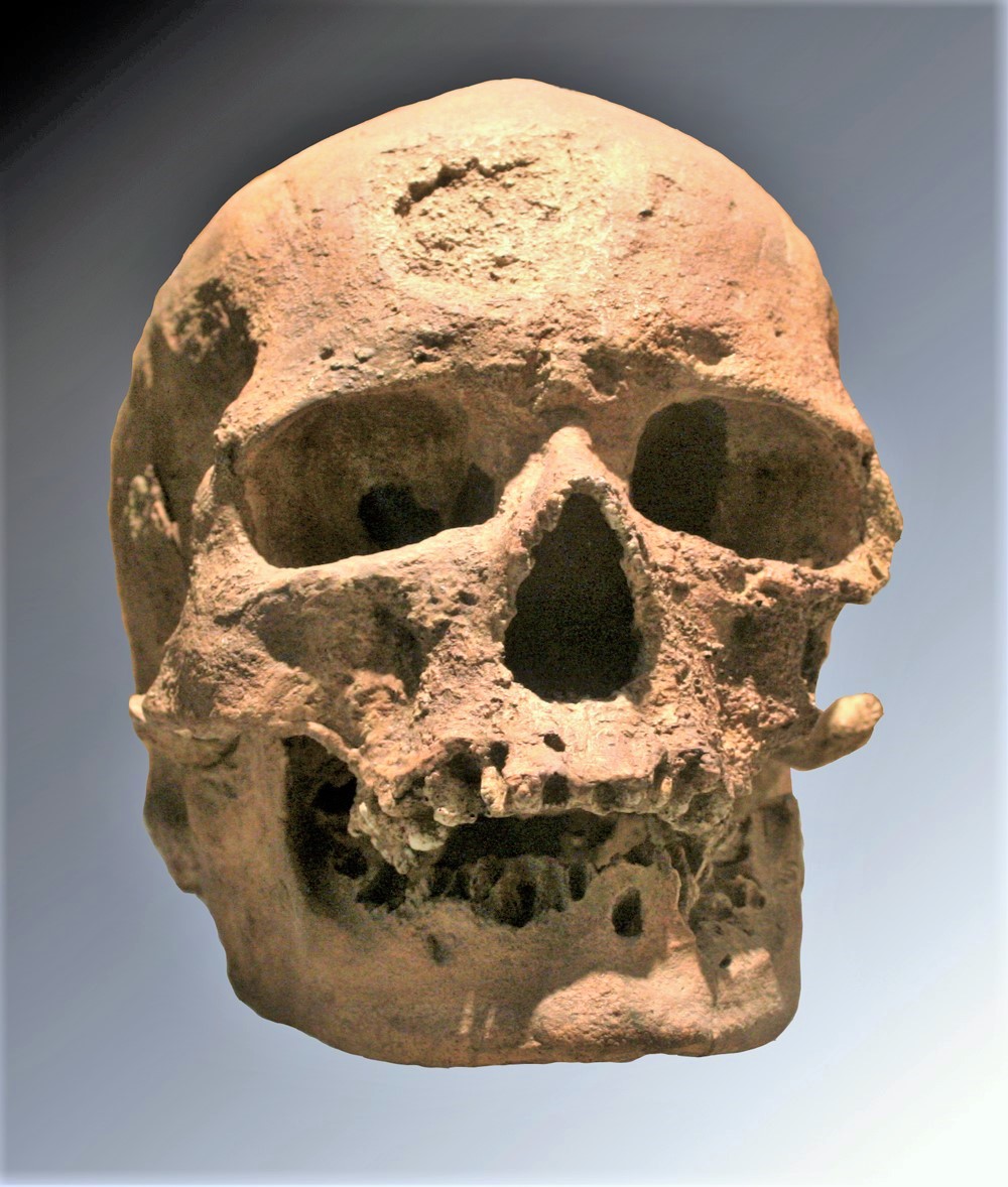
Cro-Magnon (, ; french: Abri de Cro-Magnon )French ''abri'' means "rock shelter", ''crô'' means "hole" in Occitan (standard French ''creux''), and ''Magnon'' is the surname of the land owner at the time. is an Aurignacian (Upper Paleolithic) site, located in a rock shelter at Les Eyzies, a hamlet in the commune of Les Eyzies-de-Tayac-Sireuil, Dordogne, southwestern France. Most notably, it is the site of the discovery of anatomically modern human remains, apparently buried at the site, dated to about 28,000 years ago.Cro-Magnon 1: 27,680 ± 270 BP Because of its archeological importance, ''Abri de Cro-Magnon'' was inscribed on the UNESCO World Heritage List as part of the Prehistoric Sites and Decorated Caves of the Vézère Valley site. Human remains In 1868, workmen found animal bones, flint tools, and human skulls in the rock shelter. French geologist Louis Lartet was called for excavations, and found the partial skeletons of four prehistoric adults and one infant, a ... [...More Info...] [...Related Items...] OR: [Wikipedia] [Google] [Baidu] |
Font De Gaume
Font-de-Gaume is a cave near Les Eyzies-de-Tayac-Sireuil in the Dordogne départment of south-west France. The cave contains prehistoric polychrome cave paintings and engravings dating to the Magdalenian period. Discovered in 1901, more than 200 images have been identified in Font-de-Gaume. Along with other nearby prehistoric archeological sites, Font-de-Gaume was inscribed on the UNESCO World Heritage List in 1979 as the Prehistoric Sites and Decorated Caves of the Vézère Valley. History The paintings were discovered by Denis Peyrony, a local schoolmaster, on 12 September 1901. The cave had been known to the general public before this, but the significance of the paintings had not been recognised. Four days earlier Peyrony had visited the cave at Les Combarelles, a short distance away, with the archaeologist Henri Breuil, where he saw its prehistoric engravings. The paintings in the cave at Font-de-Gaume were the first to be discovered in the Périgord province. Prehist ... [...More Info...] [...Related Items...] OR: [Wikipedia] [Google] [Baidu] |
Corrèze (river)
The Corrèze ( oc, Corresa) is a 95 km long river in south-western France, left tributary of the river Vézère. Its source is in the north-western Massif Central. It flows south-west through the Corrèze ''département'' (named after the river) and the cities Tulle and Brive-la-Gaillarde Brive-la-Gaillarde (; Limousin dialect of oc, Briva la Galharda) is a commune of France. It is a sub-prefecture and the largest city of the Corrèze department. It has around 46,000 inhabitants, while the population of the agglomeration was 7 .... A few km downstream from Brive-la-Gaillarde, the Corrèze flows into the Vézère. References Rivers of France Rivers of Corrèze Rivers of Nouvelle-Aquitaine {{France-river-stub ... [...More Info...] [...Related Items...] OR: [Wikipedia] [Google] [Baidu] |
Les Combarelles
Les Combarelles is a cave in Les Eyzies de Tayac, Dordogne, France, which was inhabited by Cro-Magnon people between approximately 13,000 to 11,000 years ago. Holding more than 600 prehistoric engravings of animals and symbols, the two galleries in the cave were crucial in the re-evaluation of the mental and technical capabilities of these prehistoric humans around the turn of the last century. In 1979, along with other nearby paleolithic sites and cave paintings, the cave was inscribed on the UNESCO World Heritage List as part of the ''Prehistoric Sites and Decorated Caves of the Vézère Valley''. Formed by an underground river, the cave is approximately long with an average width of . Discovery Long used as a stable by local peasants who regularly found Magdalenian artifacts in the cave, the cave and its content remained unstudied by scientists for a long period. It was officially discovered in September 1901 by pre-historians Denis Peyrony, Abbé Breuil, and Louis Cap ... [...More Info...] [...Related Items...] OR: [Wikipedia] [Google] [Baidu] |
Le Bugue
Le Bugue (; oc, Al Buga or ''Lo Buga'') is a commune in the Dordogne department in southwestern France. Geography Le Bugue is located on the banks of the river Vézère a few kilometres before the confluence of the Vézère with the Dordogne at Limeuil. Le Bugue is also on two national routes (Route Nationale 703 and Route Nationale 710). Le Bugue station has rail connections to Périgueux and Agen. History Le Bugue has been inhabited since prehistoric times. In 964 a Benedictine monastery was founded in Le Bugue under the name of Saint Marcel and Saint Salvador. The monastery had disappeared by the late 19th century. Le Bugue enjoyed a period of prosperity until 1154, when the province of Périgord came under English control. Le Bugue was often disputed between British troops and those of the King of France, and therefore suffered greatly. One of the most important dates in the history of Le Bugue is November 1319, when the King of France, Philippe Le Long, ordered by deed ... [...More Info...] [...Related Items...] OR: [Wikipedia] [Google] [Baidu] |


