|
Vorderer Tajakopf
The Vorderer Tajakopf is a 2,450-metre-high mountain in the Mieming Chain in the Austrian state of Tyrol. The normal route to the summit runs from the Coburger Hut (1,917 m) over the ''Vorderes Tajatörl'' and the south arête. More recently the Vorderer Tajakopf has been climbed more frequently up a challenging klettersteig laid out in 2000 along the west arête. The neighbouring Hinterer Tajakopf (2,408 m) is accessible via the Vorderer Tajatörl on the ''Coburger Klettersteig'' or from the Hinterer Tajatörl. Literature * Rudolf Wutscher: ''Mieminger Kette. Ein Führer für Täler, Hütten und Berge'' (= ''Alpine Club Guide The ''Alpine Club Guides'' (german: Alpenvereinsführer, commonly shortened to ''AV Führer'' or ''AVF'') are the standard series of Alpine guides that cover all the important mountain groups in the Eastern Alps. They are produced jointly by the Ge .... Ostalpen.''). Published iaw the guidelines of the UIAA. Bergverlag Rother, Munich, 1989, , p ... [...More Info...] [...Related Items...] OR: [Wikipedia] [Google] [Baidu] |
Seebensee
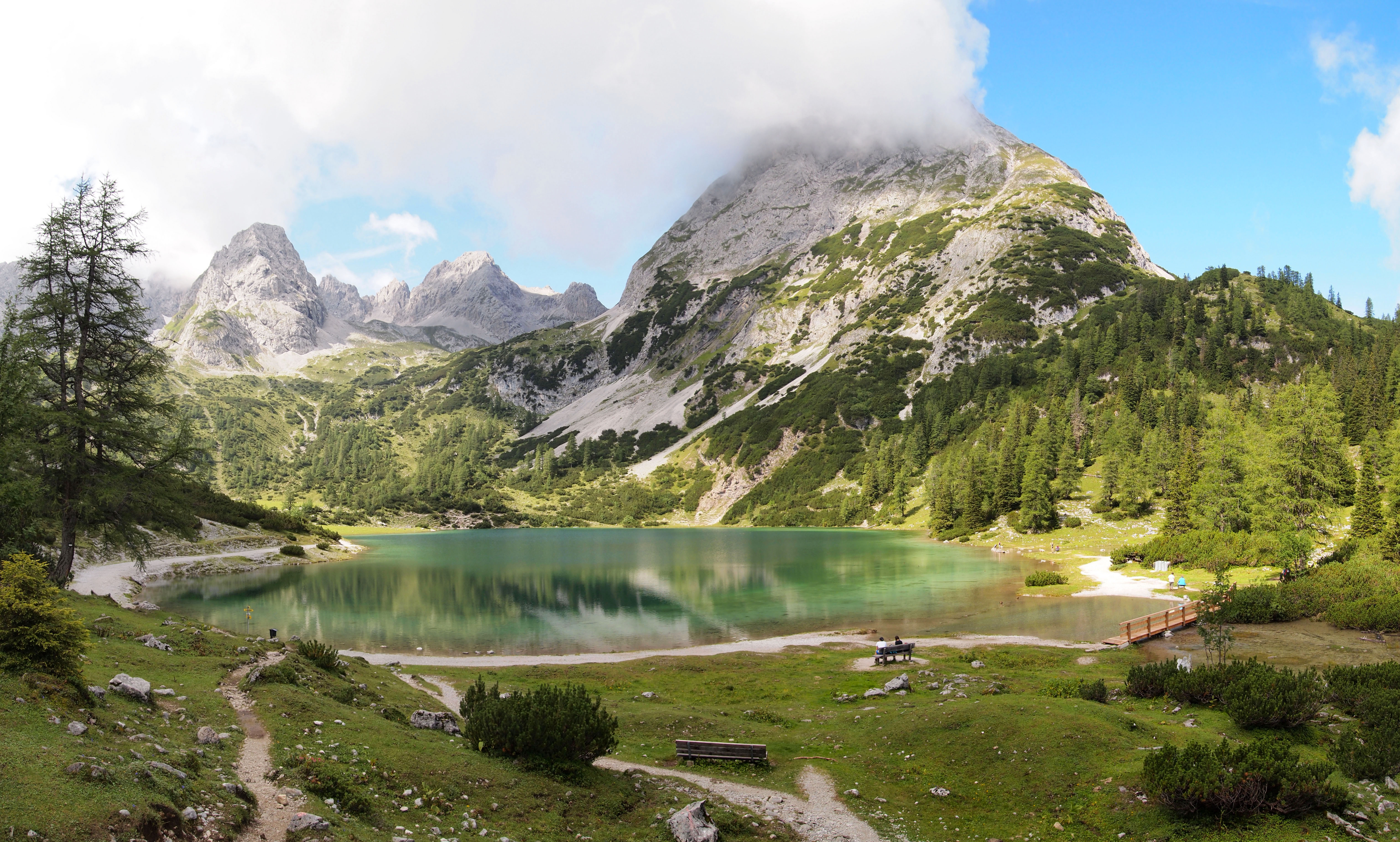
The Seebensee is a natural high mountain lake (an ice-age affected, rock basin lake) at a height of 1,657 metres, south of Ehrwald in the Mieming Range. It is surrounded by the Vorderer Tajakopf in the east, the Vorderer Drachenkopf in the south and the Ehrwalder Sonnenspitze in the west. The Seebensee has no significant above-ground inflows and one outflow via the Seebenbach Falls and the Geißbach into the Loisach river. The lake may be reached from Ehrwald on a forest track via the Ehrwalder Alm, via the Seeben Klettersteig, a difficult klettersteig, or via one of the two protected mountain trails '' Hoher Gang'' or '' Immensteig''. From Biberwier, the lake may be reached via the arête of the Biberwierer Scharte, and from Leutasch through the Gaistal valley. Near the lake (to the northeast) lies the managed alpine pasture of Seebenalm. To the south on a rock terrace above the lake is the Coburger Hut owned by the German Alpine Club. The surface of the lake covers around 6 ... [...More Info...] [...Related Items...] OR: [Wikipedia] [Google] [Baidu] |
Two-thousanders Of Austria
Two-thousanders are mountains that have a height of at least 2,000 metres above sea level, but less than 3,000 metres. The term is used in Alpine circles, especially in Europe (e.g. German: ''Zweitausender''). The two photographs show two typical two-thousanders in the Alps that illustrate different types of mountain. The Säuling (top) is a prominent, individual peak, whereas the Schneeberg (bottom) is an elongated limestone massif. In ranges like the Allgäu Alps, the Gesäuse or the Styrian-Lower Austrian Limestone Alps the mountain tour descriptions for mountaineers or hikers commonly include the two-thousanders, especially in areas where only a few summits exceed this level. Examples from these regions of the Eastern Alps are: * the striking Nebelhorn (2,224 m) near Oberstdorf or the Säuling (2,047 m) near Neuschwanstein, * the Admonter Reichenstein (2,251 m), Eisenerzer Reichenstein (2,165 m), Großer Pyhrgas (2,244 m) or Hochtor (2,369&nbs ... [...More Info...] [...Related Items...] OR: [Wikipedia] [Google] [Baidu] |
Mieming Chain
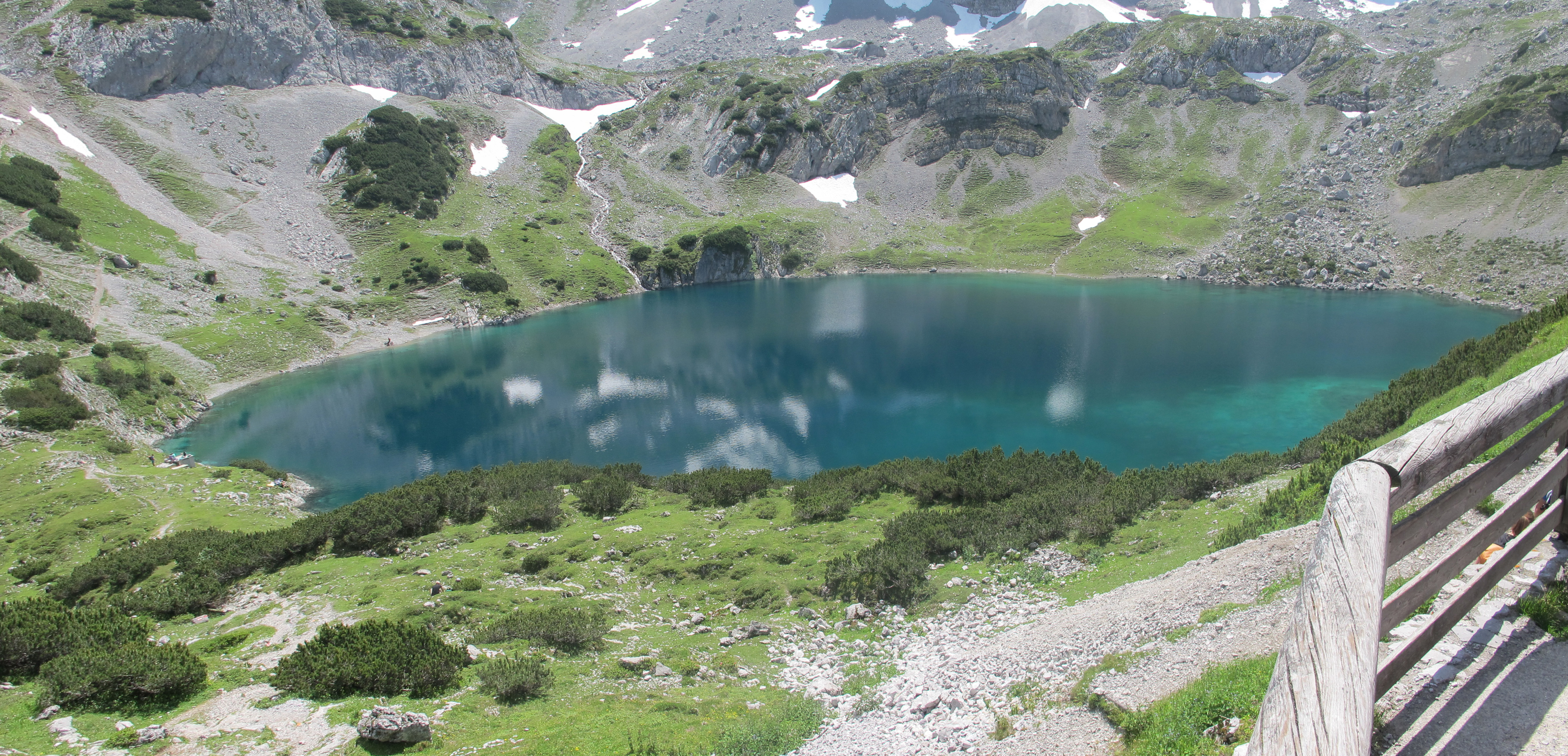
The Mieming(er) Range, Mieminger Chain (german: Mieminger Kette) or Mieminger Mountains (''Mieminger Gebirge''), is a mountain range of the Northern Limestone Alps in the Eastern Alps. It is located entirely in Austria within the state of Tyrol. This sub-group is somewhat in the shadows of its more famous neighbour, the Wetterstein to the north. Whilst the region around the Coburger Hut and the lakes of Seebensee and Drachensee in the west ( Ehrwalder Sonnenspitze and Vorderer Tajakopf with its new ''klettersteig'' over the Tajakante) and the Hohe Munde in the extreme east receive large numbers of visitors, the less developed central area remains very quiet. The Hohe Munde is also a popular and challenging ski touring destination. Public transport links: The Außerfern Railway stops at Ehrwald on the western side of the range. Busses run from Leutasch on the southern side of the mountains to Mittenwald and Seefeld in Tirol. Geology The Mieminger Mountains lie in a partic ... [...More Info...] [...Related Items...] OR: [Wikipedia] [Google] [Baidu] |
Tyrol (state)
Tyrol (; german: Tirol ; it, Tirolo) is a States of Austria, state (''Land'') in western Austria. It comprises the Austrian part of the historical County of Tyrol, Princely County of Tyrol. It is a constituent part of the present-day Euroregion Tyrol–South Tyrol–Trentino (together with South Tyrol and Trentino in Italy). The capital of Tyrol is Innsbruck. Geography The state of Tyrol is separated into two parts, divided by a strip. The larger territory is called North Tyrol (''Nordtirol'') and the smaller area is called East Tyrol (''Osttirol''). The neighbouring Austrian state of Salzburg (state), Salzburg stands to the east, while on the south Tyrol has a border with the Italy, Italian province of South Tyrol (Trentino-Alto Adige/Südtirol) which was part of the Austro-Hungarian Empire before the First World War. With a land area of , Tyrol is the third-largest state in Austria. Tyrol shares its borders with the federal state of Salzburg in the east and Vorarlberg in th ... [...More Info...] [...Related Items...] OR: [Wikipedia] [Google] [Baidu] |
Austria
Austria, , bar, Östareich officially the Republic of Austria, is a country in the southern part of Central Europe, lying in the Eastern Alps. It is a federation of nine states, one of which is the capital, Vienna, the most populous city and state. A landlocked country, Austria is bordered by Germany to the northwest, the Czech Republic to the north, Slovakia to the northeast, Hungary to the east, Slovenia and Italy to the south, and Switzerland and Liechtenstein to the west. The country occupies an area of and has a population of 9 million. Austria emerged from the remnants of the Eastern and Hungarian March at the end of the first millennium. Originally a margraviate of Bavaria, it developed into a duchy of the Holy Roman Empire in 1156 and was later made an archduchy in 1453. In the 16th century, Vienna began serving as the empire's administrative capital and Austria thus became the heartland of the Habsburg monarchy. After the dissolution of the H ... [...More Info...] [...Related Items...] OR: [Wikipedia] [Google] [Baidu] |
Wetterstein Limestone
The Wetterstein Formation is a regional geologic formation of the Northern Limestone Alps and Western Carpathians extending from southern Bavaria, Germany in the west, through northern Austria to northern Hungary and western Slovakia in the east. The formation dates back to the Ladinian to Carnian stages of the Late Triassic. The formation is named after the Wetterstein Mountains in southern Germany and northwestern Austria. The center of its distribution, however, is in the Karwendel Mountains. It occurs in the Northern and Southern Limestone Alps and in the Western Carpathians. The formation is composed of mostly reefal limestones and dolomites, the latter the result of widespread diagenesis. In many areas there is a frequent alternation of limestone and dolomite facies. Local variants to indicate the Wetterstein Formation include german: Wettersteinkalk (Wetterstein Limestone), Wettersteindolomit ("Wetterstein Dolomite") and combinations thereof. The Wetterstein Formation rea ... [...More Info...] [...Related Items...] OR: [Wikipedia] [Google] [Baidu] |
Schwierigkeitsskala (Klettern)
In rock climbing, mountaineering, and other climbing disciplines, climbers give a grade to a climbing route or boulder problem, intended to describe concisely the difficulty and danger of climbing it. Different types of climbing (such as sport climbing, bouldering or ice climbing) each have their own grading systems, and many nationalities developed their own, distinctive grading systems. There are a number of factors that contribute to the difficulty of a climb, including the technical difficulty of the moves, the strength, stamina and level of commitment required, and the difficulty of protecting the climber. Different grading systems consider these factors in different ways, so no two grading systems have an exact one-to-one correspondence. Climbing grades are inherently subjective.Reynolds Sagar, Heather, 2007, ''Climbing your best: training to maximize your performance'', Stackpole Books, UK, 9. They may be the opinion of one or a few climbers, often the first ascensi ... [...More Info...] [...Related Items...] OR: [Wikipedia] [Google] [Baidu] |
Normal Route
A normal route or normal way (french: voie normale; german: Normalweg) is the most frequently used route for ascending and descending a mountain peak. It is usually the simplest route. Overview In the Alps, routes are classed in the following ways, based on their waymarking, construction and upkeep: * Footpaths (''Fußwege'') *Hiking trails (''Wanderwege'') * Mountain trails (''Bergwege'') * Alpine routes (''Alpine Routen'') *Climbing routes (''Kletterrouten'') and High Alpine routes (''Hochalpine Routen'') in combined rock and ice terrain, (UIAA) graded by difficulty Sometimes the normal route is not the easiest ascent to the summit, but just the one that is most used. There may be technically easier variations. This is especially the case on the Watzmannfrau, the Hochkalter and also Mount Everest. There may be many reasons these easier options are less well-used: * the simplest route is less well known than the normal route (Watzmannfrau). * the technically easiest route is mor ... [...More Info...] [...Related Items...] OR: [Wikipedia] [Google] [Baidu] |
Coburger Hut
The Coburger Hut (german: Coburger Hütte) is an Alpine hut owned by the Coburg Branch of the German Alpine Club. It is located in the Mieming Range in the Austrian state of Tyrol (state), Tyrol and lies only a few metres in height above the lake of Drachensee (Ehrwald), Drachensee. The accommodation is generally open from June to early October and there is a winter room. History The construction of the hut goes back to a proposal by the Munich alpinist, Ferdinand Kilger, in 1890. This was taken up in 1895 by the Coburg branch of the German Alpine Club, a branch which had been founded in 1879. In 1901 the first hut was finished and, in the years that followed, it was given a water connexion (the "drinking quality water" was drawn from the Grünsteinsee, a lake which has now dried out), an electrical generator and, in 1908, a telephone line. After the First World War the building was extended for the first time and, in 1962, the material ropeway was built. For the 75th anniver ... [...More Info...] [...Related Items...] OR: [Wikipedia] [Google] [Baidu] |
Arête
An arête ( ) is a narrow ridge of rock which separates two valleys. It is typically formed when two glaciers erode parallel U-shaped valleys. Arêtes can also form when two glacial cirques erode headwards towards one another, although frequently this results in a saddle-shaped pass, called a col. The edge is then sharpened by freeze-thaw weathering, and the slope on either side of the arête steepened through mass wasting Mass wasting, also known as mass movement, is a general term for the movement of rock or soil down slopes under the force of gravity. It differs from other processes of erosion in that the debris transported by mass wasting is not entrained in ... events and the erosion of exposed, unstable rock. The word ''arête'' () is actually French for "edge" or "ridge"; similar features in the Alps are often described with the German language, German equivalent term ''Grat''. Where three or more cirques meet, a pyramidal peak is created. Cleaver A ''cleaver' ... [...More Info...] [...Related Items...] OR: [Wikipedia] [Google] [Baidu] |
Klettersteig
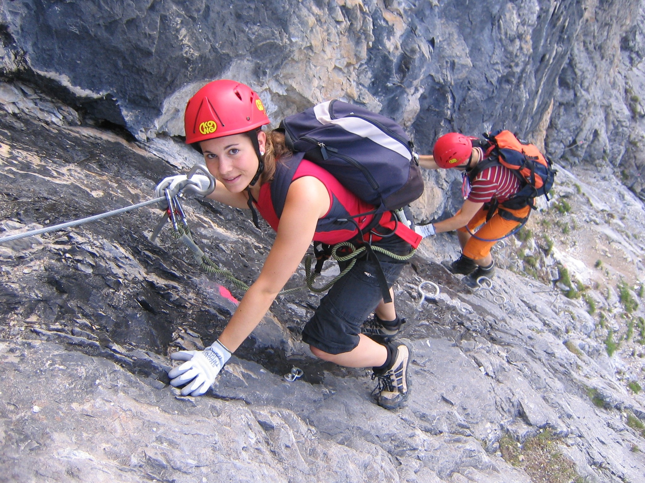
A via ferrata (Italian language, Italian for "iron path", plural ''vie ferrate'' or in English ''via ferratas'') is a protected climbing route found in the Alps and certain other locations. The term "via ferrata" is used in most countries and languages except notably in German-speaking regions, which use ''Klettersteig''—"climbing path" (plural ''Klettersteige''). Infrastructure A via ferrata is a climbing route that employs steel cables, rungs or ladders, fixed to the rock to which the climbers affix #Safety and equipment, a harness with two leashes, which allows the climbers to secure themselves to the metal fixture and limit any fall. The cable and other fixtures, such as iron rungs (stemples), pegs, carved steps, and ladders and bridges, provide both footings and handholds, as well. This allows climbing on otherwise dangerous routes without the risks of unprotected scrambling and climbing or the need for technical climbing equipment. They expand the opportunities for acce ... [...More Info...] [...Related Items...] OR: [Wikipedia] [Google] [Baidu] |


