|
Vlachs Of Serbia
The Vlachs (endonym: ''Rumînji'' or ''Rumâni'', sr, Власи, Vlasi) are a Romanian-speaking ethnic minority in eastern Serbia with an origin from Wallachia (now part of Romania). They mostly live in the Eastern Serbia region (roughly corresponding to the districts of Bor and Zaječar), but also in Braničevo and Pomoravlje districts. A small Vlach population also exists in Smederevo and Velika Plana (Podunavlje District), and in the municipalities of Aleksinac and Kruševac (Rasina District). Etymology Vlach could be an exonym for the eastern Latin-speaking community in the Balkans that was considered foreign in medieval times, which resulted from the occupation and colonization of the region during the Roman Empire. Vlach was later used to describe not only a member of the population but some occupations like guardian soldiers or frontier troops and cattleman, as they were jobs required in the medieval era. Eventually, the various ethnic groups under the label mixed a ... [...More Info...] [...Related Items...] OR: [Wikipedia] [Google] [Baidu] |
Velika Plana
Velika Plana ( sr-Cyrl, Велика Плана, pronounced ) is a town and municipality located in the Podunavlje District of Serbia. As of 2011, the town has 16,088 inhabitants, while the municipality has 40,902. Velika Plana lies on the left bank of Velika Morava. Neighbourhoods The municipality of Velika Plana has 13 settlements. The town of Velika Plana is composed of three townships: Town Mains, Stari Odbor (the Old Downtown), and Bresje. Town Mains is further subdivided into the neighbourhoods of Centar, Bugarija, Đurakovac, Kod Železničke (railway station area), Gloža-Ciglana (brick factory area) where a tiny Morava river village has been reconstructed, and Magareća Glava ('Donkey Head'). There is also a satellite so-called weekend settlement () next to the Pokajnica monastery between Velika Plana, Staro Selo (Velika Plana), Staro Selo and Radovanje, Serbia, Radovanje. Demographics As of the 2011 census, the municipality has 40,902 inhabitants. Ethnic groups The e ... [...More Info...] [...Related Items...] OR: [Wikipedia] [Google] [Baidu] |
Bulgaria
Bulgaria (; bg, България, Bǎlgariya), officially the Republic of Bulgaria,, ) is a country in Southeast Europe. It is situated on the eastern flank of the Balkans, and is bordered by Romania to the north, Serbia and North Macedonia to the west, Greece and Turkey to the south, and the Black Sea to the east. Bulgaria covers a territory of , and is the sixteenth-largest country in Europe. Sofia is the nation's capital and largest city; other major cities are Plovdiv, Varna and Burgas. One of the earliest societies in the lands of modern-day Bulgaria was the Neolithic Karanovo culture, which dates back to 6,500 BC. In the 6th to 3rd century BC the region was a battleground for ancient Thracians, Persians, Celts and Macedonians; stability came when the Roman Empire conquered the region in AD 45. After the Roman state splintered, tribal invasions in the region resumed. Around the 6th century, these territories were settled by the early Slavs. The Bulgars, led by Asp ... [...More Info...] [...Related Items...] OR: [Wikipedia] [Google] [Baidu] |
Vidin Province
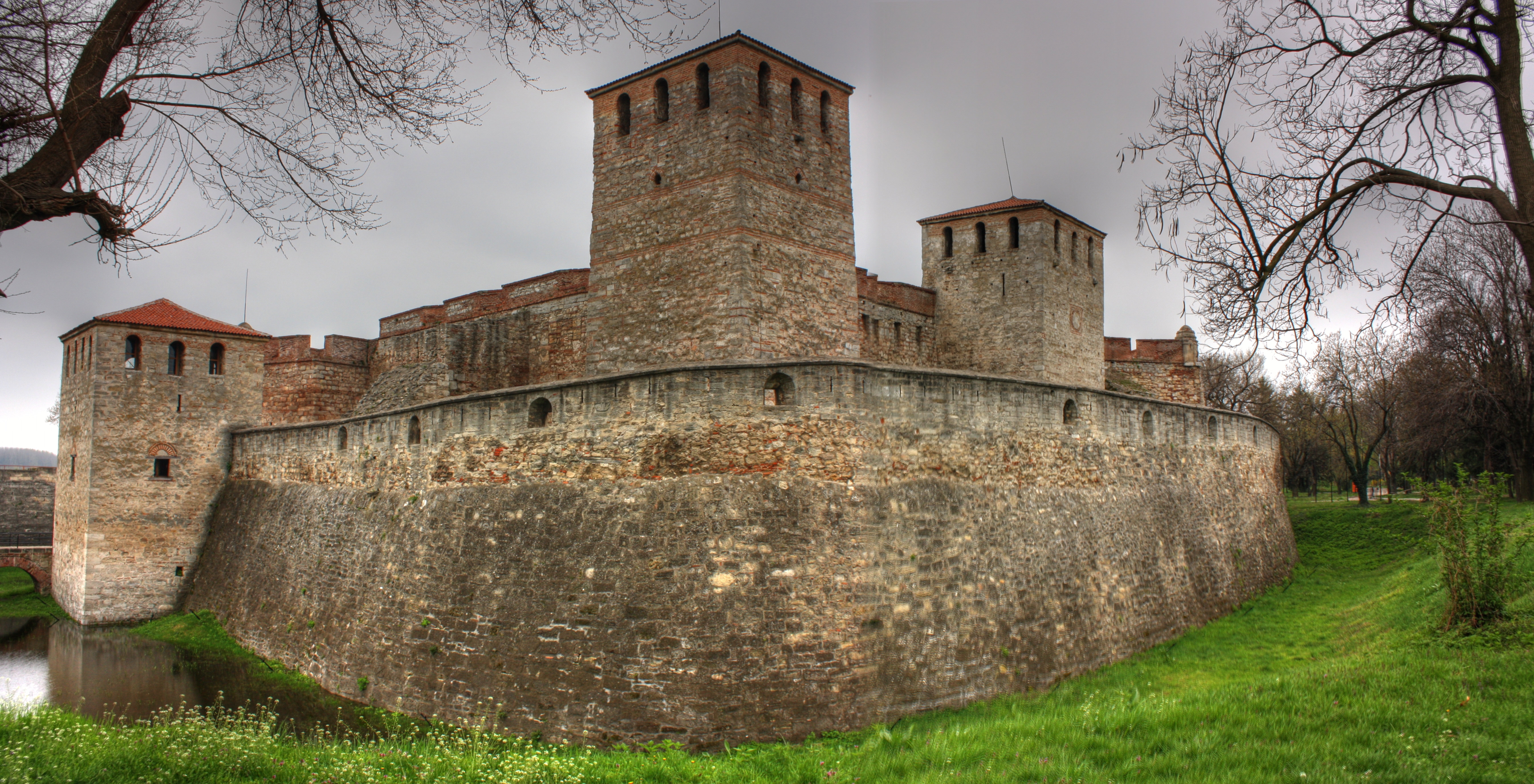
Vidin Province () is the northwesternmost province of Bulgaria. It borders Serbia to the west and Romania to the northeast. Its administrative centre is the city of Vidin on the Danube river. The area is divided into 11 municipalities. As of December 2009, the province has a population of 108,067 inhabitants. There are remains of many castles, including Baba Vida, one of the last Bulgarian strongholds during the Ottoman invasion and the Belogradchik fortress. Municipalities The Vidin Province contains 11 municipalities (singular: община, ''obshtina'' - plural: общини, ''obshtini''). The following table shows the names of each municipality in English and Cyrillic, the main town (in bold) or village, and the population of each as of December 2009. Geography The territory of the province includes the most western parts of the Danubian Plain and Stara Planina, while the Danube forms the border with Romania. The slopes of Stara Planina are covered with dense f ... [...More Info...] [...Related Items...] OR: [Wikipedia] [Google] [Baidu] |
Kingdom Of Romania
The Kingdom of Romania ( ro, Regatul României) was a constitutional monarchy that existed in Romania from 13 March ( O.S.) / 25 March 1881 with the crowning of prince Karl of Hohenzollern-Sigmaringen as King Carol I (thus beginning the Romanian royal family), until 1947 with the abdication of King Michael I of Romania and the Romanian parliament's proclamation of the Romanian People's Republic. From 1859 to 1877, Romania evolved from a personal union of two vassal principalities (Moldavia and Wallachia) under a single prince to an autonomous principality with a Hohenzollern monarchy. The country gained its independence from the Ottoman Empire during the 1877–1878 Russo-Turkish War (known locally as the Romanian War of Independence), when it also received Northern Dobruja in exchange for the southern part of Bessarabia. The kingdom's territory during the reign of King Carol I, between 13 ( O.S.) / 25 March 1881 and 27 September ( O.S.) / 10 October 1914 is sometimes referred ... [...More Info...] [...Related Items...] OR: [Wikipedia] [Google] [Baidu] |
Kingdom Of Serbia
The Kingdom of Serbia ( sr-cyr, Краљевина Србија, Kraljevina Srbija) was a country located in the Balkans which was created when the ruler of the Principality of Serbia, Milan I, was proclaimed king in 1882. Since 1817, the Principality was ruled by the Obrenović dynasty (replaced by the Karađorđević dynasty for a short time). The Principality, under the suzerainty of the Ottoman Empire, ''de facto'' achieved full independence when the last Ottoman troops left Belgrade in 1867. The Congress of Berlin in 1878 recognized the formal independence of the Principality of Serbia, and in its composition Nišava, Pirot, Toplica and Vranje districts entered the South part of Serbia. In 1882, Serbia was elevated to the status of a kingdom, maintaining a foreign policy friendly to Austria-Hungary. Between 1912 and 1913, Serbia greatly enlarged its territory through engagement in the First and Second Balkan Wars— Sandžak-Raška, Kosovo Vilayet and Vardar Macedonia ... [...More Info...] [...Related Items...] OR: [Wikipedia] [Google] [Baidu] |
Tara Romaneasca
Wallachia or Walachia (; ro, Țara Românească, lit=The Romanian Land' or 'The Romanian Country, ; archaic: ', Romanian Cyrillic alphabet: ) is a historical and geographical region of Romania. It is situated north of the Lower Danube and south of the Southern Carpathians. Wallachia is traditionally divided into two sections, Muntenia (Greater Wallachia) and Oltenia (Lesser Wallachia). Dobruja could sometimes be considered a third section due to its proximity and brief rule over it. Wallachia as a whole is sometimes referred to as Muntenia through identification with the larger of the two traditional sections. Wallachia was founded as a principality in the early 14th century by Basarab I after a rebellion against Charles I of Hungary, although the first mention of the territory of Wallachia west of the river Olt dates to a charter given to the voivode Seneslau in 1246 by Béla IV of Hungary. In 1417, Wallachia was forced to accept the suzerainty of the Ottoman Empire; thi ... [...More Info...] [...Related Items...] OR: [Wikipedia] [Google] [Baidu] |
Oltenia
Oltenia (, also called Lesser Wallachia in antiquated versions, with the alternative Latin names ''Wallachia Minor'', ''Wallachia Alutana'', ''Wallachia Caesarea'' between 1718 and 1739) is a historical province and geographical region of Romania in western Wallachia. It is situated between the Danube, the Southern Carpathians and the Olt river. History Ancient times Initially inhabited by Dacians, Oltenia was incorporated in the Roman Empire (106, at the end of the Dacian Wars; ''see Roman Dacia''). In 129, during Hadrian's rule, it formed Dacia Inferior, one of the two divisions of the province (together with Dacia Superior, in today's Transylvania); Marcus Aurelius' administrative reform made Oltenia one of the three new divisions (''tres Daciae'') as Dacia Malvensis, its capital and chief city being named Romula. It was colonized with veterans of the Roman legions. The Romans withdrew their administration south of the Danube at the end of the 3rd century and Oltenia wa ... [...More Info...] [...Related Items...] OR: [Wikipedia] [Google] [Baidu] |
Banat
Banat (, ; hu, Bánság; sr, Банат, Banat) is a geographical and historical region that straddles Central and Eastern Europe and which is currently divided among three countries: the eastern part lies in western Romania (the counties of Timiș, Caraș-Severin, Arad south of the Mureș river, and the western part of Mehedinți); the western part of Banat is in northeastern Serbia (mostly included in Vojvodina, except for a small part included in the Belgrade Region); and a small northern part lies within southeastern Hungary (Csongrád-Csanád County). The region's historical ethnic diversity was severely affected by the events of World War II. Today, Banat is mostly populated by ethnic Romanians, Serbs and Hungarians, but small populations of other ethnic groups also live in the region. Nearly all are citizens of either Serbia, Romania or Hungary. Name During the Middle Ages, the term "banate" designated a frontier province led by a military governor who was called ... [...More Info...] [...Related Items...] OR: [Wikipedia] [Google] [Baidu] |
Subdialect
Subdialect (from Latin , "under", and Ancient Greek , "discourse") is a linguistic term designating a dialectological category between the levels of dialect and idiolect. Subdialects are basic subdivisions of a dialect. Subdialects can be divided further, ultimately down to idiolects. Normally subdialects of one dialect are quite close to each other, differing mainly in pronunciation and certain local words. See also * Accent (dialect) * Variety (linguistics) * Language cluster * Dubrovnik subdialect * Laško subdialect The Laško subdialect (''laški govor''Smole, Vera. 1998. "Slovenska narečja." ''Enciklopedija Slovenije'' vol. 12, pp. 1–5. Ljubljana: Mladinska knjiga, p. 2.) is a Slovene subdialect in the Styrian dialect group. It is a subdialect of the Low ... * Lwów subdialect * Supradialect Reference Literature * Joseph R. Applegate, "Phonological Rules of a Subdialect of English", Word, vol. 17/2 (1961), p. 186-193. * Asta Leskauskaite, "The Periphery Sub ... [...More Info...] [...Related Items...] OR: [Wikipedia] [Google] [Baidu] |
Sanjak Of Smederevo
The Sanjak of Smederevo ( tr, Semendire Sancağı; sr, / ), also known in historiography as the Pashalik of Belgrade ( tr, Belgrad Paşalığı; sr, / ), was an Ottoman Empire, Ottoman administrative unit (sanjak), that existed between the 15th and the outset of the 19th centuries. It was located in the territory of present-day Central Serbia, Serbia. Administration Eyalet belonging The sanjak belonged to Rumelia Eyalet between 1459 and 1541, and again between 1716 and 1717 and again 1739 and 1817 (nominally to 1830), to Budin Eyalet between 1541 and 1686, and to Temeșvar Eyalet between 1686 and 1688 and again between 1690 and 1716. Borders During the governorship of Hadji Mustafa Pasha (1793–1801), the administration was expanded eastwards to include the Kladovo area, until then part of the Sanjak of Vidin. History 15th century The Sanjak of Smederevo was formed after the fall of the Serbian Despotate in 1459, and its administrative seat was Smederevo. Ottoman sources n ... [...More Info...] [...Related Items...] OR: [Wikipedia] [Google] [Baidu] |
Rasina District
The Rasina District ( sr, / , ) is one of eight administrative districts of Šumadija and Western Serbia. It expands to the central parts of Serbia. According to the 2011 census results, it has a population of 241,999 inhabitants. The administrative center of the Rasina District is Kruševac. Municipalities The district encompasses the municipalities of: * Varvarin * Trstenik * Ćićevac * Kruševac * Aleksandrovac * Brus Demographics According to the last official census done in 2011, the Rasina District has 241,999 inhabitants. 53.8% of the population lives in the urban areas. Ethnic composition of the district: Culture and history Kruševac and its vicinity are distinguished by numerous historic monuments: The Lazar's Town, with the remnants of the medieval fortification and the Lazarica Church has an epic quality in the Serbian tradition. The Lazarica Church, built in 1376 on the occasion of Stephan's son birth, and dedicated to St. Stephen, is the model of the Moravs ... [...More Info...] [...Related Items...] OR: [Wikipedia] [Google] [Baidu] |


