|
Visakhapatnam Port
Visakhapatnam Port is one of 13 major ports in India and the only major port of Andhra Pradesh. It is India's third largest state-owned port by volume of cargo handled and largest on the Eastern Coast. It is located midway between the Chennai and Kolkata Ports on the Bay of Bengal. History Although the need for building a port on the east coast to access Central Provinces was felt by the British in the 19th century, the proposal of Col. H.Cartwright Reid of British Admiralty for constructing a harbour at Visakhapatnam was approved by the Government only after the First World War. The Inner Harbour was built by the Bengal Nagpur Railway between 1927 and 1933 to facilitate the export of manganese ore from the Central Provinces. The port, built at a cost of 378 lakhs was inaugurated by Lord Willingdon on 19 December 1933. During the Second World War, the military significance of the port increased. After India's independence, the port witnessed growth under the various Five ... [...More Info...] [...Related Items...] OR: [Wikipedia] [Google] [Baidu] |
Visakhapatnam
, image_alt = , image_caption = From top, left to right: Visakhapatnam aerial view, Vizag seaport, Simhachalam Temple, Aerial view of Rushikonda Beach, Beach road, Novotel, Novotel Visakhapatnam, INS Kursura (S20), INS Kursura submarine museum, Vizag skyline, Kambalakonda wildlife sanctuary , etymology = , nickname = The City of DestinyThe Jewel of the East Coast , image_map = , map_caption = , pushpin_map = India Visakhapatnam#India Andhra Pradesh#India#Asia#Earth , pushpin_label_position = left , pushpin_map_alt = , pushpin_map_caption = , coordinates = {{coord, 17, 42, 15, N, 83, 17, 52, E, display=inline,title , subdivision_type = Country , subdivision_name = {{flag, India , subdivision_type1 = States and union territories of India, State , subdivision_name1 = Andhra Pradesh , subdivision_type2 = ... [...More Info...] [...Related Items...] OR: [Wikipedia] [Google] [Baidu] |
Second World War
World War II or the Second World War, often abbreviated as WWII or WW2, was a world war that lasted from 1939 to 1945. It involved the vast majority of the world's countries—including all of the great powers—forming two opposing military alliances: the Allies and the Axis powers. World War II was a total war that directly involved more than 100 million personnel from more than 30 countries. The major participants in the war threw their entire economic, industrial, and scientific capabilities behind the war effort, blurring the distinction between civilian and military resources. Aircraft played a major role in the conflict, enabling the strategic bombing of population centres and deploying the only two nuclear weapons ever used in war. World War II was by far the deadliest conflict in human history; it resulted in 70 to 85 million fatalities, mostly among civilians. Tens of millions died due to genocides (including the Holocaust), starvation, ma ... [...More Info...] [...Related Items...] OR: [Wikipedia] [Google] [Baidu] |
Capesize
Capesize ships are the largest dry cargo ships with ball mark dimension: about 170,000 DWT (deadweight tonnage) capacity, 290 m long, 45 m beam (wide), 18m draught (under water depth). They are too large to transit the Suez Canal ( Suezmax limits) or Panama Canal ( Neopanamax limits), and so have to pass either Cape Agulhas or Cape Horn to traverse between oceans. When the Suez Canal was deepened in 2009, it became possible for some capesize ships to transit the Canal and so change categories. Routes Major capesize bulk trade routes include: Brazil to China, Australia to China, South Africa to China and South Africa to Europe. Classification Ships in this class are bulk carriers, usually transporting coal, ore and other commodity raw materials. The term ''capesize'' is not applied to tankers. The average size of a capesize bulker is around , although larger ships (normally dedicated to ore transportation) have been built, up to . The large dimensions and deep drafts ... [...More Info...] [...Related Items...] OR: [Wikipedia] [Google] [Baidu] |
Visakhapatnam Steel Plant
Visakhapatnam Steel Plant is the integrated steel plants of Rashtriya Ispat Nigam Limited in Visakhapatnam. Founded in 1971, the plant focuses on producing value-added steel, producing 5.773 million tonnes of hot metal, 5.272 million tonnes of crude steel and 5.138 million tonnes of saleable steel in the 2021-2022 financial year. History On 17 April 1970, the Prime Minister of India, the Indira Gandhi, announced the government's decision to establish a steel plant at Visakhapatnam. With the offer of assistance from the government of the erstwhile USSR, a revised project evolved some years later. A detailed project report for a plant with a capacity of 3.4 Mtpa was prepared in November 1980 and in February 1981, a contract was signed with the USSR for the preparation of working drawings of coke ovens, blast furnace and sinter plant. The blast furnace foundation was laid, with first mass concreting, in January 1982. The construction of the local township was also started ... [...More Info...] [...Related Items...] OR: [Wikipedia] [Google] [Baidu] |
Rashtriya Ispat Nigam Limited
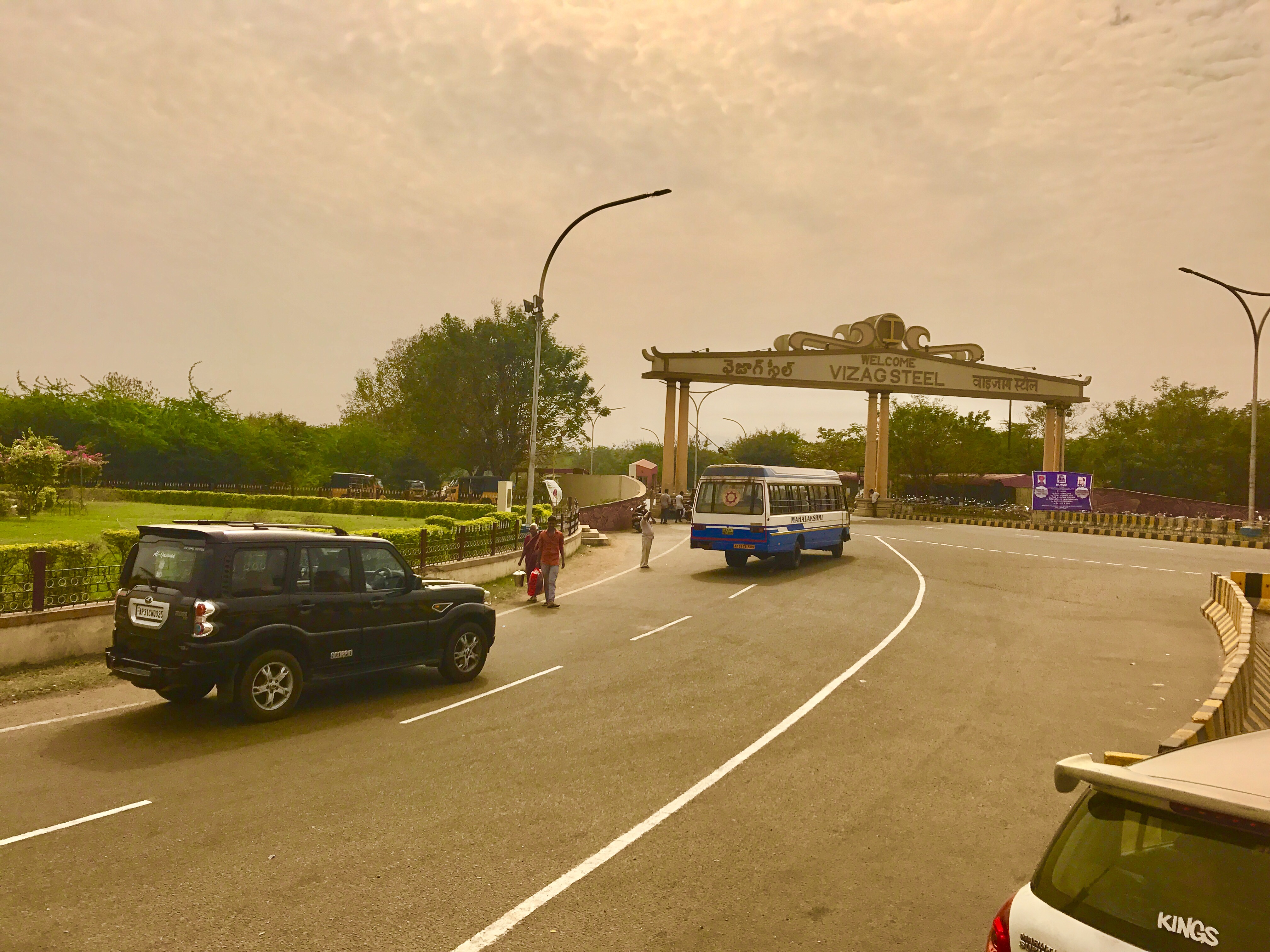
Rashtriya Ispat Nigam Ltd, (abbreviated as RINL), also known as ''Vizag Steel'', is a public steel producer based in Visakhapatnam, India. Rashtriya Ispat Nigam Limited (RINL) is the corporate entity of Visakhapatnam Steel Plant (VSP), India's first shore-based integrated steel plant built with state-of-the-art technology. Visakhapatnam Steel Plant (VSP) is a 7.3 MTPA plant. It was commissioned in 1992 with a capacity of 3.0 MTPA of liquid steel. The company subsequently completed its capacity expansion to 6.3 MTPA in April 2015 and to 7.3 MTPA in December 2017. The company is having one subsidiary, viz. Eastern Investment Limited (EIL) with 51% shareholding, which in turn is having two subsidiaries, viz. M/s Orissa Mineral Development Company Ltd (OMDC) and M/s Bisra Stone Lime Company Ltd (BSLC). The company has a partnership in RINMOIL Ferro Alloys Private Limited and International Coal Ventures Limited in the form of Joint Ventures with 50% and 26.49% shareholding respective ... [...More Info...] [...Related Items...] OR: [Wikipedia] [Google] [Baidu] |
Visakhapatnam Seaport From Fishing Harbour
, image_alt = , image_caption = From top, left to right: Visakhapatnam aerial view, Vizag seaport, Simhachalam Temple, Aerial view of Rushikonda Beach, Beach road, Novotel Visakhapatnam, INS Kursura submarine museum, Vizag skyline, Kambalakonda wildlife sanctuary , etymology = , nickname = The City of DestinyThe Jewel of the East Coast , image_map = , map_caption = , pushpin_map = India Visakhapatnam#India Andhra Pradesh#India#Asia#Earth , pushpin_label_position = left , pushpin_map_alt = , pushpin_map_caption = , coordinates = {{coord, 17, 42, 15, N, 83, 17, 52, E, display=inline,title , subdivision_type = Country , subdivision_name = {{flag, India , subdivision_type1 = State , subdivision_name1 = Andhra Pradesh , subdivision_type2 = Districts , subdivision_name2 = Visakhapatnam, Anakapall ... [...More Info...] [...Related Items...] OR: [Wikipedia] [Google] [Baidu] |
Orissa, India
Odisha (English: , ), formerly Orissa ( the official name until 2011), is an Indian state located in Eastern India. It is the 8th largest state by area, and the 11th largest by population. The state has the third largest population of Scheduled Tribes in India. It neighbours the states of Jharkhand and West Bengal to the north, Chhattisgarh to the west, and Andhra Pradesh to the south. Odisha has a coastline of along the Bay of Bengal in Indian Ocean. The region is also known as Utkala and is also mentioned in India's national anthem, "Jana Gana Mana". The language of Odisha is Odia, which is one of the Classical Languages of India. The ancient kingdom of Kalinga, which was invaded by the Mauryan Emperor Ashoka (which was again won back from them by King Kharavela) in 261 BCE resulting in the Kalinga War, coincides with the borders of modern-day Odisha. The modern boundaries of Odisha were demarcated by the British Indian government when Orissa Province was established ... [...More Info...] [...Related Items...] OR: [Wikipedia] [Google] [Baidu] |
Chhattisgarh
Chhattisgarh (, ) is a landlocked state in Central India. It is the ninth largest state by area, and with a population of roughly 30 million, the seventeenth most populous. It borders seven states – Uttar Pradesh to the north, Madhya Pradesh to the northwest, Maharashtra to the southwest, Jharkhand to the northeast, Odisha to the east, Telangana and Andhra Pradesh to the south. Formerly a part of Madhya Pradesh, it was granted statehood on 1 November 2000 with Raipur as the designated state capital. Chhattisgarh is one of the fastest-developing states in India. Its Gross State Domestic Product (GSDP) is , with a per capita GSDP of . A resource-rich state, it has the third largest coal reserves in the country and provides electricity, coal, and steel to the rest of the nation. It also has the third largest forest cover in the country after Madhya Pradesh and Arunachal Pradesh with over 40% of the state covered by forests. Etymology There are several theories as to the ... [...More Info...] [...Related Items...] OR: [Wikipedia] [Google] [Baidu] |
Narava Gedda
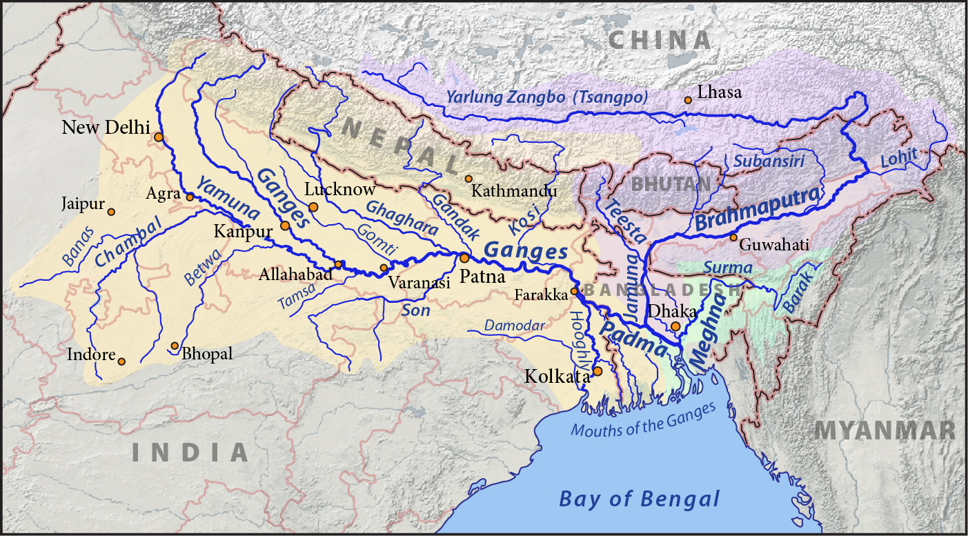
This is a list of rivers of India, starting in the west and moving along the Indian coast southward, then northward. Tributary rivers are listed hierarchically in upstream order: the lower in the list, the more upstream. The overall discharge of rivers in India or passing/originating in India : List of rivers of India by discharge The major rivers of India are: * Flowing into the Arabian Sea: Narmada, Tapi, Sindhu, Sabarmati, Mahi, Purna * Flowing into the Bay of Bengal: Brahmaputra, Yamuna, Ganga, Meghna, Mahanadi, Godavari, Krishna, Kaveri, Penna River Mizoram and Bangladesh. Meghna River Basin The Meghna-Surma-Barak River System is located in India and Bangladesh. * Meghna River (in the Bangladesh) ** ** Dhaleshwari River ** Dakatia River ** Gumti River ** Feni River ** Tista River, also called the Haora River ** Surma River *** Kangsha River **** Someshwari River ** Kushiyara River *** Manu River ** Barak River *** Tuivai River *** Irang River Ganges River B ... [...More Info...] [...Related Items...] OR: [Wikipedia] [Google] [Baidu] |
Creek (tidal)
A tidal creek or tidal channel is a narrow inlet or estuary that is affected by the ebb and flow of ocean tides. Thus, it has variable salinity and electrical conductivity over the tidal cycle, and flushes salts from inland soils. Tidal creeks are characterized by slow water velocity, resulting in buildup of fine, organic sediment in wetlands. Creeks may often be a dry to muddy channel with little or no flow at low tide, but with significant depth of water at high tide. Due to the temporal variability of water quality parameters within the tidally influenced zone, there are unique biota associated with tidal creeks which are often specialised to such zones. Nutrients and organic matter are delivered downstream to habitats normally lacking these, while the creeks also provide access to inland habitat for salt-water organisms. Terminology A "creek" normally refers to a tidal water channel in British English and in other parts of the Anglosphere. This is the case in many countries ... [...More Info...] [...Related Items...] OR: [Wikipedia] [Google] [Baidu] |
Dolphin's Nose
Dolphin's Nose is a hill in Visakhapatnam between Yarada and Gangavaram Port. The hill is named Dolphin's Nose because it resembles a dolphin's nose. It is a conspicuous land mark in Visakhapatnam. Dolphin's nose is a huge rocky head land which is 174 meters high and 358 meters above sea level. The powerful beacon of the light house set on this rock at sea directs ships 65 km away. History Before independence, the British Army used it as a Military Camp. There is a Hindu Temple, a Church, and a Mosque on a nearby hill. In 1804 British and French forces fought the Battle of Vizagapatam near this hill. Lighthouse A lighthouse on this hill guided ships to enter Visakhapatnam Port. The lighthouse currently uses 7 million candle power that covers up to a distance of 64 kilometers. Recently the Government of India The Government of India (ISO: ; often abbreviated as GoI), known as the Union Government or Central Government but often simply as the Centre, is the nationa ... [...More Info...] [...Related Items...] OR: [Wikipedia] [Google] [Baidu] |
Panamax
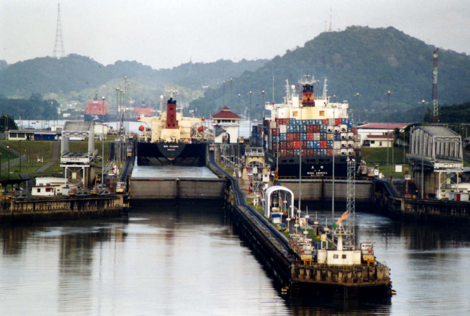
Panamax and New Panamax (or Neopanamax) are terms for the size limits for ships travelling through the Panama Canal. The limits and requirements are published by the Panama Canal Authority (ACP) in a publication titled "Vessel Requirements". These requirements also describe topics like exceptional dry seasonal limits, propulsion, communications, and detailed ship design. The allowable size is limited by the width and length of the available lock chambers, by the depth of water in the canal, and by the height of the Bridge of the Americas since that bridge's construction. These dimensions give clear parameters for ships destined to traverse the Panama Canal and have influenced the design of cargo ships, naval vessels, and passenger ships. Panamax specifications have been in effect since the opening of the canal in 1914. In 2009, the ACP published the New Panamax specification which came into effect when the canal's third set of locks, larger than the original two, opened on ... [...More Info...] [...Related Items...] OR: [Wikipedia] [Google] [Baidu] |


.png)


