|
Villers-Perwin
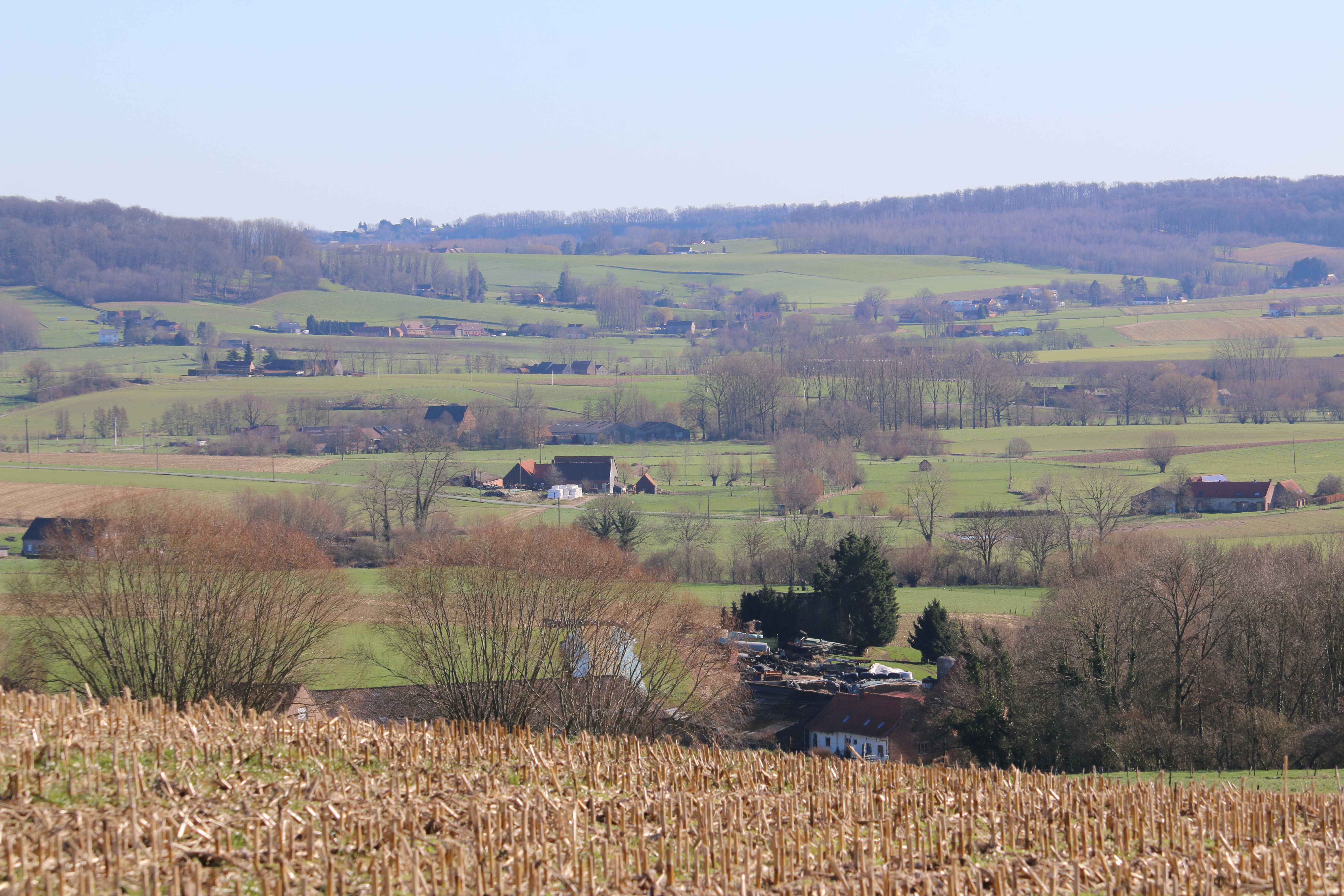
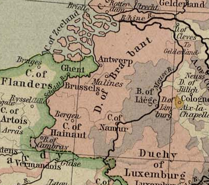
Villers-Perwin ( wa, Viyé-Perwin) is a village of Wallonia and a district of the municipality of Les Bons Villers, located in the province of Hainaut, Belgium. Villers-Perwin was a municipality on its own until the Fusion of the communes in Belgium in 1977. History Villers-Perwin has been a part of the Duchy of Brabant for 1000 years (802-1802) and is now located in the province of Hainaut. The first lords of the village were the Villers-Perwin, then passed successively to the de Walhain (13th century), the de Berghes (15th century) and the de Ligne (16th century). Albert de Ligne sold the seigniory in 1618 to Gérard de Villers, counselor of Archduke Albert and Isabelle. In 1670 it became property of Christophe Hannosset, counselor and receiver general of the province of Brabant. The last lords were the Castro y Toledo and finally the de Renette that built the Chapelle Saint-Hubert in 1760 for the protector of the hunters, celebrated on 3 November and the Chapelle Saint-Jacques ... [...More Info...] [...Related Items...] OR: [Wikipedia] [Google] [Baidu] |
Arthur Grumiaux
Baron Arthur Grumiaux (; 21 March 1921 – 16 October 1986) was a Belgian violinist, considered by some to have been "one of the few truly great violin virtuosi of the twentieth century". He has been noted for having a "consistently beautiful tone and flawless intonation". English music critic and broadcaster, Edward Greenfield wrote of him that he was "a master virtuoso who consistently refused to make a show of his technical prowess". Early life Born to a working-class family in the Belgian town of Villers-Perwin, on 21 March 1921, Grumiaux was only three years old when his grandfather urged him to begin music studies. He entered the conservatoire in Charleroi at the age of six; the normal entry age was eleven. He studied violin and piano there until the age of eleven, when he graduated and moved to the Royal Conservatoire in Brussels to study violin. Career He variously has been described as having made his debut in Brussels at the age of 14, or in 1935, although his deb ... [...More Info...] [...Related Items...] OR: [Wikipedia] [Google] [Baidu] |
Mellet
Mellet ( wa, Melet; in Old French ''Meflet'') (pronounced ɛ">Open-mid_front_unrounded_vowel.html" ;"title="əlOpen-mid front unrounded vowel">ɛby the inhabitants) is a village of Wallonia and a district of the municipality of Les Bons Villers, located in the Hainaut Province, province of Hainaut, Belgium. Geography Mellet is crossed by a stream called Tintia. The Tintia flows into the Piéton. It is part of the Meuse basin. The altitude of Mellet is 140 meters. Recent history In 1977, five villages ( Frasnes-lez-Gosselies, Mellet, Rèves, Villers-Perwin and Wayaux) came together to form the commune of Les Bons Villers Les Bons Villers (; wa, Les Bons Viyés) is a municipality of Wallonia located in the province of Hainaut, Belgium. On 1 January 2018 the municipality had 9,457 inhabitants. The total area is 42.55 km², giving a population density Popul .... Mellet was a municipality in its own right before the merger of the municipalities. Heritage * An old ... [...More Info...] [...Related Items...] OR: [Wikipedia] [Google] [Baidu] |
Les Bons Villers
Les Bons Villers (; wa, Les Bons Viyés) is a municipality of Wallonia located in the province of Hainaut, Belgium. On 1 January 2018 the municipality had 9,457 inhabitants. The total area is 42.55 km², giving a population density Population density (in agriculture: Stock (other), standing stock or plant density) is a measurement of population per unit land area. It is mostly applied to humans, but sometimes to other living organisms too. It is a key geographical ... of 222 inhabitants per km². The municipality consists of the following districts: Frasnes-lez-Gosselies, Mellet, Rèves, Villers-Perwin and Wayaux. References External links * Municipalities of Hainaut (province) {{Hainaut-geo-stub ... [...More Info...] [...Related Items...] OR: [Wikipedia] [Google] [Baidu] |
Wallonia
Wallonia (; french: Wallonie ), or ; nl, Wallonië ; wa, Waloneye or officially the Walloon Region (french: link=no, Région wallonne),; nl, link=no, Waals gewest; wa, link=no, Redjon walone is one of the three regions of Belgium—along with Flanders and Brussels. Covering the southern portion of the country, Wallonia is primarily French-speaking. It accounts for 55% of Belgium's territory, but only a third of its population. The Walloon Region and the French Community of Belgium, which is the political entity responsible for matters related mainly to culture and education, are independent concepts, because the French Community of Belgium encompasses both Wallonia and the bilingual Brussels-Capital Region. There is a German-speaking minority in eastern Wallonia, resulting from the annexation of three cantons previously part of the German Empire at the conclusion of World War I. This community represents less than 1% of the Belgian population. It forms the German-speak ... [...More Info...] [...Related Items...] OR: [Wikipedia] [Google] [Baidu] |
Hainaut Province
Hainaut (, also , , ; nl, Henegouwen ; wa, Hinnot; pcd, Hénau), historically also known as Heynowes in English, is a province of Wallonia and Belgium. To its south lies the French department of Nord, while within Belgium it borders (clockwise from the North) on the Flemish provinces of West Flanders, East Flanders, Flemish Brabant and the Walloon provinces of Walloon Brabant and Namur. Its capital is Mons (Dutch ''Bergen'') and the most populous city is Charleroi, the province's urban, economic and cultural hub, the financial capital of Hainaut and the fifth largest city in the country by population. Hainaut has an area of and as of January 2019 a population of 1,344,241. Another remarkable city is Tournai (Dutch ''Doornik'') on the Scheldt river, one of the oldest cities of Belgium and the first capital of the Frankish Empire. Hainaut province exists of a wavy landscape, except for the very southern part, the so-called ''Boot of Hainaut'', which is quite hilly and bel ... [...More Info...] [...Related Items...] OR: [Wikipedia] [Google] [Baidu] |
Belgium
Belgium, ; french: Belgique ; german: Belgien officially the Kingdom of Belgium, is a country in Northwestern Europe. The country is bordered by the Netherlands to the north, Germany to the east, Luxembourg to the southeast, France to the southwest, and the North Sea to the northwest. It covers an area of and has a population of more than 11.5 million, making it the 22nd most densely populated country in the world and the 6th most densely populated country in Europe, with a density of . Belgium is part of an area known as the Low Countries, historically a somewhat larger region than the Benelux group of states, as it also included parts of northern France. The capital and largest city is Brussels; other major cities are Antwerp, Ghent, Charleroi, Liège, Bruges, Namur, and Leuven. Belgium is a sovereign state and a federal constitutional monarchy with a parliamentary system. Its institutional organization is complex and is structured on both regional ... [...More Info...] [...Related Items...] OR: [Wikipedia] [Google] [Baidu] |
Fusion Of The Communes
The fusion of the Belgian municipalities (French: ''fusion des communes'', Dutch: ''fusie van Belgische gemeenten'') was a Belgian political process that rationalized and reduced the number of municipalities in Belgium between 1975 and 1983. In 1961, there were 2,663 such municipalities; by 1983, these had been re-arranged and combined into 589 municipalities. The project of merging a number of local authorities to improve service delivery by streamlining administration and creating economies of scale was the work of the government headed by Leo Tindemans (1974–1978), and in particular of Interior Minister Joseph Michel. The legal framework in which the mergers would be implemented was laid out in an act passed by the Belgian Parliament on 30 December 1975.M. Lazzari, P. Verjans and A.-L. DurviauxLa fusion des communes: une réforme trentenaire (Merger of municipalities: a thirty-year old reform) ''Territoire(s) wallon(s)'', special issue (August 2008), pp. 27-34. 21st century ... [...More Info...] [...Related Items...] OR: [Wikipedia] [Google] [Baidu] |
Duchy Of Brabant
The Duchy of Brabant was a State of the Holy Roman Empire established in 1183. It developed from the Landgraviate of Brabant and formed the heart of the historic Low Countries, part of the Burgundian Netherlands from 1430 and of the Habsburg Netherlands from 1482, until it was partitioned after the Dutch revolt. Present-day North Brabant (''Noord-Brabant'') was ceded to the Generality Lands of the Dutch Republic according to the 1648 Peace of Westphalia, while the reduced duchy remained part of the Habsburg Netherlands until it was conquered by French Revolutionary forces in 1794, which was recognized by treaty in 1797. Today all the duchy's former territories, apart from exclaves, are in Belgium except for the Dutch province of North Brabant. Geography The Duchy of Brabant (adjective: ''Brabantian'' or '' Brabantine'') was historically divided into four parts, each with its own capital. The four capitals were Leuven, Brussels, Antwerp and 's-Hertogenbosch. Before 's-Hertogenb ... [...More Info...] [...Related Items...] OR: [Wikipedia] [Google] [Baidu] |
Battle Of Fleurus (1622)
The Battle of Fleurus of August 29, 1622 was fought in the Spanish Netherlands between a Spanish army, and the Protestant forces of Ernst von Mansfeld and Christian of Brunswick during the Eighty Years' War and Thirty Years' War. The bloody struggle left the Protestants mangled and the Spanish masters of the field and would ensure Catholic dominance in Germany till the intervention of Denmark–Norway. Campaign After failing to relieve Heidelberg, besieged by Tilly's army, Frederick V, Elector Palatine, decided to disband his army. On July 13, 1622 the contract was cancelled and the unemployed army of Mansfeld and Christian of Brunswick was hired by the Dutch to help in the relief of the siege of Bergen-op-Zoom. The Protestant army departed from Alsace and at a fast pace crossed Northern France, entering the Spanish Low Countries through Hainaut. The Spanish Army of Flanders, under command of Ambrogio Spinola, engaged in the siege of Bergen-op-Zoom, a town on the estuary of ... [...More Info...] [...Related Items...] OR: [Wikipedia] [Google] [Baidu] |
World War II
World War II or the Second World War, often abbreviated as WWII or WW2, was a world war that lasted from 1939 to 1945. It involved the vast majority of the world's countries—including all of the great powers—forming two opposing military alliances: the Allies and the Axis powers. World War II was a total war that directly involved more than 100 million personnel from more than 30 countries. The major participants in the war threw their entire economic, industrial, and scientific capabilities behind the war effort, blurring the distinction between civilian and military resources. Aircraft played a major role in the conflict, enabling the strategic bombing of population centres and deploying the only two nuclear weapons ever used in war. World War II was by far the deadliest conflict in human history; it resulted in 70 to 85 million fatalities, mostly among civilians. Tens of millions died due to genocides (including the Holocaust), starvation, ma ... [...More Info...] [...Related Items...] OR: [Wikipedia] [Google] [Baidu] |
Roman Road
Roman roads ( la, viae Romanae ; singular: ; meaning "Roman way") were physical infrastructure vital to the maintenance and development of the Roman state, and were built from about 300 BC through the expansion and consolidation of the Roman Republic and the Roman Empire. They provided efficient means for the overland movement of armies, officials, civilians, inland carriage of official communications, and trade goods. Roman roads were of several kinds, ranging from small local roads to broad, long-distance highways built to connect cities, major towns and military bases. These major roads were often stone-paved and metaled, cambered for drainage, and were flanked by footpaths, bridleways and drainage ditches. They were laid along accurately surveyed courses, and some were cut through hills, or conducted over rivers and ravines on bridgework. Sections could be supported over marshy ground on rafted or piled foundations.Corbishley, Mike: "The Roman World", page 50. Warwick Press, ... [...More Info...] [...Related Items...] OR: [Wikipedia] [Google] [Baidu] |
.jpg)


