|
Villa De Tututepec De Melchor Ocampo
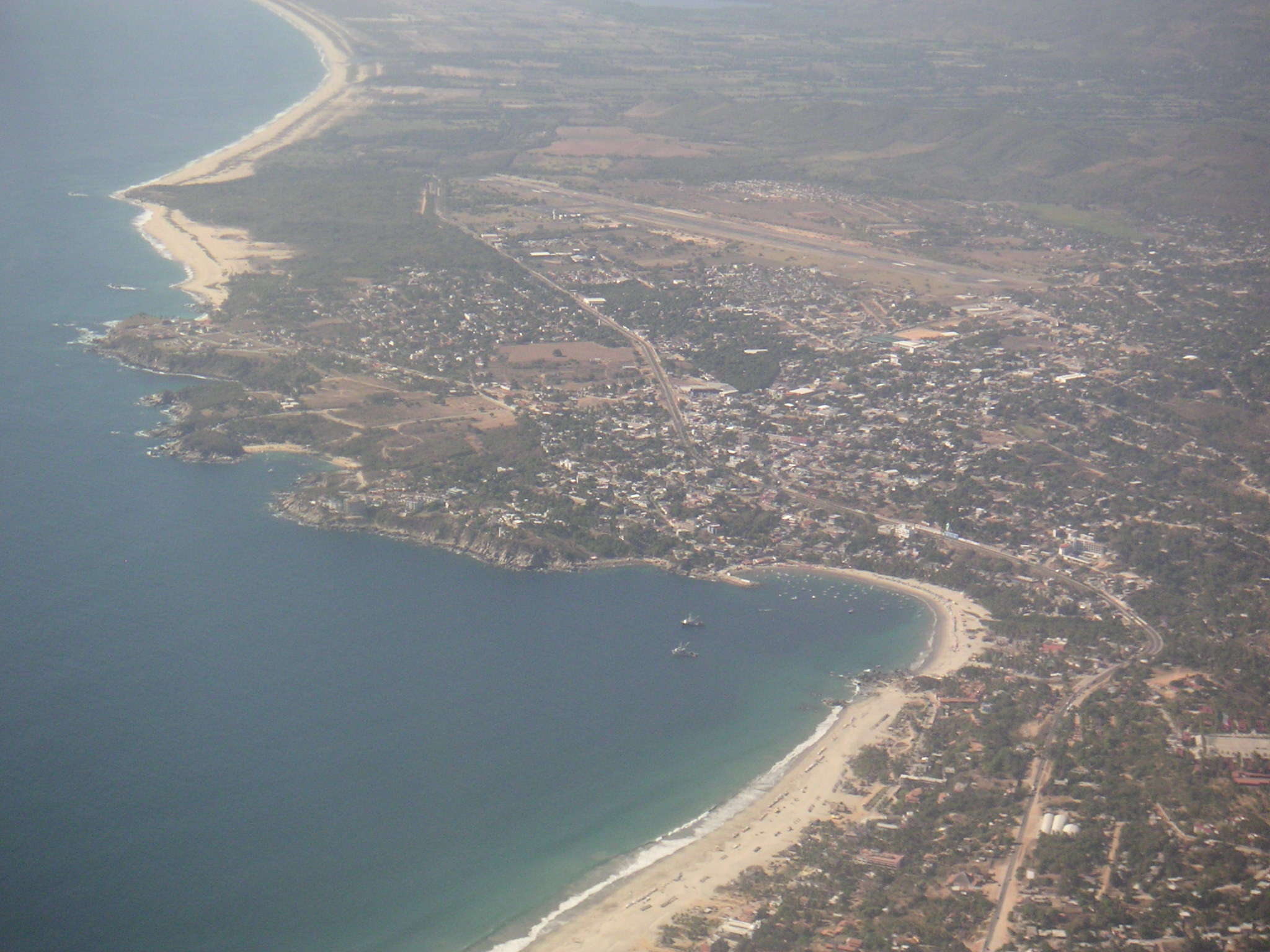
Villa de Tututepec de Melchor Ocampo is a town and municipality in Oaxaca in south-western Mexico. History Before the arrival of Spanish, the area was occupied by a small Mixtec kingdom, established in 357 AD, when Prince Mazatzin arrived from Tilantongo. Upon climbing a mountain full of seabirds, Prince Mazatzin decided to found his capital in this beautiful location, calling it “Yucu – Saa”, or "Bird mountain" in the Mixtec language. Tututepec served as a Mixtec capital under Eight Deer Jaguar Claw, maintaining its independence despite coming under attack from the Aztecs between 1483–1519. When the conquistador Pedro de Alvarado arrived March 3, 1522, he defeated Tututepec's warriors, who fought under Cuaxintecutli (Venerable Lord Serpent). Cuaxintecutli died from torture on March 22, 1522. In April 1522, Hernán Cortés moved the Villa de la Segura de la Frontera to Tututepec, and installed Gutierre de Badajoz as the first mayor. Geography Tututepec is part of the ... [...More Info...] [...Related Items...] OR: [Wikipedia] [Google] [Baidu] |
Municipalities Of Oaxaca
Oaxaca is a state in Southwest Mexico that is divided into 570 municipalities, more than any other state. According to Article 113 of the state's constitution, the municipalities are grouped into 30 judicial and tax districts to facilitate the distribution of the state's revenues, although they may not currently function as per their intended purpose. It's the only entity in Mexico with this particular organization. According to the 2020 Mexican Census, it is the tenth most populated state with inhabitants and the 5th largest by land area spanning . Municipalities in Oaxaca are administratively autonomous of the state according to the 115th article of the 1917 Constitution of Mexico. Every three years, citizens elect a municipal president ( es, links=no, presidente municipal) by a plurality voting system who heads a concurrently elected municipal council () responsible for providing all the public services for their constituents. The municipal council consists of a variable n ... [...More Info...] [...Related Items...] OR: [Wikipedia] [Google] [Baidu] |
Pedro De Alvarado
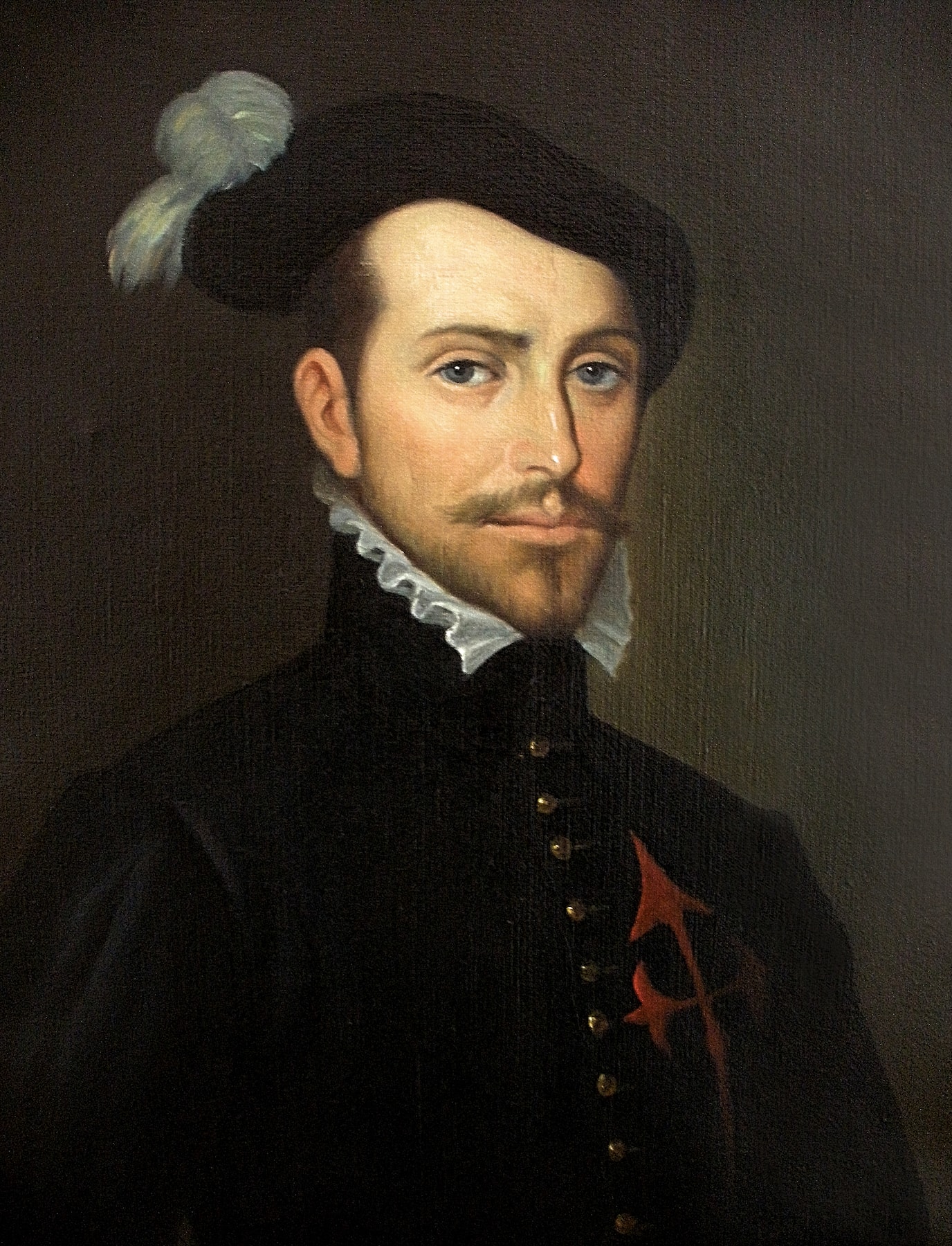
Pedro de Alvarado (; c. 1485 – 4 July 1541) was a Spanish conquistador and governor of Guatemala.Lovell, Lutz and Swezey 1984, p. 461. He participated in the conquest of Cuba, in Juan de Grijalva's exploration of the coasts of the Yucatán Peninsula and the Gulf of Mexico, and in the conquest of the Aztec Empire led by Hernán Cortés. He is considered the conquistador of much of Central America, including Guatemala, Honduras and El Salvador. Character and appearance Pedro de Alvarado was flamboyant and charismatic, and was both a brilliant military commander and a cruel, hardened man. His hair and beard were red, which reminded the Aztecs of their sun-god (often painted red) Tōnatiuh. He was handsome, and presented an affable appearance, but was volatile and quick to anger.Burland 1973, p. 216. He was ruthless in his dealings with the indigenous peoples he set out to conquer. Historians judge that his greed drove him to excessive cruelty,Recinos 1986, p. 205. and his ... [...More Info...] [...Related Items...] OR: [Wikipedia] [Google] [Baidu] |
Atole
''Atole'' (, from Nahuatl '' ātōlli'' ), also known as ''atolli'' and ''atol de elote'', is a traditional hot corn- and masa-based beverage of Mexican origin. Chocolate ''atole'' is known as ''champurrado'' or ''atole''. It typically accompanies tamales, and is very popular during Day of the Dead (observed November 2) and ''Las Posadas'' (Christmas holiday season). In Mexico In Mexico, the drink typically includes'' masa ''(corn hominy flour), water, ''piloncillo'' (unrefined cane sugar), cinnamon, vanilla, and optional chocolate or fruit. The mixture is blended and heated before serving. ''Atole'' is made by toasting ''masa'' on a ''comal'' (griddle), then adding water that was boiled with cinnamon sticks. The resulting blends vary in texture, ranging from a porridge to a very thin, liquid consistency. ''Atole'' can also be prepared with rice, wheat, or oatmeal in place of masa. In northern Mexico, a variation is also made using ''pinole'' (sweetened toasted corn meal). ... [...More Info...] [...Related Items...] OR: [Wikipedia] [Google] [Baidu] |
Chocolate
Chocolate is a food made from roasted and ground cacao seed kernels that is available as a liquid, solid, or paste, either on its own or as a flavoring agent in other foods. Cacao has been consumed in some form since at least the Olmec civilization (19th-11th century BCE), and the majority of Mesoamerican people ─ including the Maya and Aztecs ─ made chocolate beverages. The seeds of the cacao tree have an intense bitter taste and must be fermented to develop the flavor. After fermentation, the seeds are dried, cleaned, and roasted. The shell is removed to produce cocoa nibs, which are then ground to cocoa mass, unadulterated chocolate in rough form. Once the cocoa mass is liquefied by heating, it is called chocolate liquor. The liquor may also be cooled and processed into its two components: cocoa solids and cocoa butter. Baking chocolate, also called bitter chocolate, contains cocoa solids and cocoa butter in varying proportions, without any added sugar. Powder ... [...More Info...] [...Related Items...] OR: [Wikipedia] [Google] [Baidu] |
Champurrado
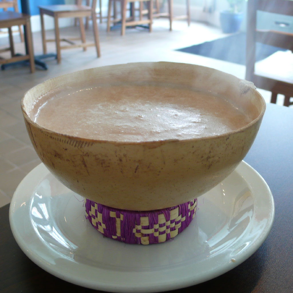
Champurrado is a chocolate-based ''atole'', a warm and thick Mexican beverage. It is prepared with either '' masa de maíz'' (lime-treated corn dough),'' masa harina'' (a dried version of this dough), or corn flour (simply very finely ground dried corn, especially local varieties grown for ''atole''); ''piloncillo''; water or milk; and occasionally containing cinnamon, anise seed, or vanilla. Ground nuts, orange zest, and egg can also be added to thicken and enrich the drink. ''Atole'' drinks are whipped up using a wooden whisk called a '' molinillo''. The whisk is rolled between the palms of the hands, then moved back and forth in the mixture until it is aerated and frothy; a blender may also be used. Champurrado is traditionally served with ''churros'' in the morning as a simple breakfast or as a late afternoon snack. Champurrado is also very popular during Day of the Dead and at ''Las Posadas'' (during the Christmas season), where it is served alongside ''tamales''. Cham ... [...More Info...] [...Related Items...] OR: [Wikipedia] [Google] [Baidu] |
Tututepec Mixtec
Tututepec Mixtec is a Mixtec language The Mixtec () languages belong to the Mixtecan group of the Oto-Manguean language family. Mixtec is spoken in Mexico and is closely related to Trique and Cuicatec. The varieties of Mixtec are spoken by over half a million people.2000 census; ... of Oaxaca, spoken in Santa María Acatepec, Santa Cruz Tututepec, San Pedro Tututepec and other towns. It is not close to other varieties of Mixtec. Ethnologue estimates 61% intelligibility of Ixtayutla Mixtec, and 50% of Pinotepa Mixtec. References External links OLAC resources in and about the Tututepec Mixtec language* {{Oto-Manguean languages Mixtec language Endangered Oto-Manguean languages ... [...More Info...] [...Related Items...] OR: [Wikipedia] [Google] [Baidu] |
Lagunas De Chacahua National Park
The Lagunas de Chacahuan National Park ( es, Parque Nacional Lagunas de Chacahua), created in 1937, is a national park located in the Municipality of ChineseVilla de Tututepec de Melchor Ocampo in the Mexican state of Oaxaca, about 54 km west of Puerto Escondido, near a village called Zapotalito. It can be reached via Federal Highway 200 or by boat from Puerto Escondido. It is located between the towns of Santiago Jamiltepec and Puerto Escondido. The park encompasses 132.73 square kilometres, about 30 km² of which is taken by various lagoons such as the ‘’’Laguna de Chacahua,’’’ ‘’’Laguna de La Pastoria,’’’ and Laguna Las Salinas. There are various smaller lagoons that are connected by narrow channels. The rest of the park consists of dry land. I cum inside the park has 10 different types of vegetation: “selva espinosa", swampland, deciduous, sub tropical broadleaf, mangroves, savannah, “bosque de galleria”, “tular”, palm trees, a ... [...More Info...] [...Related Items...] OR: [Wikipedia] [Google] [Baidu] |
Instituto Nacional Para El Federalismo Y El Desarrollo Municipal {{R from other capitalisation ...
#REDIRECT Instituto Nacional para el Federalismo y el Desarrollo Municipal #REDIRECT Instituto Nacional para el Federalismo y el Desarrollo Municipal {{R from other capitalisation ... [...More Info...] [...Related Items...] OR: [Wikipedia] [Google] [Baidu] |
Costa Region
The Costa Region or Costa Chica lies on the Pacific coast of the state of Oaxaca, Mexico, south of the more mountainous Sierra Sur inland from the coast. It includes the districts of Jamiltepec, Juquila and Pochutla. Climate The region has a tropical climate in the coastal plain, with a more temperate climate higher up. Average temperatures range between , and maximum annual rainfall is between - Economy The population is mainly engaged in agriculture and waterfront fisheries. One of the best coffees in the world, the Pluma Hidalgo, is cultivated in the Pochutla district. In other parts of the region lemons are grown to make lemon oil, a raw material for perfumes and medicines. Pine and oak wood is harvested for plywood. Ranching is a major source of revenue. There is also small-scale exploitation of iron, copper and magnesium, and the region has titanium deposits. It is a tourist region, based on the beaches of Huatulco and Puerto Escondido. To develop this industry, ... [...More Info...] [...Related Items...] OR: [Wikipedia] [Google] [Baidu] |
Juquila District
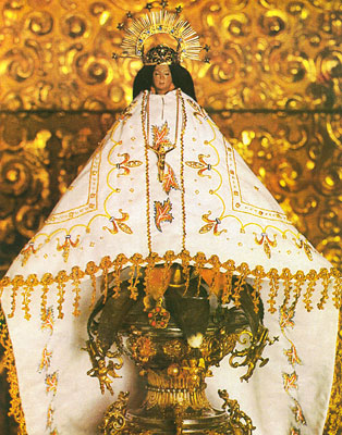
Juquila District is located in the center of the Costa Region of the State of Oaxaca, Mexico, on the Pacific coast. It has an area of 5,055 km2. As of 2005 it had a total population of 134,365 of whom 33,106 spoke an indigenous language. Economic activities include agriculture and tourism. The Santuario (Sanctuary) de Juquila is a major attraction. Environment The district lies on the Pacific coast of southwestern Oaxaca, with generally hilly land rising to the southern edge of the Sierra Madre del Sur. The coastal climate is hot and humid, while inland the climate is warm and humid. The western part of the district includes the Lagunas de Chacahua National Park, which includes the lagoons of Chacahua, La Pastoria, Las Salinas. Economy The most important economic activity is agriculture, including cultivation of maize, beans and vegetables for personal consumption. The people practice animal husbandry on a small scale, and some also hunt and fish. Coffee is grown inland, ... [...More Info...] [...Related Items...] OR: [Wikipedia] [Google] [Baidu] |
Aztecs
The Aztecs () were a Mesoamerican culture that flourished in central Mexico in the post-classic period from 1300 to 1521. The Aztec people included different Indigenous peoples of Mexico, ethnic groups of central Mexico, particularly those groups who spoke the Nahuatl, Nahuatl language and who dominated large parts of Mesoamerica from the 14th to the 16th centuries. Aztec culture was organized into city-states (''altepetl''), some of which joined to form alliances, political confederations, or empires. The Aztec Empire was a confederation of three city-states established in 1427: Tenochtitlan, city-state of the Mexica or Tenochca; Texcoco (altepetl), Texcoco; and Tlacopan, previously part of the Tepanec empire, whose dominant power was Azcapotzalco (altepetl), Azcapotzalco. Although the term Aztecs is often narrowly restricted to the Mexica of Tenochtitlan, it is also broadly used to refer to Nahuas, Nahua polities or peoples of central Pre-Columbian Mexico, Mexico in the preh ... [...More Info...] [...Related Items...] OR: [Wikipedia] [Google] [Baidu] |
Administrative Divisions Of Mexico
The United Mexican States ( es, Estados Unidos Mexicanos) is a federal republic composed of 32 federal entities: 31 states and Mexico City, an autonomous entity. According to the Constitution of 1917, the states of the federation are free and sovereign in all matters concerning their internal affairs. Each state has its own congress and constitution. Federal entities of Mexico States Roles and powers of the states The states of the Mexican Federation are free, sovereign, autonomous and independent of each other. They are free to govern themselves according to their own laws; each state has a constitution that cannot contradict the federal constitution, which covers issues of national competence. The states cannot make alliances with other states or any independent nation without the consent of the whole federation, except those related to defense and security arrangements necessary to keep the border states secure in the event of an invasion. The political organizat ... [...More Info...] [...Related Items...] OR: [Wikipedia] [Google] [Baidu] |


