|
Vertical-lift Bridge
A vertical-lift bridge or just lift bridge is a type of movable bridge in which a span rises vertically while remaining parallel with the deck. The vertical lift offers several benefits over other movable bridges such as the bascule and swing-span bridges. Generally speaking, they cost less to build for longer moveable spans. The counterweights in a vertical lift are only required to be equal to the weight of the deck, whereas bascule bridge counterweights must weigh several times as much as the span being lifted. As a result, heavier materials can be used in the deck, and so this type of bridge is especially suited for heavy railroad use. The biggest disadvantage to the vertical-lift bridge (in comparison with many other designs) is the height restriction for vessels passing under it, due to the deck remaining suspended above the passageway. Although most vertical-lift bridges use towers, each equipped with counterweights, some use hydraulic jacks located below the deck. ... [...More Info...] [...Related Items...] OR: [Wikipedia] [Google] [Baidu] |
Bascule Bridge
A bascule bridge (also referred to as a drawbridge or a lifting bridge) is a moveable bridge with a counterweight that continuously balances a span, or leaf, throughout its upward swing to provide clearance for boat traffic. It may be single- or double-leafed. The name comes from the French term for balance scale, which employs the same principle. Bascule bridges are the most common type of movable span because they open quickly and require relatively little energy to operate, while providing the possibility for unlimited vertical clearance for marine traffic. History Bascule bridges have been in use since ancient times, but until the adoption of steam power in the 1850s, very long, heavy spans could not be moved quickly enough for practical application. Types There are three types of bascule bridge and the counterweights to the span may be located above or below the bridge deck. The fixed-trunnion (sometimes a "Chicago" bascule) rotates around a large axle that raises the ... [...More Info...] [...Related Items...] OR: [Wikipedia] [Google] [Baidu] |
Hawthorne Bridge
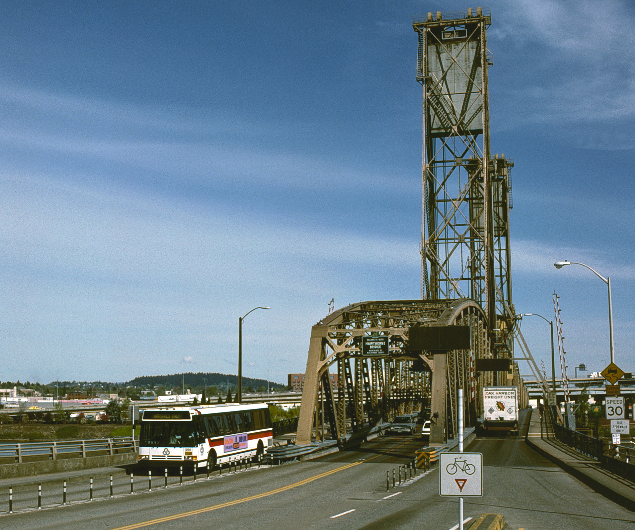
The Hawthorne Bridge is a truss bridge with a vertical lift that spans the Willamette River in Portland, Oregon, joining Hawthorne Boulevard and Madison Street. It is the oldest vertical-lift bridge in operation in the United States and the oldest highway bridge in Portland. It is also the busiest bicycle and transit bridge in Oregon, with over 8,000 cyclists and 800 TriMet buses (carrying about 17,400 riders) daily. It was added to the National Register of Historic Places in November 2012. Statistics The bridge consists of five fixed spans and one vertical-lift span. It is in total length. The bridge was originally wide, including two five-foot sidewalks, but the sidewalks were widened to 10 feet in 1998, increasing the structure's overall width to . The counterweights are suspended from the two towers. It is operated by a pair of 150-horsepower motors. On average, the lift span is raised for river traffic 120 times per month. While the river is at low level, th ... [...More Info...] [...Related Items...] OR: [Wikipedia] [Google] [Baidu] |
Kuopio Railway Station
Kuopio railway station ( fi, Kuopion rautatieasema, sv, Kuopio järnvägsstation) is located in the Maljalahti district of the city of Kuopio in the Northern Savonia region of Finland. The current concrete station building was completed in 1934, which replaced the original wooden station building situated to the east, which was constructed in 1889; the latter site is now a goods yard A goods station (also known as a goods yard or goods depot) or freight station is, in the widest sense, a railway station where, either exclusively or predominantly, goods (or freight), such as merchandise, parcels, and manufactured items, are lo .... ''Asemakatu'' ("Station Street"), the street on which the station is situated today, was previously named ''Linnankatu'' ("Castle Street") in the early 1900s. The name ''Asemakatu'' itself was previously used for a stretch of road situated north of the rail bridge at ''Maaherrankatu'' ("Landlord Street"). The aforementioned original railway station w ... [...More Info...] [...Related Items...] OR: [Wikipedia] [Google] [Baidu] |
VR Class Sr1
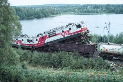
The Sr1 is a class of electric locomotives built for VR of Finland. These 25 kV locomotives were built in the Soviet Union at the Novocherkassk Electric Locomotive Factory between 1973 and 1985. Two additional locomotives of this class were built at the VR Hyvinkää Machine Workshop in 1993 and 1995, number 3111 from spare parts and number 3112 from the original prototype locomotive (number 3000) that was never used by the VR. The official classification given by the manufacturer is VL70 or ES40. The nicknames for these locomotives are "''Siperian susi''" (Wolf of Siberia; in Finnish slang "susi" can also mean a poorly manufactured object, compare English "dog" or "lemon"), "''Kaalihäkki''" (Cabbage Cage) and "''Sähköryssä''" (Electric Russkie). History In 1970, Valtionrautatiet ordered 27 electric locomotives from Energomachexport, which were delivered between September 1973 and the end of the year 1975. 82 additional locomotives were ordered and delivered between 197 ... [...More Info...] [...Related Items...] OR: [Wikipedia] [Google] [Baidu] |
Hancock, Michigan
Hancock is a city in Houghton County, Michigan, Houghton County in the U.S. state of Michigan. It is across the Keweenaw Waterway from the city of Houghton, Michigan, Houghton on the Keweenaw Peninsula. The population was 4,634 at the 2010 United States census, 2010 census. The Weather Channel has consistently ranked Hancock as the third-snowiest city in the U.S. Hancock was named after United States Founding Fathers, U.S. Founding Father John Hancock. History The story of Hancock began during the summers of 1847 and 1848, when a small group of Prospecting, prospectors laboring on a rugged hillside (later named Quincy Hill) discovered a sequence of prehistoric Ojibwe copper mining pits, stretching out for 100 feet along the local Amygdule, amygdaloid lode. Upon inspecting one, they realized that the Native Americans were able to take copper in small quantities through these pits. The discovery formed the basis upon which the Quincy Mining Company was created in October 1848, un ... [...More Info...] [...Related Items...] OR: [Wikipedia] [Google] [Baidu] |
Houghton, Michigan
Houghton (; ) is the largest city and seat of government of Houghton County in the U.S. state of Michigan. Located on the Keweenaw Peninsula, Houghton is the largest city in the Copper Country region. It is the fifth-largest city in the Upper Peninsula, with a population of 8,386 at the 2020 census. Houghton is the principal city of the Houghton micropolitan area, which includes all of Houghton and Keweenaw County. The city of Houghton and the county were named after Douglass Houghton, an American geologist and physician, primarily known for his exploration of the Keweenaw Peninsula. Houghton has been listed as one of the "100 Best Small Towns in America" despite it being considered a city. Houghton is home to Michigan Technological University, a public research college founded in 1885. Michigan Tech hosts a yearly Winter Carnival in February, drawing thousands of visitors from around the world. History Native Americans mined copper in and around what would later be ... [...More Info...] [...Related Items...] OR: [Wikipedia] [Google] [Baidu] |
Portage Lake Lift Bridge
The Portage Lake Lift Bridge (officially the Houghton–Hancock Bridge) connects the cities of Hancock and Houghton, in the US state of Michigan. It crosses Portage Lake, a portion of the waterway which cuts across the Keweenaw Peninsula with a canal linking the final several miles to Lake Superior to the northwest. US Highway 41 (US 41) and M-26 are both routed across the bridge. It is the only land-based link between the north (so-called Copper Island) and south sections of the Keweenaw peninsula. In June 2022, it was dedicated as a National Historic Civil Engineering Landmark. This moveable bridge is a lift bridge with the middle section capable of being lifted from its low point of four feet clearance over the water to a clearance of to allow boats to pass underneath. The bridge is the world's heaviest and widest double-decked vertical-lift bridge. More than 35,000 tons of concrete and 7,000 tons of steel went into the bridge, which replaced the narrow 54-year-old ... [...More Info...] [...Related Items...] OR: [Wikipedia] [Google] [Baidu] |
Lockport (city), New York
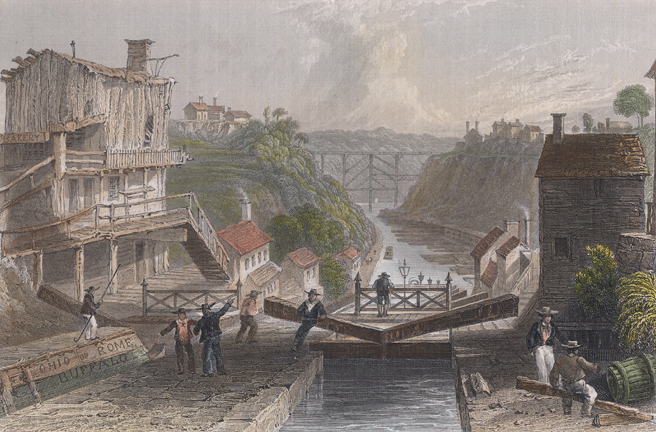
Lockport is both a city and the town that surrounds it in Niagara County, New York. The city is the Niagara county seat, with a population of 21,165 according to 2010 census figures, and an estimated population of 20,305 as of 2019. Its name derives from a set of Erie Canal locks (Lock Numbers 34 and 35) within the city that were built to allow canal barges to traverse the 60-foot natural drop of the Niagara Escarpment. It is part of the Buffalo–Niagara Falls metropolitan area. History The New York State Legislature authorized the Erie Canal's construction in April 1816. The route proposed by surveyors was to traverse an area in central Niagara County, New York, which was then "uncivilized" and free of White settlers. At the time, the nearest settlers were in nearby Cold Springs, New York. Following the announcement, land speculators began to buy large plots along and near the proposed route of the canal. By December 1820, when the exact location of the step locks had bee ... [...More Info...] [...Related Items...] OR: [Wikipedia] [Google] [Baidu] |
Erie Canal
The Erie Canal is a historic canal in upstate New York that runs east-west between the Hudson River and Lake Erie. Completed in 1825, the canal was the first navigable waterway connecting the Atlantic Ocean to the Great Lakes, vastly reducing the costs of transporting people and goods across the Appalachians. In effect, the canal accelerated the settlement of the Great Lakes region, the westward expansion of the United States, and the economic ascendancy of New York State. It has been called "The Nation's First Superhighway." A canal from the Hudson to the Great Lakes was first proposed in the 1780s, but a formal survey was not conducted until 1808. The New York State Legislature authorized construction in 1817. Political opponents of the canal, and of its lead supporter New York Governor DeWitt Clinton, denigrated the project as "Clinton's Folly" and "Clinton's Big Ditch". Nonetheless, the canal saw quick success upon opening on October 26, 1825, with toll revenue covering the ... [...More Info...] [...Related Items...] OR: [Wikipedia] [Google] [Baidu] |
Brazil
Brazil ( pt, Brasil; ), officially the Federative Republic of Brazil (Portuguese: ), is the largest country in both South America and Latin America. At and with over 217 million people, Brazil is the world's fifth-largest country by area and the seventh most populous. Its capital is Brasília, and its most populous city is São Paulo. The federation is composed of the union of the 26 States of Brazil, states and the Federal District (Brazil), Federal District. It is the largest country to have Portuguese language, Portuguese as an List of territorial entities where Portuguese is an official language, official language and the only one in the Americas; one of the most Multiculturalism, multicultural and ethnically diverse nations, due to over a century of mass Immigration to Brazil, immigration from around the world; and the most populous Catholic Church by country, Roman Catholic-majority country. Bounded by the Atlantic Ocean on the east, Brazil has a Coastline of Brazi ... [...More Info...] [...Related Items...] OR: [Wikipedia] [Google] [Baidu] |
Porto Alegre
Porto Alegre (, , Brazilian ; ) is the capital and largest city of the Brazilian state of Rio Grande do Sul. Its population of 1,488,252 inhabitants (2020) makes it the List of largest cities in Brazil, twelfth most populous city in the country and the center of Brazil's List of metropolitan areas in Brazil, fifth largest metropolitan area, with 4,405,760 inhabitants (2010). The city is the southernmost capital city of a Brazilian state. Porto Alegre was founded in 1769 by Manuel Jorge Gomes de Sepúlveda, who used the pseudonym José Marcelino de Figueiredo to hide his identity; but the official date is 1772 with the act signed by Immigration to Brazil, immigrants from the Azores, Portugal. The city lies on the eastern bank of the Guaíba Lake, where five rivers converge to form the Lagoa dos Patos, a giant freshwater lagoon navigable by even the largest of ships. This five-river junction has become an important alluvial port as well as a chief industrial and commercial center ... [...More Info...] [...Related Items...] OR: [Wikipedia] [Google] [Baidu] |
Lake Guaíba
Lake Guaíba () is a waterway (496 km²) in Rio Grande do Sul, the southernmost state of Brazil. It is famous for its beautiful reflection at sunset. The Guaíba is an extension of the Lagoa dos Patos, the largest lagoon in South America. It is commonly referred to as a "river" besides "lake". The Jacuí River, the Sinos River, the Gravataí River and the Caí River empties into the Guaíba from the north. Both Porto Alegre, the capital and most populous city of Rio Grande do Sul, and Viamão lies on its eastern shore. The cities of Guaíba, Eldorado do Sul and Barra do Ribeiro lies opposite to Porto Alegre, on the western shore. The Lake Guaíba is navigable, and is connected to the Atlantic Ocean through Lagoa dos Patos Lagoa dos Patos (, , ; English: ''Ducks' Lagoon'') is the largest lagoon in Brazil and the largest coastal lagoon in South America. It is located in the state of Rio Grande do Sul, southern Brazil. It covers an area of , is long and has a maximu ... and i ... [...More Info...] [...Related Items...] OR: [Wikipedia] [Google] [Baidu] |


