|
Verdugos
The Verdugos is a region of Los Angeles County, California including the areas in and around the Verdugo Mountains. Geography According to the Mapping L.A. survey of the ''Los Angeles Times,'' the Verdugos region consists of: *Altadena *Glendale *La Crescenta-Montrose *La Cañada Flintridge * Pasadena * Sunland * Tujunga Population In the 2000 census, the Verdugos region had a population of 453,399. References See also Other regions of Los Angeles County * Angeles National Forest * Antelope Valley * Central Los Angeles * Eastside * Harbor * Northeast Los Angeles * Northwest County * Pomona Valley * San Fernando Valley * San Gabriel Valley * South Bay * Santa Monica Mountains * South Los Angeles South Los Angeles, also known as South Central Los Angeles or simply South Central, is a region in southwestern Los Angeles County, lying mostly within the city limits of Los Angeles, south of downtown. It is "defined on Los Angeles city maps as a ... * Southeast County * Ver ... [...More Info...] [...Related Items...] OR: [Wikipedia] [Google] [Baidu] |
Verdugo Mountains
The Verdugo Mountains, also known as the Verdugo Hills or simply The Verdugos, are a small, rugged mountain range of the Transverse Ranges system in Los Angeles County, California. Located just south of the western San Gabriel Mountains, the Verdugo Mountains region incorporates the cities of Glendale, Pasadena, and La Cañada Flintridge; the unincorporated communities of Altadena and La Crescenta-Montrose; as well as the City of Los Angeles neighborhood of Sunland-Tujunga. Surrounded entirely by urban development, the Verdugo Mountains represent an isolated wildlife island and are in large part under public ownership in the form of undeveloped parkland. The mountains are used primarily for recreation in the form of hiking and mountain biking, and as the site of communications installations on the highest peaks. The mountains arise directly from the eastern floor of the San Fernando Valley, exaggerating their height from some vantages. Beginning with foothills, they rapidly ... [...More Info...] [...Related Items...] OR: [Wikipedia] [Google] [Baidu] |
Sunland-Tujunga, Los Angeles
Sunland-Tujunga is a Los Angeles city neighborhood within the Crescenta Valley and Verdugo Mountains. Sunland and Tujunga began as separate settlements and today are linked through a single police station, branch library, neighborhood council, chamber of commerce, city council district, and high school. The merging of these communities under a hyphenated name goes back as far as 1928. Sunland-Tujunga contains the highest point of the city, Mount Lukens. Geography Setting The neighborhood lies between the Verdugo Mountains and the San Gabriel Mountains. It is contiguous on the east with La Crescenta-Montrose. Sunland and Tujunga are divided by Mount Gleason Avenue, with Sunland on the west and Tujunga on the east. Mount Lukens, located within Tujunga, is the highest point in Los Angeles, at . Thoroughfares By 1927, half of the streets had been paved, and a state highway ran through the town. Streets within the Sunland and Tuna Canyon annex to Los Angeles were renamed in ... [...More Info...] [...Related Items...] OR: [Wikipedia] [Google] [Baidu] |
Westside (Los Angeles County)
The Los Angeles Westside is an urban region in western Los Angeles County, California. It has no official definition, but sources like ''LA Weekly'' and the Mapping L.A. survey of the ''Los Angeles Times'' place the region on the western side of the Los Angeles Basin south of the Santa Monica Mountains. Geography ''LA Weekly'' According to the ''LA Weekly'', there are different perspectives on where the Westside ends and the Eastside begins. Generally, the Westside is the area south of the Santa Monica Mountains and Sepulveda Pass, and west of either: * Downtown Los Angeles – a historic definition supported by UCLA urban and cultural historian Eric Avila. Most of the number streets and big boulevards get a “west” before their names west of Main Street and an east if they are “east” of Main Street. * The 110 Freeway * La Cienega Boulevard * The 405 Freeway Mapping L.A. boundaries ''Los Angeles Times'' readers submitted more than 300 maps, with borders ranging from ... [...More Info...] [...Related Items...] OR: [Wikipedia] [Google] [Baidu] |
La Cañada Flintridge, California
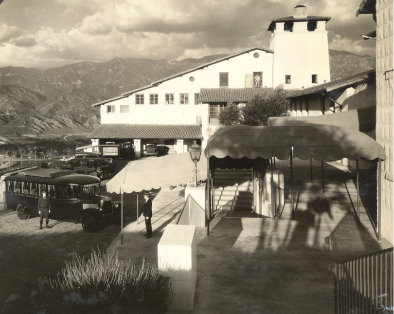
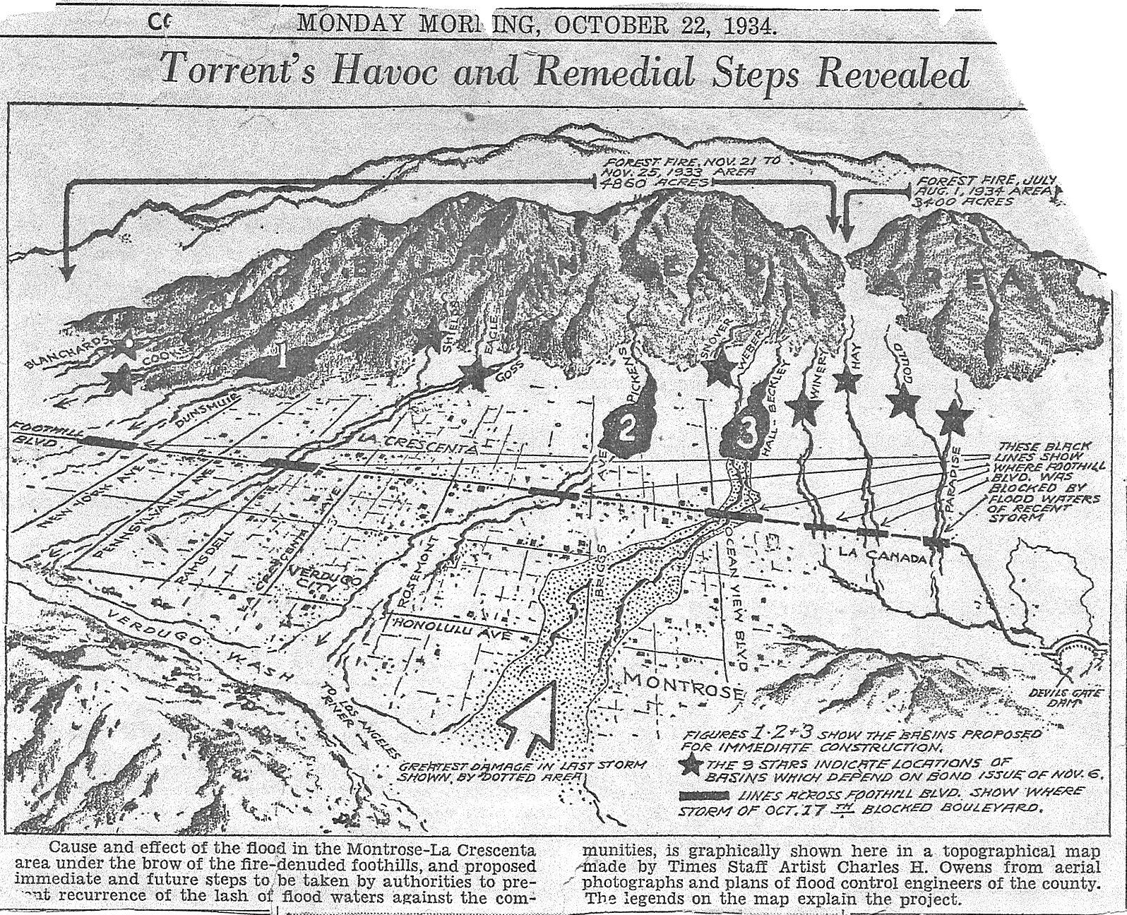
La Cañada Flintridge, commonly known as "La Cañada" (Spanish for "The Canyon"), is a city in the foothills of the Verdugo Mountains in Los Angeles County, California. Located in the Crescenta Valley, in the western edge of Southern California's San Gabriel Valley, it is the location of NASA's Jet Propulsion Laboratory. Before the city's incorporation on November 30, 1976, it consisted of two distinct communities, "La Cañada" and "Flintridge". History Reference to the entire city is often shortened to just "La Cañada" or seldom to just "Flintridge". The full city name specifically does not have a hyphen in it, to illustrate unity between the two communities that became one. La Cañada During the Spanish and Mexican eras, the area was known as . La Cañada comes from the Spanish word (), meaning 'canyon', 'gorge', or 'ravine'. In December 1933 and January 1934, the La Cañada Valley was severely flooded in the Crescenta Valley flood (1933 and 1934). Flintridge Fl ... [...More Info...] [...Related Items...] OR: [Wikipedia] [Google] [Baidu] |
Northeast Los Angeles
Northeast Los Angeles (abbreviated NELA) is a region of Los Angeles County, comprising seven neighborhoods within the City of Los Angeles. The area is home to Occidental College located in Eagle Rock. History The bulk of the area closer to Pueblo de Los Angeles-Downtown Los Angeles was part of the original Spanish and Mexican land grants of Rancho San Rafael and Rancho San Pascual when the city incorporated in 1850. One of the first annexations of the city was Highland Park in 1895. Other nearby communities attached to Los Angeles were Garvanza (1899), Arroyo Seco (1912) and Eagle Rock (1923). Development in the Northeast was fostered by service of the Los Angeles Railway "Yellow Cars." Traditionally a heavily Latino and working-class part of the city, Northeast Los Angeles has undergone gentrification starting in the 2000s. With the influx of young professionals, Northeast Los Angeles has gained attention for its hipster culture and a new wave of commercial development; ... [...More Info...] [...Related Items...] OR: [Wikipedia] [Google] [Baidu] |
Central Los Angeles
__NOTOC__ Central Los Angeles is the historic urban region of the City of Los Angeles, California. Geography The City of Los Angeles The Los Angeles Department of City Planning divides the city into Area Planning Commission (APC) areas, each further divided into Community Plan areas (CPAs). The Central Los Angeles APC area is made up of the following six CPAs: * Central City CPA * Central City North CPA * Hollywood CPA * Westlake CPA * Wilshire CPA Each CPA is divided by neighborhood council, though a neighborhood council can cover an area in more than one CPA. Neighborhoods within each CPA include the following: Central City CPA * Bunker Hill * Central City East * Civic Center * Convention Center district * El Pueblo de Los Ángeles Historical Monument, El Pueblo district * Fashion District, Los Angeles, Fashion District * Historic Core, Los Angeles, Historic Core * Little Tokyo, Los Angeles, Little Tokyo * South Park (Downtown Los Angeles), South Park * Wholesale Dis ... [...More Info...] [...Related Items...] OR: [Wikipedia] [Google] [Baidu] |
Altadena, California
Altadena () ("Alta", Spanish for "Upper", and "dena" from Pasadena) is an unincorporated area and census-designated place in the Verdugo Mountains region of Los Angeles County, California, approximately 14 miles (23 km) from the downtown Los Angeles Civic Center, and directly north of the city of Pasadena, California. The population was 42,777 at the 2010 census, up from 42,610 at the 2000 census. Etymology The name Altadena derives from the Spanish ''alta'', meaning "upper", and ''dena'' from Pasadena; the area is adjacent to, but at a higher elevation than, Pasadena.Manning, Mike. The word Altadena was first used by Byron Clark, who coined it for his nursery located south of present-day Woodbury on the west side of town. When he moved his nursery to Linda Vista, he agreed to let the Woodburys take the name for their new subdivision.ALTADENA, CALIFORNIA: an abbreviated history for the internet"Altadena Town Council Retrieved on March 18, 2007. History In the mi ... [...More Info...] [...Related Items...] OR: [Wikipedia] [Google] [Baidu] |
Glendale, California
Glendale is a city in the San Fernando Valley and Verdugo Mountains regions of Los Angeles County, California, United States. At the 2020 U.S. Census the population was 196,543, up from 191,719 at the 2010 census, making it the fourth-largest city in Los Angeles County and the 24th-largest city in California. It is located about north of downtown Los Angeles. Glendale lies in the Verdugo Mountains, and is a suburb in the Los Angeles metropolitan area. The city is bordered to the northwest by the Sun Valley and Tujunga neighborhoods of Los Angeles; to the northeast by La Cañada Flintridge and the unincorporated area of La Crescenta; to the west by Burbank and Griffith Park; to the east by Eagle Rock and Pasadena; to the south by the Atwater Village neighborhood of Los Angeles; and to the southeast by Glassell Park neighborhood of Los Angeles. The Golden State, Ventura, Glendale, and Foothill freeways run through the city. History Spanish rule In 1798, José Ma ... [...More Info...] [...Related Items...] OR: [Wikipedia] [Google] [Baidu] |
La Crescenta-Montrose, California
La Crescenta-Montrose () is an unincorporated area in Los Angeles County, California, United States. The community is bordered by Glendale to the south and west, La Cañada Flintridge to the east, and Angeles National Forest to the north. According to the United States Census Bureau, the La Crescenta-Montrose Census-Designated Place (CDP) measures about , and the population was 19,997 at the 2020 census, up from 19,653 in 2010 and 18,532 in 2000. Geography La Crescenta-Montrose encompasses those parts of the Crescenta Valley, northwestern San Rafael Hills, and northeastern Verdugo Mountains not within the cities of Glendale or La Cañada Flintridge. For statistical purposes, the United States Census Bureau has defined La Crescenta-Montrose as a CDP. La Crescenta-Montrose is bordered on the north by the San Gabriel Mountains and Angeles National Forest, on the east by La Cañada Flintridge, on the south by the Verdugo Mountains and central Glendale, and the northwest by the ... [...More Info...] [...Related Items...] OR: [Wikipedia] [Google] [Baidu] |
Pomona Valley
The Pomona Valley is located in the Greater Los Angeles Area between the San Gabriel Valley and San Bernardino Valley in Southern California. The valley is approximately east of downtown Los Angeles. History On March 1, 1893 the California Assembly voted 54–14 for a new county to form in the region, to be named San Antonio County, with Pomona as its seat. Los Angeles interests in the Senate rejected the concept, however, and today the eastern and western portions of the valley remain divided between San Bernardino and Los Angeles counties (San Antonio Creek). Geography The alluvial valley is formed by the Santa Ana River and its tributaries. The Pomona Valley is separated from San Gabriel Valley to the west by the northeastern end of the San Jose Hills, running approximately along State Route 57. The eastern boundaries are the Jurupa Hills and the Cajon Pass, (the eastern end of the San Gabriel Mountains) running near Interstate 15, which separates the Pomona Vall ... [...More Info...] [...Related Items...] OR: [Wikipedia] [Google] [Baidu] |
Southeast County
The points of the compass are a set of horizontal, radially arrayed compass directions (or azimuths) used in navigation and cartography. A compass rose is primarily composed of four cardinal directions—north, east, south, and west—each separated by 90 degrees, and secondarily divided by four ordinal (intercardinal) directions—northeast, southeast, southwest, and northwest—each located halfway between two cardinal directions. Some disciplines such as meteorology and navigation further divide the compass with additional azimuths. Within European tradition, a fully defined compass has 32 'points' (and any finer subdivisions are described in fractions of points). Compass points are valuable in that they allow a user to refer to a specific azimuth in a colloquial fashion, without having to compute or remember degrees. Designations The names of the compass point directions follow these rules: 8-wind compass rose * The four cardinal directions are north (N), east (E), s ... [...More Info...] [...Related Items...] OR: [Wikipedia] [Google] [Baidu] |
South Los Angeles
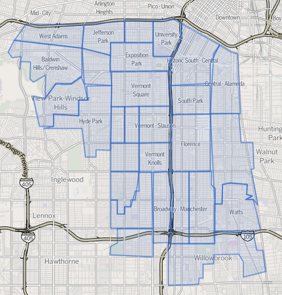
South Los Angeles, also known as South Central Los Angeles or simply South Central, is a region in southwestern Los Angeles County, lying mostly within the city limits of Los Angeles, south of downtown. It is "defined on Los Angeles city maps as a 16-square-mile rectangle with two prongs at the south end.” In 2003, the Los Angeles City Council renamed this area "South Los Angeles". The name South Los Angeles can also refer to a larger 51-square mile region that includes areas within the city limits of Los Angeles as well as five unincorporated areas in the southern portion of the County of Los Angeles."South L.A." Mapping L.A. website of the ''Los Angeles Times'' Geography City of Los Angeles The City of Los Angeles delineates the South Los Angeles Communi ...[...More Info...] [...Related Items...] OR: [Wikipedia] [Google] [Baidu] |


