|
Varapuzha
Varappuzha, , (also known by its former name Verapoly) is a northern suburb of the city of Kochi. It is a census town in Paravur Taluk, Ernakulam district in the Indian state of Kerala. Situated around 15 km (9 mi) from the city centre and 8 km (5 mi) from Edapally, the areas lies in the NH 66 connecting Vytilla with North Paravur. Its specialty is that considerably large-scale paddy cultivating area is situating western part of Varapuzha which is called Devaswompadam, specialised with Pokkali paddy cultivation and interim crop as fish cultivation locally called 'Kettu'. The common work of the natives are fishing and agriculture. Varapuzha is known for its fish market (Chettibagam market). The Varapuzha Bridge (Near Historical Varapuzha Island) connects Varapuzha (Mannantturuthu) with the neighboring Cheranallur. Demographics India census, Varappuzha had a population of 24,516. Males constitute 48% of the population and females 52%. Varappuzha has an avera ... [...More Info...] [...Related Items...] OR: [Wikipedia] [Google] [Baidu] |
Varapuzha Church
The Basilica of Our lady of Mount Carmel & St Joseph, popularly known as Varapuzha Basilica, is in Varappuzha, Varapuzha, a northern suburban town of Kochi City in the Ernakulam district of Kerala state, India. It was built in 1673. The basilica is dedicated to Our Lady of Mount Carmel and Saint Joseph, St Joseph. The solemnity of the Assumption of Mary, Assumption of Our Lady is celebrated as an annual sixteen-day confraternity festival, from 31 July to 15 August. The basilica is also famous as a pilgrimage centre in the southern part of India. It serves as the mother church for 14 churches. History This church was the seat of the metropolitans until 1904. The headquarters was then shifted to the town of Ernakulam, for easier administration. As the original seat of the Latin bishop, the church holds a unique place in the history of Latin Catholics in the area. Presently the church offers solace to the faithful who gather there for the powerful intercessions of Our Lady and St ... [...More Info...] [...Related Items...] OR: [Wikipedia] [Google] [Baidu] |
Varapuzha Bridge
The Varapuzha bridge on NH 17 is a cantilever bridge spanning the Periyar river between Varappuzha and Cheranallur in Kochi, India. Varapuzha Bridge is the first bridge in Kerala Kerala ( ; ) is a state on the Malabar Coast of India. It was formed on 1 November 1956, following the passage of the States Reorganisation Act, by combining Malayalam-speaking regions of the erstwhile regions of Cochin, Malabar, South ... to be constructed using Balanced Cantilever technique(120m span) and also the first bridge in Kerala where Caisson floating technique was adopted. On 16 January 2001, Varapuzha Bridge was opened to traffic. OneIndia news in Malayalam This bridge reduces the distance between Malabar and Kochi. References [...More Info...] [...Related Items...] OR: [Wikipedia] [Google] [Baidu] |
Cheranallur
Cheranallur or Cheranellore or Cheranelloor is a suburb of Kochi city in the state of Kerala, India and lies on the banks of the Periyar River. According to tradition, the area was named by its earlier inhabitants who found this place very fertile and beautiful. The name in its local language Malayalam means "Good Village of Cheras". The National Highway 66, which connects Cochin with Mumbai-Panvel, goes through Cheranalloor crossing the Vallarpadam International Container National Highway National Highway 47C (India) (the only junction between the two Highways). Cheranallur is a place surrounded by backwaters, and brackish lagoons which are commonplace in Kerala. The former ruler of these area was known as "Cheranallor Karthavu" - he was one of the influential lords around Cochin area before the Sakthan Thampuran of Cochin. Location Demographics India census, Cheranallur had a population of 26,330. Males constitute 50% of the population and females 50%. Cheranallur has an ... [...More Info...] [...Related Items...] OR: [Wikipedia] [Google] [Baidu] |
Ernakulam
Ernakulam () is the Central Business District of the city of Kochi in Kerala, India and has lent its name to the Ernakulam district. Many major establishments, including the Kerala High Court, the office of the Kochi Municipal Corporation and the Cochin Shipyard are situated here. History Classical history The region can claim to have played a significant part in fostering the trade relations between Kerala and the outside world in the ancient and medieval period. The early political history of Ernakulam is interlinked with that of the Chera Dynasty of the Sangam age, who ruled over vast portions of Kerala and Tamil Nadu. After the Cheras, the place was later ruled by the Kingdom of Cochin (Perumpadapu Swaroopam). Princely State of Cochin Although under British suzerainty (specifically the East India Company) since the Anglo-Dutch Treaty of 1814, Rama Varma XII of the Kingdom of Cochin moved his capital from Mattancherry to Tripunithura in about 1840. Fort Cochin Munic ... [...More Info...] [...Related Items...] OR: [Wikipedia] [Google] [Baidu] |
List Of Renamed Places In India
Since India gained independence from the United Kingdom in 1947, names of many cities, streets, places, and buildings throughout the republic of India have been systematically changed, often to better approximate their native endonymic pronunciation. Certain traditional names that have not been changed, however, continue to be popular. States or provinces * East Punjab to Punjab (change effective from 26 January 1950; state later trifurcated into modern-day Haryana, Himachal Pradesh and Punjab under the Punjab Reorganisation Act, 1966; Chandigarh became a Union territory and the shared capital city of Punjab and Haryana) * United Provinces to Uttar Pradesh (change effective from 24 January 1950) * Andhra State, the Telugu-speaking part of Madras Presidency, attained statehood on 1 October 1953. Three years later, Hyderabad State was invaded and combined with Andhra State and it was renamed Andhra Pradesh on 1 November 1956. * Travancore–Cochin to Kerala (change effective ... [...More Info...] [...Related Items...] OR: [Wikipedia] [Google] [Baidu] |
Paravur Taluk
Paravur Taluk, {{IPA-ml, pɐrɐʋuːr, IPA, is a taluk of Ernakulam District in the States and territories of India, Indian State of Kerala. North Paravur is the capital of the taluk. Paravur Taluk lies in the north western part of Ernakulam district bordering Thrissur district. The surrounding taluks are Kochi to the west consisting of Vypin Island, Kodungallur to the north, Chalakudy to the north consisting of Mala, Aluva to the east consisting of Angamaly, Nedumbassery and Aluva, Kanayanur to the south consisting of Cochin City. Paravur is a part of Kochi UA, Kochi urban agglomeration area. The western parts of taluk are coastal areas with cultivations like prawn and pokkali rice. The eastern parts are fertile lands. The heavy industries of Kochi is located in Eloor, Udyogmandal area of the taluk. History Parur taluk was prominent in the history of Kerala. Taluk was an attraction to Kochi, Malabar and Travancore Kingdoms. Parur has got its own brands like * Parur Central Ba ... [...More Info...] [...Related Items...] OR: [Wikipedia] [Google] [Baidu] |
North Paravur
North Paravur. formerly known as Paravur or Parur, is a municipality and suburb in Ernakulam district in the Indian state of Kerala. It is a northern suburb of the city of Kochi and is situated around 20 km from the city centre. It is also the first place in India to use electronic voting machine during the by-elections in 1982. Overview The coastal highway NH-66 Panvel-Kanyakumari passes through this historic town. The National Waterway-3 Kollam- Kottapuram passes through the west end of the taluk. Paravur is believed to be one of the 64 villages created by Parashurama. This town had been an old trading post, a Jewish synagogue and a thriving Jewish community before their conversion to Syrian Christianity in the first century and their resettlement in Israel after its establishment. Cochin Jews lived in the towns of Kochi and North Paravur. The various denominations of modern Saint Thomas Christians ascribe their unwritten tradition to the end of the 1st century ... [...More Info...] [...Related Items...] OR: [Wikipedia] [Google] [Baidu] |
WikiProject Indian Cities
A WikiProject, or Wikiproject, is a Wikimedia movement affinity group for contributors with shared goals. WikiProjects are prevalent within the largest wiki, Wikipedia, and exist to varying degrees within sister projects such as Wiktionary, Wikiquote, Wikidata, and Wikisource. They also exist in different languages, and translation of articles is a form of their collaboration. During the COVID-19 pandemic, CBS News noted the role of Wikipedia's WikiProject Medicine in maintaining the accuracy of articles related to the disease. Another WikiProject that has drawn attention is WikiProject Women Scientists, which was profiled by '' Smithsonian'' for its efforts to improve coverage of women scientists which the profile noted had "helped increase the number of female scientists on Wikipedia from around 1,600 to over 5,000". On Wikipedia Some Wikipedia WikiProjects are substantial enough to engage in cooperative activities with outside organizations relevant to the field at issue. For ex ... [...More Info...] [...Related Items...] OR: [Wikipedia] [Google] [Baidu] |
Vytilla
Vyttila, , is an intersection as well as the name of a region in the city of Kochi, in the state of Kerala, India. It is the busiest as well as one of the largest intersections in Kerala. This node intersects the main north–south artery of the state of ''Kerala'', namely, the Kochi Bypass, with three city roads of ''Kochi'' viz, the S. A. Road (One of the city's most prominent arterial road in the east–west direction), the ''Vyttila-Petta Road'', and the ''Thammanam Road''. The name ''Vyttila'' is said to be evolved from the word "Vayal Thala" meaning the main part of the paddy field. Once the area including Elamkulam, were paddy fields and paddy cultivation were the main sources of income. The paddy field existed from Ernakulam, Girinagar, Panampilly Nagar, Gandhi Nagar, Jawahar Nagar, Kumarananshan Nagar and extended to Kaniyampuzha and Panamkutyy bridge. Some also say that because there existed a bunch of dacoits, who murdered and looted the travelers the name evolve ... [...More Info...] [...Related Items...] OR: [Wikipedia] [Google] [Baidu] |
Kadamakkudy
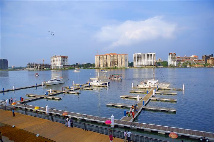
Kadamakkudy Islands is an island suburb of the city of Kochi in the Indian state of Kerala. It is situated around 8 km (6 mi) north of the city centre. Geography Kadamakkudy Islands is a cluster of fourteen islands: Valiya Kadamakudy (the main island), Murikkal, Palyam Thuruth, Pizhala, Cheriya Kadamakudy, Pulikkapuram, Moolampilly, Puthussery, Chariyam Thuruth, Chennur, Kothad, Korambadam, Kandanad and Karikkad Thuruthu. The Grama panchayth is administered under the kerala Panchayth Raj system and the present administrators are The President Smt Shalini Babu and The Panchayth Secretary Sri Dylan Tom Demographics India census, Kadamakkudy islands had a population of 15,823. Males constitute 49% of the population and females 51%. Kadamakkudy has an average literacy rate of 84%, higher than the national average of 59.5%: male literacy is 86%, and female literacy is 82%. In Kadamakkudy islands, 11% of the population is under 6 years of age. Religion Kadamakkudy isl ... [...More Info...] [...Related Items...] OR: [Wikipedia] [Google] [Baidu] |
Syro-Malabar Catholic Church
lat, Ecclesia Syrorum-Malabarensium mal, മലബാറിലെ സുറിയാനി സഭ , native_name_lang=, image = St. Thomas' Cross (Chennai, St. Thomas Mount).jpg , caption = The Mar Thoma Nasrani Sliva or Saint Thomas christian cross, the symbol of the Syro-Malabar Church. , abbreviation=SMC, type = Catholic particular churches and liturgical rites, Self-governing church (''sui iuris'') , main_classification = Eastern Catholic , orientation = Eastern Christianity(Syriac Christianity) , scripture = , polity = Episcopal polity , governance=Holy Episcopal Synod of the Syro-Malabar Church, theology = East Syriac theology , leader_title = Pope , leader_name = Pope Francis, Francis , leader_title1 = Major Archbishop , leader_name1 = George Alencherry , leader_title3 = Administration , leader_name3 = Major Archiepiscopal Curia , ... [...More Info...] [...Related Items...] OR: [Wikipedia] [Google] [Baidu] |


