|
Valles Marineris
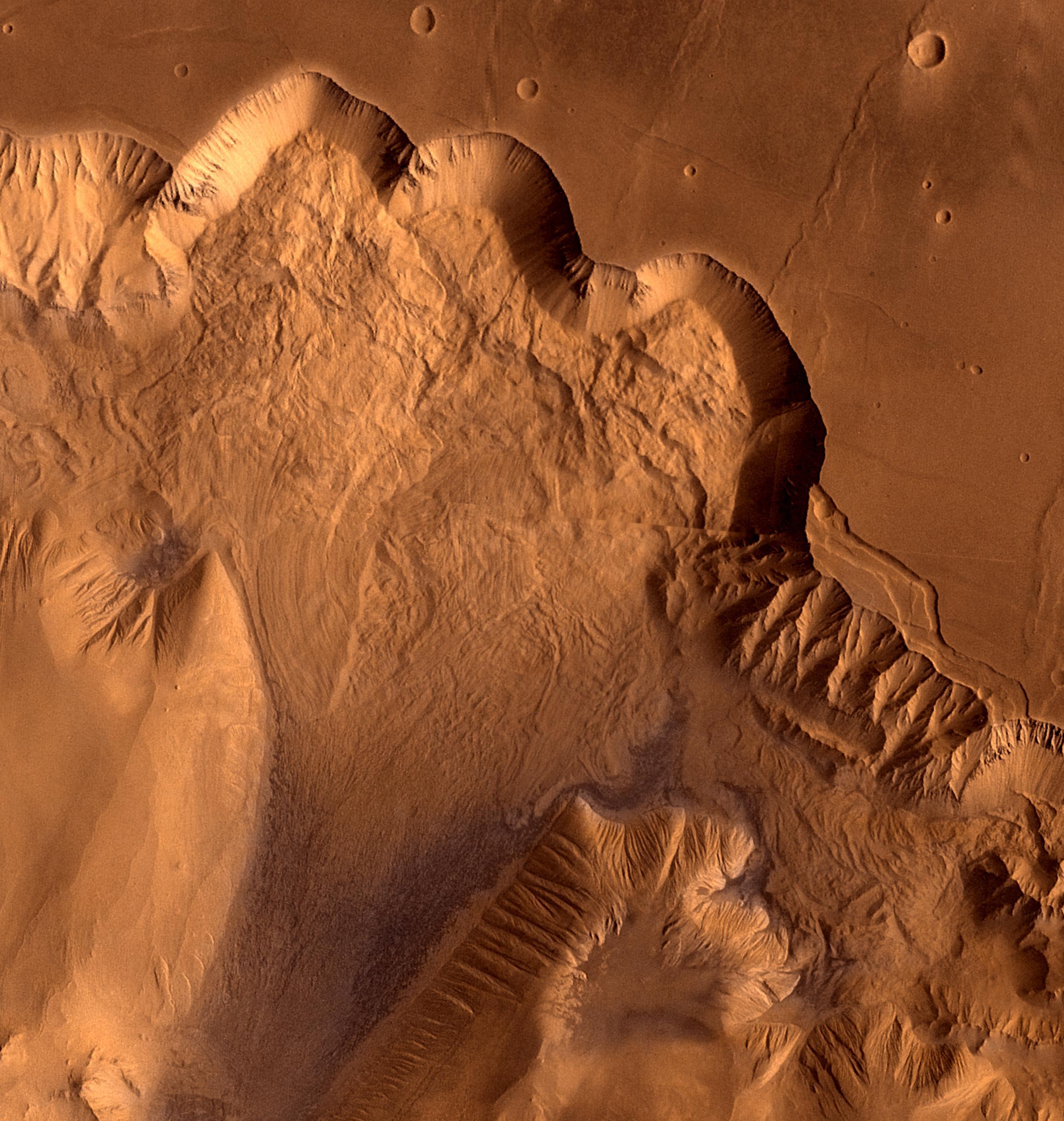
Valles Marineris (; Latin for ''Mariner program, Mariner Valleys'', named after the ''Mariner 9'' Mars orbiter of 1971–72 which discovered it) is a system of canyons that runs along the Mars, Martian surface east of the Tharsis region. At more than long, wide and up to deep, Valles Marineris is one of the largest List of largest rifts and valleys in the Solar System, canyons of the Solar System, surpassed in length only by the rift valleys of the mid-ocean ridge system of Earth. Valles Marineris is located along the equator of Mars, on the east side of the Tharsis Bulge, and stretches for nearly a quarter of the planet's circumference. The canyon system starts in the west with Noctis Labyrinthus; proceeding to the east are Tithonium Chasma, Tithonium and Ius Chasma, Ius chasmata, then Melas Chasma, Melas, Candor Chasma, Candor and Ophir Chasma, Ophir chasmata, then Coprates Chasma, then Ganges Chasma, Ganges, Capri Chasma, Capri and Eos Chasma, Eos chasmata; finally it emptie ... [...More Info...] [...Related Items...] OR: [Wikipedia] [Google] [Baidu] |
Mars Valles Marineris
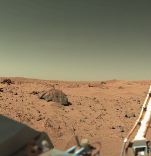
Mars is the fourth planet from the Sun and the second-smallest planet in the Solar System, only being larger than Mercury (planet), Mercury. In the English language, Mars is named for the Mars (mythology), Roman god of war. Mars is a terrestrial planet with a thin atmosphere (less than 1% that of Earth's), and has a crust primarily composed of elements similar to Earth's crust, as well as a core made of iron and nickel. Mars has surface features such as impact craters, valleys, dunes and polar ice caps. It has two small and irregularly shaped moons, Phobos (moon), Phobos and Deimos (moon), Deimos. Some of the most notable surface features on Mars include Olympus Mons, the largest volcano and List of tallest mountains in the Solar System, highest known mountain in the Solar System and Valles Marineris, one of the largest canyons in the Solar System. The North Polar Basin (Mars), Borealis basin in the Northern Hemisphere covers approximately 40% of the planet and may be a la ... [...More Info...] [...Related Items...] OR: [Wikipedia] [Google] [Baidu] |
Noctis Labyrinthus
Noctis Labyrinthus () is a region of Mars located in the Phoenicis Lacus quadrangle, between Valles Marineris and the Tharsis upland. The region is notable for its maze-like system of deep, steep-walled valleys. The valleys and canyons of this region formed by faulting and many show classic features of grabens, with the upland plain surface preserved on the valley floor. In some places the valley floors are rougher, disturbed by landslides, and there are places where the land appears to have sunk down into pit-like formations. It is thought that this faulting was triggered by volcanic activity in the Tharsis region. Research described in December 2009 found a variety of minerals, including clays, sulfates, and hydrated silicas, in some of the layers. Context Noctis Labyrinthus is located in the heart of Tharsis at the western end of the Valles Marineris, manifesting as a network of graben that extends in a spider-like network before coalescing into a coherent, relatively sh ... [...More Info...] [...Related Items...] OR: [Wikipedia] [Google] [Baidu] |
Tectonics
Tectonics (; ) are the processes that control the structure and properties of the Earth's crust and its evolution through time. These include the processes of mountain building, the growth and behavior of the strong, old cores of continents known as cratons, and the ways in which the relatively rigid plates that constitute the Earth's outer shell interact with each other. Tectonics also provide a framework for understanding the earthquake and volcanic belts that directly affect much of the global population. Tectonic studies are important as guides for economic geologists searching for fossil fuels and ore deposits of metallic and nonmetallic resources. An understanding of tectonic principles is essential to geomorphologists to explain erosion patterns and other Earth surface features. Main types of tectonic regime Extensional tectonics Extensional tectonics is associated with the stretching and thinning of the crust or the lithosphere. This type of tectonics is found ... [...More Info...] [...Related Items...] OR: [Wikipedia] [Google] [Baidu] |
Chryse Planitia
Chryse Planitia (Greek, "''Golden Plain''") is a smooth circular plain in the northern equatorial region of Mars close to the Tharsis region to the west, centered at . Chryse Planitia lies partially in the Lunae Palus quadrangle, partially in the Oxia Palus quadrangle, partially in the Mare Acidalium quadrangle. It is 1600 km or 994 mi in diameter and with a floor 2.5 km below the average planetary surface altitude, and has been suggested to be an ancient buried impact basin, though this is contested. It has several features in common with lunar maria, such as Wrinkle-ridge, wrinkle ridges. The density of impact craters in the range is close to half the average for lunar maria. Chryse Planitia shows evidence of water erosion in the past, and is the bottom end for many outflow channels from the southern highlands as well as from Valles Marineris and the flanks of the Tharsis bulge. It is one of the lowest regions on Mars ( below the mean surface elevation of Mars) ... [...More Info...] [...Related Items...] OR: [Wikipedia] [Google] [Baidu] |
Chaotic Terrain
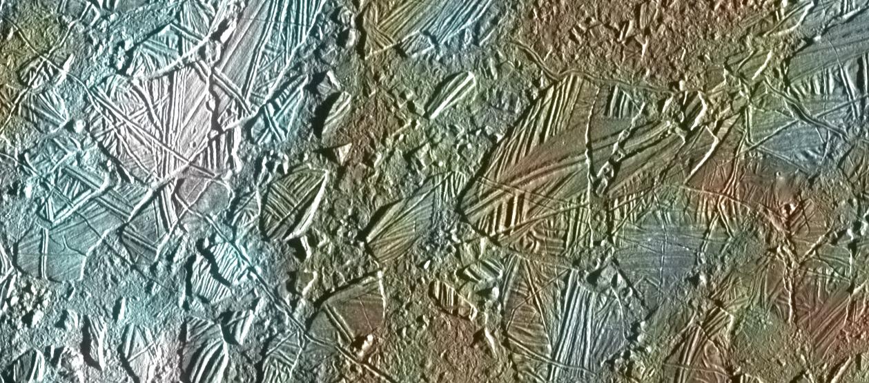
In astrogeology, chaos terrain, or chaotic terrain, is a planetary surface area where features such as ridges, cracks, and plains appear jumbled and enmeshed with one another. Chaos terrain is a notable feature of the planets Mars and Mercury (planet), Mercury, Jupiter's moon Europa (moon), Europa, and the dwarf planet Pluto. In scientific nomenclature, "chaos" is used as a component of proper nouns (e.g., "Aureum Chaos" on Mars). On Mars Wikichaosmap.jpg, Tography map of Oxia Palus region of Mars showing the location of a number of chaos regions Mapbeer.jpg, Map showing location of Arsinoes Chaos (far left), Iani Chaos, Aureum Chaos, Margaritifer Chaos, and other nearby features Image:Margaritifer Sinus Map.JPG, Map of Margaritifer Sinus quadrangle with major features labeled. Aureum Chaos is near the top of the map. Image:Canyons and Mesas of Aureum Chaos in Oxia Palus.JPG, Huge canyons in Aureum Chaos, as seen by THEMIS. Gullies are rare at this latitude. Image from M ... [...More Info...] [...Related Items...] OR: [Wikipedia] [Google] [Baidu] |
Eos Chasma
Eos Chasma is a chasma in the southern part of the Valles Marineris canyon system of the Coprates quadrangle and the Margaritifer Sinus quadrangles of the planet Mars. Eos Chasma’s western floor is mainly composed of an etched massive material composed of either volcanic or eolian deposits later eroded by the Martian wind. The eastern end of the Eos chasma has a large area of streamlined bars and longitudinal striations. This is interpreted to be stream-carved plateau deposits and material transported and deposited by flowing fluid. Ganges Chasma is an offshoot of Eos Chasma. MRO discovered sulfate, hydrated sulfate, and iron oxides in Eos Chasma. According to an analysis by Vicky Hamilton of the University of Hawaii, Eos Chasma may be the source of the ALH84001 meteorite, which some believe to be evidence of past life on Mars.Birthplace of famous Mars meteorite pinpointed". New Scientist. Retrieved March 18, 2006. However, the analysis was not conclusive, in part because it ... [...More Info...] [...Related Items...] OR: [Wikipedia] [Google] [Baidu] |
Capri Chasma
Capri Mensa is a Mensa (geology), mesa in the Coprates quadrangle of Mars at 14° south latitude and 47.4° west longitude. It is about 275 km long and was named after a classical albedo feature name. Valles Marineris Canyon System Capri Mensa is a mesa in the largest canyon system in the solar system; this great canyon would go almost all the way across the United States. The name for the whole system of canyons is Valles Marineris. Starting at the west with Noctis Labyrinthus in the Phoenicis Lacus quadrangle, the canyon system ends in the Margaritifer Sinus quadrangle with Capri Chasma and Eos Chasma (in the south). The word Chasma has been designated by the International Astronomical Union to refer to an elongate, steep-sided depression. Valles Marineris was discovered by and named for the Mariner 9 mission. Moving east from Noctis Labyrinthus, the canyon splits into two troughs, Tithonium and Ius Chasma in the south. In the middle of the system are very wide vall ... [...More Info...] [...Related Items...] OR: [Wikipedia] [Google] [Baidu] |
Ganges Chasma
Ganges Chasma is a deep canyon at the eastern end of the vast Valles Marineris system on Mars, an offshoot of Capri Chasma, and is in the Coprates quadrangle. It is named after the River Ganges in South Asia. Ganges Chasma is thought to have formed through a series of catastrophic discharges of water and CO2 from chaos terrains such as that preserved in Ganges Chaos at its southern margin. Most of the evidence for these discharges and the ensuing collapses is believed to have been washed away. Prior to developing an outlet that joined it to Capri Chasma and the connected outflow channels to its east, Ganges Chasma may at some point in the Noachian period have contained a lake which drained northward through partially subsurface pathways into Shalbatana Vallis. File:Xantheterra6.jpg, Map of Xanthe Terra that shows location of Ganges Chasma and other major features Image:Ganges Chasma.JPG, Cliff in northern wall of Ganges Chasma, as seen by THEMIS. Click on image to see relatio ... [...More Info...] [...Related Items...] OR: [Wikipedia] [Google] [Baidu] |
Coprates Chasma
Coprates Chasma () is a huge canyon in the Coprates quadrangle of Mars, located at 13.4° south latitude and 61.4° west longitude, part of the Valles Marineris canyon system. It is long and was named after a classical albedo feature name. It was named from the classical Greek name for the Dez River in Persia. Near 60° W is the deepest point of the Valles Marineris system (as well as its lowest point by elevation) at below the surrounding plateau. Eastward from here there is about a 0.03 degree upward slope before reaching the outflow channels, which means that if you filled the canyon with fluid, it would create a lake with a depth of before the fluid would overflow out onto the northern plains. Keith Harrison and Mary Chapman described strong evidence for a lake in the eastern part of Valles Marineris, especially in Coprates Chasma. It would have had an average depth of only 842 m—much smaller than the 5–10 km depth of parts of Valles Marineris. Still, its v ... [...More Info...] [...Related Items...] OR: [Wikipedia] [Google] [Baidu] |
Ophir Chasma
Ophir Chasma is a canyon in the Coprates quadrangle of Mars at 4° south latitude and 72.5° west longitude. It is about 317 km long and was named after Ophir, a land mentioned in the Bible. In the Bible it was the land which King Solomon sent an expedition that returned with gold. It is a classical albedo feature name. Valles Marineris canyon system Ophir Chasma is part of the largest canyon system in the solar system; this great canyon would go almost all the way across the United States. The name for the whole system of canyons is Valles Marineris. Starting at the west with Noctis Labyrinthus in the Phoenicis Lacus quadrangle, the canyon system ends in the Margaritifer Sinus quadrangle with Capri Chasma and Eos Chasma (in the south). The word ''chasma'' has been designated by the International Astronomical Union to refer to an elongate, steep-sided depression. Valles Marineris was discovered by and named for the Mariner 9 mission. Moving east from Noctis Labyri ... [...More Info...] [...Related Items...] OR: [Wikipedia] [Google] [Baidu] |
Candor Chasma
Candor Chasma is one of the largest canyons in the Valles Marineris canyon system on Mars. The feature is geographically divided into two halves: East and West Candor Chasmas, respectively. It is unclear how the canyon originally formed; one theory is that it was expanded and deepened by tectonic processes similar to a graben, while another suggests that it was formed by subsurface water erosion similar to a karst. Mars Reconnaissance Orbiter, MRO discovered sulfates, hydrated sulfates, and iron oxides in Candor Chasma. One of the pictures below shows branched channels. Many places on Mars show channels of different sizes. Many of these channels probably carried water, at least for a time. The climate of Mars may have been such in the past that water ran on its surface. It has been known for some time that Mars undergoes many large changes in its tilt or obliquity because its two small moons lack the gravity to stabilize it, as the Moon stabilizes Earth; at times the tilt of ... [...More Info...] [...Related Items...] OR: [Wikipedia] [Google] [Baidu] |
Melas Chasma
Melas Chasma is a canyon on Mars, the widest segment of the Valles Marineris canyon system, located east of Ius Chasma at 9.8°S, 283.6°E in Coprates quadrangle. It cuts through layered deposits that are thought to be sediments from an old lake that resulted from runoff of the valley networks to the west. Other theories include windblown sediment deposits and volcanic ash. Support for abundant, past Water on Mars, water in Melas Chasma is the discovery by Mars Reconnaissance Orbiter, MRO of hydrated sulfates. In addition, sulfate and iron oxides were found by the same satellite. Although not chosen as one of the finalists, it was one of eight potential landing sites for the ''Mars 2020'' rover, a mission with a focus on astrobiology. The floor of Melas Chasma is about 70% younger massive material that is thought to be volcanic ash whipped up by the wind into eolian features. It also contains rough floor material from the erosion of the canyon walls. Around the edges of Melas is a ... [...More Info...] [...Related Items...] OR: [Wikipedia] [Google] [Baidu] |


