|
Vistula Historic District
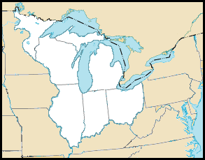
Vistula Historic District is a designated historic district in the city of Toledo, Ohio, USA, listed on the National Register of Historic Places. The district comprises Toledo's oldest extant neighborhood and encompasses an area roughly bounded by Champlain, Summit, Walnut and Magnolia streets. Vistula was a village established on land in what was then part of Michigan Territory, purchased in 1832 by Benjamin F. Stickney, in company with several investors from Lockport, New York, including Edward Bissell. In January 1833, Stickney platted the village of Vistula."Toledo's Start and Progress" Chapter VI in ''History of the City of Toledo and Lucas County, Ohio, by Clark Waggoner, pp. 370-396, Munsell:New York, 1888 Another settlement, named Port Lawrence, had first been established in 1817, al ... [...More Info...] [...Related Items...] OR: [Wikipedia] [Google] [Baidu] |
Toledo, Ohio
Toledo ( ) is a city in and the county seat of Lucas County, Ohio, United States. A major Midwestern United States port city, Toledo is the fourth-most populous city in the state of Ohio, after Columbus, Cleveland, and Cincinnati, and according to the 2020 census, the 79th-largest city in the United States. With a population of 270,871, it is the principal city of the Toledo metropolitan area. It also serves as a major trade center for the Midwest; its port is the fifth-busiest in the Great Lakes and 54th-biggest in the United States. The city was founded in 1833 on the west bank of the Maumee River, and originally incorporated as part of Monroe County, Michigan Territory. It was refounded in 1837, after the conclusion of the Toledo War, when it was incorporated in Ohio. After the 1845 completion of the Miami and Erie Canal, Toledo grew quickly; it also benefited from its position on the railway line between New York City and Chicago. The first of many glass manufacturers ... [...More Info...] [...Related Items...] OR: [Wikipedia] [Google] [Baidu] |
Historic District (United States)
Historic districts in the United States are designated historic districts recognizing a group of buildings, Property, properties, or sites by one of several entities on different levels as historically or architecturally significant. Buildings, structures, objects and sites within a historic district are normally divided into two categories, Contributing property, contributing and non-contributing. Districts vary greatly in size: some have hundreds of structures, while others have just a few. The U.S. federal government designates historic districts through the United States Department of the Interior, United States Department of Interior under the auspices of the National Park Service. Federally designated historic districts are listed on the National Register of Historic Places, but listing usually imposes no restrictions on what property owners may do with a designated property. U.S. state, State-level historic districts may follow similar criteria (no restrictions) or may req ... [...More Info...] [...Related Items...] OR: [Wikipedia] [Google] [Baidu] |
National Register Of Historic Places
The National Register of Historic Places (NRHP) is the United States federal government's official list of districts, sites, buildings, structures and objects deemed worthy of preservation for their historical significance or "great artistic value". A property listed in the National Register, or located within a National Register Historic District, may qualify for tax incentives derived from the total value of expenses incurred in preserving the property. The passage of the National Historic Preservation Act (NHPA) in 1966 established the National Register and the process for adding properties to it. Of the more than one and a half million properties on the National Register, 95,000 are listed individually. The remainder are contributing resources within historic districts. For most of its history, the National Register has been administered by the National Park Service (NPS), an agency within the U.S. Department of the Interior. Its goals are to help property owners and inte ... [...More Info...] [...Related Items...] OR: [Wikipedia] [Google] [Baidu] |
Michigan Territory
The Territory of Michigan was an organized incorporated territory of the United States that existed from June 30, 1805, until January 26, 1837, when the final extent of the territory was admitted to the Union as the State of Michigan. Detroit was the territorial capital. History and government The earliest European explorers of Michigan saw it mostly as a place to control the fur trade. Small military forces, Jesuit missions to Native American tribes, and isolated settlements of trappers and traders accounted for most of the inhabitants of what would become Michigan. Early government in Michigan After the arrival of Europeans, the area that became the Michigan Territory was first under French and then British control. The first Jesuit mission, in 1668 at Sault Saint Marie, led to the establishment of further outposts at St. Ignace (where a mission began work in 1671) and Detroit, first occupied in 1701 by the garrison of the former Fort de Buade under the leadership of Anto ... [...More Info...] [...Related Items...] OR: [Wikipedia] [Google] [Baidu] |
Lockport (city), New York
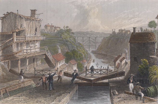
Lockport is both a city and the town that surrounds it in Niagara County, New York. The city is the Niagara county seat, with a population of 21,165 according to 2010 census figures, and an estimated population of 20,305 as of 2019. Its name derives from a set of Erie Canal locks (Lock Numbers 34 and 35) within the city that were built to allow canal barges to traverse the 60-foot natural drop of the Niagara Escarpment. It is part of the Buffalo–Niagara Falls metropolitan area. History The New York State Legislature authorized the Erie Canal's construction in April 1816. The route proposed by surveyors was to traverse an area in central Niagara County, New York, which was then "uncivilized" and free of White settlers. At the time, the nearest settlers were in nearby Cold Springs, New York. Following the announcement, land speculators began to buy large plots along and near the proposed route of the canal. By December 1820, when the exact location of the step locks had bee ... [...More Info...] [...Related Items...] OR: [Wikipedia] [Google] [Baidu] |
Plat
In the United States, a plat ( or ) (plan) is a cadastral map, drawn to scale, showing the divisions of a piece of land. United States General Land Office surveyors drafted township plats of Public Lands Surveys to show the distance and bearing between section corners, sometimes including topographic or vegetation information. City, town or village plats show subdivisions broken into blocks with streets and alleys. Further refinement often splits blocks into individual lots, usually for the purpose of selling the described lots; this has become known as subdivision. After the filing of a plat, legal descriptions can refer to block and lot-numbers rather than portions of sections. In order for plats to become legally valid, a local governing body, such as a public works department, urban planning commission, or zoning board must normally review and approve them. In gardening history, in both varieties of English (and in French etc), a "plat" means a section of a formal par ... [...More Info...] [...Related Items...] OR: [Wikipedia] [Google] [Baidu] |
Toledo War
The Toledo War (1835–36), also known as the Michigan–Ohio War or the Ohio–Michigan War, was an almost bloodless boundary dispute between the U.S. state of Ohio and the adjoining territory of Michigan over what is now known as the Toledo Strip. Control of the mouth of the Maumee River and the inland shipping opportunities it represented, and the good farmland to the west were seen by both parties as valuable economic assets. Poor geographical understanding of the Great Lakes helped produce conflicting state and federal legislation between 1787 and 1805, and varying interpretations of the laws led the governments of Ohio and Michigan to both claim jurisdiction over a region along their border. The situation came to a head when Michigan petitioned for statehood in 1835 and sought to include the disputed territory within its boundaries. Both sides passed legislation attempting to force the other side's capitulation, and Ohio's Governor Robert Lucas and Michigan's 24-year-o ... [...More Info...] [...Related Items...] OR: [Wikipedia] [Google] [Baidu] |
History Of Toledo, Ohio
Toledo ( ) is a city in and the county seat of Lucas County, Ohio, United States. A major Midwestern United States port city, Toledo is the fourth-most populous city in the state of Ohio, after Columbus, Cleveland, and Cincinnati, and according to the 2020 census, the 79th-largest city in the United States. With a population of 270,871, it is the principal city of the Toledo metropolitan area. It also serves as a major trade center for the Midwest; its port is the fifth-busiest in the Great Lakes and 54th-biggest in the United States. The city was founded in 1833 on the west bank of the Maumee River, and originally incorporated as part of Monroe County, Michigan Territory. It was refounded in 1837, after the conclusion of the Toledo War, when it was incorporated in Ohio. After the 1845 completion of the Miami and Erie Canal, Toledo grew quickly; it also benefited from its position on the railway line between New York City and Chicago. The first of many glass manufacturers arri ... [...More Info...] [...Related Items...] OR: [Wikipedia] [Google] [Baidu] |
National Register Of Historic Places In Lucas County, Ohio
__NOTOC__ This is a list of the National Register of Historic Places listings in Lucas County, Ohio. This is intended to be a complete list of the properties and districts on the National Register of Historic Places in Lucas County, Ohio, United States. The locations of National Register properties and districts for which the latitude and longitude coordinates are included below, may be seen in an online map. There are 97 properties and districts listed on the National Register in the county, including 2 National Historic Landmarks. Another 6 properties were once listed but have been removed. Current listings Former listings See also * List of National Historic Landmarks in Ohio * Listings in neighboring counties: Fulton, Henry, Lenawee (MI), Monroe (MI), Ottawa, Wood * National Register of Historic Places listings in Ohio References {{Lucas County, Ohio Luc ... [...More Info...] [...Related Items...] OR: [Wikipedia] [Google] [Baidu] |
Historic Districts On The National Register Of Historic Places In Ohio
History (derived ) is the systematic study and the documentation of the human activity. The time period of event before the History of writing#Inventions of writing, invention of writing systems is considered prehistory. "History" is an umbrella term comprising past events as well as the memory, discovery, collection, organization, presentation, and interpretation of these events. Historians seek knowledge of the past using historical sources such as written documents, oral accounts, art and material artifacts, and ecological markers. History is not complete and still has debatable mysteries. History is also an Discipline (academia), academic discipline which uses narrative to describe, examine, question, and analyze past events, and investigate their patterns of cause and effect. Historians often debate which narrative best explains an event, as well as the significance of different causes and effects. Historians also debate the historiography, nature of history as an end in ... [...More Info...] [...Related Items...] OR: [Wikipedia] [Google] [Baidu] |
Neighborhoods In Toledo, Ohio
Many Neighborhoods of Toledo, Ohio are of historic interest.http://timault.tripod.com/ Commonly used indicators like South Toledo can be misleading, since these indicators are most likely based on the original plan of Downtown Toledo, North is really Northeast, South is really Southwest, West is really Northwest, and East is really Southeast. Neighborhoods *Arlington (South) *Auburndale: A large neighborhood in central-west Toledo, generally bounded by Monroe Street on the north, the Norfolk & Southern Railroad on the east, Oakwood Street and W. Bancroft on the south and Torrey Hill on the west. *Beverly (South) is a quiet suburban-like neighborhood. *Birmingham: (East) is a neighborhood formerly inhabited almost exclusively by Hungarian immigrants. *Crossgates: (South) **St. Peter's & St.Pauls Catholic School & Church on St.Claire Street.~Now Only The Church is active. the School of St Peter & Pauls & St.James Catholic School from Colburn St.Merged with Immaculate Conception/Da ... [...More Info...] [...Related Items...] OR: [Wikipedia] [Google] [Baidu] |


.jpg)