|
Vilayet Croats
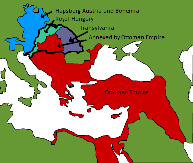
The Croatian Vilayet ( ota, vilâyet-i Hırvat) was a temporary borderland entity in Dalmatia in the 16th century. Its capital was Sinj. Establishment and territory Immediately after the Ottoman capture of the Dalmatian hinterland and Lika from the Kingdom of Croatia and the Republic of Venice in the 1520s, they organized it as a borderland entity and named it the Vilayet of "Croats" ( tr, Hırvat, hr, Hrvati). The southern border of the territory of this vilayet was river Cetina while north-western border was Lika and river Zrmanja. It also included region around river Krka. This territory was administratively governed as the Croatian vilayet which belonged to the Sanjak of Bosnia and listed as such in its 1530 ''defter'' (tax registry). Administration The capital of the vilayet was Sinj. Its territory was under the jurisdiction of the Skradin ''kadiluk''. Aličić claimed that territories of the Croatian vilayet and Skradin kadiluk were the same and that the official Otto ... [...More Info...] [...Related Items...] OR: [Wikipedia] [Google] [Baidu] |
March (territorial Entity)
In medieval Europe, a march or mark was, in broad terms, any kind of borderland, as opposed to a national "heartland". More specifically, a march was a border between realms or a neutral buffer zone under joint control of two states in which different laws might apply. In both of these senses, marches served a political purpose, such as providing warning of military incursions or regulating cross-border trade. Marches gave rise to titles such as marquess (masculine) or marchioness (feminine) in England, ''marqués'' (masculine) and ''marquesa'' (feminine) in Spanish-speaker countries, as well as in the Catalan and Galician regions, ''marquês'' (masculine) and ''marquesa'' (feminine) in Portuguese-speaker countries, ''markesa'' (both masculine and feminine) in Euskadi, ''marquis'' (masculine) or ''marquise'' (feminine) in France and Scotland, margrave (german: Markgraf, lit=march count; masculine) or margravine (, feminine) in Germany, and corresponding titles in other European ... [...More Info...] [...Related Items...] OR: [Wikipedia] [Google] [Baidu] |
Petrovo Polje, Croatia
The Petrovo Polje ( hr, Petrovo polje, "Peter's Field") is a karstic field in the northern part of Dalmatian Hinterland in Croatia. Geography Petrovo Polje is the shape of an isosceles triangle long and wide, and is surrounded by mountains Svilaja, Promina (mountain), Promina and Moseć. It slopes from the north-east at 320 m.a.s.l. to its south-western end at 265 m.a.s.l. Its area is . Climate The climate of Petrovo Polje has the elements of both the cooler and harsher continental climate of the north and the warmer climate predominant in the south. In the winter, jugo and Bora (wind), bora winds are common. The average number of frost days per year is 30, between October and April. Summers are dry. Settlements The settlements are situated on the edge of the field: Drniš, Kričke, Šibenik-Knin County, Kričke, Ružić, Croatia, Ružić, Umljanović, Kljake, Čavoglave, Gradac, Šibenik-Knin County, Gradac, Otavice, Croatia, Otavice, Kanjane, Parčić, Drniš, Parčić ... [...More Info...] [...Related Items...] OR: [Wikipedia] [Google] [Baidu] |
Battle Of Mohács
The Battle of Mohács (; hu, mohácsi csata, tr, Mohaç Muharebesi or Mohaç Savaşı) was fought on 29 August 1526 near Mohács, Kingdom of Hungary, between the forces of the Kingdom of Hungary and its allies, led by Louis II, and those of the Ottoman Empire, led by Suleiman the Magnificent. The Ottoman victory led to the partition of Hungary for several centuries between the Ottoman Empire, the Habsburg monarchy, and the Principality of Transylvania. Further, the death of Louis II as he fled the battle marked the end of the Jagiellonian dynasty in Hungary and Bohemia, whose dynastic claims passed to the House of Habsburg. Background Decline of Hungarian royal power (1490–1526) After the death of the absolutist King Matthias Corvinus in 1490, the Hungarian magnates, who did not want another heavy-handed king, procured the accession of the notoriously weak-willed King Vladislaus of Bohemia, who reigned as King Vladislaus II of Hungary from 1490 to 1516. He was kn ... [...More Info...] [...Related Items...] OR: [Wikipedia] [Google] [Baidu] |
Obrovac, Croatia
Obrovac (; it, Obrovazzo) is a town located in northern Dalmatia, in the Zadar County of Croatia. The Obrovac municipality has a total population of 4,323 people. The town is located in the canyon of the river Zrmanja. Geography Obrovac is a town on the Zrmanja River some 11 km from the mouth of the river of the Novigrad sea. Above the town are the ruins of a fortified city. Its tributary Krupa attracts numerous day-trippers, and in recent times, rafting, canoe, and kayak lovers. Not far from the town of Krupa is a monastery with a valuable icon collection. About north-west of the town, along the road heading up to the mountains, lies a huge deserted industrial complex, an alumina plant built in the 1970s. South of the town there is extraordinary Bijela River canyon with a lot of waterfalls and small ponds and pools. History Obrovac first got its name in 1337. In 1527 Obrovac was taken over by the Ottoman Turks. In October 1683, the population of Venetian Dalmatia, p ... [...More Info...] [...Related Items...] OR: [Wikipedia] [Google] [Baidu] |
Nadin, Croatia
Nadin is a Croatian village in the Zadar County, located between Benkovac and Škabrnja. The population is 406 (census 2011). The village was inhabited since the time of the Liburnians when it was named '. It was conquered by Ottoman Empire in 1527 and was part of Sanjak of Krka till 1683 except brief occupation of Republic of Venice in 1647. It was also ruled by Venice between 1683 and 1797. Nadin was included in Republic of Serbian Krajina The Republic of Serbian Krajina or Serb Republic of Krajina ( sh, Република Српска Крајина, italics=no / or РСК / ''RSK'', ), known as the Serbian Krajina ( / ) or simply Krajina, was a self-proclaimed Serb proto-state, ... between 1991 and 1995. References Populated places in Zadar County Benkovac {{Zadar-geo-stub ... [...More Info...] [...Related Items...] OR: [Wikipedia] [Google] [Baidu] |
Bukovica, Croatia
Bukovica is a geographical region in Croatia. It lies in northern Dalmatia, with Lika to the north, Kninska Krajina to the east, and Ravni Kotari to the southwest. History Vlachs were recorded among the inhabitants of the region in 1420. Their basic economic activity was related to transhumant livestock breeding in conjunction with carrying merchants’ goods. Many Vlachs (also recorded as Morlachs) moved to the Ottoman areas in the Dalmatian hinterland which were occupied by 1573 from Bukovica. Geography Bukovica is a small plateau region about 250 to 300 meters above sea level. The karst landscape covers most of the region up to the Zrmanja valley. Towns and villages Bukovica covers a triangular area between the towns of Benkovac, Obrovac, and Knin. The region includes the municipalities of Jasenice, Ervenik, Kistanje, and Lišane Ostrovičke. See also *Geography of Croatia The geography of Croatia is defined by its location—it is described as a part of Centra ... [...More Info...] [...Related Items...] OR: [Wikipedia] [Google] [Baidu] |
Benkovac
Benkovac () is a town in the interior of Zadar County, Croatia. Geography Benkovac is located where the plain of Ravni Kotari and the karstic plateau of Bukovica meet, 20 km from the town of Biograd na Moru and 30 km from Zadar. The Zagreb-Split motorway and Zadar-Knin railway pass through the town. It borders the municipalities of Novigrad, Posedarje, Obrovac, Lišane Ostrovičke, Kistanje and Stankovci. Demography According to the 2011 census, the municipality had 11,026 inhabitants of which 13.8% were from a Serbian descent and 84.9% were Croatian. Before the Croatian War of Independence, Serbs made up about 57%, and Croats about 41%, however Croats only held 18% of the jobs in the local government, which led to high tensions in the 1990s. During Operation Storm (''Oluja''), almost all of the Serbs left the town, and after the war they were replaced by Bosnian Croat settlers. According to the Austrian Census in 1900, the town of Benkovac consisted of 356 Cath ... [...More Info...] [...Related Items...] OR: [Wikipedia] [Google] [Baidu] |
Ostrovica, Croatia
Ostrovica is a village in Croatia , image_flag = Flag of Croatia.svg , image_coat = Coat of arms of Croatia.svg , anthem = "Lijepa naša domovino"("Our Beautiful Homeland") , image_map = , map_caption = , capit ... in the Zadar County, in the Lišane Ostrovičke municipality, population 86 (census 2011). Near the village there is an eponymous ruined medieval castle of the Šubić noble family. References Populated places in Zadar County {{Zadar-geo-stub ... [...More Info...] [...Related Items...] OR: [Wikipedia] [Google] [Baidu] |
Skradin
Skradin ( it, Scardona; grc, Σκάρδων) is a small town in the Šibenik-Knin County of Croatia, with a population of 3,825 (2011 census). It is located near the Krka river and at the entrance to the Krka National Park, from Šibenik and from Split. The main attraction of the park, Slapovi Krke, is a series of waterfalls, the biggest of which, Skradinski buk, was named after Skradin. History It was a Liburnian city, named Scardon ( grc, Σκάρδων). Later it became a Roman town (Scardona in Latin), as the administrative and military centre of the region. It was destroyed during the Migration Period, and had by the 9th century been settled by Slavs. During the 10th century, it was one of the fortified towns in Croatia, as the centre of the Skradin županija. Skradin under Šubić rule In the late 13th and early 14th centuries, Skradin flourished as the capital of the Šubić bans, Paul I and Mladen II. The Šubić's built the Turina fortress on the hill overlookin ... [...More Info...] [...Related Items...] OR: [Wikipedia] [Google] [Baidu] |
Knin
Knin (, sr, link=no, Книн, it, link=no, Tenin) is a city in the Šibenik-Knin County of Croatia, located in the Dalmatian hinterland near the source of the river Krka (Croatia), Krka, an important traffic junction on the rail and road routes between Zagreb and Split, Croatia, Split. Knin rose to prominence twice in history, as the capital of both the Kingdom of Croatia (Medieval), medieval Kingdom of Croatia and, briefly, of the unrecognized self-proclaimed Republic of Serbian Krajina for the duration of Croatian War of Independence from 1991 to 1995. Etymology The name is likely derived from the Illyrian language, Illyrian ''Ninia''. According to an alternative explanation, offered by Franz Miklosich and Petar Skok, the name - derived from a Slavic root ''*tьn-'' ("to cut", "to chop") - has a meaning of "cleared forest". The medieval names of Knin include hu, Tinin; it, Tenin; la, Tinum. The Latin name is still used as a titular see, titular episcopal see, the Diocese o ... [...More Info...] [...Related Items...] OR: [Wikipedia] [Google] [Baidu] |
Strmica, Croatia
Strmica is a small village in the Knin Municipality. It is located north of Knin, just south of the border to Bosnia & Herzegovina. The population is 268 (census 2001). External links Strmica Populated places in Šibenik-Knin County Knin {{ŠibenikKnin-geo-stub ... [...More Info...] [...Related Items...] OR: [Wikipedia] [Google] [Baidu] |


