|
Vik, Sortland
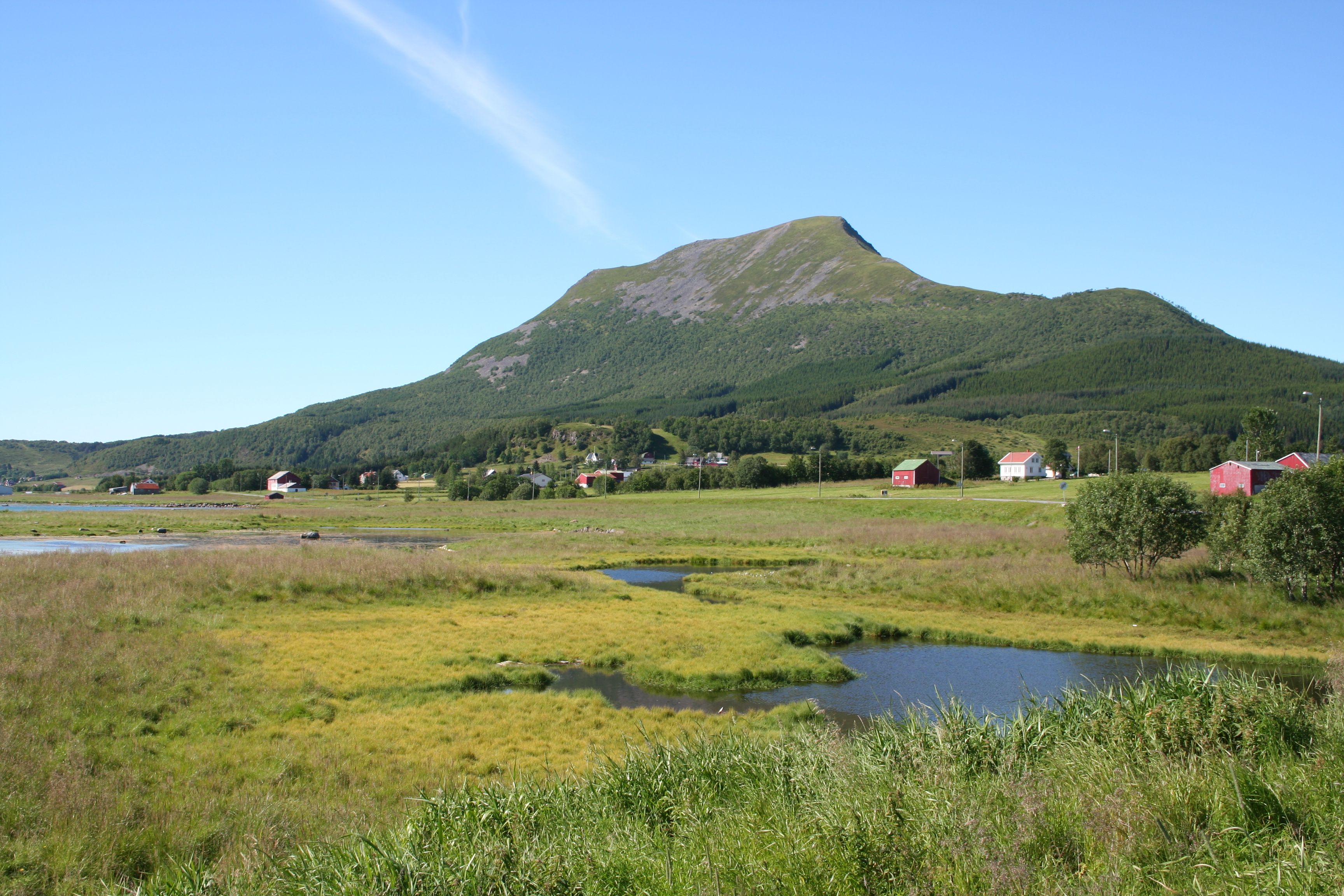
Vik is a village in Sortland Municipality in Nordland county, Norway. The village is located on the island of Langøya, about north of the town of Sortland. The Vik farm previously comprised an area completely from the isthmus Vikeid in the west to Gåsfjord in the northeast, spanning between its furthers points. Today, however, Vik is considered limited to the middle of this larger area. Vik lies on the north side of the inlet Vikosen, the outlet of the river Vikelva. The valley Vikdalen and the lake Vikvatnet lie north of Vik. The island Vikøya lies in the Sortlandsundet strait east of Vik and across the bay entrance Vikbotn. Vik is connected to the town of Sortland by County Road 956, which branches off of County Road 820 at the Vik Bridge where the river Vikelva empties into the inlet Vikosen. Vik has a long history and is one of the oldest inhabited places in Sortland. It was mentioned in a letter dating from 1400, and its name was recorded as ''Viick'', ''Wiigh'', ... [...More Info...] [...Related Items...] OR: [Wikipedia] [Google] [Baidu] |
Nordland
Nordland (; smj, Nordlánnda, sma, Nordlaante, sme, Nordlánda, en, Northland) is a county in Norway in the Northern Norway region, the least populous of all 11 counties, bordering Troms og Finnmark in the north, Trøndelag in the south, Norrbotten County in Sweden to the east, Västerbotten County to the south-east, and the Atlantic Ocean (Norwegian Sea) to the west. The county was formerly known as ''Nordlandene amt''. The county administration is in the town of Bodø. The remote Arctic island of Jan Mayen has been administered from Nordland since 1995. In the southern part of the county is Vega, listed on the UNESCO World Heritage Site list. Districts The county is divided into traditional districts. These are Helgeland in the south (south of the Arctic Circle), Salten in the centre, and Ofoten in the north-east. In the north-west lie the archipelagoes of Lofoten and Vesterålen. Geography Nordland is located along the northwestern coast of the Scandinavia ... [...More Info...] [...Related Items...] OR: [Wikipedia] [Google] [Baidu] |
Langøya
Langøya is the third largest island of Norway (outside of Svalbard), with an area of . The island is a part of the Vesterålen archipelago in Nordland county, Norway. The island includes the municipalities of Bø and Øksnes as well as parts of the municipalities of Sortland and Hadsel. Geography Langøya is mountainous, with mountains reaching 400 - 700 meter above sea level, the highest is Snykolla (763 m). There are also lowland near the coasts around the island, and in some valleys, some of it is bogs. The treeline is around 300 meter above sea level on Langøya. The total population on the island is 15,600 and the largest population center is Sortland (pop 5,487), another town is Myre. Langøya has been settled since the stone age. The larger island Hinnøya lies to the east (on the other side of the Sortlandssundet). The island of Andøya lies to the northeast. The small island of Skogsøya lies to the northwest. The island of Hadseløya lies to the south. Th ... [...More Info...] [...Related Items...] OR: [Wikipedia] [Google] [Baidu] |
Pink-footed Goose
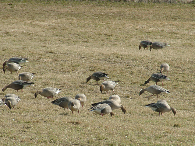
The pink-footed goose (''Anser brachyrhynchus'') is a goose which breeds in eastern Greenland, Iceland and Svalbard. It is migratory, wintering in northwest Europe, especially Ireland, Great Britain, the Netherlands, and western Denmark. The name is often abbreviated in colloquial usage to "pinkfoot" (plural "pinkfeet"). ''Anser'' is the Latin for "goose", and ''brachyrhynchus'' comes from the ancient Greek ''brachus'' "short" and ''rhunchos'' "bill". It is a medium-sized goose, long, the wingspan , and weighing . It has a short bill, bright pink in the middle with a black base and tip, and pink feet. The body is mid-grey-brown, the head and neck a richer, darker brown, the rump and vent white, and the tail grey with a broad white tip. The upper wing-coverts are of a somewhat similar pale bluish-grey as in the greylag goose, and the flight feathers blackish-grey. The species is most closely related to the bean goose ''Anser fabalis'' (having even been treated as a subspecies ... [...More Info...] [...Related Items...] OR: [Wikipedia] [Google] [Baidu] |
Vik Inlet Nature Reserve
The Vikosen Nature Reserve ( no, Vikosen naturreservat) is located in the municipality of Sortland in Nordland county, Norway. The nature reserve includes a shallow water area in the inlet Vikosen and a wide zone of shoreline above it. The reserve has an area of , of which is land and is sea. The area is protected in order to safeguard an important wetland area with natural flora and fauna, especially for its function as a nationally significant area used by the pink-footed goose during migration. It offers the geese a much-needed gathering and resting point during their strenuous spring migration. County Road 956 passes through the village of Vik Vik (Old Norse: vík) means wick or bay in Norwegian and Swedish (''vig'' in Danish), and it may refer to the following: Places Iceland *Vík í Mýrdal, a village in southern Iceland Iran *Vik, Iran, a village in Zanjan Province, Iran Norway *V ... along the northwest shore of the reserve, and County Road 820 to Sortland runs ... [...More Info...] [...Related Items...] OR: [Wikipedia] [Google] [Baidu] |
Voss
Voss () is a municipality and a traditional district in Vestland county, Norway. The administrative center of the municipality is the village of Vossevangen. Other villages include Bolstadøyri, Borstrondi, Evanger, Kvitheim, Mjølfjell, Oppheim, Stalheim, and Vinje. The municipality is the 35th largest by area of Norway's 356 municipalities. Voss is Norway's 77th most populous municipality, with a population of 15,875. Its population density is and its population has increased by 6.5% over the last 10 years. Municipal history The parish of Voss was established as a municipality on 1 January 1838 (see formannskapsdistrikt law). On 1 January 1867, a small area in northern Voss (population 28) was transferred to the municipality of Hosanger. On 1 January 1868, the municipality's northern district (population 2,009) was separated to form the new municipality of Vossestrand. This left 7,592 residents in Voss. On 21 August 1868, an unpopulated area of northern Voss w ... [...More Info...] [...Related Items...] OR: [Wikipedia] [Google] [Baidu] |
Norwegian County Road 820
County Road 820 ( no, Fylkesvei 820) is a road in the municipalities of Bø, Øksnes, and Sortland in Nordland County, Norway. It starts in the village of Straumsnes in the municipality of Bø, where it continues south from County Road 901, circles around the west end of the island of Langøya through the Straume Nature Reserve to the village of Straume, and continues east to the Ryggedal Tunnel. It then passes through the municipality of Øksnes along the west shore of Ånnfjord and south shore of Skjellfjord before entering the municipality of Sortland. There it passes along the inner shore of Eidsfjord through Frøskeland, crosses Vikeid (the Vik Isthmus), where County Road 956 branches off to Vik, and then runs past the southwest shore of the Vikosen Nature Reserve and along the west side of Sortlandssundet strait, where it terminates at the town of Sortland. Prior to January 1, 2010, the route was a national road. After the national road network regional reform ca ... [...More Info...] [...Related Items...] OR: [Wikipedia] [Google] [Baidu] |
Norwegian County Road 956
County Road 956 ( no, Fylkesvei 956) is a road in Sortland Municipality in Nordland County, Norway.''Vegliste 2016: Fylkes- og kommunale veger. Nordland''. 2016. Bodø: Statens vegvesen Region nord, p. 82. It starts near the village of , where it branches off to the north from County Road 820 and then follows the west side of |
Sortlandsundet
Sortlandsundet or Sortlandssundet ( en, Sortland Sound''Norges Geologiske Undersøkelse'' no. 212. 1983. Trondheim: Norges Geologiske Undersokelse, p. 6.) is a strait or sound in Sortland Municipality in Nordland Nordland (; smj, Nordlánnda, sma, Nordlaante, sme, Nordlánda, en, Northland) is a county in Norway in the Northern Norway region, the least populous of all 11 counties, bordering Troms og Finnmark in the north, Trøndelag in the south, N ... county, Norway. It separates the islands of Langøya and Hinnøya and it connects the Hadselfjorden in the south and the Gavlfjorden in the north. The Sortland Bridge is the only bridge that crosses the long strait. References Sortland Vesterålen {{Nordland-geo-stub ... [...More Info...] [...Related Items...] OR: [Wikipedia] [Google] [Baidu] |
Vikeid
Vikeid (the Vik Isthmus) is a flat isthmus on the island of Langøya in the municipality of Sortland in Nordland county, Norway. The village of Vik lies on the east side of the isthmus and the village of Frøskeland lies on the west side. The isthmus has the Eidsfjorden to the west and the Sortlandsundet strait in the east. The isthmus almost divides Langøya in two. To the north lies the northwestern part of the municipality of Sortland, and further north the municipality of Øksnes. The southwest part of the municipality of Sortland lies south of the isthmus. The Eidsfjorden and the western part of the isthmus belonged to the municipality of Hadsel until 1963, when it was transferred to Sortland. The isthmus is marshy. Parts of the isthmus are cultivated as grassland, and some areas have been trenched and planted with Norway spruce. In the eastern part of the isthmus is the former Vikeid Agricultural Machine Operators' School. The school was closed in the summer of 2005. Ther ... [...More Info...] [...Related Items...] OR: [Wikipedia] [Google] [Baidu] |
Sortland (town)
is a town and the administrative centre of Sortland Municipality in Nordland county, Norway. The town is located on the east coast of the island of Langøya, along the Sortlandsundet strait. In 1997, the municipality decided to declare "town status" for the urban area of Sortland. Sortland is the largest town and commercial centre in the whole Vesterålen region and is often referred to as "the blue town by the strait" () since many of the buildings are painted blue. The town has a population (2018) of 5,404 which gives the town a population density of . The Norwegian National Road 85 highway begins at Sortland and crosses the Sortland Bridge to connect the town to the nearby European route E10 highway on the neighboring island of Hinnøya. The town has a regional high school, a cultural centre, library, cinema, Sortland Museum, and Sortland Church. The town is also a regular stop of the Hurtigruten boats. Etymology The town (and municipality) is named after the old '' ... [...More Info...] [...Related Items...] OR: [Wikipedia] [Google] [Baidu] |
Sortland Municipality
or is a municipality in Nordland county, Norway. It is part of the traditional region of Vesterålen. The administrative centre of the municipality is the town of Sortland. Other population centres in Sortland include Bø, Holand, Holmstad, Liland, Sigerfjord, Strand, and Vik. The Norwegian Coast Guard has its northern base in Sortland, called ''Kystvaktskvadron Nord''. In 1997, the municipal council declared "town status" for the urban area of Sortland. Sortland is the largest town and commercial centre in Vesterålen. The town of Sortland is located close to the Sortland Bridge which crosses the Sortlandsundet strait and connects the two large islands of Langøya and Hinnøya by road. Since a lot of houses in the town are painted blue, Sortland is sometimes referred to as "the blue city". The municipality is the 159th largest by area out of the 356 municipalities in Norway. Sortland is the 109th most populous municipality in Norway with a population of 10,468. ... [...More Info...] [...Related Items...] OR: [Wikipedia] [Google] [Baidu] |


