|
Vettar River
The Vettar River is a river in the Kaveri delta that flows through the Thanjavur, Tiruvarur, and Nagapattinam districts of the Indian state of Tamil Nadu. Course The Vettar is a distributary of the Vennar River, and begins northwest of Thennankudi at the Thenperambur dam in Thanjavur district. The Vettar branches off to the northeast, while the Vennar continues to the east. The river flows to the north of Melattur, before turning to the southeast as it passes to the south of Valangaiman. North of Koradacheri, it turns back to the northeast, passing to the north of Thiruvarur. A distributary of the Vettar, the Odambokkai River, flows through Thiruvarur. After passing Thiruvarur, the Vettar continues flowing to the east, through Nagapattinam district, before it empties into the Bay of Bengal in the town of Nagore Nagore is a town in the Nagapattinam District, Tamil Nadu, India. It is located approximately 12 km North of Karaikal and 5 km South of Nagapattinam. N ... [...More Info...] [...Related Items...] OR: [Wikipedia] [Google] [Baidu] |
Kaveri
The Kaveri (also known as Cauvery, the anglicized name) is one of the major Indian rivers flowing through the states of Karnataka and Tamil Nadu. The Kaveri river rises at Talakaveri in the Brahmagiri range in the Western Ghats, Kodagu district of the state of Karnataka, at an elevation of 1,341 m above mean sea level and flows for about 800 km before its outfall into the Bay of Bengal. It reaches the sea in Poompuhar in Mayiladuthurai district. It is the third largest river after Godavari and Krishna in southern India, and the largest in the State of Tamil Nadu, which, on its course, bisects the state into north and south. In ancient Tamil literature, the river was also called Ponni (the golden maid, in reference to the fine silt it deposits). The Kaveri is a sacred river to the people of South India and is worshipped as the Goddess Kaveriamma (Mother Cauvery). It is considered to be among the seven holy rivers of India. It is extensively used for agriculture in bo ... [...More Info...] [...Related Items...] OR: [Wikipedia] [Google] [Baidu] |
Thanjavur District
Thanjavur District is one of the Districts of Tamil Nadu, 38 districts of the States and territories of India, state of Tamil Nadu, in southeastern India. Its headquarters is Thanjavur. The district is located in the delta of the Cauvery River and is mostly agrarian. As of 2011, Thanjavur district had a population of 2,405,890 with a sex-ratio of 1,035 females for every 1,000 males. Geography The district is located at in Central Tamil Nadu bounded on the northeast by Mayiladuthurai district, on the east by Tiruvarur District, on the south by the Palk Strait of Bay of Bengal on the west by Pudukkottai District and Tiruchirappalli District, Tiruchirappalli, small border with Cuddalore district, Cuddalore on the northeast and on the north by the river Kollidam, across which lie part of Tiruchirappalli District, Tiruchirappalli, and Ariyalur district, Ariyalur districts. Demographics According to 2011 census of India, 2011 census, Thanjavur district had a population of 2,4 ... [...More Info...] [...Related Items...] OR: [Wikipedia] [Google] [Baidu] |
Tiruvarur District
Thiruvarur district is one of the 38 districts in the Tamil Nadu state of India. As of 2011, the district had a population of 1,264,277 with a sex-ratio of 1,017 females for every 1,000 males. Geography The district occupies an area of 2,161 km². The district is bounded by Nagapattinam district on the east, Mayiladuthurai district on the north, Thanjavur District on the west, Palk Strait on the south and a small border on the northeast with the Karaikal district of the union territory Puducherry. Demographics According to 2011 census, Thiruvarur district had a population of 1,264,277 with a sex-ratio of 1,017 females for every 1,000 males, much above the national average of 929. A total of 121,973 were under the age of six, constituting 62,280 males and 59,693 females. Scheduled Castes and Scheduled Tribes accounted for 34.08% and 0.24% of the population respectively. The average literacy of the district was 74.86%, compared to the national average of 72.99%. The dis ... [...More Info...] [...Related Items...] OR: [Wikipedia] [Google] [Baidu] |
Nagapattinam District
Nagapattinam district is one of the 38 districts (a coastal district) of Tamil Nadu state in southern India. Nagapattinam district was carved out by bifurcating the erstwhile composite Thanjavur district on 19 October 1991. The town of Nagapattinam is the district headquarters. As of 2011, the district had a population of 697,069 with a sex-ratio of 1,025 females for every 1,000 males. Until Mayiladuthurai district was created out of it on 24 March 2020, Nagapattinam was the only discontiguous district in Tamil Nadu. Etymology ''Nagapattinam'' is derived from ''Nagar'', referring to people, and ''pattinam'' referring to town. In Tamil ''Pattinam'' and ''paakkam'' depicts coastal towns. The town was also called ''Cholakula Vallipattinam'' during the Chola period, when it was one of the important ports. Ptolemy refers to Nagapattinam as Nikam and mentions it as one of the most important trade centres of the ancient Tamil country. This view is doubtful as there is no contemporary e ... [...More Info...] [...Related Items...] OR: [Wikipedia] [Google] [Baidu] |
India
India, officially the Republic of India (Hindi: ), is a country in South Asia. It is the seventh-largest country by area, the second-most populous country, and the most populous democracy in the world. Bounded by the Indian Ocean on the south, the Arabian Sea on the southwest, and the Bay of Bengal on the southeast, it shares land borders with Pakistan to the west; China, Nepal, and Bhutan to the north; and Bangladesh and Myanmar to the east. In the Indian Ocean, India is in the vicinity of Sri Lanka and the Maldives; its Andaman and Nicobar Islands share a maritime border with Thailand, Myanmar, and Indonesia. Modern humans arrived on the Indian subcontinent from Africa no later than 55,000 years ago., "Y-Chromosome and Mt-DNA data support the colonization of South Asia by modern humans originating in Africa. ... Coalescence dates for most non-European populations average to between 73–55 ka.", "Modern human beings—''Homo sapiens''—originated in Africa. Then, int ... [...More Info...] [...Related Items...] OR: [Wikipedia] [Google] [Baidu] |
Tamil Nadu
Tamil Nadu (; , TN) is a States and union territories of India, state in southern India. It is the List of states and union territories of India by area, tenth largest Indian state by area and the List of states and union territories of India by population, sixth largest by population. Its capital and largest city is Chennai. Tamil Nadu is the home of the Tamil people, whose Tamil language—one of the longest surviving Classical languages of India, classical languages in the world—is widely spoken in the state and serves as its official language. The state lies in the southernmost part of the Indian peninsula, and is bordered by the Indian union territory of Puducherry (union territory), Puducherry and the states of Kerala, Karnataka, and Andhra Pradesh, as well as an international maritime border with Sri Lanka. It is bounded by the Western Ghats in the west, the Eastern Ghats in the north, the Bay of Bengal in the east, the Gulf of Mannar and Palk Strait to the south-eas ... [...More Info...] [...Related Items...] OR: [Wikipedia] [Google] [Baidu] |
Thennankudi
Thennangudi is a medium-size village in Peravurani Taluk, Thanjavur district, Tamil Nadu Tamil Nadu (; , TN) is a States and union territories of India, state in southern India. It is the List of states and union territories of India by area, tenth largest Indian state by area and the List of states and union territories of India ..., India. With many coconut farms, each with a house attached, the main product of this village is coconut. The two Kalabairavar temple is famous for astami pooja and sangu pooja and yuthrayagam. The Sri Kala Bairavar Temple is in the village. The Cauvery sub river runs through the village and has three ponds, two small and one with a surface area of ten acres. At the bus facility from 6AM to 11pm the #5 bus from Pattukottai to Peravurani runs continuously. Kalathur Kalakam Mavadukuruchi and Otangadu are near the village. Demographics The population of Thennangudi village is just 887, as per 2011 Census of India. The male population is 424 and f ... [...More Info...] [...Related Items...] OR: [Wikipedia] [Google] [Baidu] |
Melattur, Tamil Nadu
Melattur is a panchayat town in Thanjavur district in the Indian state of Tamil Nadu. It is located 18 kilometres from the town of Thanjavur. It is the origin of the Melattur style of Bharatanatyam founded by Mangudi Dorairaja Iyer and a series of dance-drama performances called the ''Bhagavatha Mela''s. Demographics India census, Melattur had a population of 7815. Males constitute 50% of the population and females 50%. Melattur has an average literacy rate of 66%, higher than the national average of 59.5%: male literacy is 74%, and female literacy is 59%. In Melattur, 12% of the population is under 6 years of age. History Inscriptions at the largest Shiva temple in Melattur indicate that the village might have existed as early as the times of Vikrama Chola who lived in 12th century AD. Earlier known as Nritta Vinoda Valanadu, the village was rechristened as Unnathapuri in honor of Unnathapureswarar, the presiding deity of the temple and the form in which Lord Shiva was wors ... [...More Info...] [...Related Items...] OR: [Wikipedia] [Google] [Baidu] |
Valangaiman
Valangaiman (also spelt as Valangaiman) is a town Panchayat in the Valangaiman taluk of Thiruvarur district in the Indian state of Tamil Nadu. It is the headquarters of Valangaiman Taluk. Geography Valangiman has an elevation of . It is situated about 31 kilometres northwest of the district seat of Tiruvarur and 10 kilometres south of Kumbakonam. It is about 40 kilometers east of Thanjavur, 14 kilometers north of Needamangalam and 30 km west of Thiruvarur. Demographics In the 2011 India census, Valangaiman had a population of 11,754. Males constituted 49% of the population and females 51%. Valangaiman had an average literacy rate of 68%, higher than the national average of 59.5%: male literacy was 73%, and female literacy was 63%. In 2001 in Valangaiman, 10% of the population was under 6 years of age. Education Govt. Polytechnic College Valangaiman, 300 students per year 60 per branch are admitted every year. Politics Valangaiman belongs to Nannilam assembly constituency ... [...More Info...] [...Related Items...] OR: [Wikipedia] [Google] [Baidu] |
Koradacheri
Koradacheri is a panchayat town in Thiruvarur district in the Indian state of Tamil Nadu. It lies between the rivers Vettar and Vennar flowing at a distance of about 1.5 km. This is the Panchayat Town. Major income only from Agriculture, most of them are farmers. There are two government schools (Boys & Girls). There is a Railway station and a Government hospital. Demographics India census A census is the procedure of systematically acquiring, recording and calculating information about the members of a given population. This term is used mostly in connection with national population and housing censuses; other common censuses incl ..., Koradacheri had a population of 5970. Males constitute 50% of the population and females 50%. Koradacheri has an average literacy rate of 75%, higher than the national average of 59.5%: male literacy is 81%, and female literacy is 69%. In Koradacheri, 11% of the population is under 6 years of age. Climate References Cities and t ... [...More Info...] [...Related Items...] OR: [Wikipedia] [Google] [Baidu] |
Thiruvarur
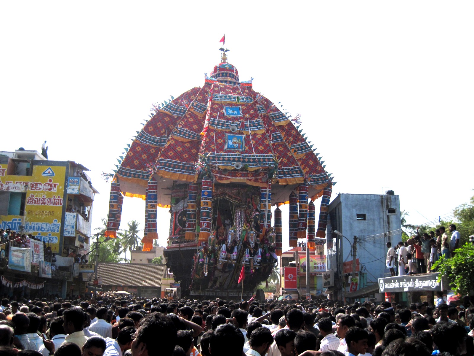
Thiruvarur () also spelt as Tiruvarur is a town and municipality in the Indian state of Tamil Nadu. It is the administrative headquarters of Thiruvarur district and Thiruvarur taluk. The temple chariot of the Thyagaraja temple, weighing and measuring tall is the largest temple chariot in India. Thiruvarur is the birthplace of Tyagaraja, Muthuswami Dikshitar and Syama Sastri, popularly known as the Trinity of Carnatic music of the 18th century CE. Thiruvarur Thiyagarajaa Swaamy temple is older than Tanjore big temple. Thiruvarur was a part of Thanjavur district until 1991. The Odambokki river passes through the centre of the town. Thiruvarur covers an area of and had a population of 58,301 as of 2011. Out of total population of Tiruvarur, 1,403,348 in the district, 257,795 are in urban area and 1,006,482 are in rural area. 65,220 households are in urban, 261,999 are in rural area. It is administered by a first grade municipality. The town is a part of the Cauvery delta region ... [...More Info...] [...Related Items...] OR: [Wikipedia] [Google] [Baidu] |


_female_head.jpg)
.jpg)