|
Vestfjarðagöng
Vestfjarðagöng (, regionally also , "Westfjords Tunnel") is the longest tunnel in Iceland, located in Westfjords in northwestern Iceland. It has a length of and was opened in September 1996. The tunnel has three entrances and the three arms meet at junction in the tunnel. The three arms are known as: *Breiðadalur, 4,150 m (13,615 ft), which gives access to Flateyri and the south-western part of the Westfjords; *Botnsdalur 2,907 m (9,537 ft), which gives access to the village of Suðureyri to the west, a dead end route; *Tungudalur 2,103 m (6,900 ft), which gives access to Ísafjörður Ísafjörður (pronounced , meaning ''ice fjord'', literally ''fjord of ices'') is a town in the northwest of Iceland. The oldest part of Ísafjörður with the town centre is located on a spit of sand, or ''eyri'', in Skutulsfjörður, a fjord ... and the northern part of the Westfjords. Only the Tungudalur arm has two lanes throughout. Much of the rest of the tunnel has only one lane w ... [...More Info...] [...Related Items...] OR: [Wikipedia] [Google] [Baidu] |
Ísafjörður
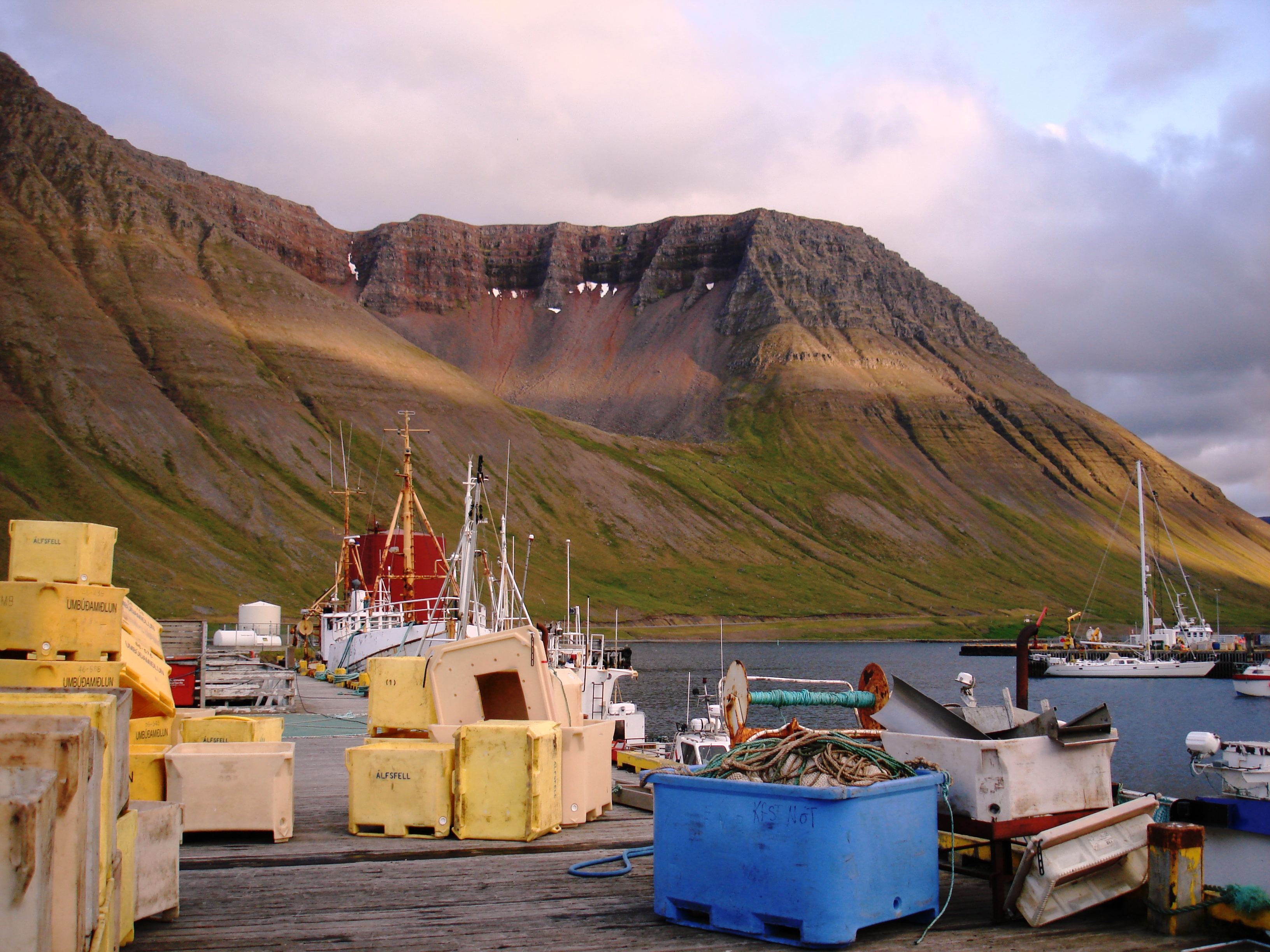
Ísafjörður (pronounced , meaning ''ice fjord'', literally ''fjord of ices'') is a town in the northwest of Iceland. The oldest part of Ísafjörður with the town centre is located on a spit of sand, or ''eyri'', in Skutulsfjörður, a fjord which meets the waters of the larger fjord Ísafjarðardjúp. With a population of about 2,600, Ísafjörður is the largest settlement in the peninsula of Vestfirðir (Westfjords) and the administration centre of the Ísafjarðarbær municipality, which includes—besides Ísafjörður—the nearby villages of Hnífsdalur, Flateyri, Suðureyri, and Þingeyri. History According to the Landnámabók (the book of settlement), Skutulsfjörður was first settled by Helgi Magri Hrólfsson in the 9th century. In the 16th century, the town grew as it became a trading post for foreign merchants. Witch trials were common around the same time throughout the Westfjords, and many people were banished to the nearby peninsula of Hornstrandir, now a na ... [...More Info...] [...Related Items...] OR: [Wikipedia] [Google] [Baidu] |
Westfjords
The Westfjords or West Fjords ( is, Vestfirðir , ISO 3166-2:IS: IS-4) is a large peninsula in northwestern Iceland and an administrative district, the least populous administrative district. It lies on the Denmark Strait, facing the east coast of Greenland. It is connected to the rest of Iceland by a seven-kilometre-wide isthmus between Gilsfjörður and Bitrufjörður . The Westfjords are very mountainous; the coastline is heavily indented by dozens of fjords surrounded by steep hills. These indentations make roads very circuitous and communications by land difficult. In addition many of the roads are closed by ice and snow for several months of the year. The Vestfjarðagöng road tunnel from 1996 has improved that situation. The cliffs at Látrabjarg comprise the longest bird cliff in the northern Atlantic Ocean and are at the westernmost point in Iceland. The Drangajökull glacier is located in the north of the peninsula and is the fifth-largest of the country, but the only ... [...More Info...] [...Related Items...] OR: [Wikipedia] [Google] [Baidu] |
Ísafjarðarbær
Ísafjarðarbær () is a municipality of Iceland in the Westfjords region, created in 1996 from Flateyrarhreppur, Ísafjarðarkaupstaður, Mosvallahreppur, Mýrahreppur, Suðureyrarhreppur and Þingeyrarhreppur. Geography The principal settlement is Ísafjörður, others being Hnífsdalur, Flateyri, Suðureyri and Þingeyri. Education * University Centre of the Westfjords — a higher education institute in Ísafjörður * Flateyri Folk High School — a folk high school in Flateyri * Menntaskólinn á Ísafirði — a gymnasium in Ísafjörður Sports Local football club Vestri plays in the country's second tier as of 2022. They play their home games at the Torfnesvöllur in Ísafjörður. Transport The municipality is served by Ísafjörður Airport. Twin towns – sister cities Ísafjarðarbær is twinned with: * Joensuu, Finland * Kaufering, Germany * Linköping, Sweden * Runavík, Faroe Islands * Tønsberg Tønsberg , historically Tunsberg, is a city and mun ... [...More Info...] [...Related Items...] OR: [Wikipedia] [Google] [Baidu] |
Iceland
Iceland ( is, Ísland; ) is a Nordic island country in the North Atlantic Ocean and in the Arctic Ocean. Iceland is the most sparsely populated country in Europe. Iceland's capital and largest city is Reykjavík, which (along with its surrounding areas) is home to over 65% of the population. Iceland is the biggest part of the Mid-Atlantic Ridge that rises above sea level, and its central volcanic plateau is erupting almost constantly. The interior consists of a plateau characterised by sand and lava fields, mountains, and glaciers, and many glacial rivers flow to the sea through the lowlands. Iceland is warmed by the Gulf Stream and has a temperate climate, despite a high latitude just outside the Arctic Circle. Its high latitude and marine influence keep summers chilly, and most of its islands have a polar climate. According to the ancient manuscript , the settlement of Iceland began in 874 AD when the Norwegian chieftain Ingólfr Arnarson became the first p ... [...More Info...] [...Related Items...] OR: [Wikipedia] [Google] [Baidu] |
Route 60 (Iceland)
The following highways are numbered 60: International * Asian Highway 60 * European route E60 Australia * Bruxner Highway * Dawson Highway (Rolleston to Gladstone) - Queensland State Route 60 Brazil * BR-060 Canada * Alberta Highway 60 * Manitoba Highway 60 * Newfoundland and Labrador Route 60 * Ontario Highway 60 * Saskatchewan Highway 60 China * G60 Expressway Hungary * M60 motorway (Hungary) India * Israel/Palestine * Highway 60 (Israel–Palestine) Italy * Autostrada A60 Japan * Obihiro-Hiroo Expressway Jordan * Korea, South * Seoul–Yangyang Expressway *Gukjido 60 New Zealand * New Zealand State Highway 60 Philippines * N60 highway (Philippines) United Kingdom * British A60 * British M60 United States * U.S. Route 60 * Alabama State Route 60 * Arkansas Highway 60 * California State Route 60 * Colorado State Highway 60 * Florida State Road 60 * Georgia State Route 60 ** Georgia State Route 60 (former) ** Georgia State Route 60 (former) * Idaho State H ... [...More Info...] [...Related Items...] OR: [Wikipedia] [Google] [Baidu] |
Vegagerðin
The Road and Coastal Administration ( ) is a state run institution in Iceland whose purpose is to construct and maintain roads and infrastructure (land and sea) in rural areas and between urban areas. Formerly belonging to the Ministry of the Interior, it is now part of the Ministry of Infrastructure (until November 2021 named '' Ministry of Transport and Local Government''). Vegagerðin is the legal owner of the roads and has the authority to execute construction of infrastructures on demand from the ministry. History Until the 20th century Until the 18th century there were no official roads in Iceland, only paths and barely visible tracks which people followed with the help of cairns for a few kilometers in either direction. In the 19th century, when fishing villages began to spring up on shores and sandbanks, infrastructure between farms and villages began to improve. As fishermen's camps became villages, with homes and workshops, they also became important trading posts for th ... [...More Info...] [...Related Items...] OR: [Wikipedia] [Google] [Baidu] |
Flateyri
Flateyri ( Icelandic: ) is a village situated in Iceland's Westfjords. It is part of the municipality of Ísafjarðarbær and has a population of approximately 200, making it the largest settlement in Önundarfjörður. History Flateyri has been a trading post since 1792 and temporarily became a major whaling center in the 19th century. On October 26, 1995, an avalanche hit the village, destroying 29 homes and burying 45 people, which resulted in 20 fatalities. Since then a deflecting dam has been built to protect the village from any further avalanches. In the 1990s, Flateyri prospered as a fishing village, but after the 2008–2011 financial crisis hit its main fishing companies shut down, and many people left. A German fishing company has set up base in Flateyri and is currently fishing in and just out of Önundarfjörður. The Esso gas station in Flateyri was the subject of a Belgian documentary in a series about gas stations around the world. The avalanche 1995 was al ... [...More Info...] [...Related Items...] OR: [Wikipedia] [Google] [Baidu] |
Suðureyri
Suðureyri () is a small Icelandic fishing village perched on the tip of the 13 km-long Súgandafjörður in the Westfjords. The community was isolated for years by the huge mountains and rough road that led over them. Now it is connected to Ísafjörður Ísafjörður (pronounced , meaning ''ice fjord'', literally ''fjord of ices'') is a town in the northwest of Iceland. The oldest part of Ísafjörður with the town centre is located on a spit of sand, or ''eyri'', in Skutulsfjörður, a fjord ... by a 5 km tunnel. The village has tours set up to allow visitors to experience traditional Icelandic life firsthand. This includes going out on original fishing boats or visiting the fish factory in town. Amenities include a geothermal swimming pool, campsite, hotel and a restaurant. The church was built in 1937. Climate References External links Fisherman Hotel Sudureyri Populated places in Westfjords Fishing communities Fishing communities in Icelan ... [...More Info...] [...Related Items...] OR: [Wikipedia] [Google] [Baidu] |
Road Tunnels In Iceland
A road is a linear way for the conveyance of traffic that mostly has an improved surface for use by vehicles (motorized and non-motorized) and pedestrians. Unlike streets, the main function of roads is transportation. There are many types of roads, including parkways, avenues, controlled-access highways (freeways, motorways, and expressways), tollways, interstates, highways, thoroughfares, and local roads. The primary features of roads include lanes, sidewalks (pavement), roadways (carriageways), medians, shoulders, verges, bike paths (cycle paths), and shared-use paths. Definitions Historically many roads were simply recognizable routes without any formal construction or some maintenance. The Organization for Economic Co-operation and Development (OECD) defines a road as "a line of communication (travelled way) using a stabilized base other than rails or air strips open to public traffic, primarily for the use of road motor vehicles running on their own wheels", w ... [...More Info...] [...Related Items...] OR: [Wikipedia] [Google] [Baidu] |
Tunnels Completed In 1996
A tunnel is an underground passageway, dug through surrounding soil, earth or rock, and enclosed except for the entrance and exit, commonly at each end. A pipeline is not a tunnel, though some recent tunnels have used immersed tube construction techniques rather than traditional tunnel boring methods. A tunnel may be for foot or vehicular road traffic, for rail traffic, or for a canal. The central portions of a rapid transit network are usually in the tunnel. Some tunnels are used as sewers or aqueducts to supply water for consumption or for hydroelectric stations. Utility tunnels are used for routing steam, chilled water, electrical power or telecommunication cables, as well as connecting buildings for convenient passage of people and equipment. Secret tunnels are built for military purposes, or by civilians for smuggling of weapons, contraband, or people. Special tunnels, such as wildlife crossings, are built to allow wildlife to cross human-made barriers safely. Tunne ... [...More Info...] [...Related Items...] OR: [Wikipedia] [Google] [Baidu] |


