|
Varig Flight 850
The Varig Flight 850 was an international commercial route operated by the Brazilian airline Varig that departed from Salgado Filho International Airport, in Porto Alegre, to JFK International Airport, in New York, USA, with stopovers scheduled for São Paulo, Rio de Janeiro, Belém, Ciudad Trujilo (now Santo Domingo) and Miami. On August 14, 1957, the flight departed from Porto Alegre to complete the planned route. In the late morning of August 16, 1957, 50 minutes after take-off from Ciudad Trujillo-General Andrews International Airport in the Dominican Republic, with only 11 crew members, the pilots were forced to make an emergency landing in the Atlantic Ocean, after losing the aircraft's engines number 3 and 4, which had already taken off without engine number 2. With the landing at sea, the tail detached from the plane, causing the disappearance of a flight attendant. The aircraft The aircraft was a Lockheed L-1049 Super Constellation built in 1955 with factory number 461 ... [...More Info...] [...Related Items...] OR: [Wikipedia] [Google] [Baidu] |
Atlantic Ocean
The Atlantic Ocean is the second-largest of the world's five oceans, with an area of about . It covers approximately 20% of Earth's surface and about 29% of its water surface area. It is known to separate the " Old World" of Africa, Europe and Asia from the "New World" of the Americas in the European perception of the World. The Atlantic Ocean occupies an elongated, S-shaped basin extending longitudinally between Europe and Africa to the east, and North and South America to the west. As one component of the interconnected World Ocean, it is connected in the north to the Arctic Ocean, to the Pacific Ocean in the southwest, the Indian Ocean in the southeast, and the Southern Ocean in the south (other definitions describe the Atlantic as extending southward to Antarctica). The Atlantic Ocean is divided in two parts, by the Equatorial Counter Current, with the North(ern) Atlantic Ocean and the South(ern) Atlantic Ocean split at about 8°N. Scientific explorations of the A ... [...More Info...] [...Related Items...] OR: [Wikipedia] [Google] [Baidu] |
Belém
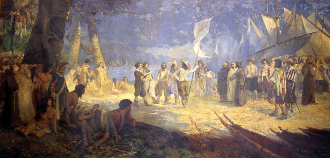
Belém (; Portuguese for Bethlehem; initially called Nossa Senhora de Belém do Grão-Pará, in English Our Lady of Bethlehem of Great Pará) often called Belém of Pará, is a Brazilian city, capital and largest city of the state of Pará in the country's north. It is the gateway to the Amazon River with a busy port, airport, and bus/coach station. Belém lies approximately 100 km upriver from the Atlantic Ocean, on the Pará River, which is part of the greater Amazon River system, separated from the larger part of the Amazon delta by ''Ilha de Marajó'' ( Marajo Island). With an estimated population of 1,499,641 people — or 2,491,052, considering its metropolitan area — it is the 11th most populous city in Brazil, as well as the 16th by economic relevance. It is the second largest in the North Region, second only to Manaus, in the state of Amazonas. Founded in 1616 by the Kingdom of Portugal, Belém was the first European colony on the Amazon but did not become ... [...More Info...] [...Related Items...] OR: [Wikipedia] [Google] [Baidu] |
Flight Plan
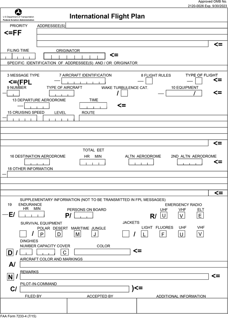
Flight plans are documents filed by a pilot or flight dispatcher with the local Air Navigation Service Provider (e.g. the FAA in the United States) prior to departure which indicate the plane's planned route or flight path. Flight plan format is specified in ICAO Doc 4444. They generally include basic information such as departure and arrival points, estimated time en route, alternate airports in case of bad weather, type of flight (whether instrument flight rules FRor visual flight rules FR, the pilot's information, number of people on board, and information about the aircraft itself. In most countries, flight plans are required for flights under IFR, but may be optional for flying VFR unless crossing international borders. Flight plans are highly recommended, especially when flying over inhospitable areas such as water, as they provide a way of alerting rescuers if the flight is overdue. In the United States and Canada, when an aircraft is crossing the Air Defense Identificat ... [...More Info...] [...Related Items...] OR: [Wikipedia] [Google] [Baidu] |
Air Traffic Control
Air traffic control (ATC) is a service provided by ground-based air traffic controllers who direct aircraft on the ground and through a given section of controlled airspace, and can provide advisory services to aircraft in non-controlled airspace. The primary purpose of ATC worldwide is to prevent collisions, organize and expedite the flow of air traffic, and provide information and other support for pilots. Air traffic controllers monitor the location of aircraft in their assigned airspace by radar and communicate with the pilots by radio. To prevent collisions, ATC enforces traffic separation rules, which ensure each aircraft maintains a minimum amount of empty space around it at all times. In many countries, ATC provides services to all private, military, and commercial aircraft operating within its airspace. Depending on the type of flight and the class of airspace, ATC may issue ''instructions'' that pilots are required to obey, or ''advisories'' (known as ''flight infor ... [...More Info...] [...Related Items...] OR: [Wikipedia] [Google] [Baidu] |
Air Navigation
The basic principles of air navigation are identical to general navigation, which includes the process of planning, recording, and controlling the movement of a craft from one place to another. Successful air navigation involves piloting an aircraft from place to place without getting lost, not breaking the laws applying to aircraft, or endangering the safety of those on board or on the ground. Air navigation differs from the navigation of surface craft in several ways; Aircraft travel at relatively high speeds, leaving less time to calculate their position en route. Aircraft normally cannot stop in mid-air to ascertain their position at leisure. Aircraft are safety-limited by the amount of fuel they can carry; a surface vehicle can usually get lost, run out of fuel, then simply await rescue. There is no in-flight rescue for most aircraft. Additionally, collisions with obstructions are usually fatal. Therefore, constant awareness of position is critical for aircraft pilots. The ... [...More Info...] [...Related Items...] OR: [Wikipedia] [Google] [Baidu] |
Puerto Plata Province
Puerto Plata (, ''Silver Port'') is one of the northern provinces of the Dominican Republic. The area has become an increasingly popular tourist attraction since the late 1990s mainly due to its fine beaches. It borders the Septentrional mountain range to the north (which separates it from Laguna Salada). Created from the Santiago Province (Dominican Republic), Santiago Province in 1867 as a "maritime district", it became a province in 1907, when maritime districts were suppressed by a new Dominican constitution. Municipalities and municipal districts The province is divided into the following Municipalities of the Dominican Republic, municipalities (''municipios'') and municipal districts (''distrito municipal'' - D.M.) within them: *San Felipe de Puerto Plata **Maimón (D.M.) **Yásica Arriba (D.M.) *Altamira, Puerto Plata, Altamira **Río Grande, Puerto Plata, Río Grande (D.M.) *Guananico *Imbert, Puerto Plata, Imbert *Los Hidalgos **Cerro de Navas (D.M.) *Luperón (localit ... [...More Info...] [...Related Items...] OR: [Wikipedia] [Google] [Baidu] |
Cabarete
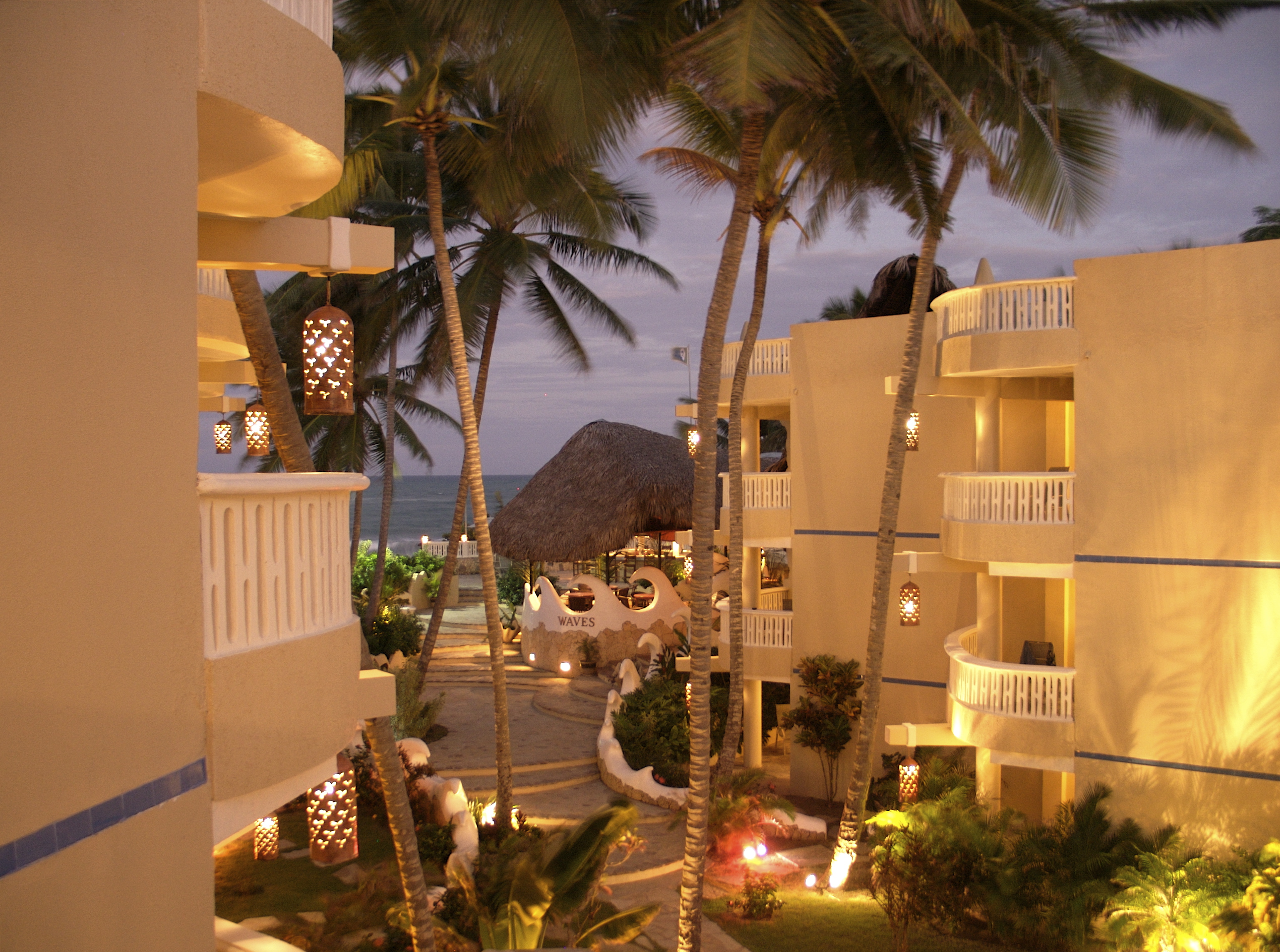
Cabarete is a town in the Puerto Plata province of the Dominican Republic, noted for its tourism and beaches. It is located on Camino Cinco approximately from the airport of Puerto Plata (POP). History Cabarete was founded in 1835 by the merchant Zephaniah Kingsley as part of his Mayorasgo de Koka estate, where he moved along with his mixed-race family and 53 slaves he had freed from his Florida plantations and brought here while the island was under Jean Pierre Boyer's administration. He subsequently brought another 100 slaves. Anna Kingsley had a beach cottage by the harbour. Several descendants of the Kingsleys and of the former slaves live in the area today. Beaches * Cabarete Bay is considered "town" and has hosted many professional kitesurfing competitions like WorldCup/Copa Mundial, Master of the Ocean, PKRA, and WKL. * Kite Beach is 1.5 miles to the west of Cabarete Bay and is a kiting beach. It also has a reef break that is visited by stand up paddle surfers. * Pla ... [...More Info...] [...Related Items...] OR: [Wikipedia] [Google] [Baidu] |
Santo Domingo
Santo Domingo ( meaning "Saint Dominic"), once known as Santo Domingo de Guzmán, known as Ciudad Trujillo between 1936 and 1961, is the capital and largest city of the Dominican Republic and the largest metropolitan area in the Caribbean by population. the city and immediate surrounding area (the Distrito Nacional) had a population of 1,029,110 while the total population is 3,798,699 when including Greater Santo Domingo (the "metropolitan area"). The city is coterminous with the boundaries of the Distrito Nacional ("D.N.", "National District"), itself bordered on three sides by Santo Domingo Province. Founded by the Spanish in 1496, on the east bank of the Ozama River and then moved by Nicolás de Ovando in 1502 to the west bank of the river, the city is the oldest continuously inhabited European settlement in the Americas, and was the first seat of the Spanish colonial rule in the New World, the Captaincy General of Santo Domingo. It is the site of the first university, cathe ... [...More Info...] [...Related Items...] OR: [Wikipedia] [Google] [Baidu] |
Wright R-3350 Duplex-Cyclone
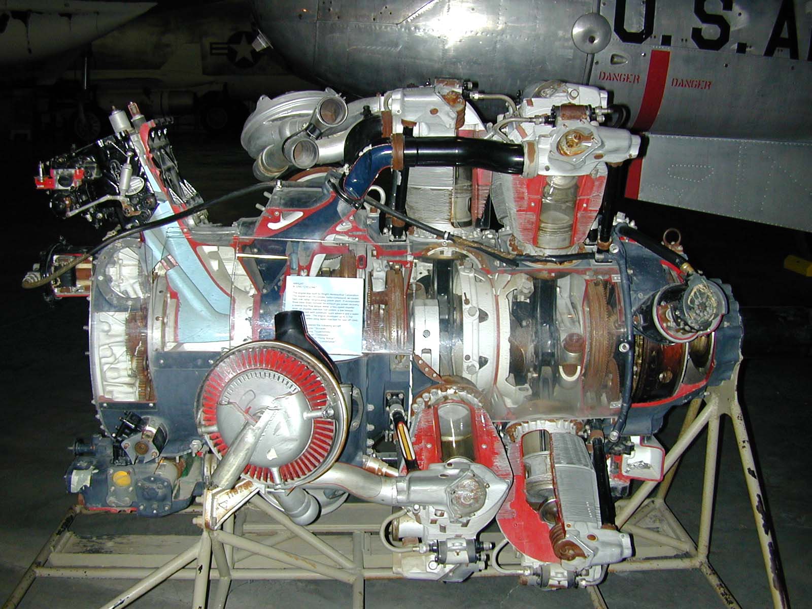
The Wright R-3350 Duplex-Cyclone is an American twin-row, supercharged, air-cooled, radial aircraft engine with 18 cylinders displacing nearly . Power ranged from 2,200 to over 3,700 hp (1,640 to 2,760 kW), depending on the model. Developed before World War II, the R-3350's design required a long time to mature before finally being used to power the Boeing B-29 Superfortress. After the war, the engine had matured sufficiently to become a major civilian airliner design, notably in its turbo-compound forms, and was used in the Lockheed L-1049 Super Constellation airliners into the 1990s. The engine is commonly used on Hawker Sea Fury and Grumman F8F Bearcat Unlimited Class Racers at the Reno Air Races. Its main rival was the , Pratt & Whitney R-4360 Wasp Major, first run some seven years after the Duplex-Cyclone's beginnings. Design and development In 1927, Wright Aeronautical introduced its famous "Cyclone" engine, which powered a number of designs in the 1930s. A ... [...More Info...] [...Related Items...] OR: [Wikipedia] [Google] [Baidu] |
VARIG
VARIG (acronym for Viação Aérea RIo-Grandense, ''Rio Grandean Airways'') was the first airline founded in Brazil, in 1927. From 1965 until 1990, it was Brazil's leading airline, and virtually its only international one. In 2005, Varig went into judicial restructuring, and in 2006 it was split into two companies – Flex Linhas Aéreas, informally known as "old" Varig, heir to the original airline – now defunct, and "new" Varig, a new company, fully integrated into Gol Airlines. History Formation and Early Years (1927–1943) ''Sociedade Anônima Empresa de Viação Aérea Rio-Grandense – VARIG'' was the first national airline established in Brazil. It was founded on 7 May 1927 in Porto Alegre, by Otto Ernst Meyer-Labastille, a German aviator decorated in the World War I, who immigrated to Brazil in 1921 and noticed how necessary air transportation was for a large country like Brazil. Varig was an off-spring of the German trade company and airline Condor Syndikat, thus sh ... [...More Info...] [...Related Items...] OR: [Wikipedia] [Google] [Baidu] |
Lockheed L-1049 Super Constellation
The Lockheed L-1049 Super Constellation is an American aircraft, a member of the Lockheed Constellation aircraft line. The L-1049 was Lockheed's response to the successful Douglas DC-6 airliner, first flying in 1950. The aircraft was also produced for both the United States Navy as the WV / R7V and U.S. Air Force as the C-121 for transport, electronics, and airborne early warning and control aircraft. Development Beginning in 1943, Lockheed planned stretched variants of the Constellation family. The first was the L-049 with a fuselage lengthened by 13 feet (4 meters) and the second the L-749 stretched 18 feet (5.5 meters). Douglas launched a stretched version of its DC-6 airliner as a cargo transport, designated DC-6A, for both military and civilian operators. Douglas was soon to launch a passenger version (the DC-6B) of this new aircraft. The DC-6B could carry 23 more passengers than Lockheed's current production L-749 Constellation. In 1950, Lockheed had repurchased the ... [...More Info...] [...Related Items...] OR: [Wikipedia] [Google] [Baidu] |


