|
Vanand Peak
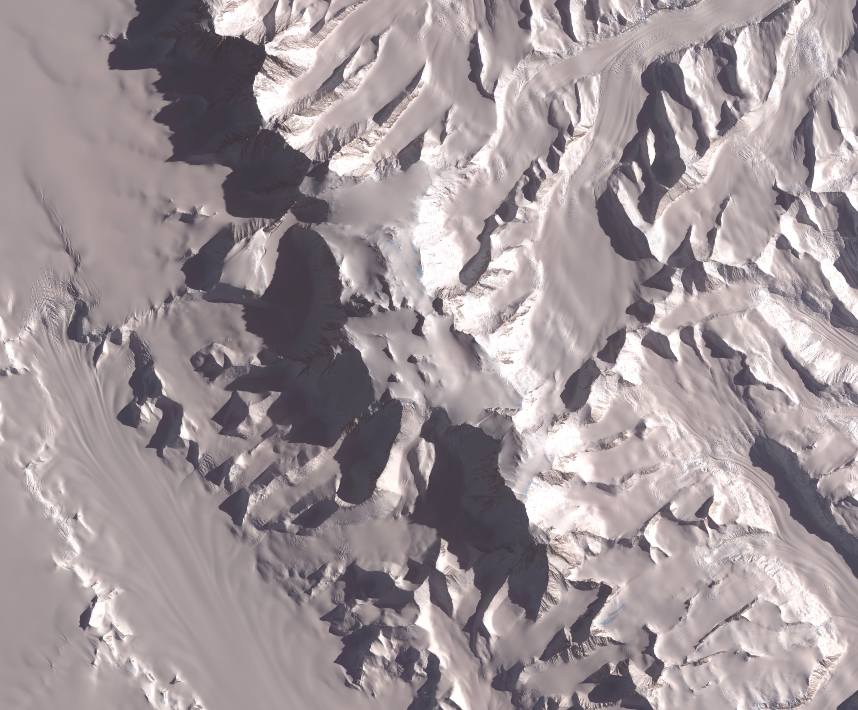
Vanand Peak ( bg, връх Вананд, vrah Vanand, ) is the sharp peak rising to 3045 mReference Elevation Model of Antarctica. Polar Geospatial Center. University of Minnesota, 2019 in Zinsmeister Ridge on the northeast side of in , in |
Vanand
Vanand () is the area of historic Armenia that roughly corresponds to the Kars Province of present-day Turkey. Named after the Armenian family of Vanandi, it was a principality of the Kingdom of Armenia and a later province of the Democratic Republic of Armenia. Its historic capital was the city of Kars. The region fell to numerous invaders including the Assyrians, Greeks, Romans, Byzantines, Arabs, Mongols, Persians, and the Ottoman Turks. After the 1877-1878 Russo-Turkish War, the Russian Empire acquired the region at the Congress of Berlin. The area still retained a substantial Armenian population, but after World War I, most of it was decimated during the Turkish-Armenian War in 1920. This region was passed to Turkish control by the Treaty of Alexandropol and the Treaty of Kars. See also * Armavir region Princes of Vanand * Until 451: Aravand Vanandi * 451: Tathul Vanandi * 480: Vren Vanandi See also *List of regions of old Armenia This is a list of regions and ... [...More Info...] [...Related Items...] OR: [Wikipedia] [Google] [Baidu] |
Antarctic Place-names Commission
The Antarctic Place-names Commission was established by the Bulgarian Antarctic Institute in 1994, and since 2001 has been a body affiliated with the Ministry of Foreign Affairs of Bulgaria. The Commission approves Bulgarian place names in Antarctica, which are formally given by the President of the Republic according to the Bulgarian Constitution (Art. 98) and the established international practice. Bulgarian names in Antarctica Geographical names in Antarctica reflect the history and practice of Antarctic exploration. The nations involved in Antarctic research give new names to nameless geographical features for the purposes of orientation, logistics, and international scientific cooperation. As of 2021, there are some 20,091 named Antarctic geographical features, including 1,601 features with names given by Bulgaria.Bulgarian Antarctic Gazett ... [...More Info...] [...Related Items...] OR: [Wikipedia] [Google] [Baidu] |
Mount Waldron
Mount Waldron is a mountain (3,100 m) in Antarctica, the summit of Veregava Ridge in the Sentinel Range of Ellsworth Mountains. It is situated 3 nautical miles (6 km) north of Mount Tuck, and surmounts Dater Glacier to the west, Orizari Glacier to the north, Berisad Glacier to the northeast, and Hansen Glacier to the southeast. The mountain was discovered by U.S. Navy Squadron VX-6 on photographic flights of December 14–15, 1959, and was mapped from these photos by the United States Geological Survey (USGS). It was named by the Advisory Committee on Antarctic Names (US-ACAN) for Kenneth L. Waldron, a construction electrician in the U.S. Navy and a member of the IGY South Pole Station South is one of the cardinal directions or compass points. The direction is the opposite of north and is perpendicular to both east and west. Etymology The word ''south'' comes from Old English ''sūþ'', from earlier Proto-Germanic ''*sunþaz ... winter party of 1957. Maps Vinson ... [...More Info...] [...Related Items...] OR: [Wikipedia] [Google] [Baidu] |
Toros Peak
Toros Peak ( bg, връх Торос, vrah Toros, ) is the rocky twin summit peak rising to 2961 mReference Elevation Model of Antarctica. Polar Geospatial Center. University of Minnesota, 2019 in Zinsmeister Ridge on the northeast side of in , in |
Mount Segers
Mount Segers () is a mountain at the south extremity of Sullivan Heights in the Sentinel Range, Ellsworth Mountains in Antarctica, separated from Vinson Massif to the southwest by Vranya Pass. It is situated 11 km (7 mi) east of Mount Tyree, on the east side of the head of Crosswell Glacier and surmounting Hinkley Glacier to the southeast. The peak was discovered by US Navy Squadron VX-6 on photographic flights of Dec. 14–15, 1959, and mapped by USGS from these photos. Named by US-ACAN for Chester W. Segers, a Navy cook and a member of the first wintering party at the South Pole Station South is one of the cardinal directions or compass points. The direction is the opposite of north and is perpendicular to both east and west. Etymology The word ''south'' comes from Old English ''sūþ'', from earlier Proto-Germanic ''*sunþaz ... during the IGY in 1957. Maps Vinson Massif. Scale 1:250 000 topographic map. Reston, Virginia: US Geological Survey, 1988. Anta ... [...More Info...] [...Related Items...] OR: [Wikipedia] [Google] [Baidu] |
Mount Shinn
Mount Shinn is a mountain 4,661 meters in elevation, standing 6 km (4 miles) southeast of Mount Tyree in the Sentinel Range, Ellsworth Mountains in Antarctica. It surmounts Ramorino Glacier to the north, upper Crosswell Glacier to the northeast, Goodge Col to the southeast, and Branscomb Glacier to the south-southwest. Mount Shinn is thought to be the third-highest peak in Antarctica. The peak was discovered on IGY reconnaissance flights in January 1958, and named by the Advisory Committee on Antarctic Names (US-ACAN) for Lieutenant Commander Conrad S. (Gus) Shinn, U.S. Navy, a pilot on some of these flights. Shinn was pilot of the Navy R4D aircraft carrying Admiral Dufek which, on October 31, 1956, made the first plane landing at the geographic South Pole. It had been thought to be over 4800m high, but was re-measured in 2001 by Damien Gildea Damien Gildea (born 1969) is an Australian mountaineer and Antarctic explorer who has climbed extensively in Antarctic ... [...More Info...] [...Related Items...] OR: [Wikipedia] [Google] [Baidu] |
Mount Vinson
Vinson Massif () is a large mountain massif in Antarctica that is long and wide and lies within the Sentinel Range of the Ellsworth Mountains. It overlooks the Ronne Ice Shelf near the base of the Antarctic Peninsula. The massif is located about from the South Pole. Vinson Massif was discovered in January 1958 by U.S. Navy aircraft. In 1961, the Vinson Massif was named by the Advisory Committee on Antarctic Names (US-ACAN), after Carl G. Vinson, United States congressman from the state of Georgia, for his support for Antarctic exploration. On November 1, 2006, US-ACAN declared Mount Vinson and Vinson Massif to be separate entities.Stewart, J. (2011) ''Antarctic An Encyclopedia'' McFarland & Company Inc, New York. 1776 pp. . Vinson Massif lies within the Chilean claim under the Antarctic Treaty System. Mount Vinson is the highest peak in Antarctica, at . It lies in the north part of Vinson Massif's summit plateau in the south portion of the main ridge of the Sentinel Range ... [...More Info...] [...Related Items...] OR: [Wikipedia] [Google] [Baidu] |
Old Armenia
The history of Armenia covers the topics related to the history of the Republic of Armenia, as well as the Armenian people, the Armenian language, and the regions historically and geographically considered ''Armenian''. Armenia is located in the highlands surrounding the Biblical mountains of Ararat. The original Armenian name for the country was ''Hayk'', later ''Hayastan'' ( hy, Հայաստան), translated as 'the land of Hayk', derived from Hayk and the Persian suffix '-stan' ("land"). The historical enemy of Hayk (the legendary ruler of Armenia) was Bel, or in other words Baal (Akkadian cognate Bēlu). The name Armenia was given to the country by the surrounding states, and it is traditionally derived from Armenak or Aram (the great-grandson of Haik's great-grandson, and another leader who is, according to Armenian tradition, the ancestor of all Armenians). In the Bronze Age, several states flourished in the area of Greater Armenia, including the Hittite Empire (at ... [...More Info...] [...Related Items...] OR: [Wikipedia] [Google] [Baidu] |
Bulgars
The Bulgars (also Bulghars, Bulgari, Bolgars, Bolghars, Bolgari, Proto-Bulgarians) were Turkic semi-nomadic warrior tribes that flourished in the Pontic–Caspian steppe and the Volga region during the 7th century. They became known as nomadic equestrians in the Volga-Ural region, but some researchers say that their ethnic roots can be traced to Central Asia. During their westward migration across the Eurasian steppe, the Bulgar tribes absorbed other tribal groups and cultural influences in a process of ethnogenesis, including Iranian, Finnic and Hunnic tribes. Modern genetic research on Central Asian Turkic people and ethnic groups related to the Bulgars points to an affiliation with Western Eurasian populations. The Bulgars spoke a Turkic language, i.e. Bulgar language of Oghuric branch. They preserved the military titles, organization and customs of Eurasian steppes, as well as pagan shamanism and belief in the sky deity Tangra. The Bulgars became semi-sedentary durin ... [...More Info...] [...Related Items...] OR: [Wikipedia] [Google] [Baidu] |
Hinkley Glacier
Hinkley Glacier () is a glacier flowing northeastward from Corbet Peak and Schoening Peak, Vinson Massif on the east slope of Sentinel Range in the Ellsworth Mountains, Antarctica, and continuing between Mount Segers and Zinsmeister Ridge to enter Dater Glacier southeast of Nebeska Peak and northwest of Sipey Bluff. It was named by US-ACAN (2006) after Todd K. Hinkley, Technical Director, National Ice Core Laboratory, U.S. Geological Survey, Denver, CO,2001-06. See also * List of glaciers in the Antarctic * Glaciology Maps Vinson Massif. Scale 1:250 000 topographic map. Reston, Virginia: US Geological Survey, 1988. Antarctic Digital Database (ADD).Scale 1:250000 topographic map of Antarctica. Scientific Committee on Antarctic Research (SCAR). Since 1993, regularly updated. References * External links Hinkley GlacierSCAR A scar (or scar tissue) is an area of fibrous tissue that replaces normal skin after an injury. Scars result from the biological process of w ... [...More Info...] [...Related Items...] OR: [Wikipedia] [Google] [Baidu] |


