|
Vakuta
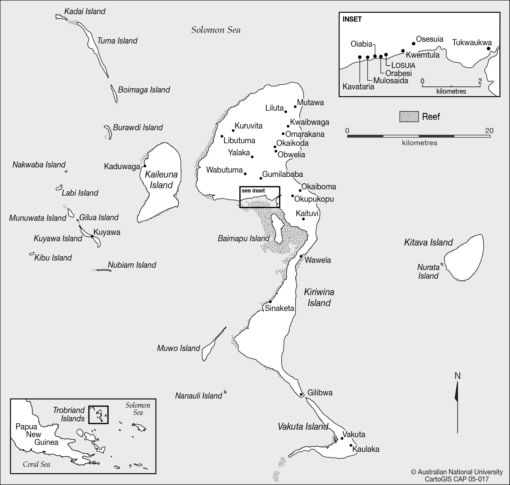
Vakuta is an island in the Trobriand Islands group of Papua New Guinea. Vakuta is a near continuation of the Trobriands' main island Kiriwina to the south, separated from it only through the wide ''Kasilamaka Passage''. It has an area of . At the census of population in 2000, Vakuta had a population of 971. ReferencesVakutaat WikiMapia Wikimapia is a geographic online encyclopedia project. The project implements an interactive "clickable" web map that utilizes Google Maps with a geographically-referenced wiki system, with the aim to mark and describe all geographical objects ... Trobriand Islands Islands of Milne Bay Province {{PapuaNewGuinea-island-stub ... [...More Info...] [...Related Items...] OR: [Wikipedia] [Google] [Baidu] |
Trobriand Islands
The Trobriand Islands are a archipelago of coral atolls off the east coast of New Guinea. They are part of the nation of Papua New Guinea and are in Milne Bay Province. Most of the population of 12,000 indigenous inhabitants live on the main island of Kiriwina, which is also the location of the government station, Losuia. Other major islands in the group are Kaileuna, Vakuta, and Kitava. The group is considered to be an important tropical rainforest ecoregion in need of conservation. Geography The Trobriands consist of four main islands, the largest being Kiriwina Island, and the others being Kaileuna, Vakuta and Kitava. Kiriwina is long, and varies in width from . In the 1980s, there were around sixty villages on the island, containing around 12,000 people, while the other islands were restricted to a population of hundreds. Other than some elevation on Kiriwina, the islands are flat coral atolls and "remain hot and humid throughout the year, with frequent rainfall." Peo ... [...More Info...] [...Related Items...] OR: [Wikipedia] [Google] [Baidu] |
Papua New Guinea
Papua New Guinea (abbreviated PNG; , ; tpi, Papua Niugini; ho, Papua Niu Gini), officially the Independent State of Papua New Guinea ( tpi, Independen Stet bilong Papua Niugini; ho, Independen Stet bilong Papua Niu Gini), is a country in Oceania that comprises the eastern half of the island of New Guinea and its offshore islands in Melanesia (a region of the southwestern Pacific Ocean north of Australia). Its capital, located along its southeastern coast, is Port Moresby. The country is the world's third largest island country, with an area of . At the national level, after being ruled by three external powers since 1884, including nearly 60 years of Australian administration starting during World War I, Papua New Guinea established its sovereignty in 1975. It became an independent Commonwealth realm in 1975 with Elizabeth II as its queen. It also became a member of the Commonwealth of Nations in its own right. There are 839 known languages of Papua New Guinea, on ... [...More Info...] [...Related Items...] OR: [Wikipedia] [Google] [Baidu] |
Kiriwina
Kiriwina is the largest of the Trobriand Islands, with an area of 290.5 km². It is part of the Milne Bay Province of Papua New Guinea. Most of the 12,000 people who live in the Trobriands live on Kiriwina. The Kilivila language, also known as Kiriwina, is spoken on the island. The main town is Losuia. The island falls under the administrative division of Kiriwina Rural LLG. History Allied forces landed on Kiriwina and Woodlark Island on June 30, 1943 during Operation Chronicle in World War II. Following the landing U.S. Army Engineers supervised construction of Kiriwina Airfield, including a 2,000 metre (6,000 ft) coral Corals are marine invertebrates within the class Anthozoa of the phylum Cnidaria. They typically form compact colonies of many identical individual polyps. Coral species include the important reef builders that inhabit tropical oceans and secre ...-surfaced runway. "In September 1943, at the request of the 6th Army, 12 officers and 306 men o ... [...More Info...] [...Related Items...] OR: [Wikipedia] [Google] [Baidu] |
WikiMapia
Wikimapia is a geographic online encyclopedia project. The project implements an interactive "clickable" web map that utilizes Google Maps with a geographically-referenced wiki system, with the aim to mark and describe all geographical objects in the world. Wikimapia was created by Alexandre Koriakine and Evgeniy Saveliev in May 2006. The data, a crowdsourced collection of places marked by registered users and guests, has grown to just under 28,000,000 objects , and is released under the Creative Commons License Attribution-ShareAlike (CC BY-SA). Although the project's name is reminiscent of that of Wikipedia, and the creators share parts of the "wiki" philosophy, it is not a part of the non-profit Wikimedia Foundation family of wikis. Since 2018, following years of declining popularity, the site has gone nearly inactive with the site's owners having been unable to pay for the usage of Google Maps and the site's social media accounts having remained derelict. A study from 2017 ... [...More Info...] [...Related Items...] OR: [Wikipedia] [Google] [Baidu] |

.jpg)
