|
VPB-34
VPB-34 was a Patrol Bombing Squadron of the U.S. Navy. The squadron was established as Patrol Squadron 34 (VP-34) on 16 April 1942, redesignated Patrol Bombing Squadron 34 (VPB-34) on 1 October 1944 and disestablished on 7 April 1945. Operational history *16 April 1942: VP-34 was established at NAS Norfolk, Virginiua, under the operational control of FAW-5, as a seaplane squadron flying the PBY-5 Catalina. A shortage of aircraft prevented the squadron from receiving its full complement of Catalinas until early June 1942. In the interim VP-81 loaned the squadron one PBY-5 with which to practice. Several aircrews were sent to NAS Banana River, Florida and NAS Key West, Florida, for flight instruction with other squadrons. *25 July 1942: VP-34 was by this time fully equipped and manned. Orders were received for duty at NAS Coco Solo, Panama Canal Zone, with detachments at Kingston, Jamaica, and Trujillo, Honduras. During this period the squadron conducted Anti-submarine warfare ( ... [...More Info...] [...Related Items...] OR: [Wikipedia] [Google] [Baidu] |
United States Department Of The Navy Seal
United may refer to: Places * United, Pennsylvania, an unincorporated community * United, West Virginia, an unincorporated community Arts and entertainment Films * ''United'' (2003 film), a Norwegian film * ''United'' (2011 film), a BBC Two film Literature * ''United!'' (novel), a 1973 children's novel by Michael Hardcastle Music * United (band), Japanese thrash metal band formed in 1981 Albums * ''United'' (Commodores album), 1986 * ''United'' (Dream Evil album), 2006 * ''United'' (Marvin Gaye and Tammi Terrell album), 1967 * ''United'' (Marian Gold album), 1996 * ''United'' (Phoenix album), 2000 * ''United'' (Woody Shaw album), 1981 Songs * "United" (Judas Priest song), 1980 * "United" (Prince Ital Joe and Marky Mark song), 1994 * "United" (Robbie Williams song), 2000 * "United", a song by Danish duo Nik & Jay featuring Lisa Rowe Television * ''United'' (TV series), a 1990 BBC Two documentary series * ''United!'', a soap opera that aired on BBC One from 1965-19 ... [...More Info...] [...Related Items...] OR: [Wikipedia] [Google] [Baidu] |
Roosevelt Roads Naval Station
Roosevelt Roads Naval Station is a former United States Navy base in the town of Ceiba, Puerto Rico. The site operates today as José Aponte de la Torre Airport, a public use airport. History In 1919, future US President Franklin D. Roosevelt, then Assistant Secretary of the Navy, toured Puerto Rico, visiting Ceiba. When he returned to the White House, he expressed a liking for the terrain where the base was to be located. This was during the World War I era, and the US could benefit from an air field in Ceiba. While Puerto Rico is a Commonwealth, its territorial rights belong to the US, which made it feasible for the US government to build an air base in Ceiba. It took many years for the US to become convinced of the need for an air base in Ceiba. When Adolf Hitler and Nazi Germany began to invade other European countries, the US, led by then President Roosevelt, considered the idea of a naval air station in Ceiba. With war in the European and Pacific theatres, they saw an ... [...More Info...] [...Related Items...] OR: [Wikipedia] [Google] [Baidu] |
Bismarck Sea
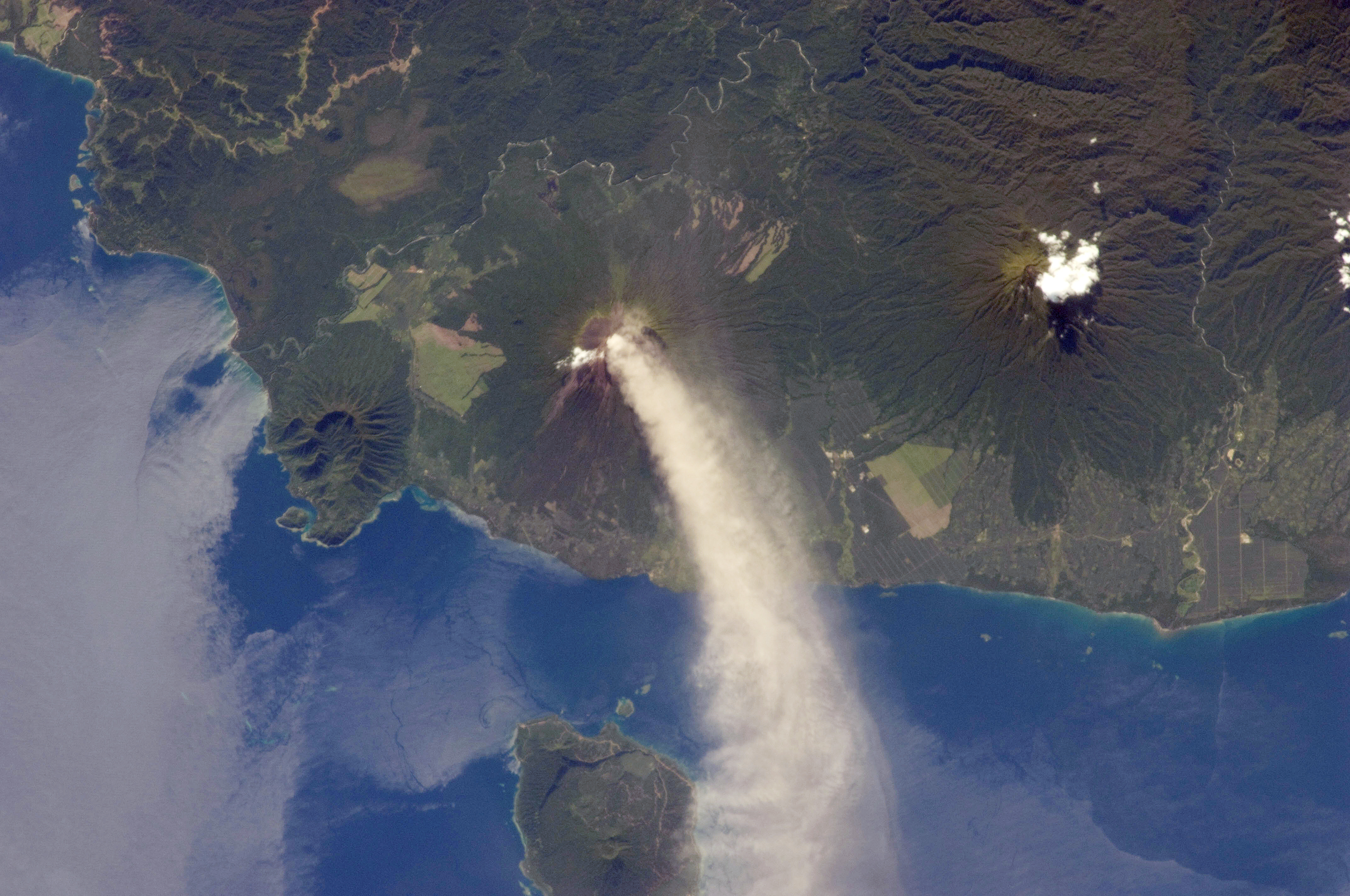
The Bismarck Sea (, ) lies in the southwestern Pacific Ocean within the nation of Papua New Guinea. It is located northeast of the island of New Guinea and south of the Bismarck Archipelago. It has coastlines in districts of the Islands Region, Momase Region, and Papua Region. Geography Like the Bismarck Archipelago, it is named in honour of the first German Chancellor Otto von Bismarck. The Bismarck Archipelago extends round to the east and north of the sea, enclosing the Bismarck Sea and separating it from the Southern Pacific Ocean. To the south it is linked to the Solomon Sea by the Vitiaz Strait. Official boundaries The International Hydrographic Organization defines the Bismarck Sea as "that area of the Pacific Ocean, South Pacific Ocean off the northeast coast of New Guinea", with the following limits: ''On the North and East.'' By the Northern and Northeastern coasts of the islands of New Ireland (island), New Ireland, New Hanover Island, New Hanover, the Admiralty I ... [...More Info...] [...Related Items...] OR: [Wikipedia] [Google] [Baidu] |
Samarai
Samarai is an island and former administrative capital in Milne Bay Province, Papua New Guinea. The island is historically significant as the site of a trading port and stop-over between Australia and East Asia. Samarai town was established on the island and at its height was the second largest after Port Moresby in the Territory of Papua. The town of Samarai was ordered to be destroyed by the British during World War II, fearing Japanese occupation. Although rebuilt after the war, and functioning as provincial headquarters until 1968, economic changes meant that Samarai did not fully regain its regional status and it has since largely fallen into disrepair. The island was declared a ''National Historical Heritage Island'' by the government of Papua New Guinea in 2006. Geography Located off the south-eastern tip of New Guinea in the China Strait, Samarai has an area of just or 29 hectares. At the census of population 2014, the island had a population of 460, making it one o ... [...More Info...] [...Related Items...] OR: [Wikipedia] [Google] [Baidu] |
Palm Island, Queensland
Palm Island is a locality consisting of an island group of 16 islands, split between the Shire of Hinchinbrook and the Aboriginal Shire of Palm Island, in Queensland, Australia. The locality coincides with the geographical entity known as the Palm Island group, also known as the Greater Palm group, originally named the Palm Isles. In the , Palm Island had a population of 2,455 people. Material was copied from this source, which is available under a Creative Commons Attribution 4.0 International License However, the term "Palm Island" is most often used to refer to the main island, Great Palm Island, the largest island in the group and the only one with a significant population of permanent residents, most of whom are Aboriginal. The island is also known by the name "Bwgcolman", meaning "one people from many groups", derived from an Aboriginal language of one of the earliest groups of Aboriginal people removed from the mainland and settled there from 1918 onwards, during its ... [...More Info...] [...Related Items...] OR: [Wikipedia] [Google] [Baidu] |
Perth
Perth is the capital and largest city of the Australian state of Western Australia. It is the fourth most populous city in Australia and Oceania, with a population of 2.1 million (80% of the state) living in Greater Perth in 2020. Perth is part of the South West Land Division of Western Australia, with most of the metropolitan area on the Swan Coastal Plain between the Indian Ocean and the Darling Scarp. The city has expanded outward from the original British settlements on the Swan River, upon which the city's central business district and port of Fremantle are situated. Perth is located on the traditional lands of the Whadjuk Noongar people, where Aboriginal Australians have lived for at least 45,000 years. Captain James Stirling founded Perth in 1829 as the administrative centre of the Swan River Colony. It was named after the city of Perth in Scotland, due to the influence of Stirling's patron Sir George Murray, who had connections with the area. It gained city statu ... [...More Info...] [...Related Items...] OR: [Wikipedia] [Google] [Baidu] |
Funafuti
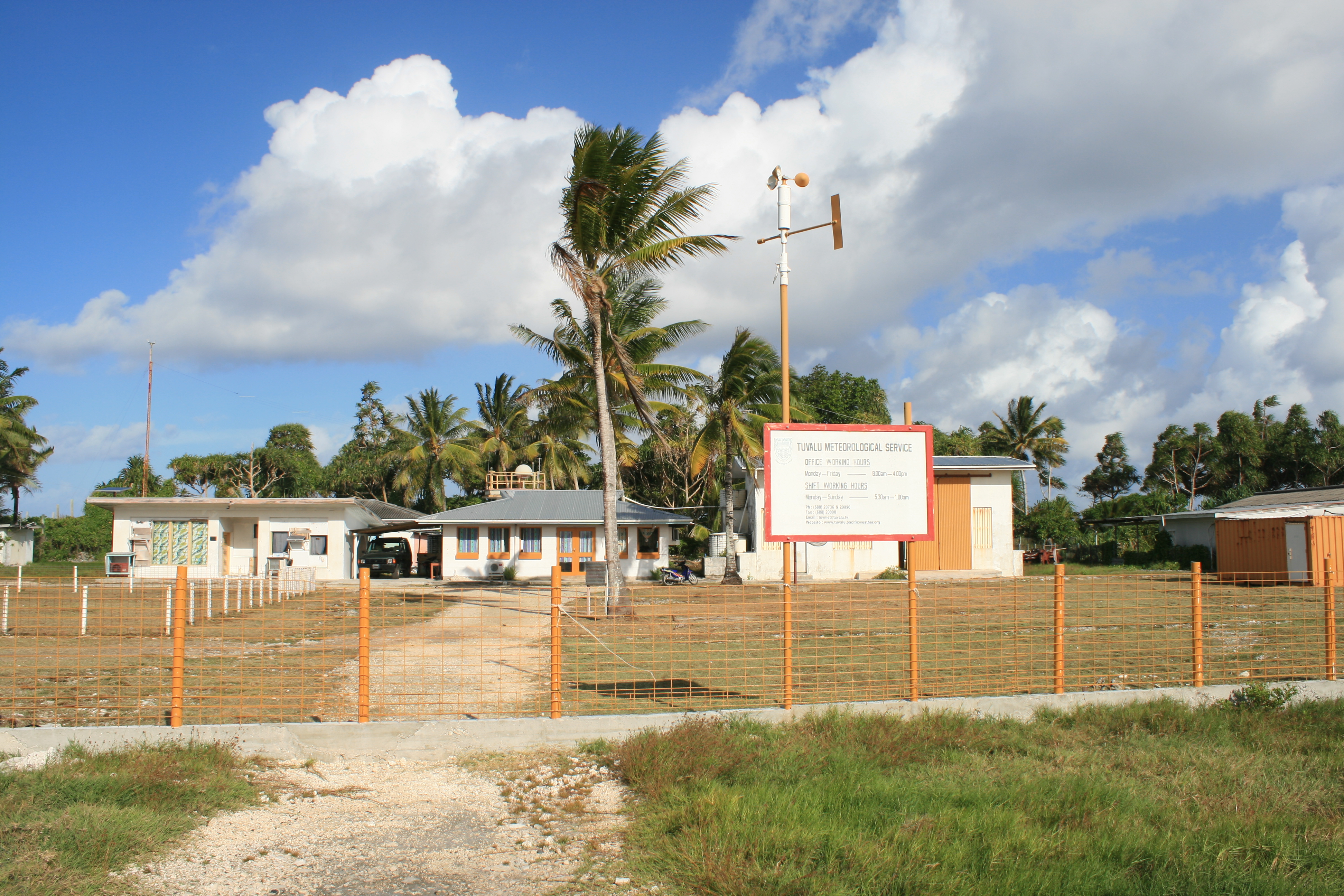
Funafuti is the capital of the island nation of Tuvalu. It has a population of 6,320 people (2017 census), and so it has more people than the rest of Tuvalu combined, with approximately 60% of the population. It consists of a narrow sweep of land between wide, encircling a large lagoon (''Te Namo'') long and wide. The average depth of the Funafuti lagoon is about 20 fathoms (36.5 metres or 120 feet). With a surface area of , it is by far the largest lagoon in Tuvalu. The land area of the 33 islets around the atoll of Funafuti totals ; taken together, they constitute less than one percent of the total area of the atoll. Cargo ships can enter Funafuti's lagoon and dock at the port facilities on Fongafale. The capital of Tuvalu is sometimes said to be Fongafale or Vaiaku, but, officially, the entire atoll of Funafuti is its capital, since it has a single government that is responsible for the whole atoll. Fongafale The largest island is Fongafale. The island houses four villag ... [...More Info...] [...Related Items...] OR: [Wikipedia] [Google] [Baidu] |
Johnston Atoll
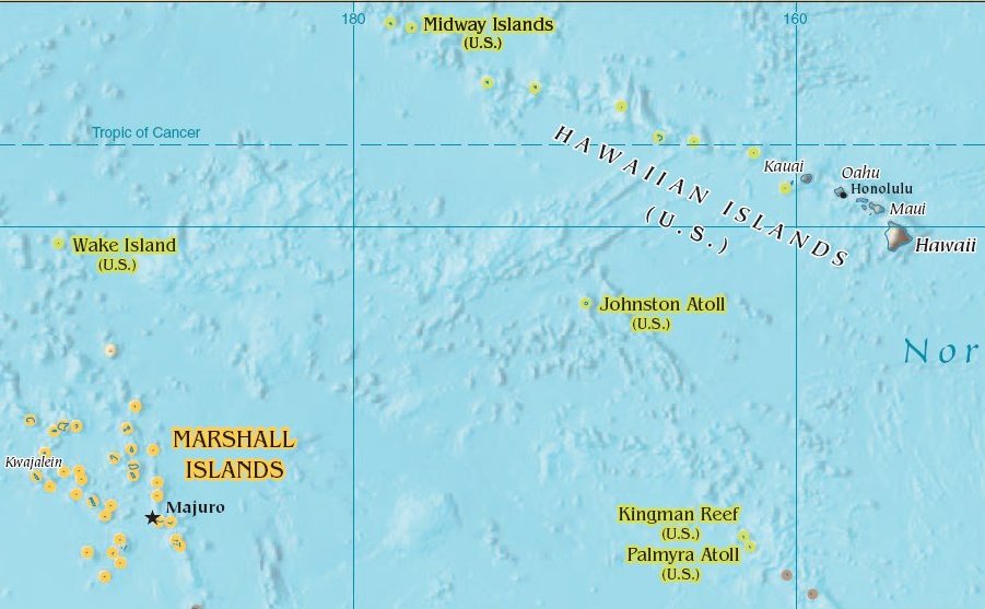
Johnston Atoll is an Unincorporated territories of the United States, unincorporated territory of the United States, currently administered by the United States Fish and Wildlife Service (USFWS). Johnston Atoll is a National Wildlife Refuge and part of the Pacific Remote Islands Marine National Monument. It is closed to public entry, and limited access for management needs is only granted by Letter of Authorization from the United States Air Force and a Special Use Permit from the U.S. Fish and Wildlife Service. For nearly 70 years, the isolated atoll was under the control of the United States Armed Forces, U.S. military. During that time, it was variously used as a naval refueling depot, an Johnston Island Air Force Base, airbase, a testing site for nuclear and biological weapons, a secret missile base, and a site for the storage and disposal of chemical weapons and Agent Orange. Those activities left the area environmentally contaminated, and monitoring continues. The island i ... [...More Info...] [...Related Items...] OR: [Wikipedia] [Google] [Baidu] |
Kanton Island
Canton Island (also known as Kanton or Abariringa), previously known as Mary Island, Mary Balcout's Island or Swallow Island, is the largest, northernmost, and , the sole inhabited island of the Phoenix Islands, in the Republic of Kiribati. It is an atoll located in the South Pacific Ocean roughly halfway between Hawaii and Fiji. The island is a narrow ribbon of land around a lagoon; an area of . Canton's closest neighbour is the uninhabited Enderbury Island, west-southwest. The capital of Kiribati, South Tarawa, lies to the west. , the population was 20, down from 61 in 2000. The island's sole village is called Tebaronga. Kiribati declared the Phoenix Islands Protected Area in 2006, with the park being expanded in 2008. The marine reserve contains eight coral atolls, including Canton. Because it is inhabited, management of Canton Island is described in the Canton Resource Use Sustainability Plan (KRUSP), which covers a radius around the atoll. Over 50% of the island and lago ... [...More Info...] [...Related Items...] OR: [Wikipedia] [Google] [Baidu] |
Midway Island
Midway Atoll (colloquial: Midway Islands; haw, Kauihelani, translation=the backbone of heaven; haw, Pihemanu, translation=the loud din of birds, label=none) is a atoll in the North Pacific Ocean. Midway Atoll is an insular area of the United States and is an unorganized and unincorporated territory. The largest island is Sand Island, which has housing and an airstrip. Immediately to the east of Sand Island across the narrow Brooks Channel is Eastern Island, which is uninhabited and no longer has any facilities. Forming a rough, incomplete circle around the two main islands and creating Midway Lagoon is Spit Island, a narrow reef. Roughly equidistant between North America and Asia, Midway is the only island in the Hawaiian Archipelago that is not part of the state of Hawaii. Unlike the other Hawaiian islands, Midway observes Samoa Time ( UTC−11:00, i.e., eleven hours behind Coordinated Universal Time), which is one hour behind the time in the Hawaii–Aleutian Time Zone ... [...More Info...] [...Related Items...] OR: [Wikipedia] [Google] [Baidu] |
NAS Kaneohe Bay
Marine Corps Air Station Kaneohe Bay or MCAS Kaneohe Bay is a United States Marine Corps (USMC) airfield located within the Marine Corps Base Hawaii complex, formerly known as Marine Corps Air Facility (MCAF) Kaneohe Bay or Naval Air Station (NAS) Kaneohe Bay. Most of the original contract work at Kaneohe had been completed when the Navy transferred what was undone to the Seabees of the 56th Naval Construction Battalion on 1 April 1943. The 112th CB was tasked with adding a second runway 400' x 5,000' to the airfield. That was completed by the men of the 74th CB. December 7, 1941, the Imperial Japanese Navy attacked the air station minutes prior to the attack on Pearl Harbor. Of the 36 Catalinas stationed here, 27 were destroyed and six others were damaged, along with 18 sailors who perished in the attack. The first Japanese aircraft destroyed in action were shot down at Kaneohe, along with Aviation Ordnanceman Chief Petty Officer John William Finn becoming one of the first Med ... [...More Info...] [...Related Items...] OR: [Wikipedia] [Google] [Baidu] |
NAS San Diego
Naval Air Station North Island or NAS North Island , at the north end of the Coronado peninsula on San Diego Bay in San Diego, California, is part of the largest aerospace-industrial complex in the United States Navy – Naval Base Coronado (NBC), and the home port of several aircraft carriers of the United States Navy. The commanding officer of NAS North Island (NASNI) is also the Commanding Officer, Naval Base Coronado (NBC). As such, he or she commands or administers NASNI and seven other naval facilities: Naval Amphibious Base Coronado (NABC); Outlying Field Imperial Beach; Silver Strand Training Complex; Remote Training Site, Warner Springs; Mountain Warfare Training Camp Michael Monsoor; Camp Morena; and Naval Auxiliary Landing Facility San Clemente Island. NBC, with only its commands in the metropolitan San Diego area, brackets the city of Coronado from the entrance to San Diego Bay to the Mexican border. NAS North Island itself is host to 23 aviation squadrons and 80 ... [...More Info...] [...Related Items...] OR: [Wikipedia] [Google] [Baidu] |
_1997.jpg)


