|
Uzeir
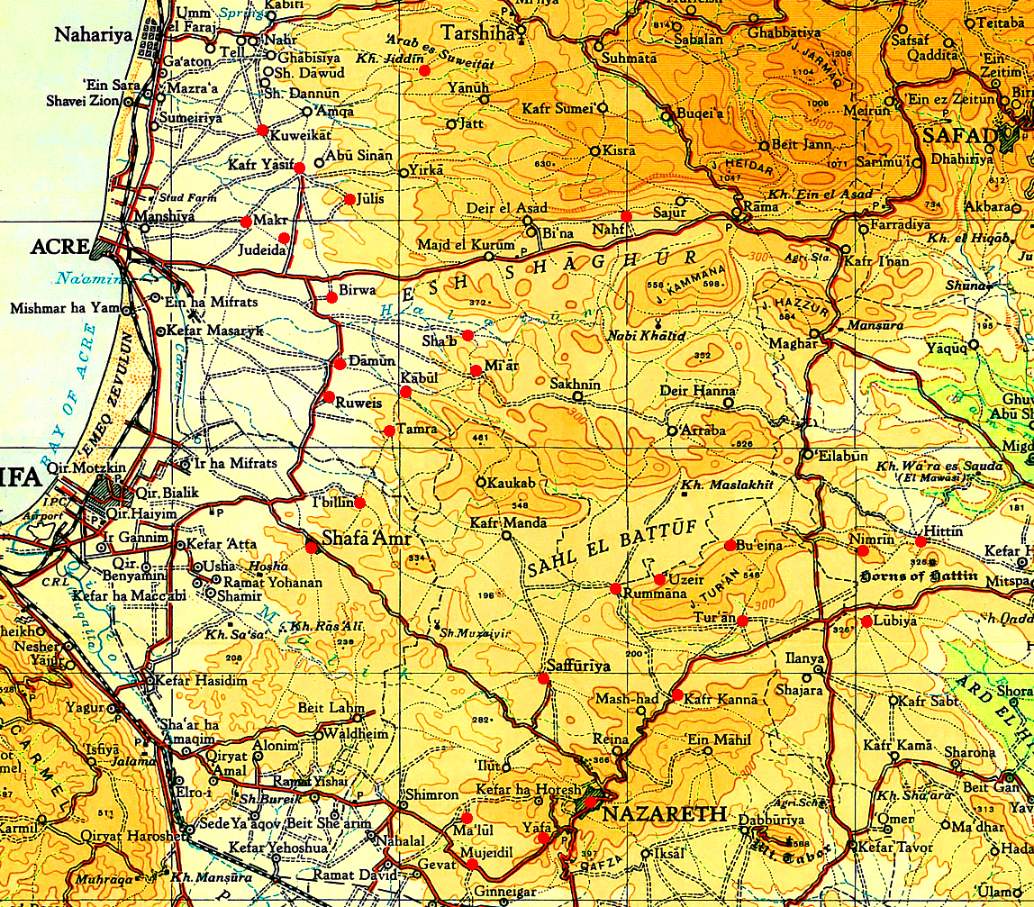
Uzeir ( ar, عزير; he, עֻזֵיר) is an Arab village in northern Israel. Located near Nazareth Illit in the Lower Galilee, it falls under the jurisdiction of al-Batuf Regional Council. In it had a population of . History Findings from the Roman, Byzantine and Early Islamic periods have been found in the village. Ottoman era It was mentioned in the Ottoman defter for the year 1555–1556, as ''Mezraa'' land, (that is, cultivated land), called ''‘Uzayr'', located in the ''Nahiya'' of Tabariyya of the '' Liwa'' of Safad. The land was designated as Timar land. In 1799, a map from Napoleon's invasion by Pierre Jacotin showed the place, named as ''El Qasr''. In 1838 it was noted as a Muslim village, ''el-'Aziz'', in the Nazareth District. In 1875, the French explorer Victor Guérin reached the village and described it as consisting of about 20 houses on the side of a hill. A few old columns were remains after an ancient site which had preceded the present village. ... [...More Info...] [...Related Items...] OR: [Wikipedia] [Google] [Baidu] |
Al-Batuf Regional Council
Al-Batuf Regional Council ( ar, البطوف, he, מועצה אזורית אל-בטוף, ''Mo'atza Azorit al-Batuf'') is a regional council located on the southern fringe of the Beit Netofa Valley North of Nazareth within the Northern District (Israel), Northern District of Israel. It was formerly part Nof HaGalil regional council until 2000 and consists of the following four rural Arab citizens of Israel, Israeli Palestinian Arab villages. *Hamaam, Israel, Hamaam *Rumana, Israel, Rumana *Rumat al-Heib *Uzeir The regional council is named after the al-Baṭūf Plain (the Arabic name of Beit Netofa Valley The Beit Netofa Valley ( he, בקעת בית נטופה) is a valley in the Lower Galilee region of Israel, midway between Tiberias and Haifa. Covering 46 km2, it is the largest valley in the mountainous part of the Galilee and one of the lar ...), on which it is located. According to the Israeli Central Bureau of Statistics, al-Batuf had a population of 6,700 in 201 ... [...More Info...] [...Related Items...] OR: [Wikipedia] [Google] [Baidu] |
Arab Localities In Israel
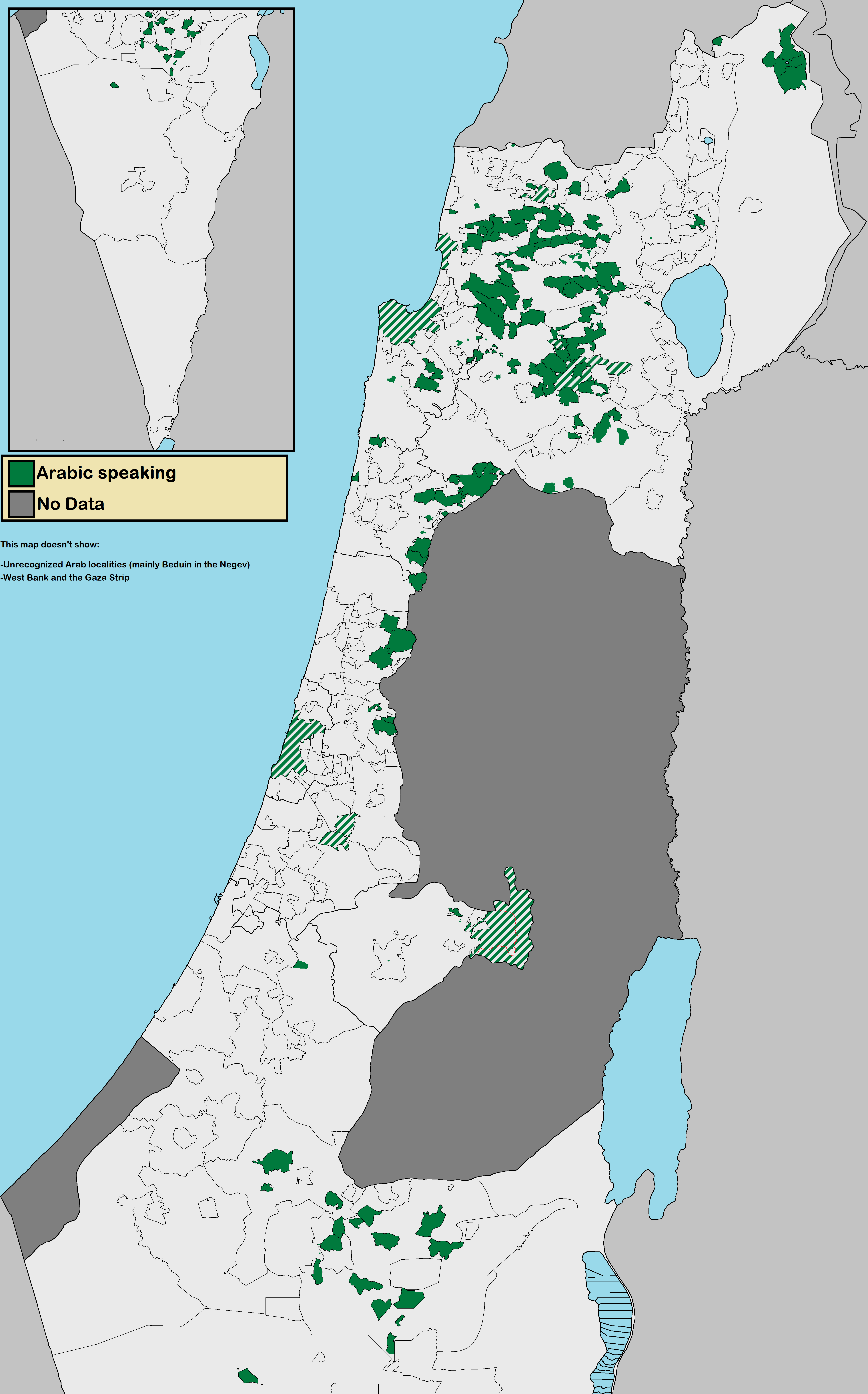
Arab localities in Israel include all population centers with a 50% or higher Arab population in Israel. East Jerusalem and Golan Heights are not internationally recognized parts of Israel proper but have been included in this list. According to the Israeli Central Bureau of Statistics census in 2010, "the Arab population lives in 134 towns and villages. About 44 percent of them live in towns (compared to 81 percent of the Jewish population); 48 percent live in villages with local councils (compared to 9 percent of the Jewish population). Four percent of the Arab citizens live in small villages with regional councils, while the rest live in unrecognized villages (the proportion is much higher, 31 percent in the Negev)". The Arab population in Israel is located in five main areas: Galilee (54.6% of total Israeli Arabs), Triangle (23.5% of total Israeli Arabs), Golan Heights, East Jerusalem, and Northern Negev (13.5% of total Israeli Arabs). Around 8.4% of Israeli Arabs live in off ... [...More Info...] [...Related Items...] OR: [Wikipedia] [Google] [Baidu] |
Operation Dekel
Operation Dekel ( he, מבצע דקל , Mivtza Dekel, Operation Palm Tree), was the largest offensive by Israeli forces in the north of Palestine after the first truce of the 1948 Arab-Israeli War. It was carried out by the 7th Armoured Brigade led by Canadian volunteer Ben Dunkelman (called Benjamin Ben-David in Israel), a battalion from the Carmeli Brigade, and some elements from the Golani Brigade between 8–18 July. Its objective was to capture Nazareth and the Lower Galilee. On 15 July Israeli aircraft bombed Saffuriya village and caused panic among the population; many of the villagers fled northwards toward Lebanon, others found shelter in Nazareth, leaving about 100 elderly people behind. On the evening of 16 July, Nazareth surrendered to the Israelis after a light fight which left one Israeli dead and one wounded. The Arab Liberation Army forces in the village under the command of Fawzi al-Qawuqji retreated to the mountains in the north. In sharp contrast to the surro ... [...More Info...] [...Related Items...] OR: [Wikipedia] [Google] [Baidu] |
Victor Guérin
Victor Guérin (15 September 1821 – 21 Septembe 1890) was a French intellectual, explorer and amateur archaeologist. He published books describing the geography, archeology and history of the areas he explored, which included Greece, Asia Minor, North Africa, Lebanon, Syria and Palestine. Biography Guérin, a devout Catholic, graduated from the ''École normale supérieure'' in Paris in 1840. After graduation, he began working as a teacher of rhetoric and member of faculty in various colleges and high schools in France, then in Algeria in 1850, and 1852 he became a member of the French School of Athens. While exploring Samos, he identified the spring that feeds the Tunnel of Eupalinos and the beginnings of the channel. His doctoral thesis of 1856 dealt with the coastal region of Palestine, from Khan Yunis to Mount Carmel. With the financial help of Honoré Théodoric d'Albert de Luynes he was able to explore Greece and its islands, Asia Minor, Egypt, Nubia, Tunisia, and the Le ... [...More Info...] [...Related Items...] OR: [Wikipedia] [Google] [Baidu] |
Crocker & Brewster
Crocker & Brewster (1818–1876) was a leading publishing house in Boston, Massachusetts, during its 58-year existence. The business was located at today's 173–175 Washington Street for nearly half a century; in 1864 it moved to the adjoining building, where it remained until the firm's dissolution. Background The firm was founded by Uriel Crocker and Osmyn Brewster, with the participation of their earlier employer, Samuel Turell Armstrong, later mayor of Boston and acting governor of the Commonwealth. In 1815, Crocker was made foreman of Armstrong's printing office, and in 1818 was, with his fellow-apprentice, Brewster, taken into partnership with Armstrong. The trio agreed that the bookstore would be named for Mr. Armstrong and the printing office for Crocker & Brewster. In 1821 a branch of the business was established in New York City. Five years later, it was sold to Daniel Appleton and Jonathan Leavitt, becoming the foundation of the firm, D. Appleton & Sons. Crocke ... [...More Info...] [...Related Items...] OR: [Wikipedia] [Google] [Baidu] |
Columbia University
Columbia University (also known as Columbia, and officially as Columbia University in the City of New York) is a private research university in New York City. Established in 1754 as King's College on the grounds of Trinity Church in Manhattan, Columbia is the oldest institution of higher education in New York and the fifth-oldest institution of higher learning in the United States. It is one of nine colonial colleges founded prior to the Declaration of Independence. It is a member of the Ivy League. Columbia is ranked among the top universities in the world. Columbia was established by royal charter under George II of Great Britain. It was renamed Columbia College in 1784 following the American Revolution, and in 1787 was placed under a private board of trustees headed by former students Alexander Hamilton and John Jay. In 1896, the campus was moved to its current location in Morningside Heights and renamed Columbia University. Columbia scientists and scholars have ... [...More Info...] [...Related Items...] OR: [Wikipedia] [Google] [Baidu] |
Martial Law
Martial law is the imposition of direct military control of normal civil functions or suspension of civil law by a government, especially in response to an emergency where civil forces are overwhelmed, or in an occupied territory. Use Martial law can be used by governments to enforce their rule over the public, as seen in multiple countries listed below. Such incidents may occur after a coup d'état ( Thailand in 2006 and 2014, and Egypt in 2013); when threatened by popular protest (China, Tiananmen Square protests of 1989); to suppress political opposition ( martial law in Poland in 1981); or to stabilize insurrections or perceived insurrections. Martial law may be declared in cases of major natural disasters; however, most countries use a different legal construct, such as a state of emergency. Martial law has also been imposed during conflicts, and in cases of occupations, where the absence of any other civil government provides for an unstable population. Examples of ... [...More Info...] [...Related Items...] OR: [Wikipedia] [Google] [Baidu] |
Dunam
A dunam ( Ottoman Turkish, Arabic: ; tr, dönüm; he, דונם), also known as a donum or dunum and as the old, Turkish, or Ottoman stremma, was the Ottoman unit of area equivalent to the Greek stremma or English acre, representing the amount of land that could be ploughed by a team of oxen in a day. The legal definition was "forty standard paces in length and breadth", but its actual area varied considerably from place to place, from a little more than in Ottoman Palestine to around in Iraq.Λεξικό της κοινής Νεοελληνικής (Dictionary of Modern Greek), Ινστιτούτο Νεοελληνικών Σπουδών, Θεσσαλονίκη, 1998. The unit is still in use in many areas previously ruled by the Ottomans, although the new or metric dunam has been redefined as exactly one decare (), which is 1/10 hectare (1/10 × ), like the modern Greek royal stremma. History The name dönüm, from the Ottoman Turkish ''dönmek'' (, "to turn"), appears ... [...More Info...] [...Related Items...] OR: [Wikipedia] [Google] [Baidu] |
Village Statistics, 1945
Village Statistics, 1945 was a joint survey work prepared by the Government Office of Statistics and the Department of Lands of the British Mandate Government for the Anglo-American Committee of Inquiry on Palestine which acted in early 1946. The data were calculated as of April 1, 1945, and was later published and also served the UNSCOP committee that operated in 1947. History Previous versions of the report were prepared in 1938 and 1943. The report found the grand total of the population of Palestine was 1,764,520; 1,061,270 Muslims, 553,600 Jews, 135,550 Christians and 14,100 classified as "others" (typically Druze).Department of Statistics, 1945, p3/ref> Regarding the accuracy of its statistics, the report said: The last population census taken in Palestine was that of 1931. Since that year, the population has grown considerably both as a consequence of Jewish immigration and of the high rate of natural increase among all sections of the population. The rapidity of the c ... [...More Info...] [...Related Items...] OR: [Wikipedia] [Google] [Baidu] |
1931 Census Of Palestine
The 1931 census of Palestine was the second census carried out by the authorities of the British Mandate for Palestine. It was carried out on 18 November 1931 under the direction of Major E. Mills after the 1922 census of Palestine. * Census of Palestine 1931, Volume I. Palestine Part I, Report. Alexandria, 1933 (349 pages). * Census of Palestine 1931, Volume II. Palestine, Part II, Tables. Alexandria, 1933 (595 pages). References Further reading * Miscellaneous short extracts from the census reports at Emory University * J. McCarthy, The Population of Palestine, Columbia University Press (1988). This contains many pages of tables extracted from the census reports. {{Authority control Censuses in Mandatory Palestine Census Of Palestine, 1931 Documents of Mandatory Palestine Palestine November 1931 events 1931 documents ... [...More Info...] [...Related Items...] OR: [Wikipedia] [Google] [Baidu] |
Mandatory Palestine
Mandatory Palestine ( ar, فلسطين الانتدابية '; he, פָּלֶשְׂתִּינָה (א״י) ', where "E.Y." indicates ''’Eretz Yiśrā’ēl'', the Land of Israel) was a geopolitical entity established between 1920 and 1948 in the region of Palestine under the terms of the League of Nations Mandate for Palestine. During the First World War (1914–1918), an Arab uprising against Ottoman rule and the British Empire's Egyptian Expeditionary Force under General Edmund Allenby drove the Ottoman Turks out of the Levant during the Sinai and Palestine Campaign. The United Kingdom had agreed in the McMahon–Hussein Correspondence that it would honour Arab independence if the Arabs revolted against the Ottoman Turks, but the two sides had different interpretations of this agreement, and in the end, the United Kingdom and France divided the area under the Sykes–Picot Agreementan act of betrayal in the eyes of the Arabs. Further complicating the issue was t ... [...More Info...] [...Related Items...] OR: [Wikipedia] [Google] [Baidu] |
1922 Census Of Palestine
The 1922 census of Palestine was the first census carried out by the authorities of the British Mandate of Palestine, on 23 October 1922. The reported population was 757,182, including the military and persons of foreign nationality. The division into religious groups was 590,890 Muslims, 83,794 Jews, 73,024 Christians, 7,028 Druze, 408 Sikhs, 265 Baháʼís, 156 Metawalis, and 163 Samaritans. Operation Censuses carried out by the Ottoman Empire, most recently in 1914, had been for the purpose of imposing taxation or locating men for military service. For this reason, the announcement of a census was unpopular and effort was made in advance to reassure the population.Barron, pp. 1–4. This was believed to be successful except in the case of the Bedouins of the Beersheva Subdistrict, who refused to cooperate. Many census gatherers, supervised by 296 Revising Operators and Enumerators, visited each dwelling, with special arrangements made for persons having no fixed address. ... [...More Info...] [...Related Items...] OR: [Wikipedia] [Google] [Baidu] |


.jpg)
