|
Uummannaq (mountain)
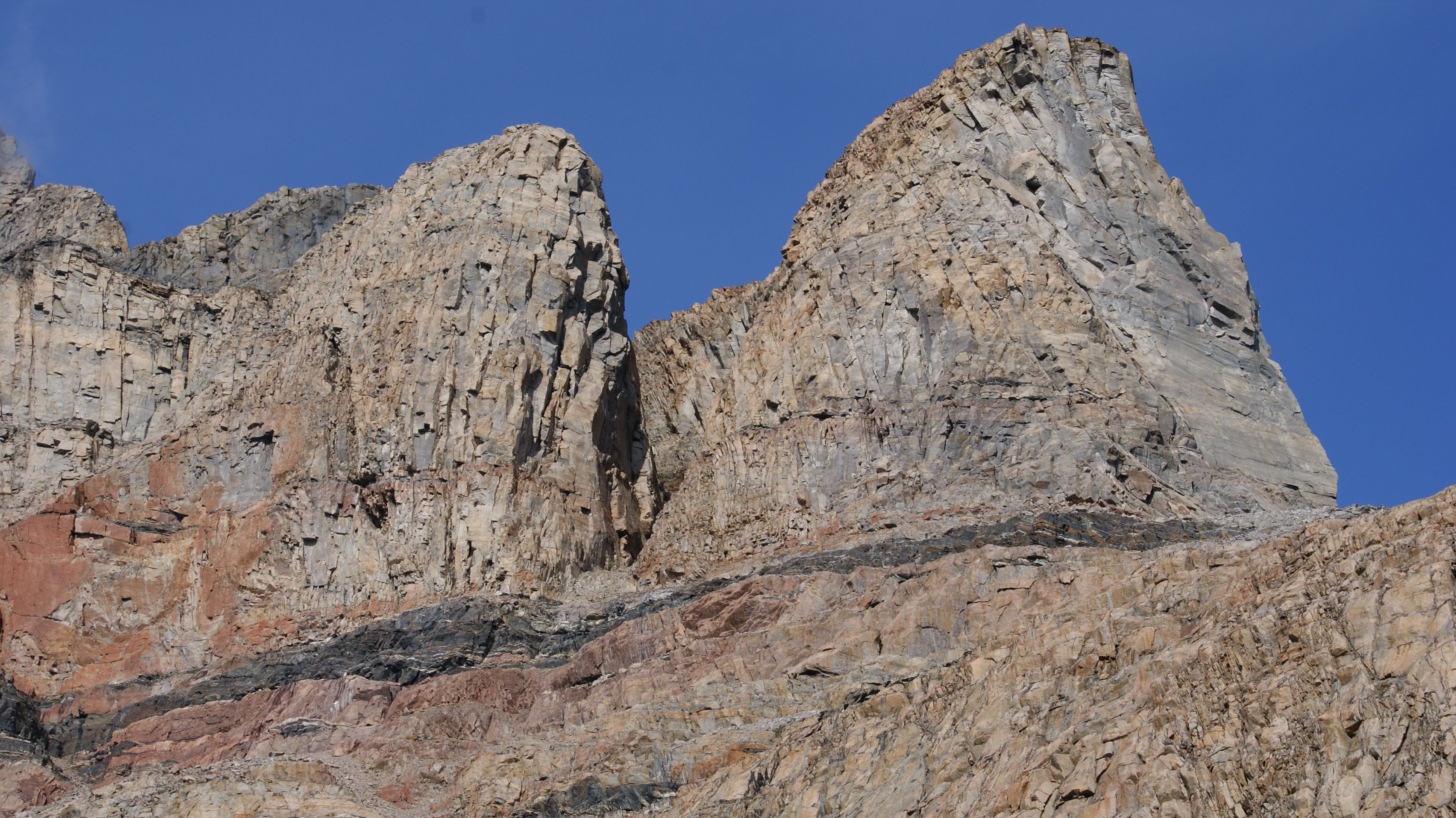
Uummannaq is a , prominent, isolated mountain in western Greenland, located on the small Uummannaq Island in the central part of the Uummannaq Fjord. It entirely dominates the landscape of the island, its base occupying its entire northern half. Formed of granite and basement gneiss, it is the most prominent mountain in the Arctic part of the west coast of Greenland. The mountain is a landmark of Greenland and a tourist magnet, often reproduced in art. Topography The mountain has two summits of similar height (the eastern summit being the higher), hence the name ''Uummannaq'', Greenlandic for ''heart-shaped''. Deep chimneys fall to the south and the north from the col between the western and eastern summits. Its eastern wall has no significant depressions, falling in a uniform cliff into Assorput Strait between Uummannaq Island and Salliaruseq Island.Nuussuaq, Saga Map, Tage Schjøtt, 1992 There are several trabant bastions in the southeastern pillar, to the northeast o ... [...More Info...] [...Related Items...] OR: [Wikipedia] [Google] [Baidu] |
Uummannaq Fjord
Uummannaq Fjord is a large fjord system in the northern part of western Greenland, the largest after Kangertittivaq fjord in eastern Greenland. It has a roughly south-east to west-north-west orientation, emptying into the Baffin Bay in the northwest. Geography With the exception of the southwestern coast formed by the Nuussuaq Peninsula, Uummannaq fjord has a developed coastline, with many bays, islands, and peninsulas. Tributary fjords South to north:Nuussuaq, Saga Map, Tage Schjøtt, 1992 * Ikerasak Fjord ( kl, Ikerasaup Sullua, also Qarajaq Icefjord) − the innermost part of the fjord at the base of Nuussuaq Peninsula. Store Gletscher flowing from the Greenland Ice Sheet empties into Ikerasak Fjord. * Qaraassap Imaa − a tributary fjord emptying into Ikerasak Fjord from the north, between Qaraasap Nunataa headland in the southeast, and Drygalski Peninsula in the northwest. Lille Gletscher flowing from the ice sheet empties into Qaraasaap Imaa. * Sermillip Kang ... [...More Info...] [...Related Items...] OR: [Wikipedia] [Google] [Baidu] |
Climbing Technique
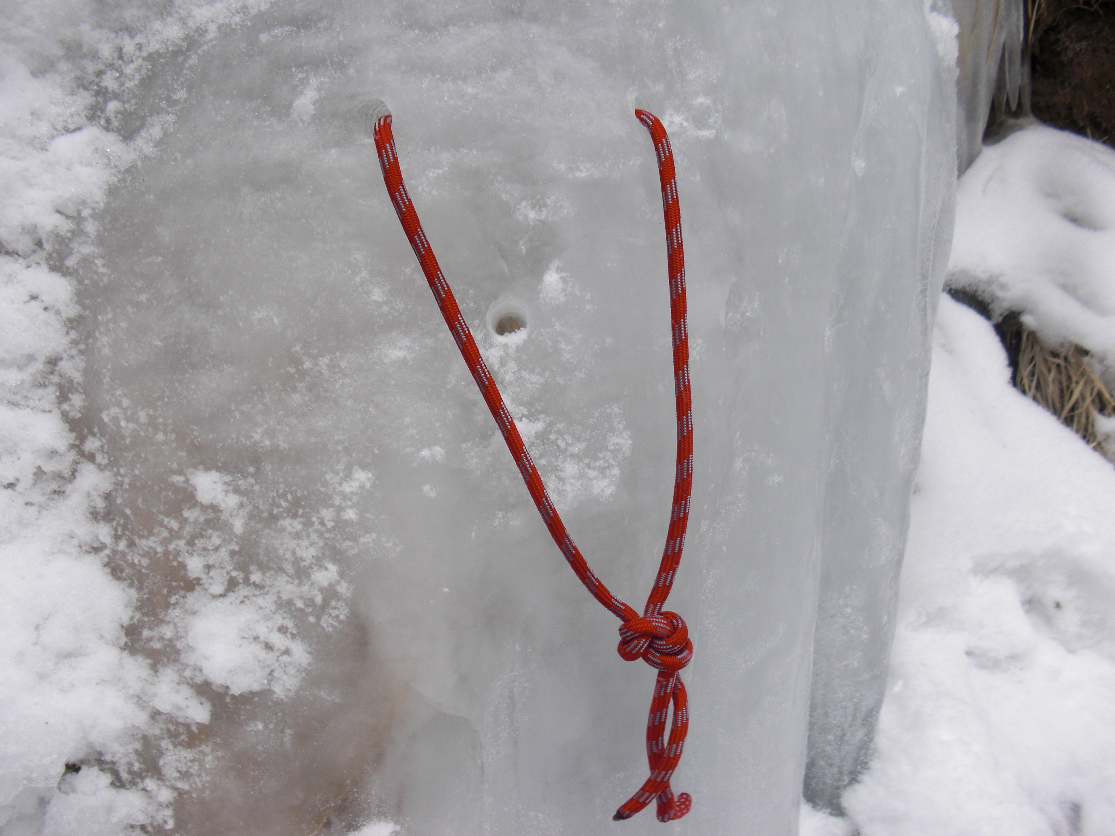
__NOTOC__ This glossary of climbing terms is a list of definitions of terms and jargon related to rock climbing and mountaineering. The specific terms used can vary considerably between different English-speaking countries; many of the phrases described here are particular to the United States and the United Kingdom. A B Completing the climb upon one's first attempt ever. Often confused with 'flashing' which is the first attempt of the day. There is a second opportunity for a climber to 'blitz' a wall after 12 months. C D E ... [...More Info...] [...Related Items...] OR: [Wikipedia] [Google] [Baidu] |
Bell 212
The Bell 212 (also known as the ''Twin Two-Twelve'') is a two-blade, medium helicopter that first flew in 1968. Originally manufactured by Bell Helicopter in Fort Worth, Texas, United States, production was moved to Mirabel, Quebec, Canada in 1988, along with all Bell commercial helicopter production after that plant opened in 1986. The 212 was marketed to civilian operators and has up to a 15-seat capacity, with one pilot and fourteen passengers. In cargo-carrying configuration the 212 has an internal capacity of 220 ft3 (6.23 m3). An external load of up to 5,000 lb (2,268 kg) can be carried. Development Based on the stretched fuselage Bell 205, the Bell 212 was originally developed for the Canadian Forces as the ''CUH-1N'' and later redesignated as the ''CH-135''. The Canadian Forces took delivery of 50 starting in May 1971. At the same time the United States military services ordered 294 Bell 212s under the designation UH-1N. By 1971, the Bell 212 had be ... [...More Info...] [...Related Items...] OR: [Wikipedia] [Google] [Baidu] |
Air Greenland
Air Greenland A/S (formerly named Grønlandsfly), also known as Greenlandair, is the flag carrier airline of Greenland, owned by the Greenlandic Government. It operates a fleet of 32 aircraft, including 1 airliner used for transatlantic and charter flights, 8 fixed-wing aircraft primarily serving the domestic network, and 18 helicopters feeding passengers from the smaller communities into the domestic airport network. Flights to heliports in the remote settlements are operated on contract with the government of Greenland. Besides running scheduled services and government-contracted flights to most villages in the country, the airline also supports remote research stations, provides charter services for tourists and Greenland's energy and mineral-resource industries and permits medivac during emergencies. Air Greenland has seven subsidiaries, an airline, hotels, tour operators, and a travel agency specialised in Greenlandic tourism. History Founded in 1960 as ''Grønlandsfly'' ... [...More Info...] [...Related Items...] OR: [Wikipedia] [Google] [Baidu] |
Mountaineering
Mountaineering or alpinism, is a set of outdoor activities that involves ascending tall mountains. Mountaineering-related activities include traditional outdoor climbing, skiing, and traversing via ferratas. Indoor climbing, sport climbing, and bouldering are also considered variants of mountaineering by some. Unlike most sports, mountaineering lacks widely applied formal rules, regulations, and governance; mountaineers adhere to a large variety of techniques and philosophies when climbing mountains. Numerous local alpine clubs support mountaineers by hosting resources and social activities. A federation of alpine clubs, the International Climbing and Mountaineering Federation (UIAA), is the International Olympic Committee-recognized world organization for mountaineering and climbing. The consequences of mountaineering on the natural environment can be seen in terms of individual components of the environment (land relief, soil, vegetation, fauna, and landscape) and location/z ... [...More Info...] [...Related Items...] OR: [Wikipedia] [Google] [Baidu] |
Salliaruseq Island
Salliaruseq Island (old spelling: ''Sagdliaruseq'', da, Storøen, translated: The-big-island) is an uninhabitedNorwegian University of Science and Technology island in municipality in northwestern . At , it is one of the larger islands in the system, located in its central part due east of |
Assorput Strait
Assorput Strait (old spelling: ''Agssorput'') is a strait in the Uummannaq Fjord system in northwestern Greenland. It separates Uummannaq Island in the west from Salliaruseq Island in the east.Nuussuaq, Saga Map, Tage Schjøtt, 1992 The strait waterway connects inner Sarqarput Strait in the southern arm of Uummannaq Fjord in the south with the central arm of Uummannaq Fjord in the north. Transport Air On the way from Qaarsut Airport on Nuussuaq Peninsula, the helicopters of Air Greenland approach the Uummannaq Heliport−located on the western shore of the strait−alongside the western wall of Salliaruseq, first converging to the island, to then turn 90 degrees to the west due to winds in the Assorput Strait. Sea The Uummannaq port occupies a small inlet of Assorput Strait in the southeastern end of the Uummannaq Island. It is not deep enough to service large cruise ships, but sufficiently deep to handle supply and fishing ships of Royal Arctic Line and Royal Greenland ... [...More Info...] [...Related Items...] OR: [Wikipedia] [Google] [Baidu] |
Mountain Pass
A mountain pass is a navigable route through a mountain range or over a ridge. Since many of the world's mountain ranges have presented formidable barriers to travel, passes have played a key role in trade, war, and both Human migration, human and animal migration throughout history. At lower elevations it may be called a hill pass. A mountain pass is typically formed between two volcanic peaks or created by erosion from water or wind. Overview Mountain passes make use of a gap (landform), gap, saddle (landform), saddle, col or notch (landform), notch. A topographic saddle is analogous to the mathematical concept of a saddle surface, with a saddle point marking the highest point between two valleys and the lowest point along a ridge. On a topographic map, passes are characterized by contour lines with an hourglass shape, which indicates a low spot between two higher points. In the high mountains, a difference of between the summit and the mountain is defined as a mountain pas ... [...More Info...] [...Related Items...] OR: [Wikipedia] [Google] [Baidu] |
Greenlandic Language
Greenlandic ( kl, kalaallisut, link=no ; da, grønlandsk ) is an Eskimo–Aleut language with about 56,000 speakers, mostly Greenlandic Inuit in Greenland. It is closely related to the Inuit languages in Canada such as Inuktitut. It is the most widely spoken Eskimo–Aleut language. Greenlandic has been the sole official language of the Greenlandic autonomous territory since June 2009, which is a move by the Naalakkersuisut, the government of Greenland, to strengthen the language in its competition with the colonial language, Danish. The main variety is Kalaallisut, or West Greenlandic. The second variety is Tunumiit oraasiat, or East Greenlandic. The language of the Thule Inuit of Greenland, Inuktun or Polar Eskimo, is a recent arrival and a dialect of Inuktitut. Greenlandic is a polysynthetic language that allows the creation of long words by stringing together roots and suffixes. The language's morphosyntactic alignment is ergative, treating both the argument (subject) ... [...More Info...] [...Related Items...] OR: [Wikipedia] [Google] [Baidu] |
Uummannaq
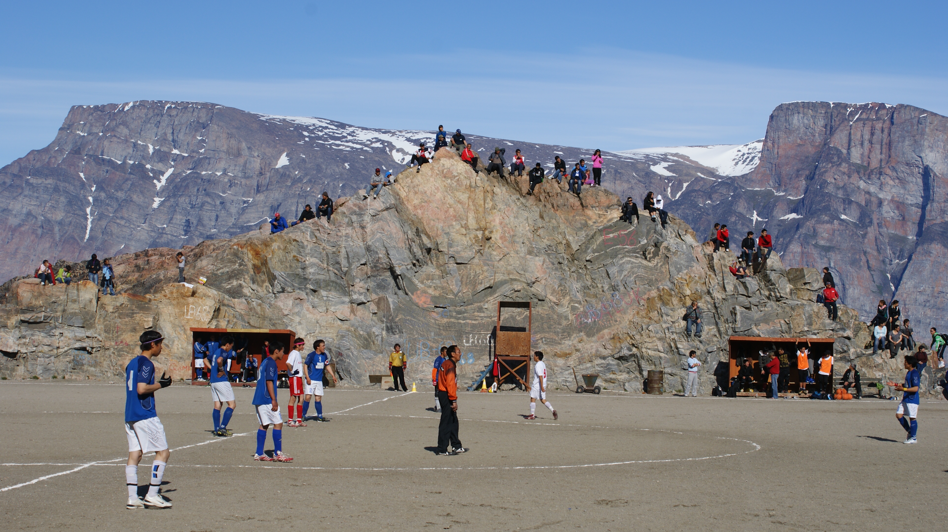
Uummannaq is a town in the Avannaata municipality, in central-western Greenland. With 1,407 inhabitants in 2020, it is the eighth-largest town in Greenland, and is home to the country's most northerly ferry terminal. Founded in 1763 as Omenak, the town is a hunting and fishing base, with a canning factory and a marble quarry. In 1932, the Universal Greenland-Filmexpedition with director Arnold Fanck released the film '' S.O.S. Eisberg'' near Uummannaq. Geography Uummannaq is located 590 kilometres north of the Arctic Circle on Uummannaq Island located in the south-central arm of the Uummannaq Fjord. ''Uummannaq'' is also the general name given to the series of inlets north of the promontory at Niaqornat on the Nuussuaq Peninsula. Uummannaq Mountain The island is also home to Uummannaq Mountain, rising very sharply to the height of 1170m. Climbing it requires technical skills. Transport Air Greenland operates helicopter services to Qaarsut Airport from Uummannaq Heliport. ... [...More Info...] [...Related Items...] OR: [Wikipedia] [Google] [Baidu] |
Arctic
The Arctic ( or ) is a polar regions of Earth, polar region located at the northernmost part of Earth. The Arctic consists of the Arctic Ocean, adjacent seas, and parts of Canada (Yukon, Northwest Territories, Nunavut), Danish Realm (Greenland), Finland, Iceland, Norway, Russia (Murmansk Oblast, Murmansk, Siberia, Nenets Autonomous Okrug, Nenets Okrug, Novaya Zemlya), Sweden and the United States (Alaska). Land within the Arctic region has seasonally varying snow and sea ice, ice cover, with predominantly treeless permafrost (permanently frozen underground ice) containing tundra. Arctic seas contain seasonal sea ice in many places. The Arctic region is a unique area among Earth's ecosystems. The cultures in the region and the Arctic indigenous peoples have adapted to its cold and extreme conditions. Life in the Arctic includes zooplankton and phytoplankton, fish and marine mammals, birds, land animals, plants and human societies. Arctic land is bordered by the subarctic. De ... [...More Info...] [...Related Items...] OR: [Wikipedia] [Google] [Baidu] |


