|
Upper Rivington Reservoir
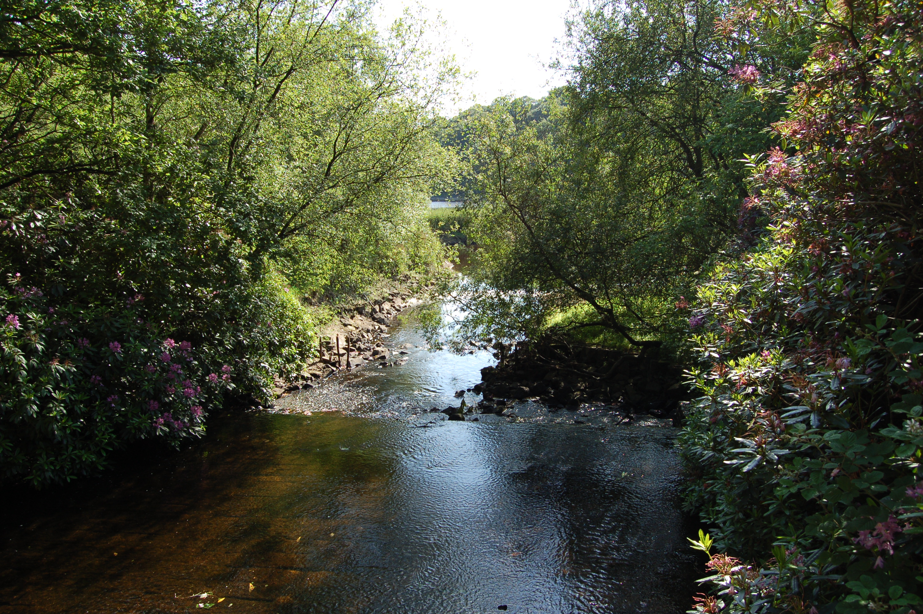
Upper Rivington Reservoir is situated centrally in the Rivington chain of reservoirs, on the West Pennine Moors in Lancashire, England, between Rivington and Anglezarke. The engineer for the Rivington reservoirs was Thomas Hawksley and construction for Liverpool Corporation Waterworks took place between 1852 and 1857. The two dams of the Upper Rivington reservoir are the Horrobin Embankment that separates it from the lower reservoir and carries a road into the village from the west, and the long, high Yarrow Embankment. There is an island. A bridleway and residence, The Street are on the side of the reservoir. It is a popular walking destination, between Anglezarke Reservoir to the north, Lower Rivington Reservoir Lower Rivington Reservoir is at the end of the Rivington chain of reservoirs in Lancashire, England, with Upper Rivington Reservoir to the north, and Rivington Water Treatment Works to the south. The Rivington chain primarily supplies 70,000 hou ... to the south ... [...More Info...] [...Related Items...] OR: [Wikipedia] [Google] [Baidu] |
Lancashire
Lancashire ( , ; abbreviated Lancs) is the name of a historic county, ceremonial county, and non-metropolitan county in North West England. The boundaries of these three areas differ significantly. The non-metropolitan county of Lancashire was created by the Local Government Act 1972. It is administered by Lancashire County Council, based in Preston, and twelve district councils. Although Lancaster is still considered the county town, Preston is the administrative centre of the non-metropolitan county. The ceremonial county has the same boundaries except that it also includes Blackpool and Blackburn with Darwen, which are unitary authorities. The historic county of Lancashire is larger and includes the cities of Manchester and Liverpool as well as the Furness and Cartmel peninsulas, but excludes Bowland area of the West Riding of Yorkshire transferred to the non-metropolitan county in 1974 History Before the county During Roman times the area was part of the Bri ... [...More Info...] [...Related Items...] OR: [Wikipedia] [Google] [Baidu] |
Reservoir
A reservoir (; from French ''réservoir'' ) is an enlarged lake behind a dam. Such a dam may be either artificial, built to store fresh water or it may be a natural formation. Reservoirs can be created in a number of ways, including controlling a watercourse that drains an existing body of water, interrupting a watercourse to form an embayment within it, through excavation, or building any number of retaining walls or levees. In other contexts, "reservoirs" may refer to storage spaces for various fluids; they may hold liquids or gasses, including hydrocarbons. ''Tank reservoirs'' store these in ground-level, elevated, or buried tanks. Tank reservoirs for water are also called cisterns. Most underground reservoirs are used to store liquids, principally either water or petroleum. Types Dammed valleys Dammed reservoirs are artificial lakes created and controlled by a dam A dam is a barrier that stops or restricts the flow of surface water or underground streams ... [...More Info...] [...Related Items...] OR: [Wikipedia] [Google] [Baidu] |
Rivington
Rivington is a village and civil parish of the Borough of Chorley, Lancashire, England, occupying . It is about southeast of Chorley and about northwest of Bolton. Rivington is a rural area consisting primarily of agricultural grazing land, moorland, with hill summits including Rivington Pike and Winter Hill within the West Pennine Moors. The area has a thriving tourist industry centred around reservoirs created to serve Liverpool in the Victorian era and Lever Park created as a public park by William Lever at the turn of the 20th century, with two converted barns, a replica of Liverpool Castle and open countryside. Rivington and Blackrod High School is located here. Rivington and its village had a population of 109 at the 2011 Census. History Toponymy The name Rivington is made up of three elements: ''riv'' is from the Old English ''hrēof'' meaning rough or rugged; ''ing'' is a place name forming suffix that seems to have crept in over the years; the last is the Old En ... [...More Info...] [...Related Items...] OR: [Wikipedia] [Google] [Baidu] |
Reservoirs
A reservoir (; from French ''réservoir'' ) is an enlarged lake behind a dam. Such a dam may be either artificial, built to store fresh water or it may be a natural formation. Reservoirs can be created in a number of ways, including controlling a watercourse that drains an existing body of water, interrupting a watercourse to form an embayment within it, through excavation, or building any number of retaining walls or levees. In other contexts, "reservoirs" may refer to storage spaces for various fluids; they may hold liquids or gasses, including hydrocarbons. ''Tank reservoirs'' store these in ground-level, elevated, or buried tanks. Tank reservoirs for water are also called cisterns. Most underground reservoirs are used to store liquids, principally either water or petroleum. Types Dammed valleys Dammed reservoirs are artificial lakes created and controlled by a dam constructed across a valley, and rely on the natural topography to provide most of the basin of the re ... [...More Info...] [...Related Items...] OR: [Wikipedia] [Google] [Baidu] |
West Pennine Moors
The West Pennine Moors is an area of the Pennines covering approximately of moorland and Reservoir (water), reservoirs in Lancashire and Greater Manchester, England. It is a Site of Special Scientific Interest. The West Pennine Moors are separated from the main Pennine range by the Irwell Valley to the east. The moorland includes Withnell, Anglezarke and Rivington Moors in the extreme west, Darwen and Turton Moors, Oswaldtwistle#Oswaldtwistle Moor, Oswaldtwistle Moors and Holcombe Moors. These moors are lower in height than the main spine of the South Pennines. At , the highest point is at Winter Hill (North West England), Winter Hill. The area is of historical importance with archaeological evidence of human activity from Neolithic times. The area is close to urban areas, the dramatic backdrop to Bolton, Blackburn and Bury, Greater Manchester, Bury and neighbouring towns affording panoramic views across the Lancashire Plain and the Greater Manchester conurbation. The moorland is ... [...More Info...] [...Related Items...] OR: [Wikipedia] [Google] [Baidu] |
Anglezarke
Anglezarke is a sparsely populated Civil parishes in England, civil parish in the Borough of Chorley in Lancashire, England. It is an agricultural area used for sheep farming, also site of reservoirs that were built to supply water to Liverpool. The area has a large expanse of moorland with many public footpaths and bridleways. The area is popular with walkers and tourists, it lies in the West Pennine Moors in Lancashire, sandwiched between the moors of Withnell and Rivington, and is close to the towns of Chorley, Horwich and Darwen. At the 2001 census it had a population of 23. At the 2011 Census the population is included within Heapey civil parish. The area was subjected to depopulation after the reservoirs were built. Toponymy Anglezarke is derived from the Old Norse name ''Anlaf'' and the Old Norse ''erg'', a 'hill pasture or shieling'. The elements together mean 'Anlaf's hill pasture'. In 1202 it was recorded as 'Andelevesarewe'. By 1225 this had become 'Anlavesargh'. In a ... [...More Info...] [...Related Items...] OR: [Wikipedia] [Google] [Baidu] |
Thomas Hawksley
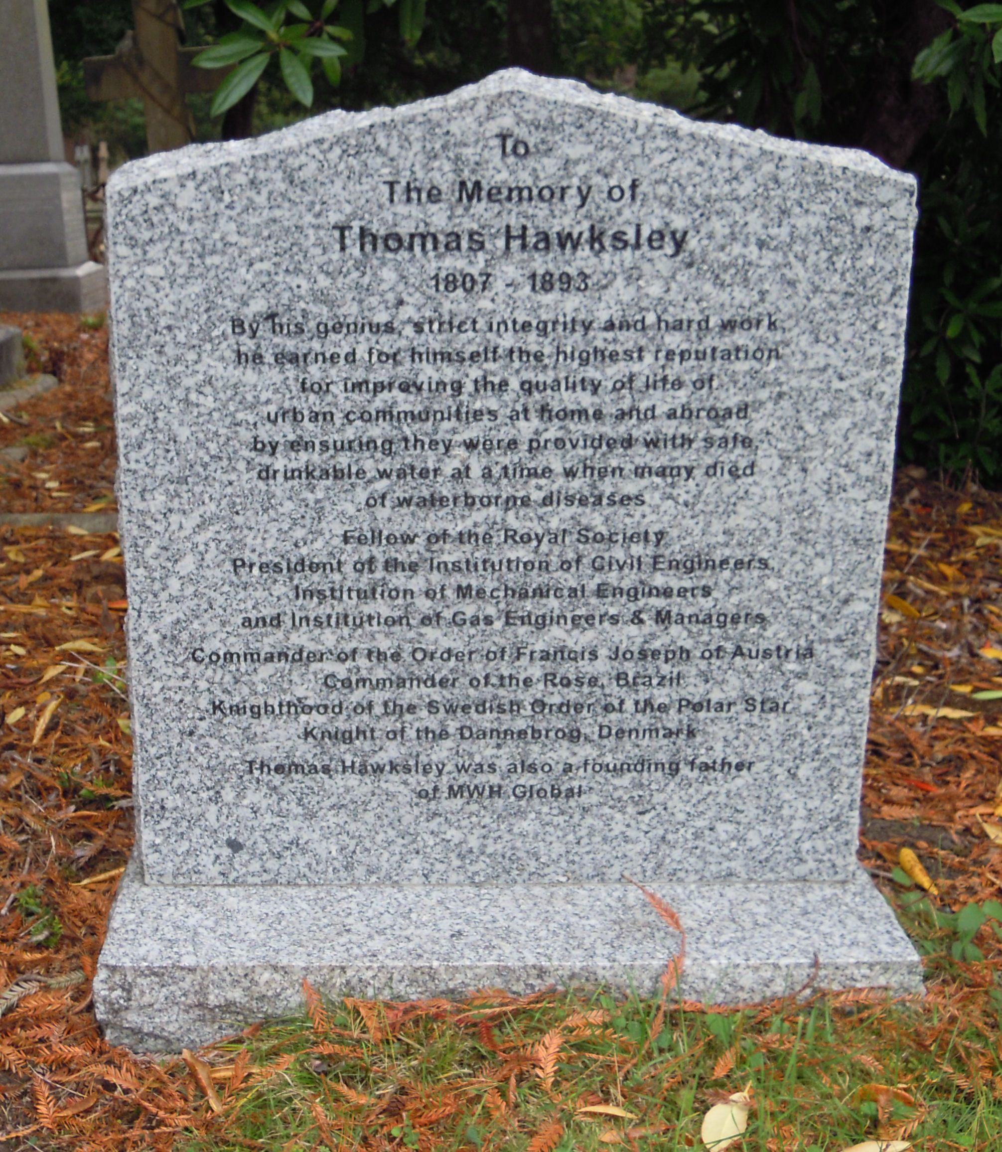
Thomas Hawksley ( – ) was an English civil engineer of the 19th century, particularly associated with early water supply and coal gas engineering projects. Hawksley was, with John Frederick Bateman, the leading British water engineer of the nineteenth century and was personally responsible for upwards of 150 water-supply schemes, in the British Isles and overseas.Hawksley, Thomas Biography The son of John Hawksley and Sarah Thompson and born in Arnot Hill House, Arnold, near |
Liverpool Corporation Waterworks
Liverpool Corporation Waterworks and its successors have provided a public water supply and sewerage and sewage treatment services to the city of Liverpool, England. In 1625 water was obtained from a single well and delivered by cart, but as the town grew, companies supplied water to homes through pipes. There were two main companies by the 1840s, but the water supply was intermittent, and there was general dissatisfaction with the service. Liverpool Corporation decided that such an important service should be provided by a public body, and sought to take over the water supply companies. A series of Acts of Parliament were obtained, the first being the Liverpool Sanatory Act 1846, which created three key posts, the Medical Officer of Health, the Inspector of Nuisances, and the Borough Engineer. The latter post was filled by James Newlands, a visionary man who defined the role of the Borough Engineer, to be copied by many other towns and cities. He set about creating large scale ma ... [...More Info...] [...Related Items...] OR: [Wikipedia] [Google] [Baidu] |
The Street (Rivington)
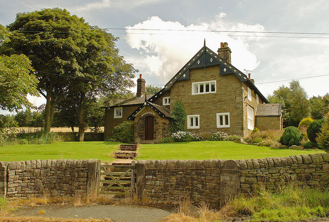
The Street is a historical property on a bridleway of the same name in Heath Charnock in the Borough of Chorley, Lancashire, England. It is located on the western banks of the Upper Rivington reservoir and close to the boundary with the village of Rivington. It has been converted to apartments. Alexander Street took his name from the property when he was the owner of the estate in 1534. After his death, a distant cousin attempted to gain control of the building, but was evicted after a presumptuous attempt to act as a guardian to the deceased's children. After the reservoir was built in 1850, the house was demolished and rebuilt with compensation from Liverpool Liverpool is a city and metropolitan borough in Merseyside, England. With a population of in 2019, it is the 10th largest English district by population and its metropolitan area is the fifth largest in the United Kingdom, with a popul ... Corporation. In 1853, the property was owned by Peter Martin, who al ... [...More Info...] [...Related Items...] OR: [Wikipedia] [Google] [Baidu] |
Anglezarke Reservoir
Anglezarke Reservoir is the largest reservoir in the Rivington chain to the west of Anglezarke in Lancashire, England. Anglezarke Reservoir has three embankments: the Charnock Embankment, the longest, is long and high, the Knowsley Embankment is long and high and the Heapey Embankment is long and high. It is fed by the River Yarrow, which has been diverted from its original course which is now covered by the Knowsley Embankment. It served the city of Liverpool before its current status as a supply mainly for Wigan. The original `Rivington Pike Scheme' was undertaken by Thomas Hawksley between 1850 and 1857 for the Liverpool Corporation Waterworks. The scheme was to construct five reservoirs and a water treatment works at the south end of Lower Rivington with a pipeline to storage reservoirs at Prescot. Water from two higher level reservoirs, Rake Brook and Lower Roddlesworth, was carried south in `The Goit', a channel connecting them to the reservoirs. In November 1997 ... [...More Info...] [...Related Items...] OR: [Wikipedia] [Google] [Baidu] |
Lower Rivington Reservoir
Lower Rivington Reservoir is at the end of the Rivington chain of reservoirs in Lancashire, England, with Upper Rivington Reservoir to the north, and Rivington Water Treatment Works to the south. The Rivington chain primarily supplies 70,000 households in the Wigan area. The chain was built to supply Liverpool. The engineer for the Rivington reservoirs was Thomas Hawksley and construction for the Liverpool Corporation Waterworks took place between 1852 and 1857. The Lower Rivington reservoir has two dams - the Millstone Embankment, which is long and high, and the Horwich Embankment, which is long and high. Filter beds were constructed at the foot of the Horwich Embankment, The original sand filters were replaced by a new treatment plant from where a pipeline runs to the service reservoirs at Eccleston, St Helens. The River Douglas was diverted through a paved channel in a deep cutting into Lower Rivington. On the Rivington bank of the reservoir is a folly which is a repli ... [...More Info...] [...Related Items...] OR: [Wikipedia] [Google] [Baidu] |
Yarrow Reservoir
Yarrow Reservoir - named after the River Yarrow - is a reservoir in the Rivington chain in Anglezarke, Lancashire, England, and has a storage capacity second to Anglezarke Reservoir. Construction of the reservoir, designed by Liverpool Borough Engineer Thomas Duncan, began in 1867. In 2002, several tons of fish were transported to this reservoir when the Upper Rivington reservoir was completely drained for essential maintenance work. The construction of Yarrow Reservoir was described in Wm. Fergusson Irvine's book "A Short History Of The Township Of Rivington" : On the banks of the reservoir is a 'face in the wall' - an effigy carved into a large stone on top of the dry stone wall, which is said to depict an inspector who worked for the Liverpool Liverpool is a city and metropolitan borough in Merseyside, England. With a population of in 2019, it is the 10th largest English district by population and its metropolitan area is the fifth largest in the United Kingdo ... [...More Info...] [...Related Items...] OR: [Wikipedia] [Google] [Baidu] |


