|
Upper Hunza
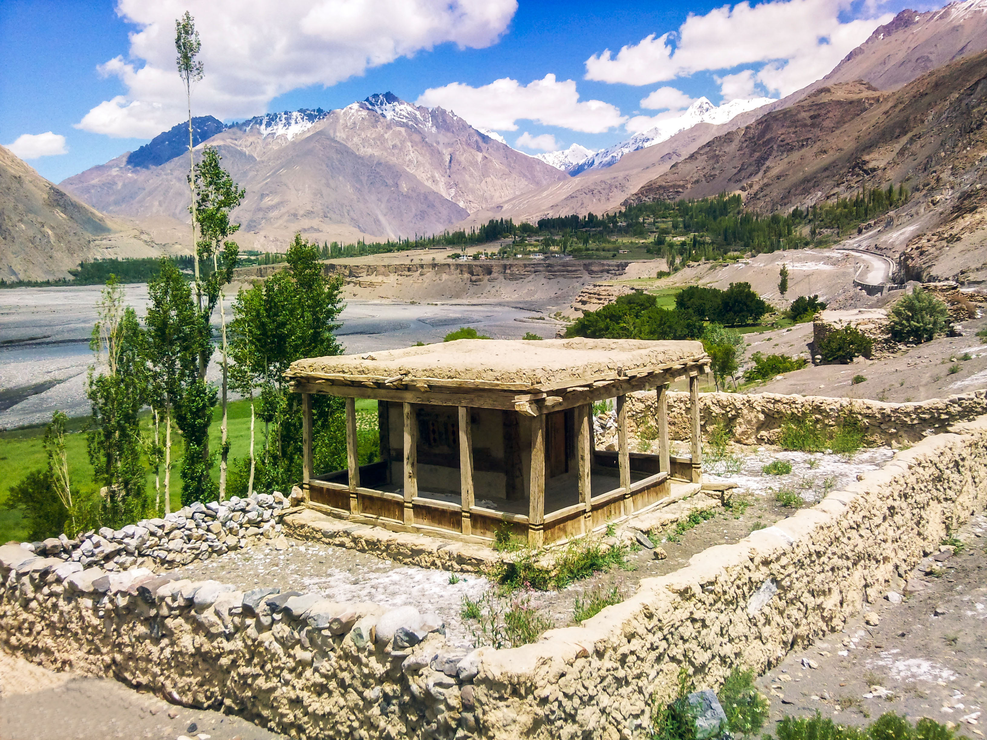
Gojal ( Wakhi: , Kyrgyz: ), also called Upper Hunza, is situated in the north western part of Pakistan. It borders China at the Khunjerab Pass, and Afghanistan at the Chapursan valley. In 2019, Gojal Valley became the second Sub-Division within the Hunza District. It is geographically the largest subdivision of the Gilgit-Baltistan. Gojal or Upper Hunza is composed of a number of large and small valleys sharing borders with Central Hunza in the South, China in the north-east, and Afghanistan in the north-west. Aeenabad is the first village of Gojal, Upper Hunza. Except for the Shimshal, Misgar, and Chipursan valleys, all the villages of Gojal, Upper Hunza can be seen from the Karakoram Highway (KKH), which crosses ''Gojal'', entering China at the Khunjerab Pass. The Gojal region has 20,000 Ismaili residents. History The valleys and villages of Gojal were settled over time by people from surrounding regions. Kyrgyz nomads initially used the areas in Upper Gojal as winter ... [...More Info...] [...Related Items...] OR: [Wikipedia] [Google] [Baidu] |
Batura
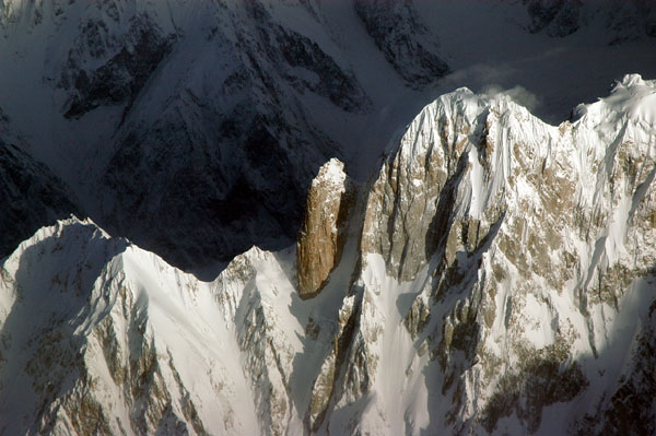
__NOTOC__ The Batura Muztagh () mountains are a sub-range of the Karakoram mountain range. They are located in between central hunza and upper hunza( Gojal valley) in the Hunza district of the Gilgit-Baltistan province in northern Pakistan. They are the westernmost sub-range of the Karakoram, running from Chalt village in Bar Valley in the east to Kampir Dior in the Kurumbar Valley in the west, and they separate the Hindu Raj range from the Karakoram range. The Muchu Chhish peak located in this sub-range remains the second highest unclimbed peak in the world. Selected peaks in the Batura Muztagh Books, pamphlets, and maps about Batura Muztagh *''High Asia: An Illustrated History of the 7000 Metre Peaks'' by Jill Neate, *''Batura Mustagh'' (sketch map and pamphlet) by Jerzy Wala, 1988. *''Orographical Sketch Map of the Karakoram'' by Jerzy Wala, 1990. Published by the Swiss Foundation for Alpine Research. See also * List of Highest Mountains of the World * List of mountains ... [...More Info...] [...Related Items...] OR: [Wikipedia] [Google] [Baidu] |
Gircha
Gircha ( Girča wakhi, گرچہ Urdu ) is a village in the Gojal Tehsil of Hunza in the Gilgit Baltistan region of Pakistan. It is one of the oldest Wakhi villages of upper Gojal Hunza, settled by Bobo e Sufi, who was the first man to settle in the region and the ancestor of present wakhis. Etymology The word "Gircha" is considered to come from Grich which means a hut near spring water. An alternative theory supposes that Gircha comes from the snail shell/ Kišrif Wakhi or reefs found in Gircha, which are of great archeological Archaeology or archeology is the scientific study of human activity through the recovery and analysis of material culture. The archaeological record consists of artifacts, architecture, biofacts or ecofacts, sites, and cultural landsca ... interest. According to numerology, the study of the significance of numbers, one is the life path number for Gircha. References {{Reflist Populated places in Hunza District ... [...More Info...] [...Related Items...] OR: [Wikipedia] [Google] [Baidu] |
Hunza Valley
The Hunza Valley ( bsk, , Wakhi: '; ur, ) is a mountainous valley in the northern part of the Gilgit-Baltistan region of Pakistan, formed by the Hunza River, bordering Ishkoman to the northwest, Shigar to the southeast, Afghanistan's Wakhan Corridor to the north, and the Xinjiang region of China to the northeast. Geography The Hunza Valley is a mountainous valley in the northern part of the Gilgit-Baltistan region of Pakistan, formed by the Hunza River, bordering Ishkoman to the northwest, Shigar to the southeast, Afghanistan's Wakhan Corridor to the north and the Xinjiang region of China to the northeast. The Hunza Valley floor is at an elevation of 2,438 meters (7,999 feet). Geographically, the Hunza Valley consists of three regions: Upper Hunza ( Gojal), Central Hunza, and Lower Hunza ( Shinaki). History Buddhism, and to a lesser extent, Bön, were the main religions in the area. The region has several surviving Buddhist archaeological sites, such as the ... [...More Info...] [...Related Items...] OR: [Wikipedia] [Google] [Baidu] |
Shimshal
Shimshal (old name: Shingshal) ( ur, شمشال) is a village located in Gojal Tehsil of Hunza District, in the Gilgit–Baltistan region of Pakistan. It lies at an altitude of above sea level and is the highest settlement in the district. It is the largest valley in Gilgit-Baltistan and it covers almost area of Hunza District. It is in the valley of the Shimshal River, a tributary of the Hunza River. Shimshal is a border village that connects the Gilgit-Baltistan area of Pakistan with China. The total area of Shimshal is approximately and there are around two thousand inhabitants with a total of 250 households. Settlements Shimshal is made up of four major hamlets; Farmanabad, Aminabad, Center Shimshal, and Khizarabad. Farmanabad is a new settlement that comes first on reaching Shimshal. Aminabad is announced by vast fields of stones hemmed in by dry stone walls, and fortress-like houses of stone and mud. As you approach Shimshal look for a glimpse of Odver Sar (), also known a ... [...More Info...] [...Related Items...] OR: [Wikipedia] [Google] [Baidu] |
Gulmit
Gulmit ( Wakhi/ ur, ), also known as Gul-e-Gulmit, is a town that serves as headquarter of the Gojal, also known as Upper Hunza, in Gilgit Baltistan, Pakistan. Gulmit is a centuries-old historic town, with mountains, peaks and glaciers. It is a tourist spot and has many historic places, hotels, shops and a museum. History Before 1974, when Hunza was a state, Gulmit used to be the Summer Capital of the state. After the abolition of the state it became the Tehsil's seat of government. The oldest intact house in Gulmit is more than six centuries old. Most of People in the entire Gojal Valley have Central Asian ancestral backgrounds. The people speak Wakhi language and belong to the Shia Imami Ismaili sect of Islam. Population of Gulmit, according to 2016 survey, consists of around 5000 individuals. Fifty-one percent of the population is female. There are many forts and fortresses in Gojal valley, such as Qalanderchi fort in Misghar valley and Rashit fort in Chipursan valley ... [...More Info...] [...Related Items...] OR: [Wikipedia] [Google] [Baidu] |
Ismaili
Isma'ilism ( ar, الإسماعيلية, al-ʾIsmāʿīlīyah) is a branch or sub-sect of Shia Islam. The Isma'ili () get their name from their acceptance of Imam Isma'il ibn Jafar as the appointed spiritual successor ( imām) to Ja'far al-Sadiq, wherein they differ from the Twelver Shia, who accept Musa al-Kadhim, the younger brother of Isma'il, as the true Imām. Isma'ilism rose at one point to become the largest branch of Shia Islam, climaxing as a political power with the Fatimid Caliphate in the 10th through 12th centuries. Ismailis believe in the oneness of God, as well as the closing of divine revelation with Muhammad, whom they see as "the final Prophet and Messenger of God to all humanity". The Isma'ili and the Twelvers both accept the same six initial Imams; the Isma'ili accept Isma'il ibn Jafar as the seventh Imam. After the death of Muhammad ibn Isma'il in the 8th century CE, the teachings of Ismailism further transformed into the belief system as it is k ... [...More Info...] [...Related Items...] OR: [Wikipedia] [Google] [Baidu] |
Oral History
Oral history is the collection and study of historical information about individuals, families, important events, or everyday life using audiotapes, videotapes, or transcriptions of planned interviews. These interviews are conducted with people who participated in or observed past events and whose memories and perceptions of these are to be preserved as an aural record for future generations. Oral history strives to obtain information from different perspectives and most of these cannot be found in written sources. ''Oral history'' also refers to information gathered in this manner and to a written work (published or unpublished) based on such data, often preserved in archives and large libraries.oral history. (n.d.) The Columbia Electronic Encyclopedia®. (2013). Retrieved March 12, 2018 from https://encyclopedia2.thefreedictionary.com/oral+history Knowledge presented by Oral History (OH) is unique in that it shares the tacit perspective, thoughts, opinions and understanding of th ... [...More Info...] [...Related Items...] OR: [Wikipedia] [Google] [Baidu] |
Sovereign State
A sovereign state or sovereign country, is a political entity represented by one central government that has supreme legitimate authority over territory. International law defines sovereign states as having a permanent population, defined territory (see territorial disputes), one government, and the capacity to enter into relations with other sovereign states. It is also normally understood that a sovereign state is independent. According to the declarative theory of statehood, a sovereign state can exist without being recognised by other sovereign states.Thomas D. Grant, ''The recognition of states: law and practice in debate and evolution'' (Westport, Connecticut: Praeger, 1999), chapter 1. Unrecognised states will often find it difficult to exercise full treaty-making powers or engage in diplomatic relations with other sovereign states. History Since the end of the 19th century, almost the entire globe has been divided into sections (countries) with more or less define ... [...More Info...] [...Related Items...] OR: [Wikipedia] [Google] [Baidu] |
Raja Of Gilgit
''Raja'' (; from , IAST ') is a royal title used for South Asian monarchs. The title is equivalent to king or princely ruler in South Asia and Southeast Asia. The title has a long history in South Asia and Southeast Asia, being attested from the Rigveda, where a ' is a ruler, see for example the ', the "Battle of Ten Kings". Raja-ruled Indian states While most of the Indian salute states (those granted a gun salute by the British Crown) were ruled by a Maharaja (or variation; some promoted from an earlier Raja- or equivalent style), even exclusively from 13 guns up, a number had Rajas: ; Hereditary salutes of 11-guns : * the Raja of Pindrawal * the Raja of Morni * the Raja of Rajouri * the Raja of Ali Rajpur * the Raja of Bilaspur * the Raja of Chamba * the Raja of Faridkot * the Raja of Jhabua * the Raja of Mandi * the Raja of Manipur * the Raja of Narsinghgarh * the Raja of Pudukkottai * the Raja of Rajgarh * the Raja of Sangli * the Raja of Sailana * the ... [...More Info...] [...Related Items...] OR: [Wikipedia] [Google] [Baidu] |
Dairy Product
Dairy products or milk products, also known as lacticinia, are food products made from (or containing) milk. The most common dairy animals are cow, water buffalo, nanny goat, and ewe. Dairy products include common grocery store food items in the Western world such as yogurt, cheese and butter. A facility that produces dairy products is known as a '' dairy''. Dairy products are consumed worldwide to varying degrees (see consumption patterns worldwide). Some people avoid some or all dairy products either because of lactose intolerance, veganism, or other health reasons or beliefs. Production relationship graph Types of dairy product Milk Milk is produced after optional homogenization or pasteurization, in several grades after standardization of the fat level, and possible addition of the bacteria '' Streptococcus lactis'' and '' Leuconostoc citrovorum''. Milk can be broken down into several different categories based on type of product produced, including cr ... [...More Info...] [...Related Items...] OR: [Wikipedia] [Google] [Baidu] |


